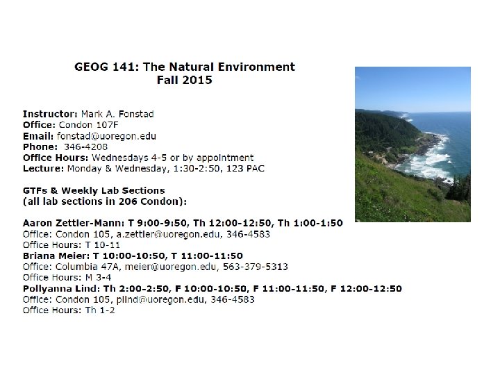
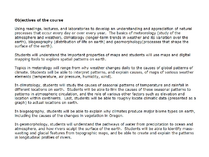
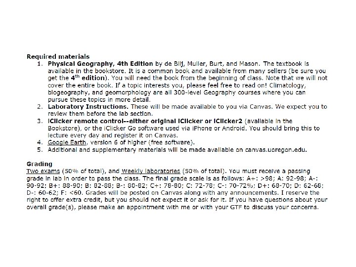
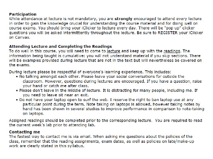
The Natural Environment Earth Systems Concepts System a


 Latitude (Parallels) 1 degree latitude = a constant 111 km")


 marks the place where each")


- Slides: 36
The Natural Environment
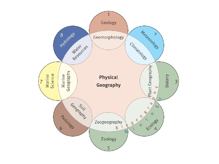
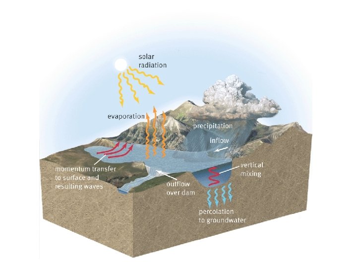
Earth Systems Concepts System- a collection of physical processes that are linked and act together in an organized way. Model- a simplified version (generalization) of reality. A leaf is a natural system
Earth Systems Concepts
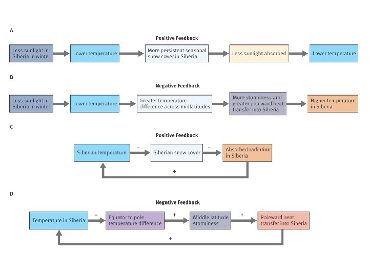
Positive feedback loop- meltwater ponds on Greenland ice sheet
Earth http: //solarsystem. nasa. gov/planets/profile. cfm? Object=Earth
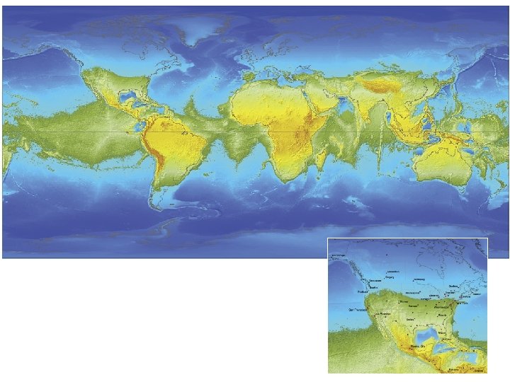
Earth’s shape = Geoid Figure 1. 11
The Geographic Grid a) Latitude (Parallels) 1 degree latitude = a constant 111 km b) Longitude (Meridians) 1 degree of longitude = 111 km at the equator and 0 at the poles
Latitude is the angle between a point on a parallel and the center of the Earth and a point on the equator Figure 1. 13
Latitude
Longitude is the angle between a point on a meridian and the centre of the Earth and a point on the Prime Meridian Figure 1. 15
Longitude
The Earth: Great Circles and Small Circles
The Earth: Time Zones International Date Line • (180°) marks the place where each day officially begins (12: 01 am) and sweeps westward as the earth rotates. • opposite the prime meridian • put in a sparsely populated area to avoid confusion
Maps, Scales, and Projections Cartography- the part of geography which embodies map making Map- a generalized view of an area, usually some portion of the Earth’s surface, as seen from above and greatly reduced in size
Maps, Scales, and Projections 3 types of map scales
Maps, Scales, and Projections Map Projections- the reduction of the spherical earth to a flat surface Problems: Figure 1. 24
Figure 1. 25