Land Introduction and MODIS Maintenance Chris Justice MODISVIIRS


- Slides: 28

Land Introduction and MODIS Maintenance Chris Justice MODIS/VIIRS Measurement Team Co-Lead University of Maryland

Coarse Resolution Land Products • Heritage of EOS MODIS Land • Science quality AM and PM observations • Peer reviewed science quality products – for the Science/Applications community • ATBD process • Systematic Improvement Reprocessing (5+ reprocessings) • Explicit QA (QA metadata) • Land Data Operational Product Evaluation (LDOPE) known issues, golden tiles, integ and test • Land Product Validation (accuracy assessment) • Land Validation Strategy > subsequently adopted by CEOS LPV • Significant initial investment in Validation – reduced in recent years • Basis for Long Term Data Record (18 years and counting) • Multiple ways to get the data easily inc. via Google EE, AWS • The ‘Gold Standard’ for Global Land Products • Unprecedented uptake and impact of land products for both science and applications

19 05 11 0: 19 00: 00 05. 0 0: 6. 0 0 1 12 905 : 00. 0 0: 6. 19 00: 00 05 13. 0 0 : 6. 00 1 14 905 : 00. 0 0: 6. 19 00: 00 05 15. 0 0: 6. 0 0 1 16 905 : 00. 0 0: 6. 19 00: 00 05 17. 0 0: 6. 00 1 18 905 : 00. 0 0: 6. 19 00: 00 05 19. 0 0 : 0 6. 0 1 20 905 : 00. 0 0: 6. 00 1 21 905 : 00. 0 0: 6. 19 00: 00 05 22. 0 0: 6. 0 0 1 23 905 : 00. 0 0: 6. 19 00: 00 05 24. 0 0: 6. 00 1 25 905 : 00. 0 0: 6. 19 00: 00 05 26. 0 0 : 0 6. 0 1 27 905 : 00. 0 0: 6. 00 1 28 905 : 00. 0 0: 6. 19 00: 00 05 29. 0 0: 6. 0 0 1 30 905 : 00. 0 0: 6. 19 00: 00 0 01 5. 0 0: 7. 00 1 02 905 : 00. 0 0: 7. 19 00: 00 05 03. 0 0 : 0 7. 0 1 04 905 : 00. 0 0: 7. 00 1 05 905 : 00. 0 0: 7. 19 00: 00 05 06. 0 0: 7. 0 0 1 07 905 : 00. 0 0: 7. 19 00: 00 0 08 5. 0 0: 7. 00 1 09 905 : 00. 0 0: 7. 19 00: 00 05 10. 0 0 : 0 7. 0 1 11 905 : 00. 0 0: 7. 19 00: 00 05 0: 00 : 0 0 . 0 6. 10 . 0 6. 09 MODIS Total Publication Statistics courtesy Dr. Salomonson MODIS ALL PUBLICATIONS TOTAL: 19, 722 as of 10/03/2018 2200 2000 1800 1600 1400 1200 1000 800 600 400 200 0

MODIS > VIIRS • VIIRS instrument adopted many of the qualities of MODIS • IPO benefited from MODIS experience - But not all science needs were accommodated • NOAA VIIRS data products were developed largely around the MODIS heritage algorithms (w. MODIS P. I. participation) • Not an exact match in algorithms/products due to a number of factors • • Operational mandate (NWS, DOD), No formal science requirements Difficult process for accepting algorithm changes w. high contractor costs Limitations and complexity of the IDPS Processing System No routine reprocessing for consistent data records • NASA Land PI’s funded to evaluate NOAA SNPP-VIIRS products for science use • NASA generated its own MODIS/VIIR Land Continuity Products to meet the needs of the science/applications users – production slower than anticipated • NOAA moved processing from IDPS to NDE and is now including reprocessing • Current divergence in the S-NPP VIIRS NASA and NOAA Level 1 products • JPSS-1/NOAA 20 continuing the NOAA Land Products (JPSS-2 and beyond)

0 : 0 00 0: 0 : 0 00 0: 0 : 0 0: 02 00. 0 : 0 7. 0 19 05 0: 03 00. 0 : 0 7. 0 19 05 0: 04 00. 0 : 0 7. 0 19 05 0: 05 00. 0 : 0 7. 0 19 05 0: 06 00. 0 : 0 7. 0 19 05 0: 07 00. 0 : 0 7. 0 19 05 0: 08 00. 0 : 0 7. 0 19 05 0: 09 00. 0 : 0 7. 0 19 05 0: 10 00. 0 : 0 7. 0 19 05 0: 11 00. 0 : 0 7. 0 19 05 0: 12 00. 0 : 0 7. 0 19 05 0: 00 : 0 0 05 07. 1 9 01. 05 06. 1 9 30. 05 06. 1 9 29. 05 . 0 6. 19 28 05 . 0 6. 19 27 05 00 0: 0 : 0 00 0: 0 : 0 00 0: 200 . 0 6. 19 26 05 . 0 6. 19 25 05 06. 1 9 24. 05 06. 1 9 23. 05 . 0 6. 19 22 05 05 06. 1 9 21. 06. 1 9 20. VIIRS Total Publication Statistics courtesy Dr. Salomonson VIIRS Total Publications Statistics 958 (as of 10/03/2018) 180 160 140 120 100 80 60 40 20 0

MODIS > VIIRS: an opportunity for Rt. O Transition • JPSS 1 -n NOAA’s operational instruments (as with AVHRR) • No significant NASA Mission ‘science’ money for JPSS-1 products and beyond • NASA Earth System Science and Applications needs Long Term Observations • The ‘Song Remains the Same’: can we successfully transition Land Science products from Research to Operations ? • Could NASA and NOAA work together so that the NOAA (NOAA 20, 21 >) provide the ‘products and services’ necessary to meet the needs of Land Earth System Science and Applications? • If not – how should NASA proceed to ensure affordable and sustained product continuity? • Product Status – next presentation

2018 Land Selections Team Member Organization MODIS VIIRS SCIENCE Role Justice Chris, Román Miguel UMD - College Park Disc Leads Land Discipline Co-leads Didan, Kamel Univ. of Arizona MOD Maint Giglio, Louis Wifrid, Schroeder UMD - College Park, NOAA MOD Maint Hall, Dorothy GSFC MOD Maint Hulley, Glen JPL MODIS VIIRS LST algorithm delivery Lyapustin, Alex GSFC MODIS >VIIRS Atmospheric correction (MAIAC) Myneni, Ranga Boston Univ. MOD Maint Riggs, George GSFC Running, Steve Univ. of Montana MOD Maint Schaaf, Crystal Univ. of Mass. Boston MOD Maint Townshend, John UMD - College Park MOD Maint Vermote, Eric GSFC MOD Maint Wang, Dongdong UMD - College Park MOD Maint MODIS Zhang, Xiaoyang South Dakota State Univ. MODIS Vegetation indices VIIRS MODIS Active fire/burned area product (Giglio) VIIRS AF (Giglio/Schroeder), VIIRS BA(Giglio) Snow and ice products LAI/f. PAR VIIRS Refinement of cryospheric algorithms Net primary production & evapotranspiration VIIRS BRDF/Albedo/NBAR analysis products Vegetation continuous fields VIIRS Land surface reflectance product Incident downward shortwave radiation and PAR >VIIRS Land surface phenology

2018 Land Selections Team Member Organization MODIS VIIRS SCIENCE Role Ackerman, Steve Univ. of Wisc. - Madison MODIS >VIIRS New Product Sea ice leads Gao, Huilin Texas A&M Univ. MODIS >VIIRS New Product Long term global reservoir products Román, Miguel GSFC VIIRS New Product Black marble Wright, Robert Univ. of Hawaii >VIIRS New Product Volcanic heat fluxes Crow, Wade USDA Data Fusion 2. 1. 1 Integrating Soil Moisture and Evapotranspiration Retrievals Bair, Ned UCSB MODIS Data Fusion 2. 1. 1 Snow water equiv (Regional Colorado and Indus Products) Czapla-Myers, Jeff U. Arizona MOD Maint CAL Validation of Terra Aqua Surface Reflectance Hook, Simon JPL Sen Review CAL Validation LST/Thermal MODIS >VIIRS

Science of Terra and Aqua 2014 – 2017 New Science/Products • Steve Frolking – Urban Change and Heat Islands (MODIS/Quickscat) • Feng Gao – Crop conditions and ET (MODIS/Landsat/GOES) • Karl Huemmrich – MODIS Photochemical Reflectance Index (MODIS) • Volker Radeloff – Dynamic Habitat Indices (MODIS) • Curtis Woodcock – NRT Forest Disturbance (MODIS/Landsat) • Robert Wright - MODVOLC: Volcano Effusive Eruptions (MODIS)

MODIS Land Product Maintenance (Senior Review Summaries)

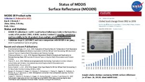
Status of MODIS Surface Reflectance – Vermote MODIS SR Product suite Collection 6: (Released in 2015) Bands 1 through 7 250 m, 500 m, 0. 05 deg. Daily, 8 days Status and Updates: • • MODIS SR Collection 6 ( La. SRC: Land Surface Reflectance Code) is the basis for a variety of SR product (VIIRS, AVHRR, Landsat, Sentinel 2) assuring consistency and traceability in the SR products from multiple satellites/instruments. Validation stage IV (AERONET) and cross-comparison with MODIS is on-going. Known Issues: • None Recent Publications: • • • Doxani, G. , Vermote, E. , Roger, J. C. , Gascon, F. , Adriaensen, S. , Frantz, D. , Hagolle, O. , Hollstein, A. , Kirches, G. , Li, F. and Louis, J. , 2018. Atmospheric correction inter-comparison exercise. Remote Sensing, 10(2), p. 352. Skakun, S. , Franch, B. , Vermote, E. , Roger, J. C. , Becker. Reshef, I. , Justice, C. and Kussul, N. , 2017. Early season large-area winter crop mapping using MODIS NDVI data, growing degree days information and a Gaussian mixture model. Remote Sensing of Environment, 195, pp. 244 -258. Breon F. M. , Vermote E. F. , Murphy E. , Franch B. , (2015) Measuring the directional variations of land surface reflectances from MODIS, IEEE transactions on Geoscience and Remote Sensing, 53 (8), 4638 -4649. “Contrary to popular opinion, tree cover increased by 2. 24 million square kilometers (more than 850, 000 square miles), an increase of about 7 percent during the time period. ” 11

Status of MODIS Active Fire - Giglio and Schroeder MODIS Active Fire Products Collection 6: (released 2015) • MOD 14/MYD 14: Terra/Aqua L 2 Swath • MOD 14 A 1/MYD 14 A 1: L 3 Daily 500 -m SIN Grid • MOD 14 A 2/MYD 14 A 2: L 3 8 -day 500 m SIN Grid • MCD 14 ML: Monthly fire locations Status and Updates: • Widely used mature product. • Stage-2 validated (using ASTER). Known Issues: • None. Recent Publications: • Giglio, L. , Schroeder, W. , and Justice, C. O. , 2016, The collection 6 MODIS active fire detection algorithm and fire products. Remote Sensing of Environment, 178, 31 -41. 12

Development of a Global Burned Area Earth System Data Record Louis Giglio 1, Luigi Boschetti 2, David Roy 3, Varaprasad Bandaru 1, Chris Justice 1 1 University of Maryland, 2 University of Idaho, 3 South Dakota State University December 2003 MODIS Burned Area Product

Status of MODIS Burned Area - Giglio MODIS Burned Area Product Collection 6: (released 2017) • MCD 64 A 1: Monthly L 3 500 m SIN Grid • MCD 64 CMH: Monthly CMG (released 2018) Status and Updates: • • Stage-2 validation complete. Stage-3 validation in preparation. Known Issues: • Edge fix for 26 tiles (patch 6. 0. 8). Recent Publications: • Giglio, L. , Boschetti, L. , Roy, D. P. , Humber, M. L. , and Justice, C. O. , 2018, The Collection 6 MODIS burned area mapping algorithm and product. Remote Sensing of Environment, 217: 72– 85. • Humber, M. L. , Boschetti, L. , Giglio, L. , and Justice, C. O. , 2018, Spatial and temporal intercomparison of four global burned area products, International Journal of Digital Earth. • Andela et al. , 2017, A human-driven decline in global burned area. Science, 356: 1356 -1362. 14

Status of MODIS GPP/NPP, ET/PET products and a LST for fun - Running MODIS GPP/NPP and ET/PET products. Collection 6: • • MOD 17 A 3 H: MODIS/Terra Annually L 4 500 m SIN Grid (GPP/NPP) MYD 17 A 3 H: MODIS/Aqua Annually L 4 500 m SIN Grid MOD 17 A 2 H: MODIS/Terra 8 -day L 4 500 m SIN Grid MYD 17 A 2 H: MODIS/Aqua 8 -day L 4 500 m SIN Grid MOD 16 A 3: MODIS/Terra Annually L 4 500 m SIN Grid (ET) MYD 16 A 3: MODIS/Aqua Annually L 4 500 m SIN Grid MOD 16 A 2: MODIS/Terra 8 -day L 4 500 m SIN Grid MYD 16 A 2: MODIS/Aqua 8 -day L 4 500 m SIN Grid Status and Updates: • • Creation of an optimized FPAR/LAI climatology. This climatology will be used to obtain gap free GPP/NPP and ET/PET products for the upcoming collection 6. 1. Known Issues: • Important gaps due to cloud contamination in heavily clouded areas. Recent Publications: • • • Alvaro Moreno, Gustau Camps-Valls, Jens Kattge, Nathaniel Robinson, Markus Reichstein, …, Steven W. Running (2018). A methodology to derive global maps of leaf traits using remote sensing and climate data, Remote Sensing of Environment, 218, 69 -88. Madani, N. , Kimball, J. S. , Ballantyne, A. P. , Affleck, D. L. , Bodegom, P. M. , Reich, P. B. , . . . & Zhao, M. (2018). Future global productivity will be affected by plant trait response to climate. Scientific reports, 8(1), 2870. He, M. , Kimball, J. S. , Maneta, M. P. , Maxwell, B. D. , Moreno, A. , Beguería, S. , & Wu, X. (2018). Regional Crop Gross Primary Productivity and Yield Estimation Using Fused Landsat-MODIS Data. Remote Sensing, 10(3), 372. Jones, M. O. , Running, S. W. , Kimball, J. S. , Robinson, N. P. , & Allred, B. W. (2018). Terrestrial primary productivity indicators for inclusion in the National Climate Indicators System. Climatic Change, 1 -14. David J. Mildrexler, Maosheng Zhao, Warren B. Cohen, Steven W. Running, Xiaopeng Song, Matthew O. Jones. 2018, Thermal Anomalies Detect Critical Global Land Surface Changes. J. Applied Meteorology and Climatology, 57, 391 -411. 15

Status of Terra/Aqua MODIS BRDF, Albedo and NBAR - Schaaf MODIS BRDF Albedo NBAR Products Collection V 006: • • • MCD 43 A: 500 m SIN grid MCD 43 A 1: BRDF/Albedo Model Parameters MCD 43 A 2: BRDF/Albedo Quality MCD 43 A 3: Albedo MCD 43 A 4: NBAR MCD 43 C: 0. 05 degree CMG MCD 43 C 1: CMG BRDF/Albedo Model Parameters MCD 43 C 2: CMG BRDF/Albedo Model Snow-Free Parameters MCD 43 C 3: CMG Albedo MCD 43 C 4: CMG NBAR MCD 43 D: 30 Arc-Second CMG (1 – 40) MCD 43 GF: CMG Gap-Filled Snow-Free Status and Updates: • New daily retrievals are being used extensively for phenology studies. • Snow free Gap Filled V 006 products (MCD 43 GF) are under production MCD 43 GF: DOY 250, 2010 Shortwave Broadband WSA Known Issues: • None Recent Publications: • Wang, Z. , Schaaf, C. B. , Sun, Q. , Shuai, Y. , & Román, M. O. (2018). Capturing Rapid Land Surface Dynamics with Collection V 006 MODIS BRDF/NBAR/Albedo (MCD 43) Products. Remote Sensing of Environment, 207(February), 50– 64. https: //doi. org/10. 1016/j. rse. 2018. 02. 001 • Sun, Q. , Wang, Z. , Li, Z. , Erb, A. , & Schaaf, C. B. (2017). Evaluation of the Global MODIS 30 Arc-Second Spatially and Temporally Complete Snow-Free Land Surface Albedo and Reflectance Anisotropy Dataset. International Journal of Applied Earth Observation and Geoinformation, 58, 36– 49. https: //doi. org/10. 1016/j. jag. 2017. 011 MCD 43 D 61: DOY 250, 2010 Shortwave Broadband WSA 16

Status of MODIS Cryosphere Products - Hall and Riggs MODIS Snow Cover Product Collection 6. 1: • New -- M*D 10 A 1 F: Daily Cloud-gap-filled product MODIS/Terra/Aqua L 3 500 m SIN Grid • M*D 10_L 2 revised algorithm and data content, improved snow cover detection Status and Updates: • • Snow cover algorithm: revised low visible reflectance screen and added two algorithm QA bit flags Product user guides updated for C 6. 1 Known Issues: • Investigating cloud/snow confusion and affect of aerosols on the snow cover algorithm Recent Publications: • • • Hall, D. K. , R. I. Cullather, J. C. Comiso, N. E. Di. Girolamo, S. M. Nowicki and B. C. Medley, 2018: A multilayer IST – albedo product of Greenland from MODIS, Remote Sensing [Special Issue: Remote Sensing of Essential Climate Variables and their Applications]. Feature Paper. 10(4), 555; https: //doi: 10. 3390/rs 10040555. Hall, D. K. , A. Frei and N. E. Di. Girolamo, 2018: On the frequency of lake-effect snowfall in the Catskill Mountains, Physical Geography, https: //doi: 10. 1080/02723646. 2018. 1440827. Riggs, G. A. , D. K. Hall and M. O. Román, 2017: Overview of NASA’s MODIS and Visible Infrared Imaging Radiometer Suite (VIIRS) snowcover Earth System Data Records, 9: 765 -777, https: //www. earth-syst-sci-data-discuss. net/essd-2017 -25/. A unique MODIS multi-layer Greenland IST and surface albedo product was generated by our team and is archived at NSIDC. 17

Generating continuous time series of daily snow cover with the MODIS Cloud-Gap-Filled (CGF) Product Dorothy Hall 1 and George Riggs 2 1 ESSIC / University of Maryland, 2 SSAI Cloud-Gap Filled Daily Snow Map with Cloud 19 March 2012 (A) Cloud (B) Comparison of Terra CGF and the standard Terra snow maps (C) The cloud-gap filled (CGF) MODIS product provides a consistent and continuous cloud free snow cover map (A) compared to the daily snow cover product (B) that has clouds which cause gaps in a time series of snow observations. The CGF maps are able to capture snow buildup and depletion (C), for example in Wind River Range, Wyoming, 1 Feb to 30 April 2012 (C).

Status of MODIS Long Term VI Time Series - Didan MODIS VI Suite (in its 19 th year) Collection 5: (Suspended in 2018) Collection 6: (Released in 2015) Collection 7: (In prep) Status and Updates: • • • Improved QA compositing scheme Multiple and ongoing algorithm adjustments to deal with changes in upstream products and/or issues Ongoing opportunistic validation (using NEON data) MODIS NDVI/EVI product suite continues to lead and drive science and applications with more than 12, 000 publications mentioning and/or using the MODIS NDVI/EVI time series, with multiple high end journal articles appearing annually. Known Issues: • The 2010 (C 6) decision to use pre-composited 8 -day surface reflectance inputs is causing spatial consistency issues that will be addressed in C 6. 1/C 7 Recent Publications: • • Jarchow, C. J. , Didan, K. , Barreto-Muñoz, A. , et al. (2018). Application and Comparison of the MODIS-Derived Enhanced Vegetation Index to VIIRS, Landsat 5 TM and Landsat 8 OLI Platforms: A Case Study in the Arid Colorado River Delta, Mexico. Sensors, 18(5), 1546. EL-Vilaly, M. A. S. , Didan, K, et al. (2018). Characterizing Drought Effects on Vegetation Productivity in the Four Corners Region of the US Southwest. Sustainability, 10(5), 1643. El-Vilaly MA, Didan K, et al. Vegetation productivity responses to drought on tribal lands in the four corners region of the Southwest USA. Frontiers of Earth Science. 2017 May: 1 -5. DOI 10. 1007/s 11707 -017 -0646 -z Peng D, Zhang X, Wu C, Huang W, et al. Intercomparison and evaluation of spring phenology products using National Phenology Network and Ameri. Flux observations in the contiguous United States. Agricultural and forest meteorology. 2017 Aug 15; 242: 33 -46. Jin, Q. , & Wang, C. (2018). The greening of Northwest Indian subcontinent and reduction of dust abundance resulting from Indian summer monsoon revival. Scientific reports, 8(1), 4573. 19

AOD Column WV RGB SR Snow. Frac, 1 km RGB Kiso (RTLS) DOY 230 DOY 60, 2005 Status of MODIS MAIAC (MCD 19) - Lyapustin MCD 19 Product Suite Collection 6: (Released in Spring of 2018) • • • MCD 19 A 1: Surface Reflectance – Daily L 3 1 km: BRF in bands 1 -12; Snow grain size and snow fraction; – Daily L 3 500 m: BRF in bands 1 -7; MCD 19 A 2: Atmospheric properties – Daily L 3 1 km: CM, AOD, CWV, Plume Injection Height (for detected smoke) MCD 19 A 3: BRDF/Albedo – 8 -Day L 3 1 km: RTLS BRDF, instantaneous albedo in bands 1 -8; Recent Publications: Status and Updates: • Fixing known issues for C 6. 1 Known Issues: • • Regional aerosol models cause AOD discontinuity in 3 regions (Sahel, Southern Africa, West India) Detection of sea ice Seasonality of aerosol models (to add) Missing some bright salt pans • Lyapustin et al. , 2018. MODIS Collection 6 MAIAC Algorithm, Atm. Meas. Techniques, doi: 10. 5194/amt-2018 -141. • Cooper et al. , 2018. Assessing snow extent data sets over North America to inform and improve trace gas retrievals from solar backscatter, Atm. Meas. Techniques, doi: 10. 5194/amt-11 -2983 -2018. • Liang F. et al. , 2018. MAIAC-based Long-term Spatiotemporal Trends of PM 2. 5 in Beijing China, Science of The Total Environment, doi: 10. 1016/j. scitotenv. 2017. 10. 155. • Chen et al. , 2017. Prototyping of LAI and FPAR Retrievals from MODIS Multi-Angle Implementation of Atmospheric Correction (MAIAC) Data. Remote Sensing, doi: 10. 3390/rs 9040370 20

Advancing MODIS-VIIRS Climate Data Records with Algorithm MAIAC Alexei Lyapustin 1, Yujie Wang 2, Sergey Korkin 3, Dong Huang 4 1 NASA GSFC; 2 UMBC; 3 USRA; 4 SSAI (C) (A) (B) Risk of death (7. 3%) at 10 g/m 3 increase in PM 2. 5 (Di et al. , Air Pollution and Mortality in the Medicare Population, The New England Journal of Medicine, doi: 10. 1056/NEJMoa 1702747) MAIAC MODIS algorithm improves the quality of cloud/snow detection, aerosol retrievals and atmospheric correction. (A) Chen et al. , (2017) showed improvement in LAI retrieval when using MAIAC surface reflectance as input; (B) Di et al. (2017) shows the risk of mortality curve as a function of air quality at PM 2. 5 levels well below the National Ambient Air Quality Standards (35 g/m 3). National daily 1 km PM 2. 5 for this study (2000 -2012) was obtained using MAIAC AOD from MODIS.

Status of MODIS LAI/FPAR - Myneni MODIS LAI/FPAR Product Collection 6: (Released in 2015) • • MOD 15 A 2 H: MYD 15 A 2 H: MCD 15 A 3 H: MODIS/Terra 8 -Day L 4 500 m SIN Grid MODIS/Aqua 8 -Day L 4 500 m SIN Grid MODIS/Terra+Aqua 4 -Day L 4 500 m SIN Grid Status and Updates: • • L 2 G–lite 500 meter surface reflectance used as input, instead of reflectance at 1 km resolution MODAGAGG. New multi-year land cover product at 500 m resolution, in place of the 1 km resolution static land cover product. Known Issues: • N/A. Recent Publications: • Chen et al. , (under review). China and India lead in greening of the world through land-use management. Nature Sustainability. • Xu et al. , 2018. An integrated method for validating longterm leaf area index products using global networks of sitebased measurements. Remote Sens. Environ. , doi: 10. 1016/j. rse. 2018. 02. 049 • Chen et al. , 2017. Prototyping of LAI and FPAR Retrievals from MODIS Multi-Angle Implementation of Atmospheric Correction (MAIAC) Data. Remote Sensing, doi: 10. 3390/rs 9040370 22

MODIS LST Detects Rising Temperatures and Heat Wave Trends in Urban Environments Los Angeles Hulley et al. 2018, RSE New MOD 21 LST product can pinpoint current and future communities that are most vulnerable to the detrimental effects of heat waves and extreme heat in urban areas. Heat vulnerability maps derived from this data can advise local governments on effective climate adaption and mitigation strategies.

Status of MODIS LST&E - Hulley Status and Updates: • • New LST&E product in Collection 6, reprocessing underway at MODAPS. Release Fall 2018 All issues with product/code resolved. All attributes, metadata, browse images cleared by LPDAAC MOD 21 LST&E Products: Collection 6: (Release Fall 2018) • Mx. D 21 L 2: Daily 5 -min L 2 Swath 1 km • Mx. D 21 A 1: Daily L 3 Global 1 km • Mx. D 21 A 2 8 -day L 3 Global 1 km Collection 6. 1: (Release 2019) • Mx. D 21 C 1: Daily 0. 05 degree Climate Modeling Grid (CMG) • Mx. D 21 C 2: 8 -day 0. 05 degree Climate Modeling Grid (CMG) • Mx. D 21 C 3: Monthly 0. 05 degree Climate Modeling Grid (CMG) Known Issues: • • • Limited support through next funding cycle resulting in semi-orphaned products. LST&E (Mx. D 11/Mx. D 21) have 10 different product types! Results in user confusion, reduced usability. No support or plan forward to retire Mx. D 11 suite of products. Requires analyzing and comparing Mx. D 11/Mx. D 21 products. Potential to reduce to 5 product types from Mx. D 21 (JPL product). Publications/Documentation: • Hulley, G. C. , Malakar, N. , Islam, T. , Freepartner, R, (2017), NASA’s MODIS and VIIRS Land Surface Temperature and Emissivity Products: A Consistent and High Quality Earth System Data Record, IEEE TGRS, DOI: 10. 1109/JSTARS. 2017. 2779330. • Malakar, N. K. , and G. C. Hulley (2016), A water vapor scaling model for improved land surface temperature and emissivity separation of MODIS thermal infrared data, Remote Sensing of Environment, 182, 252 -264 • User guide and ATBD available at: https: //modis. gsfc. nasa. gov/dataprod/mod 21. php 24

Please Visit the Posters at the Break for more details on Land Projects

MODIS Land SIPS Processing Status • Leading edge of the C 6 forward processing lags current day by a day or two except for maneuver days or satellite/instrument anomaly • Maneuver days are evaluated by LDOPE for geolocation error from LOPA • C 61 reprocessing expected to start in Nov 2018 and complete by Summer 2019. • Use C 61 L 1 B - Change in calibration approach to RVS for Aqua MODIS, Polarization correction to Terra MODIS, Cross talk correction for the TEB (PVLWIR) in Terra MODIS • Bug fix for known issues in the C 6 Land products. • No major science algorithm changes or product enhancements. • C 6 products available to public from NASA DAACs. C 6 reprocessing to be discontinued after completion of C 61 reprocessing. • NRT LANCE processing (C 6 Land using C 61 L 1 B) is completed typically 2 to 2. 5 hours after acquisition of data. • Near science quality products except for data impacted by maneuver • GIBS land product images are generated using operational C 6 products. • L 2 processing completed through Aug 28, 2018 • L 3 processing to start in Oct/Nov 2018 Details in Reports at the Land Break out session 26

C 6 MODIS Land Product Status • Tier 1: Land records from Collection 5 reprocessed in Collection 6 and distributed to public from NASA DAACs. Processing completed in 2016. Products include: LSR, Fire, LST, VI, LAI/Fpar, GPP/NPP, BRDF/Albedo, Snow, Sea-ice • Tier 2: Annual products and New land products generated at MODAPS in C 6 and distributed to public from NASA DAACs. Completed processing in 2017 and 2018. Tier 2: Product Description ESDT Processing Status Product Availability ATBD User Guide Evapotranspiration Mx. D 16 Completed ✔ ✔ ✔ JPL’s LST Mx. D 21 In progress ✔ ✔ ✔ MAIAC MCD 19 Completed ✔ ✔ ✔ Radiation and PAR MCD 18 2000 - 2008 ✔ - Beta quality ✔ ✔ Land Cover MCD 12 Q 1 Completed ✔ ✔ ✔ Phenology MCD 12 Q 2 In progress ✔ ✔ Burned Area MCD 64 A 1 Completed ✔ ✔ ✔ VCF MOD 44 B Completed ✔ ✔ ✔ Details in Reports at the Land Break out session

Land Team Foci for this Meeting • MODIS + VIIRS product maintenance > Senior Review • Securing Data Continuity MODIS> VIIRS> NOAA 20 > • Towards Long-term Land Data Records • Missions > Measurements Redux • Greater focus on multi-instrument products and science • New instruments added to the Land processing • International instruments (e. g. Sentinel 3 a/b AM orbit) • Experimental Products (Evaluation/Test) > Standard Products • Sustained Production (at the end of funding cycle) • Need for QA Metadata and QA Process • Product Validation on limited budgets (leverage CEOS LPV) • Evolving the Land SIPS for multi-instrument data • IT Infrastructure • Increased Science Stewardship for Orphaned Products • New approach to ATBDs and Documentation Developing a Long-Term Strategy for NASA Land Products
 Modis competence center
 Giglio
 Lance modis
 Hdf tools
 Stm nasa
 Modis
Modis Aqua terra modis
 3f443
3f443 Chris justice weather
 An area of land largely enclosed by higher land
 Identify the landform
 Introduction sur la maintenance industrielle
 Trey burkett
 Role of nurse in maintenance of records and reports
 University of guelph criminal justice and public policy
 Union of safety and justice employees
 Pnp badge number meaning
 Discuss the nature and concept of collaborative justice.
 Law and justice commission of pakistan
 Criminal justice corrections
 Chapter 11 basic concepts street law
 Ra 9344 juvenile justice and welfare act
 Employee termination quotes
 Justice and virtue
 Nonmaleficence
 What does the root jur mean?
 Integrity of creation reflection
 Integrity of creation
 Pros and cons of restorative justice
