MODIS MODerate resolution Imaging Spectroradiometer MODIS false color


 • Provides")


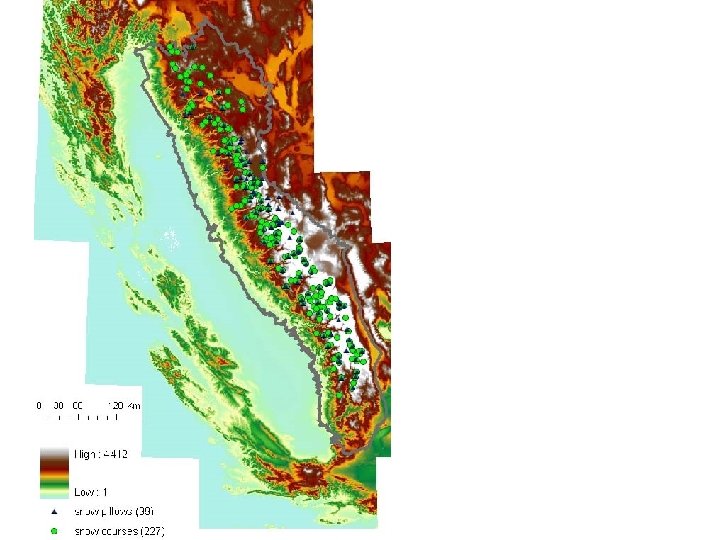
 Interpolation of ground based SWE: – Snow")
 March 7, 2004")

 March 7, 2004")


- Slides: 32
MODIS MODerate resolution Imaging Spectroradiometer MODIS false color composite of Tuolumne, Merced and adjacent basins.
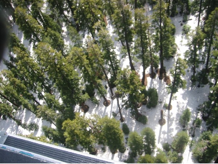
Upper Tuolumne basin, May 2005.
MODSCAG MODIS Snow Covered Area and Grain size April 10, 2004 • Based on MEMSCAG (Multiple Endmember Snow. Covered Area and Grain Size) Painter et al. , 2003, RSE
MODIS • Measures surface reflectance – Bands 1 -7 (visible and infrared) • Provides estimates of the surface spectral reflectance for each band as it would be measured from the ground in the absence of atmospheric scattering or absorption.
April 1, 2005 -Tuolumne and Merced River Basins
Spectral Mixing
Directional Effects • MODIS has 55° scan angle • Directional effects – Pixel size (bowtie) at scan edge – Forest occlusion of snow cover – Directional reflectance
Noisy variability caused by look angle, small clouds, vegetation, topography detail Vegetation causes differences in view angle 8
Vegetation Occlusion January 12, 2004 0 = 3° January 22, 2004 0 = 51°
Need to interpolate and smooth to fill the space-time cube Raw snow cover Interpolated snow cover
Approach • Wiener 2 D filter to eliminate noise (set noisy values to Na. N). • Cloud/snow discrimination based on grain size and location (set cloudy values to Na. N). • Interpolate in time dimension using smoothing splines, weighted by cos 2 of view angle. • Then interpolate in spatial dimension with quickhull algorithm.
Tuolumne 2004 January-July
Tuolumne 2004 October-2005 July
Analysis of snowcover products by basin Tuolumne Merced
% SCA 76 -100 51 -75 26 -50 1 -25 Tuolumne Merced DOY 131 – May 10
% SCA 76 -100 51 -75 26 -50 1 -25 Tuolumne Merced DOY 132 – May 11
% SCA 76 -100 51 -75 26 -50 1 -25 Tuolumne Merced DOY 133 – May 12
% SCA 1 -25 76 -100 26 -50 51 -75 26 -50 76 -100 1 -25 Tuolumne Merced DOY 134 – May 13
% SCA 76 -100 51 -75 26 -50 1 -25 Tuolumne Merced DOY 135 – May 14
% SCA 76 -100 51 -75 26 -50 1 -25 Tuolumne Merced DOY 136 – May 15
% SCA 76 -100 51 -75 26 -50 1 -25 Tuolumne Merced DOY 137 – May 16
% SCA 76 -100 51 -75 26 -50 1 -25 Tuolumne Merced DOY 138 – May 17
% SCA 76 -100 51 -75 26 -50 1 -25 Tuolumne Merced DOY 139 – May 18
Estimating SWE (Range and Basin Volume Maps) Interpolation of ground based SWE: – Snow pillow (daily) and snow course (monthly) Hypsometric method with inverse weighted distance interpolation of the residuals (detrended inverse weighted distance technique) using a grid resolution of 500 m – search radius 50 km and 100 km Fassnacht et al. , 2003, WRR.
MODIS SCA Interpolated SWE (snow pillow) March 7, 2004
Blended MODIS SCA & Interpolated SWE March 7, 2004
Upper Merced River Basin (2, 817 km 2) March 7, 2004
March 7, 2004 April 6, 2004 May 14, 2004 June 17, 2004
Snow depth as a component of water balance measurements snow distribution precipitation evapotranspiration melt timing partitioning infiltration ET runoff recharge snowmelt infiltration sublimation runoff wireless pod for snow depth ground & surface water exchange
Hydrologic modeling scheme data cube SWE SCA air precipitation temperature t y x climatology vegetation topography soils hydrologic model (PRMS) basin potential runoff SWE Time pixel by pixel runoff potential pixel by pixel SWE & SCA Time