Introduction to Geographic Information Systems GLY 560 GIS


- Slides: 23

Introduction to Geographic Information Systems GLY 560: GIS for Earth Scientists Class Home Page: http: //www. glyfac. buffalo. edu/courses/gly 560/

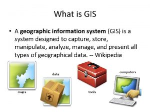
What is a Geographic Information System (GIS)? A broadly accepted definition of GIS is the one provided by the National Center of Geographic Information and Analysis (NCGIA): A GIS is a system of hardware, software and procedures to facilitate the management, manipulation, analysis, modeling, representation and display of georeferenced data to solve complex problems regarding planning and management of resources (NCGIA, 1990) GLY 560: GIS

What is a Geographic Information System (GIS)? Or simply: An information system designed for spatially referenced data. GLY 560: GIS

What is a GIS? Computer Brain Power Software Spatial Data GLY 560: GIS

Limitations of GIS In spite of the considerable power of GIS systems, it is still really just a mapmaking machine. We are still converting essentially three dimensional data to two dimensions. GLY 560: GIS

Limitations of GIS does make “psuedo” 3 -D (+z) and 4 -D (+z + t) possible by linking elevation and timeseries data to geographic position. GLY 560: GIS

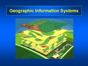
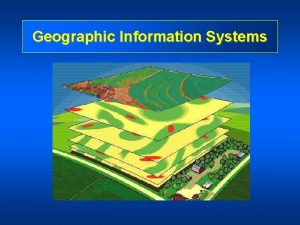
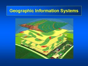
How GIS Works • Information is stored in layers. • Similar data types or “themes” are stored in each layer. • Data queries are given in terms of what layers are desired • Data are then displayed by overlaying all data requested on a single map. GLY 560: GIS

Geospatial Data Geospatial data have both spatial and thematic components: • Spatial component: The observations have two aspects in its localization: • • absolute localization based in a coordinates system topological relationship referred to other observations. GLY 560: GIS

Geospatial Data Geospatial data have both spatial and thematic components. • Thematic component: The variables or attributes can be studied considering thematic aspect (statistics), the locational aspect (spatial analysis) or both. GLY 560: GIS

Types of Spatial Data After Chang, 2002, Fig. 1. 1 GLY 560: GIS

Vector vs Raster Representation of Data Vector Representation Raster Representation GLY 560: GIS

Raster Data • Data are divided into rows and columns • Location is implicit in structure (i. e. size of each cell). • Each cell may be given values or “attributes”. Figure after: http: //www. sli. unimelb. edu. au/gisweb/GISModule/GIST_Raster. htm GLY 560: GIS

Non-Topological Vector Data Non-topological vector data can be points, lines, or polygons. ESRI calls non-topology-based maps “shapefiles”. GLY 560: GIS

Topological Vector Data Topological vector data can be label points, nodes, arcs, or polygons. ESRI calls topology-based maps “coverages”. GLY 560: GIS

Topologic vs. Non-Topologic Data Models Non-Topologic • Display quickly • Simple and compact data • Display more slowly • More complicated and less • Difficult to find and fix • Can “clean up” maps easily. • Facilitates advance spatial storage compact data storage errors • Spatial queries more difficult queries. • Can easily develop Method of choice when need a “simple map” measurements along routes Method of choice when need “smart map” GLY 560: GIS

Attribute Data • Features in a GIS usually have associated data called “attributes”. • Each feature may have a number of attributes, each attribute may have a number of features. GLY 560: GIS Attribute table for counties in Pennsylvania.

Georelational Data Model • Attributes are stored in a relational database and linked to features. This is called a “georelational data model” Attribute table for counties in Pennsylvania. GLY 560: GIS

Map Projections and Geodesy • With a GIS you still have to project 3 D globe on a 2 D surface • Must choose the appropriate projection GLY 560: GIS

Projections and Datums You must decide what map projection to use You must decide what horizontal datum to use. GIS systems allow you to convert among projections and datums efficiently. GLY 560: GIS

Geologic Maps • Legend • Scale • Coordinates • North Arrow GLY 560: GIS

GIS Generated Maps GLY 560: GIS

Data Sharing GLY 560: GIS

Summary • GIS good for 2 D static spatial data • Can be vector or raster data • Topologic or non-topologic data • Enables reprojection • Data can shared over internet GLY 560: GIS
 Octahedral optical isomers
 Gly
Gly Gly
Gly 53 sayısı 50 nin yüzde kaçıdır
 Iata airport handling manual
 Ba 560
 Ahm560
 560*.75
 Parametros ventilatorios en adultos
 560
560 560 000 in scientific notation
 Introduction to information systems 6th edition
 White-collar workers คือ
 Introduction to information systems 3rd edition
 Introduction to management information systems 5th edition
 What is information
 Accounting information system chapter 1
 Introduction to information systems 3rd edition
 Introduction to information systems 3rd edition
 In a global information system (gis), high coordination:
 Introduction to gis
 Introduction to gis
 Gis
Gis 林祥偉
林祥偉
