Input for Geological Risk Assessment Johannes Klein Jaana

- Slides: 22
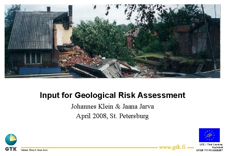
Input for Geological Risk Assessment Johannes Klein & Jaana Jarva April 2008, St. Petersburg Johanne Klein & Jaana Jarva LIFE – Third Countries Geo. Infor. M 1 LIFE 06 TCY/ROS/000267
Risk (technical approach) The probability of harmful consequences, or expected losses Risk = Hazard x Consequence (deaths, injuries, property, livelihoods, economic activity disrupted or environment damaged) resulting from interactions between natural or human-induced hazards and vulnerable conditions. Conventionally risk. Exposure is expressed by&the. Vulnerability notation Risk = Hazards x Vulnerability. Some disciplines also include the concept of exposure to refer particularly to the physical aspects of vulnerability. (UNISDR 2004) Johanne Klein & Jaana Jarva LIFE-Third Countries Geo. Infor. M 2 LIFE 06 TCY/ROS/000267
Input for the Risk Components • Hazard: – Type of hazard (geological instability, erosion, radon, flood…. ) – Probability of occurrence – Extent and magnitude • Exposure: – No. of people affected – No. of buildings affected – Length of affected network infrastructure (roads, pipelines, water supply…) • Vulnerability: – Sensitivity – Value Johanne Klein & Jaana Jarva LIFE-Third Countries Geo. Infor. M 3 LIFE 06 TCY/ROS/000267
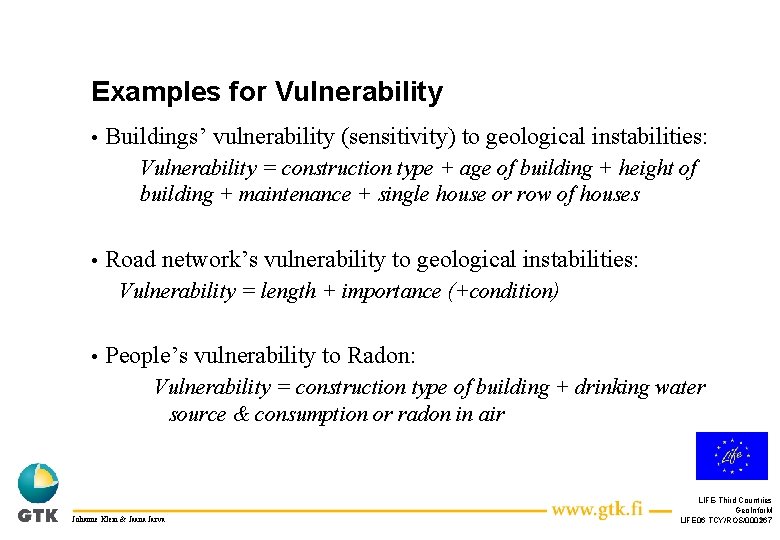
Examples for Vulnerability • Buildings’ vulnerability (sensitivity) to geological instabilities: Vulnerability = construction type + age of building + height of building + maintenance + single house or row of houses • Road network’s vulnerability to geological instabilities: Vulnerability = length + importance (+condition) • People’s vulnerability to Radon: Vulnerability = construction type of building + drinking water source & consumption or radon in air Johanne Klein & Jaana Jarva LIFE-Third Countries Geo. Infor. M 4 LIFE 06 TCY/ROS/000267
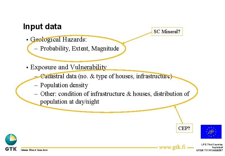
Input data • SC Mineral? Geological Hazards: – Probability, Extent, Magnitude • Exposure and Vulnerability – Cadastral data (no. & type of houses, infrastructure) – Population density – Other: condition of infrastructure & houses, distribution of population at day/night CEP? Johanne Klein & Jaana Jarva LIFE-Third Countries Geo. Infor. M 5 LIFE 06 TCY/ROS/000267
Table of Geological Risks and Vulnerability Geological Hazard Parameter Exposed Element Exposure Vulnerability Parameters and Indexes Radon concentration in air over threshold Population in radon prone area No. of people in “unprotected” houses Foundation types: Slab-on-grade, house with basement, crawl space Vuotilainen, A. and I. Mäkeläinen, 1993: Radon Risk Mapping using Indoor Monitoring Data, Indoor Air 19943, 3, 369 -375 Radon concentration in drinking water over threshold Population People using drinking water with radon concentratio n over threshold Amount of consumed radon affected drinking water Daily drinking water consumption: Adults: 140 ml/day Children: 200 ml/day Ingestion-dosefactor: Adults: 1 x 10 8 Sv/Bq Children: 2 x 10 8 Sv/Bq UNSCEAR 1993: Soruces and Effects of Ionizing Radiation – UNSCEAR 1993 Report to the General Assembly Mapping of ground stability Buildings No. of Buildings Height of buildings, age, construction type, maintenance, aggregation of buildings … Geological Instability See handed out table for more details Johanne Klein & Jaana Jarva Explanatio n … Sources … LIFE-Third Countries Geo. Infor. M 6 LIFE 06 TCY/ROS/000267
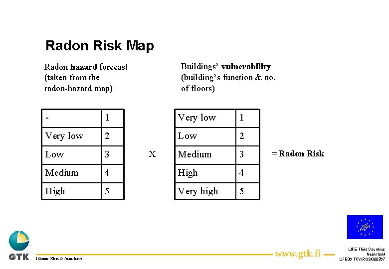
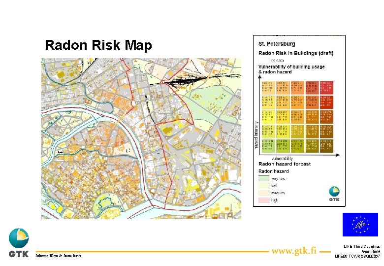
Radon Risk Map Buildings’ vulnerability (building’s function & no. of floors) Radon hazard forecast (taken from the radon-hazard map) - 1 Very low 2 Low 3 Medium 4 High 5 Very high 5 Johanne Klein & Jaana Jarva X = Radon Risk LIFE-Third Countries Geo. Infor. M 7 LIFE 06 TCY/ROS/000267
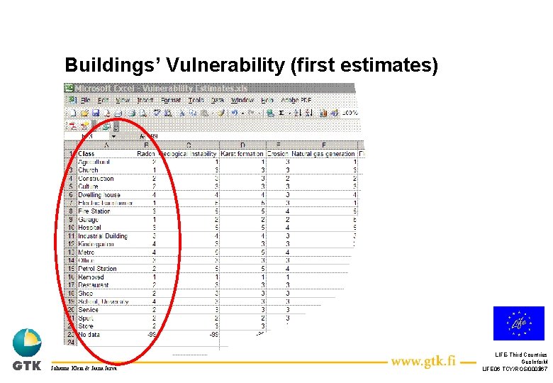
Buildings’ Vulnerability (first estimates) Johanne Klein & Jaana Jarva LIFE-Third Countries Geo. Infor. M 8 LIFE 06 TCY/ROS/000267
Radon Risk Map Johanne Klein & Jaana Jarva LIFE-Third Countries Geo. Infor. M 9 LIFE 06 TCY/ROS/000267
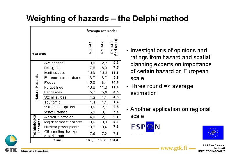
Weighting of hazards – the Delphi method Investigations of opinions and ratings from hazard and spatial planning experts on importance of certain hazard on European scale • Three round => average estimation • • Johanne Klein & Jaana Jarva Another application on regional scale LIFE-Third Countries Geo. Infor. M 10 LIFE 06 TCY/ROS/000267
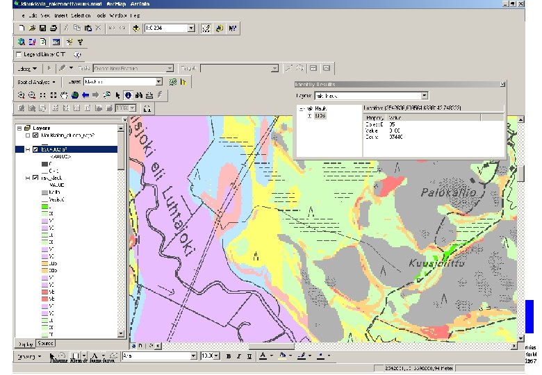
Multi-hazard (multi-risk) mapping Summing up of single hazard grid layers => classification of multi -hazards into five classes (very high, medium, low, very low) • Using the method of summing up the grids makes it possible to look backwards what is the data behind the qualitative risk assessment • See simplified example from Finland used to classify construction suitability on the regional scale • Johanne Klein & Jaana Jarva LIFE-Third Countries Geo. Infor. M 11 LIFE 06 TCY/ROS/000267
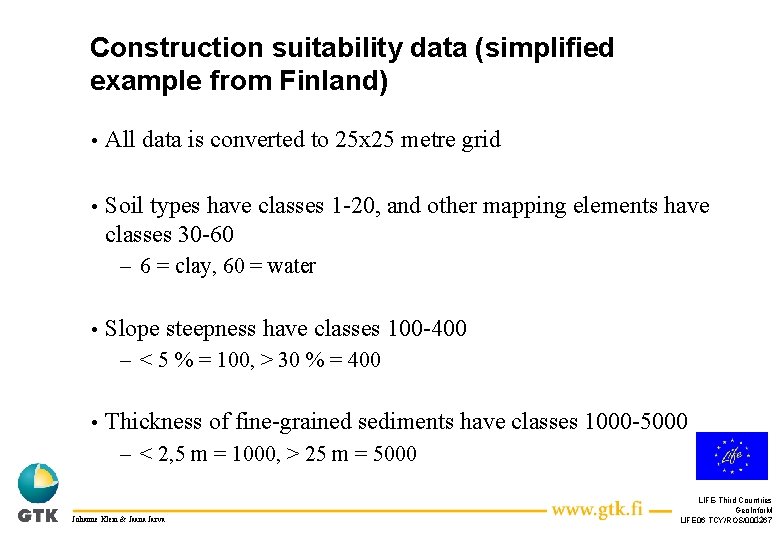
Construction suitability data (simplified example from Finland) • All data is converted to 25 x 25 metre grid • Soil types have classes 1 -20, and other mapping elements have classes 30 -60 – 6 = clay, 60 = water • Slope steepness have classes 100 -400 – < 5 % = 100, > 30 % = 400 • Thickness of fine-grained sediments have classes 1000 -5000 – < 2, 5 m = 1000, > 25 m = 5000 Johanne Klein & Jaana Jarva LIFE-Third Countries Geo. Infor. M 12 LIFE 06 TCY/ROS/000267
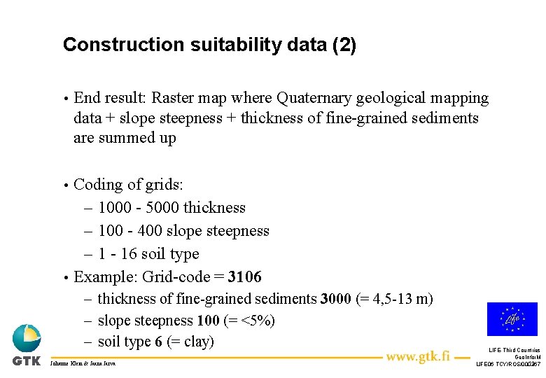
Construction suitability data (2) • End result: Raster map where Quaternary geological mapping data + slope steepness + thickness of fine-grained sediments are summed up Coding of grids: – 1000 - 5000 thickness – 100 - 400 slope steepness – 1 - 16 soil type • Example: Grid-code = 3106 • – thickness of fine-grained sediments 3000 (= 4, 5 -13 m) – slope steepness 100 (= <5%) – soil type 6 (= clay) Johanne Klein & Jaana Jarva LIFE-Third Countries Geo. Infor. M 13 LIFE 06 TCY/ROS/000267
Johanne Klein & Jaana Jarva LIFE-Third Countries Geo. Infor. M 14 LIFE 06 TCY/ROS/000267
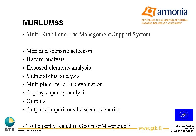
MURLUMSS • Multi-Risk Land Use Management Support System • • Map and scenario selection Hazard analysis Exposed elements analysis Vulnerability analysis Multiple criteria risk evaluation Coping capacity analysis Output comparisons between scenarios • To be partly tested in Geo. Infor. M –project? • • • Johanne Klein & Jaana Jarva LIFE-Third Countries Geo. Infor. M 15 LIFE 06 TCY/ROS/000267
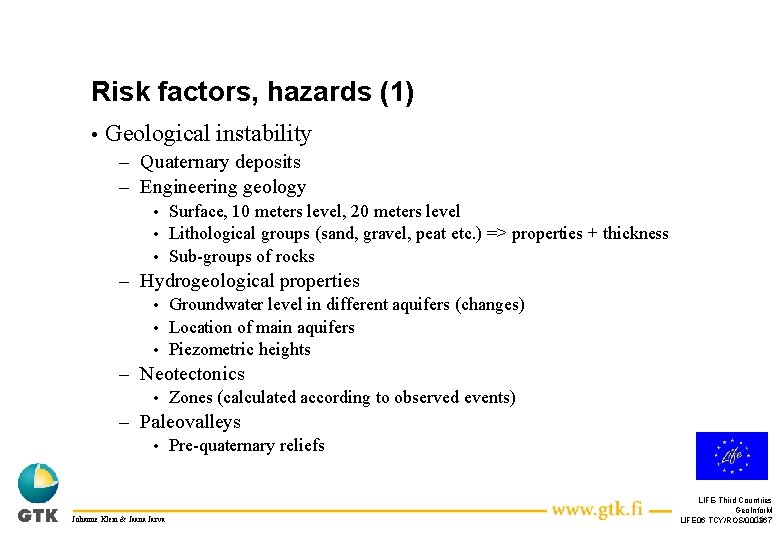
Risk factors, hazards (1) • Geological instability – Quaternary deposits – Engineering geology Surface, 10 meters level, 20 meters level • Lithological groups (sand, gravel, peat etc. ) => properties + thickness • Sub-groups of rocks • – Hydrogeological properties Groundwater level in different aquifers (changes) • Location of main aquifers • Piezometric heights • – Neotectonics • Zones (calculated according to observed events) – Paleovalleys • Johanne Klein & Jaana Jarva Pre-quaternary reliefs LIFE-Third Countries Geo. Infor. M 16 LIFE 06 TCY/ROS/000267
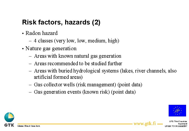
Risk factors, hazards (2) • Radon hazard – 4 classes (very low, medium, high) • Nature gas generation – Areas with known natural gas generation – Areas recommended to be studied further – Areas with buried hydrological systems (lakes, river channels, also artificial formed areas) – Gas collector wells (risk management) (point data) – Gas generation events (known risk) (point data) Johanne Klein & Jaana Jarva LIFE-Third Countries Geo. Infor. M 17 LIFE 06 TCY/ROS/000267
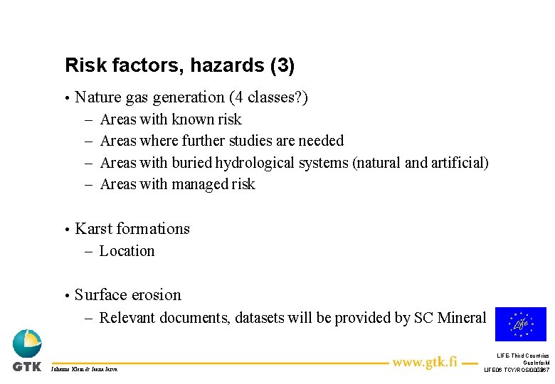
Risk factors, hazards (3) • Nature gas generation (4 classes? ) – – • Areas with known risk Areas where further studies are needed Areas with buried hydrological systems (natural and artificial) Areas with managed risk Karst formations – Location • Surface erosion – Relevant documents, datasets will be provided by SC Mineral Johanne Klein & Jaana Jarva LIFE-Third Countries Geo. Infor. M 18 LIFE 06 TCY/ROS/000267
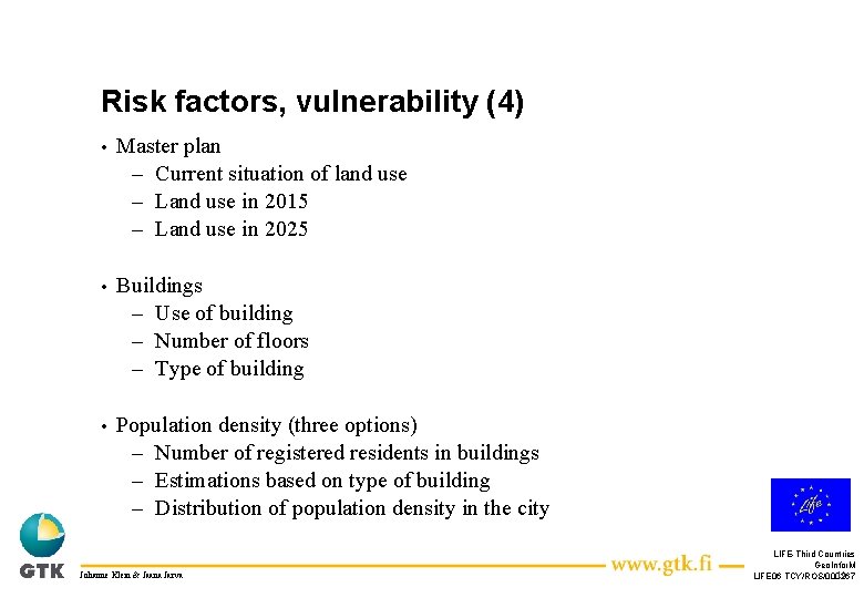
Risk factors, vulnerability (4) • Master plan – Current situation of land use – Land use in 2015 – Land use in 2025 • Buildings – Use of building – Number of floors – Type of building • Population density (three options) – Number of registered residents in buildings – Estimations based on type of building – Distribution of population density in the city Johanne Klein & Jaana Jarva LIFE-Third Countries Geo. Infor. M 19 LIFE 06 TCY/ROS/000267
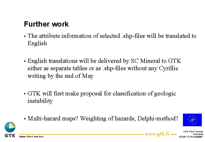
Further work • The attribute information of selected. shp-files will be translated to English • English translations will be delivered by SC Mineral to GTK either as separate tables or as. shp-files without any Cyrillic writing by the end of May • GTK will first make proposal for classification of geologic instability • Multi-hazard maps? Weighting of hazards; Delphi-method? Johanne Klein & Jaana Jarva LIFE-Third Countries Geo. Infor. M 20 LIFE 06 TCY/ROS/000267
Relevance of geological risks Results from questionnaire developed in Task 2 • The most important risk according to four interviewed groups: flooding caused by groundwater • Other relevant risks: karst formations and radon hazard • • Geological instability? Johanne Klein & Jaana Jarva LIFE-Third Countries Geo. Infor. M 21 LIFE 06 TCY/ROS/000267
Discussion Difference between options of experts and people • Promotion needed • Johanne Klein & Jaana Jarva LIFE-Third Countries Geo. Infor. M 22 LIFE 06 TCY/ROS/000267