GPS Fundamentals Jie Liu Microsoft Research Redmond WA


- Slides: 29
GPS Fundamentals Jie Liu Microsoft Research Redmond, WA 98052 Jie. liu@microsoft. com Mobile Location Sensing Tutorial at Mobi. Sys 2013
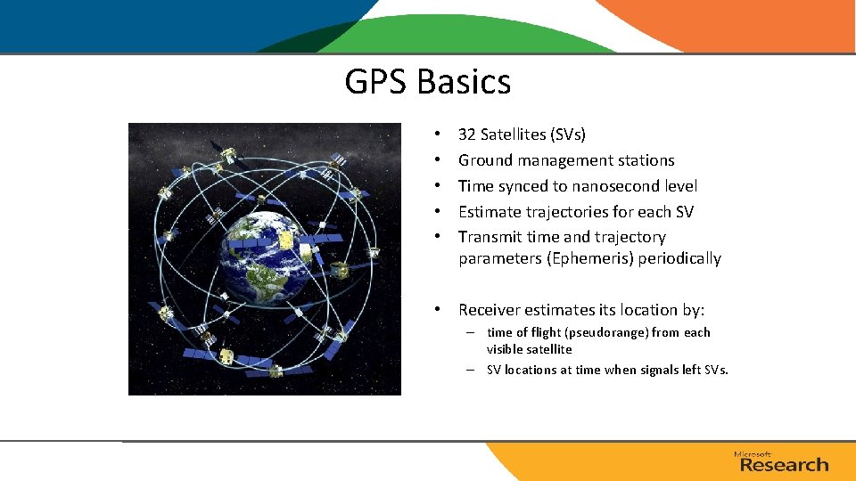
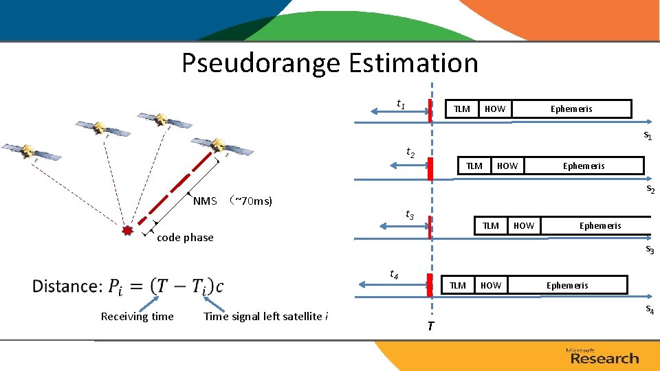
GPS Basics • • • 32 Satellites (SVs) Ground management stations Time synced to nanosecond level Estimate trajectories for each SV Transmit time and trajectory parameters (Ephemeris) periodically • Receiver estimates its location by: – time of flight (pseudorange) from each visible satellite – SV locations at time when signals left SVs.
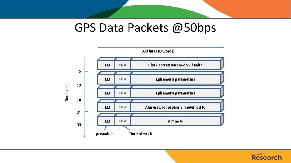
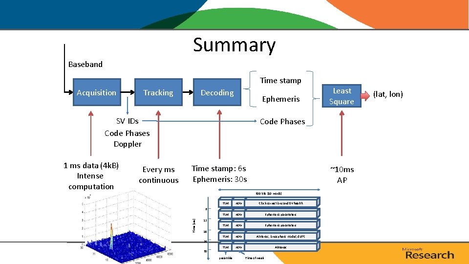
GPS Data Packets @50 bps 300 bits (10 words) TLM HOW Clock corrections and SV health TLM HOW Ephemeris parameters TLM HOW Almanac, ionospheric model, d. UTC TLM HOW Almanac Time (sec) 6 12 18 24 30 preamble Time of week
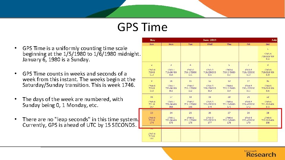
GPS Time • GPS Time is a uniformly counting time scale beginning at the 1/5/1980 to 1/6/1980 midnight. January 6, 1980 is a Sunday. • GPS Time counts in weeks and seconds of a week from this instant. The weeks begin at the Saturday/Sunday transition. This is week 1746. • The days of the week are numbered, with Sunday being 0, 1 Monday, etc. • There are no "leap seconds" in this time system. Currently, GPS is ahead of UTC by 15 SECONDS.
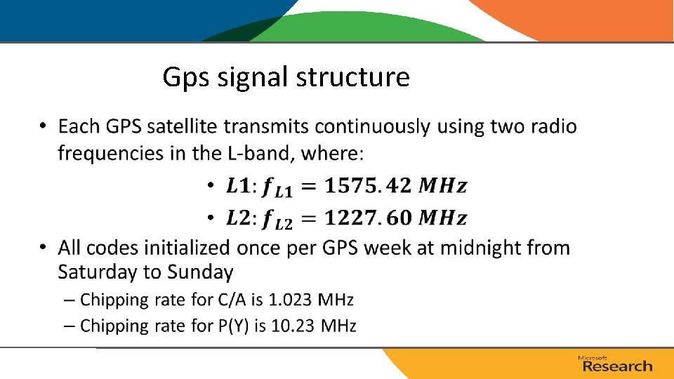
Gps signal structure •
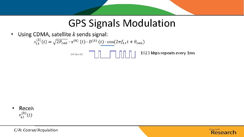
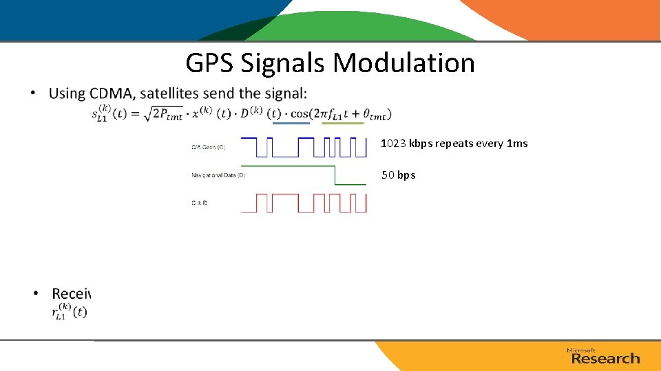
GPS Signals Modulation • 1023 kbps repeats every 1 ms C/A: Coarse/Acquisition
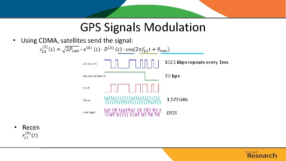
GPS Signals Modulation • 1023 kbps repeats every 1 ms 50 bps 1. 575 GHz
GPS Signals Modulation • 1023 kbps repeats every 1 ms 50 bps 1. 575 GHz DSSS
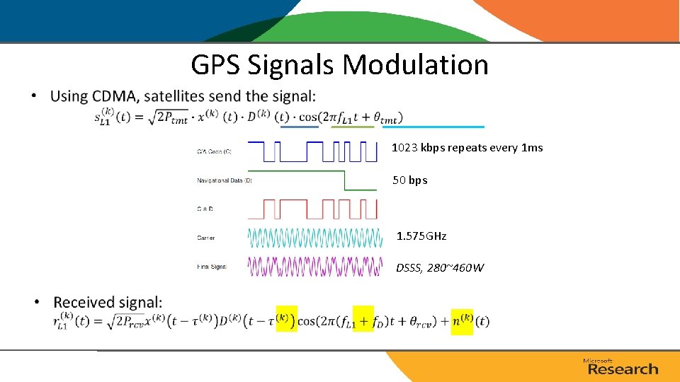
GPS Signals Modulation • 1023 kbps repeats every 1 ms 50 bps 1. 575 GHz DSSS, 280~460 W
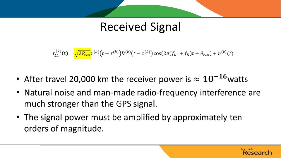
Received Signal •
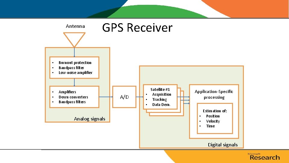
Antenna • • • Burnout protection Bandpass filter Low-noise amplifier • • • Amplifiers Down converters Bandpass filters GPS Receiver Analog signals A/D Satellite #1 • Acquisition • Tracking. . • Data Dem. Application-Specific processing Estimation of: • Position • Velocity • Time Digital signals
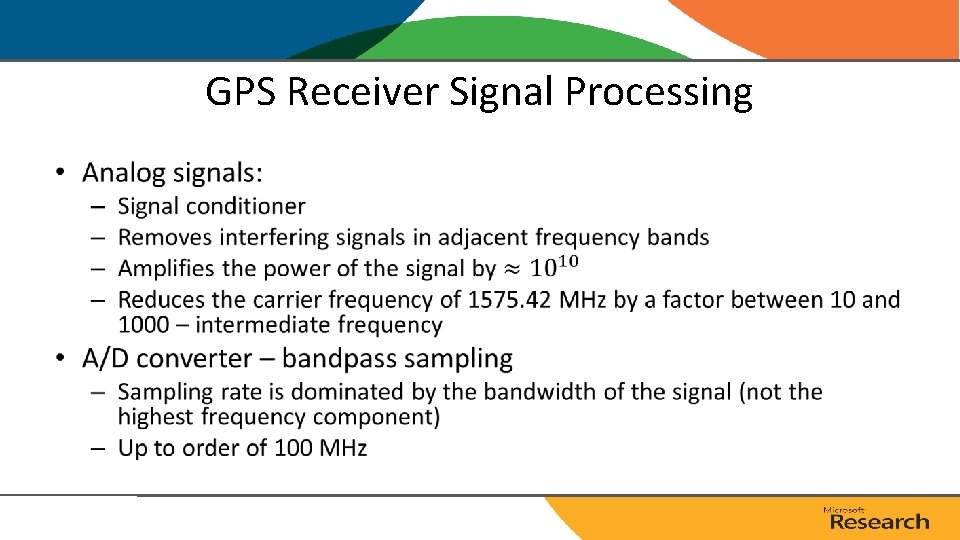
GPS Receiver Signal Processing •
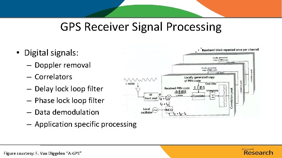
GPS Receiver Signal Processing • Digital signals: – – – Doppler removal Correlators Delay lock loop filter Phase lock loop filter Data demodulation Application specific processing Figure courtesy: F. Van Diggelen “A-GPS”
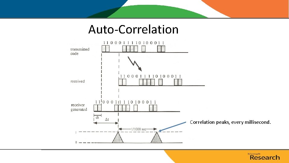
Auto-Correlation peaks, every millisecond.
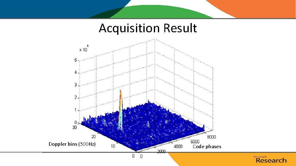
Doppler Shifts • A rising GPS satellite can move at up to 800 m/s towards a receiver, causing a frequency shift of L 1*800/c = 4. 2 k. Hz, where c is the speed of light. Simulated acquisition with no noise. Figure courtesy: F. Van Diggelen “A-GPS”
Acquisition Result Doppler bins (500 Hz) Code phases
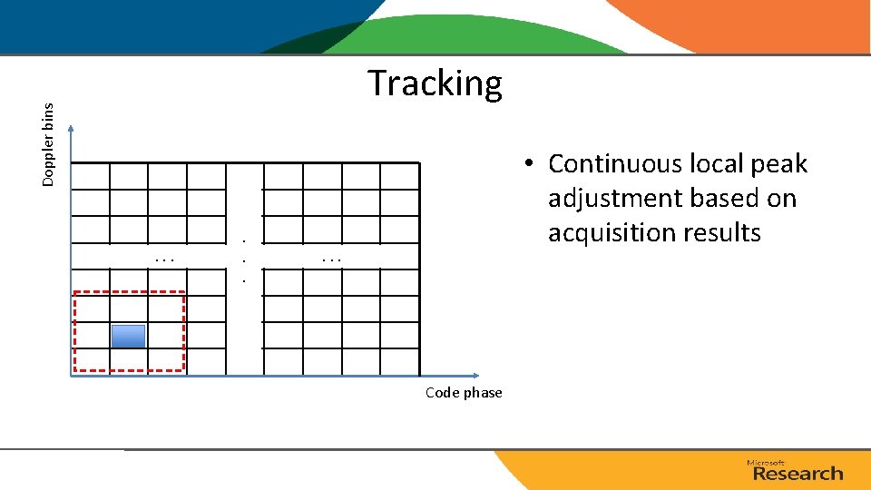
Doppler bins Tracking • Continuous local peak adjustment based on acquisition results . . . . . Code phase
Pseudorange Estimation t 1 TLM HOW Ephemeris s 1 t 2 TLM t 3 TLM code phase Time signal left satellite i HOW Ephemeris s 3 t 4 Receiving time Ephemeris s 2 NMS (~70 ms) HOW TLM HOW Ephemeris s 4 T
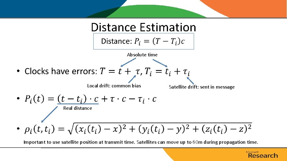
Distance Estimation Absolute time • Local drift: common bias Satellite drift: sent in message Real distance Important to use satellite position at transmit time. Satellites can move up to 60 m during propagation time.
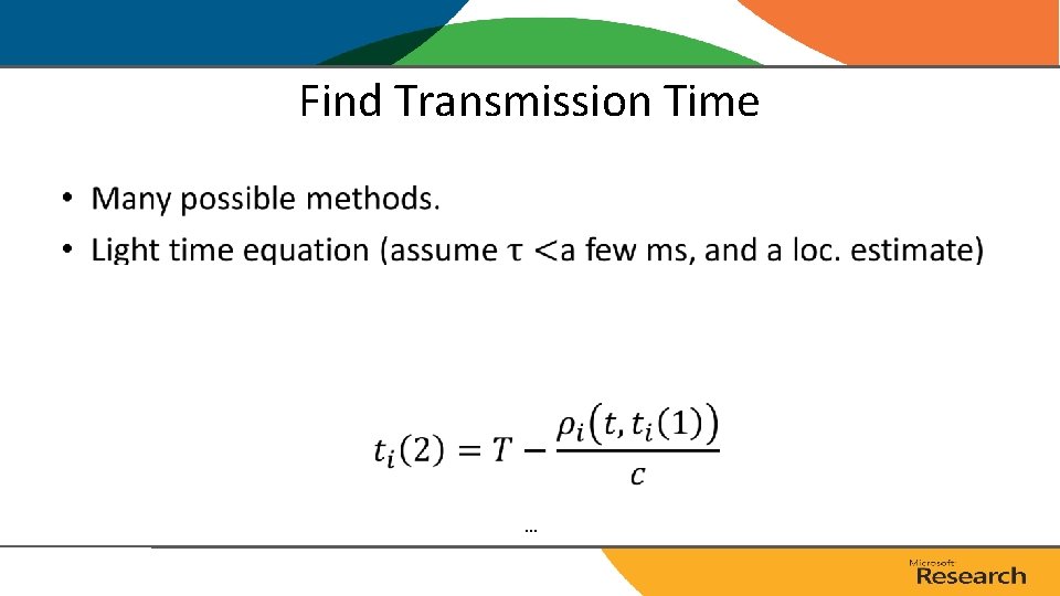
Find Transmission Time • …
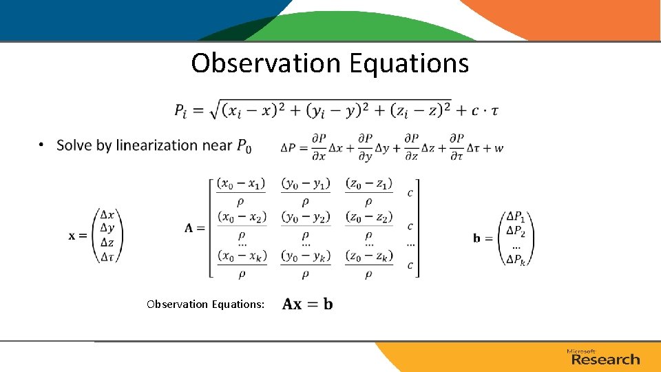
Observation Equations • Observation Equations:
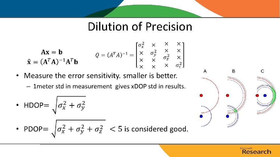
Dilution of Precision •
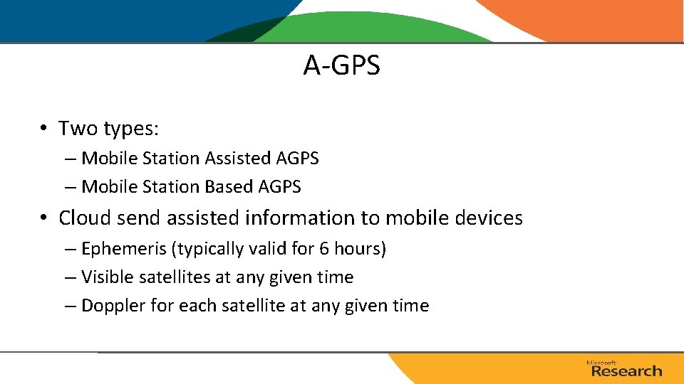
A-GPS • Two types: – Mobile Station Assisted AGPS – Mobile Station Based AGPS • Cloud send assisted information to mobile devices – Ephemeris (typically valid for 6 hours) – Visible satellites at any given time – Doppler for each satellite at any given time
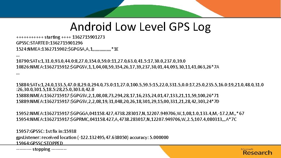
Android Low Level GPS Log ++++++ starting ++++ 1362715901273 GPSSC: STARTED: 1362715901296 1524: NMEA: 1362715902: $GPGSA, A, 1, , , , *1 E … 10790: SATs: 1, 31. 0, 93. 0, 44. 0: 8, 27. 0, 354. 0, 59. 0: 11, 27. 0, 63. 0, 41. 5: 17, 30. 0, 237. 0, 39. 0 10826: NMEA: 1362715912: $GPGSV, 1, 1, 04, 08, 59, 354, 26, 17, 39, 237, 30, 01, 44, 093, 30, 11, 41, 063, 26*7 A … 15884: SATs: 1, 24. 0, 133. 5, 47. 0: 8, 29. 0, 294. 0, 73. 0: 11, 27. 0, 100. 5, 59. 5: 15, 22. 0, 331. 5, 0. 0: 17, 25. 0, 235. 5, 16. 0: 19, 21. 0, 48. 0, 31. 0 : 26, 30. 0, 301. 5, 18. 5: 28, 25. 0, 303. 0, 42. 0 15888: NMEA: 1362715917: $GPGSV, 2, 1, 08, 73, 294, 28, 17, 16, 235, 24, 01, 47, 133, 21, 11, 59, 100, 26*71 15889: NMEA: 1362715917: $GPGSV, 2, 2, 08, 19, 31, 048, 20, 26, 18, 301, 29, 15, 00, 331, 28, 42, 303, 24*7 D 15952: NMEA: 1362715917: $GPGGA, 041158. 427, 4738. 283017, N, 12207. 949706, W, 1, 08, 1. 0, 133. 4, M, -17. 2, M, , *67 15954: NMEA: 1362715917: $GPRMC, 041158. 427, A, 4738. 283017, N, 12207. 949706, W, 2. 5, 107. 4, 080313, , , A*7 C 15957: GPSSC: 1 st fix in: 15938 gps. Listener: received location (-122. 132495, 47. 638050) accuracy: 5. 000000 15964: GPSSC: STOPPED ----- stopping -----
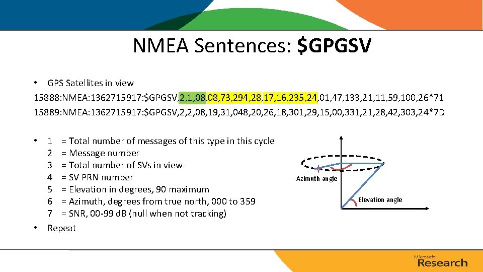
NMEA Sentences: $GPGSV • GPS Satellites in view 15888: NMEA: 1362715917: $GPGSV, 2, 1, 08, 73, 294, 28, 17, 16, 235, 24, 01, 47, 133, 21, 11, 59, 100, 26*71 15889: NMEA: 1362715917: $GPGSV, 2, 2, 08, 19, 31, 048, 20, 26, 18, 301, 29, 15, 00, 331, 28, 42, 303, 24*7 D • 1 = Total number of messages of this type in this cycle 2 = Message number 3 = Total number of SVs in view 4 = SV PRN number 5 = Elevation in degrees, 90 maximum 6 = Azimuth, degrees from true north, 000 to 359 7 = SNR, 00 -99 d. B (null when not tracking) • Repeat Azimuth angle Elevation angle
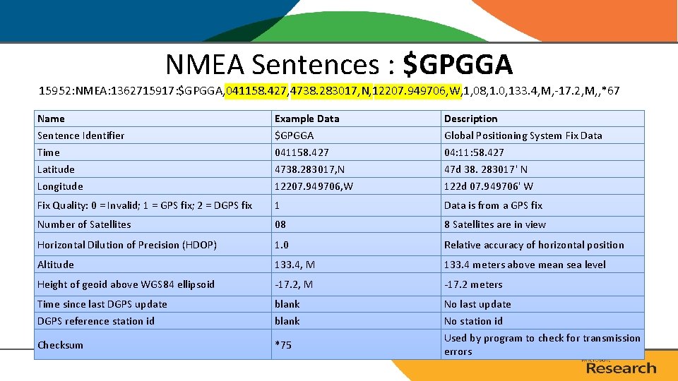
NMEA Sentences : $GPGGA 15952: NMEA: 1362715917: $GPGGA, 041158. 427, 4738. 283017, N, 12207. 949706, W, 1, 08, 1. 0, 133. 4, M, -17. 2, M, , *67 Name Sentence Identifier Time Latitude Longitude Example Data $GPGGA 041158. 427 4738. 283017, N 12207. 949706, W Description Global Positioning System Fix Data 04: 11: 58. 427 47 d 38. 283017' N 122 d 07. 949706' W Fix Quality: 0 = Invalid; 1 = GPS fix; 2 = DGPS fix 1 Data is from a GPS fix Number of Satellites 08 8 Satellites are in view Horizontal Dilution of Precision (HDOP) 1. 0 Relative accuracy of horizontal position Altitude 133. 4, M 133. 4 meters above mean sea level Height of geoid above WGS 84 ellipsoid -17. 2, M -17. 2 meters Time since last DGPS update DGPS reference station id blank Checksum *75 No last update No station id Used by program to check for transmission errors
Summary Baseband Time stamp Acquisition Tracking Decoding Ephemeris SV IDs Code Phases Doppler Every ms continuous Code Phases Time stamp: 6 s Ephemeris: 30 s ~10 ms AP 300 bits (10 words) TLM HOW Clock corrections and SV health TLM HOW Ephemeris parameters TLM HOW Almanac, ionospheric model, d. UTC TLM HOW Almanac 6 Time (sec) 1 ms data (4 k. B) Intense computation Least Square 12 18 24 30 preamble Time of week (lat, lon)
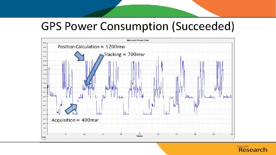
GPS Power Consumption (Succeeded)
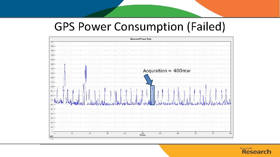
GPS Power Consumption (Failed)