Digital Maps and Digital Map Reference Ed Redmond


 • Access to surrogates without risking")
 • Out of copyright (pre-1923 for U. S.")


![1754 Sketch Map map prepared to accompany “Journey to the Ohio” [Jan. 1754]](https://slidetodoc.com/presentation_image/dae3526489059f4c807bbef30d048ddf/image-37.jpg "1754 Sketch Map map prepared to accompany “Journey to the Ohio” [Jan. 1754]")


![Plan of Clifton Neck, 1760 [recto]](https://slidetodoc.com/presentation_image/dae3526489059f4c807bbef30d048ddf/image-41.jpg "Plan of Clifton Neck, 1760 [recto]")

![Plan of Clifton Neck, 1760 [verso]](https://slidetodoc.com/presentation_image/dae3526489059f4c807bbef30d048ddf/image-43.jpg "Plan of Clifton Neck, 1760 [verso]")


![[Eight Survey Tracts Along the Great Kanawha, 1774]](https://slidetodoc.com/presentation_image/dae3526489059f4c807bbef30d048ddf/image-52.jpg "[Eight Survey Tracts Along the Great Kanawha, 1774]")
![1774 [Eight Surveys along the Great Kanawha River, WV]](https://slidetodoc.com/presentation_image/dae3526489059f4c807bbef30d048ddf/image-53.jpg "1774 [Eight Surveys along the Great Kanawha River, WV]")
![Map abt. Redstone Creek and Fort Pitt, [1780]](https://slidetodoc.com/presentation_image/dae3526489059f4c807bbef30d048ddf/image-54.jpg "Map abt. Redstone Creek and Fort Pitt, [1780]")

- Slides: 56
Digital Maps and Digital Map Reference Ed Redmond, Geography and Map Division, Library of Congress
Brief History 1995 G&M’s Digital Scanning Lab • Digitization of Historic Items • not “Born Digital” • Research Quality images through the Internet
What Do We Scan
Scanning Goals: • Research quality images (not facsimiles) • Access to surrogates without risking the original item(s) • Controlled access – Voyager – Persistent URLs (aka: Handles) – Digital IDs • Example: http: //hdl. loc. gov/loc. gmd/g 3750. ct 000097
Scanning Priorities • Popular items (cartobibliographies) • Out of copyright (pre-1923 for U. S. publications and U. S. Government publications) • Items with existing catalog records ©
Scanning with Jumbo. Scanner This scanner uses an overhead camera that scans Red, then Green, then Blue. A full bed scan of over 3’x 5’ takes about five minutes (same as with Tangent) to scan a 300 dpi item 1: 1 resolution
Processing • Raw TIFF images are stored on a server • DELLs: – 200 GB of RAM – 80 GB hard drive – 160 GB 2 nd hard drive • Adobe Photoshop • Aware JPEG 2000
Metadata • Metadata tables • Who, what, when, by whom, on which scanner, what project, file name, file location, geographic location, and notes
Cataloging Digital ID: g 3300 ct 000232 Handle: http: //hdl. loc. gov/loc. gmd/g 3300. ct 000232
Cataloging
Conservation
Mark before Refiling
Retrieval
Stacks
We have a “Beaver” Map!?
Are there any other benefits to scanning? • Funny you should ask…
LC Map Collections website now features more than 10, 000 cartographic items
LC Leaning Page created especially for teachers
LC “Collection Connections” marries digital content with education standards
Lesson Plans arranged by theme
Erie Canal lesson plan derived from LC online materials supporting 4 weeks of classroom education
Two video conferences featuring maps
Survey for John Lindsey November 17, 1750
Survey Description
1748 Map of Alexandria, VA
1749 Map of Alexandria, VA
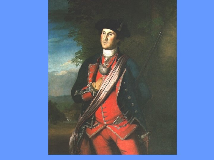
Washington and Fairfax
1754 Sketch Map map prepared to accompany “Journey to the Ohio” [Jan. 1754]
“The French are now coming…”
Lands Mapped at Mount Vernon by GW, 17471799
Plan of Clifton Neck, 1760
Plan of Clifton Neck, 1760 [recto]
Clifton Neck/River Farm
Plan of Clifton Neck, 1760 [verso]
“Inclosure lying West of the Garden. . ”
Captain Posey’s Woodland
Little Hunting Creek, 1766
River Farm, 1766
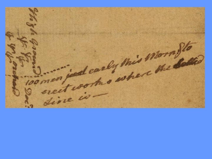
“Spy” Map of Princeton, NJ sent from Colonel John Cadwalader to George Washington Dec. 31, 1776
Defenses
Road behind Princeton
[Eight Survey Tracts Along the Great Kanawha, 1774]
1774 [Eight Surveys along the Great Kanawha River, WV]
Map abt. Redstone Creek and Fort Pitt, [1780]
Detail showing land claims