Florida Permanent Reference Network Florida Custom Geoid and







- Slides: 18
Florida Permanent Reference Network Florida Custom Geoid and New Datums Ron Hanson, PSM FPRN Manager
FPRN GEOID 2016 WHY? • Usefulness of any Geoid model is limited by data density and distribution. • NGS Hybrid Geoid philosophy limits current usefulness to surveyors. Rigorous Math vs. Survey Practical • Geoid 12 A/B is good in a relative sense – not so good in an absolute sense. • FPRN (RTK mode) requires a Geoid to be functional in the absolute sense. • Gravity based Geoid model from NGS will not be available until 2022 +.
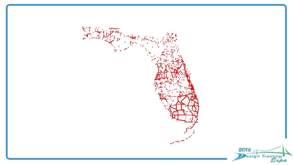
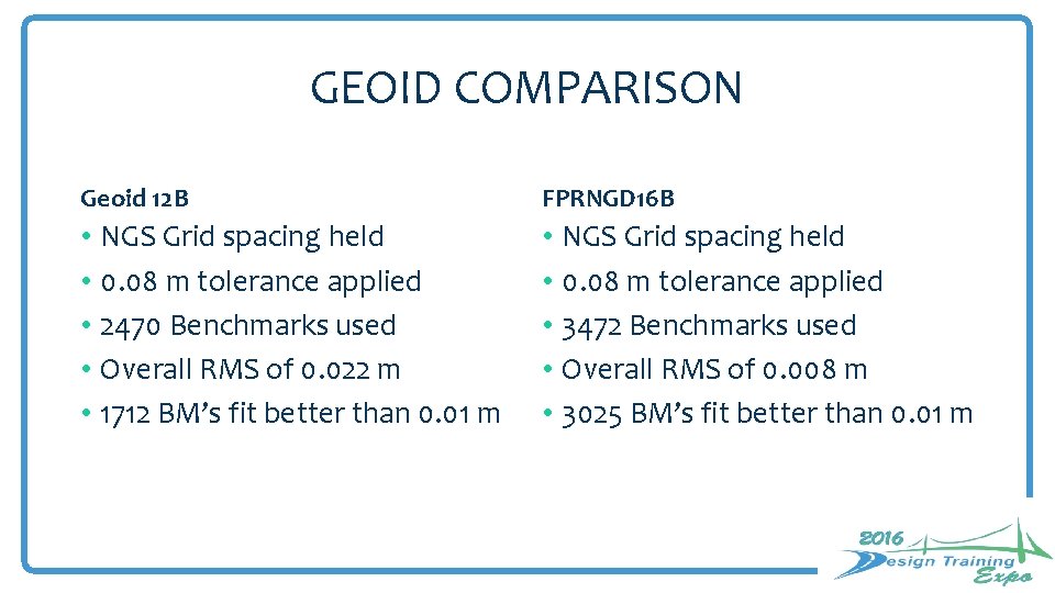
GEOID COMPARISON Geoid 12 B FPRNGD 16 B • NGS Grid spacing held • 0. 08 m tolerance applied • 2470 Benchmarks used • Overall RMS of 0. 022 m • 1712 BM’s fit better than 0. 01 m • NGS Grid spacing held • 0. 08 m tolerance applied • 3472 Benchmarks used • Overall RMS of 0. 008 m • 3025 BM’s fit better than 0. 01 m
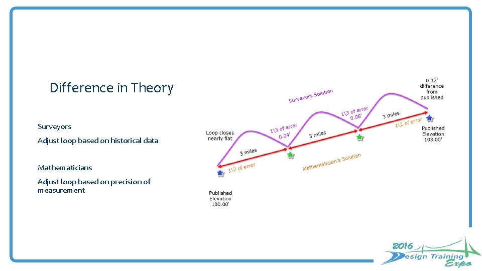
Difference in Theory Surveyors Adjust loop based on historical data Mathematicians Adjust loop based on precision of measurement
The Big Picture
In the weeds
Time is wasting
New Datums of 2022
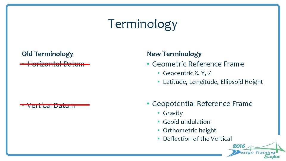
Terminology Old Terminology New Terminology • Horizontal Datum • Geometric Reference Frame • Geocentric X, Y, Z • Latitude, Longitude, Ellipsoid Height • Vertical Datum • Geopotential Reference Frame • • Gravity Geoid undulation Orthometric height Deflection of the Vertical
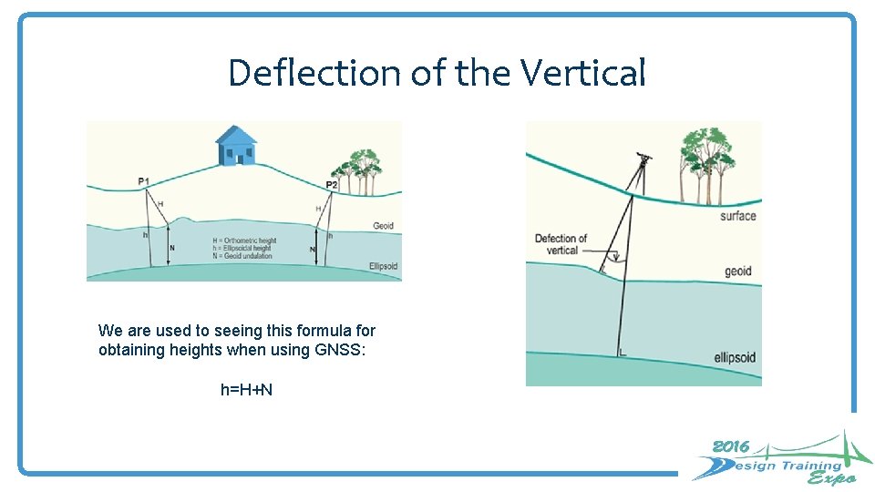
Deflection of the Vertical We are used to seeing this formula for obtaining heights when using GNSS: h=H+N
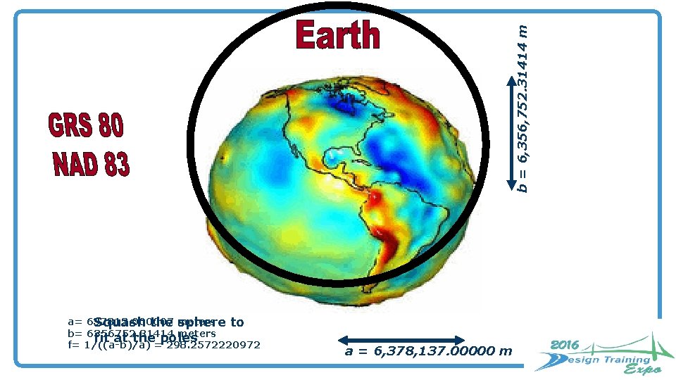
b = 6, 356, 752. 31414 m a= 637813. 000007 Squash the meters sphere to b= 6356752. 31414 meters fit at the poles f= 1/((a-b)/a) = 298. 2572220972 a = 6, 378, 137. 00000 m
New Datums are coming in 2022! • Both a new geometric (horizontal) and a new geopotential (vertical) datum will be released in 2022. • The realization of the new datums will be through GNSS receivers. • NGS will provide the tools to easily transform between the new and old datums.
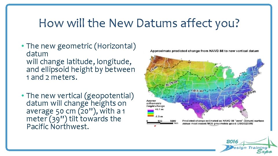
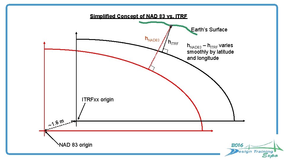
How will the New Datums affect you? • The new geometric (Horizontal) datum will change latitude, longitude, and ellipsoid height by between 1 and 2 meters. • The new vertical (geopotential) datum will change heights on average 50 cm (20''), with a 1 meter (39'') tilt towards the Pacific Northwest.
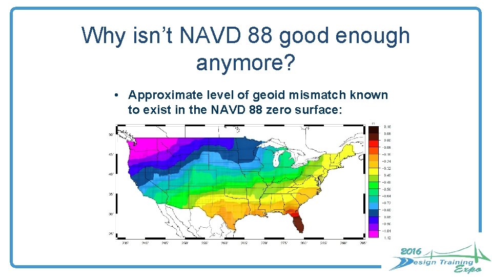
Why isn’t NAVD 88 good enough anymore? • Approximate level of geoid mismatch known to exist in the NAVD 88 zero surface:
Simplified Concept of NAD 83 vs. ITRF Earth’s Surface h. NAD 83 ITRFxx origin ~1. 6 m NAD 83 origin h. ITRF h. NAD 83 – h. ITRF varies smoothly by latitude and longitude
Questions?