Deformation The essence of structural geology this is


- Slides: 21

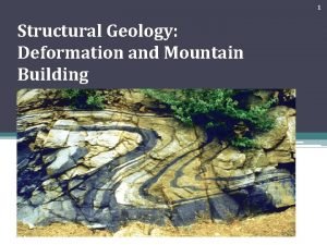
Deformation: The essence of structural geology, this is what we look for, interpret and analyze to unravel Earth’s history, ranging from grains of sand to mountain belts. (Ch 2 in Fossen). Box fold in Tien Shan Mountains of China

Deformation includes things we observe easily. Most deformation is defined as strain, - the change in shape of rocks as measured before and after deformation occurs. But we need to know what the rock looked like in the first place! Layered sediments are the most useful. Folded limestone

Deformation includes things we observe easily. Most types of deformation is defined as strain, - the change in shape of rocks as measured before and after deformation has occurred. But we need to know what the rock looked like in the first place. Besides sediments, mineral crystals, fossils and pebbles make good objects by which to measure strain.

Other types of deformation are harder to identify and include rotation or translation of rocks. But some sort of outside reference, or datum is needed to quantify this. Sea level often makes a great datum for uplift. Upraised beach ridges in San Diego

In review – Deformation is the manner and/or record of how rocks move

Remember we only see the end result of a deformational history in ancient mountain belts. For actively deforming regions, we at least get a snapshot of the latest part of the deformational history. Similar to say, watching just the credits of a movie and trying to deduce the plot versus seeing ten minutes or so at the end of the movie to determine what happened previously in the story line. The perfect situation would determine a displacement field that includes particle paths, perhaps with In. SAR or continuous GPS monitoring. But this is pretty near impossible with most methods of data analysis

Some types of deformation include processes with significant changes in volume (but this is not particularly common). The question is “how much can rocks be compressed or shrunk? What has to happen to allow this to occur? For that matter, can fluids be compressed easily? Compaction and dewatering is common as sediments are transformed into sedimentary rocks.

Volume loss can occur however by compaction as pore space is reduced by burial, and when pore fluids are expelled. Dissolution is also a means by which rocks might experience a volume loss. The shaded relief map of the area around Moab and Arches National Park illustrates the effects of dissolution - the valleys here are formed by collapse of sediments above salt that is dissolved in groundwater. Large scale dissolution of rocks occurs. This can be common in regions such as eastern Utah with thick deposits of evaporites, particularly halite. Valleys formed by collapsed folds - Moab

A nasty example of pressurized pore fluids set up the geologic conditions that lead to the blowout of the Deepwater Horizon oil well. Drillers were not prepared for a layer of sediment with highly pressured pore fluids and gas – which erupted upward through the borehole to the rig at the surface. And blowout preventers failed, and things blew up, and people died, and ecosystems got destroyed and …

So how do we measure deformation? Start with a reference frame. Then measure the change in shape or orientation in the feature itself.

Differences between pure and simple shear (and how to measure them)

Both types of shear can occur in the same region, and at different scales

In class learning module Let’s go to a highly deformed region to first identify strain, then think about how we might measure it. We’ll also start learning how to exploit Google Earth in this exercise. Break up into groups of 3 -4 students Fire up Google Earth on a laptop (or watch mine) Type in the search term for “Afar Ethiopia “ Try and identify what plate boundaries might be in this area (zoom out to see where you are located). Feel free to look for other online sources of information. Identify what types of deformation might have occurred in the region. Hint, it’s an area of very low elevation, comprised entirely of basaltic volcanic rocks at a misfit between the Horn of Africa and Yemen. What are the elongate blocks in this region? Which way does strata generally dip in the area you are looking at? If there are faults in this region, what type are they, and what direction do they dip?

Some useful tools in GE… In the Google Earth Menu (upper left), go into preferences to increase vertical exaggeration in the area you are looking at. 2 X is a good starting point. It is often easier to move around in 3 D using key commands. For macs, hold down the shift button, then press down on the keypad with your thumb. Place your forefinger on the keypad and move it to spin the scene around. The N button reorients the image to north = up The U button reorients the image so you are looking straight down onto the scene. To draw a topographic profile, draw a path (circles connected with line icon in header). Then go into the Edit button to Show Elevation Profile. Again, be sure to first figure out which way the strata are dipping.

In class learning module Once you have determined what types of geologic structures lie in the region, orient yourself so you are looking at them in cross section. It helps to consider the orientation of the volcanic strata in the region. Now relate the volcanic strata to the obvious ridges, which are bounded by faults. You can change vertical exaggeration to help visualize the features in the region. Draw a topographic profile and use this to determine the relationship between the dipping volcanic strata and the faults. How would you measure the amount of deformation in this region? Now explain how you would draw a cross section based on the topographic profile. Draw a cartoon cross section to illustrate this.

How might we measure stretching? For instance, we might want to measure the amount of stretching across a rift This GE image is from the Afar region of Ethiopia between Africa and the Middle East. How might you go about measuring the amount of stretching this region has undergone?

First draw a topographic profile (in GE), then measure the dip of the beds. Then measure the separation across the faults, assuming they dip ~ 60 degrees.

Draw a topographic profile In Google Earth Make a simple cross section, then measure its length Restore the section, first by restoring faults, then by rotating the beds Calculate the difference in length of the section And presto, you’ve calculated The amount of stretching in this region

The previous example of rotated normal faults brings us to the concept of rotation in relation to simple shear. Called vorticity, this occurs at scales of mineral grains in shear zones (i. e. garnets), to cylindrical folding above a thrust fault, or vertical axis rotations in a strike slip fault zone.

One best ways to define preciseastrain history is to One ofofthethe to adefine precise strain model systems with physical analogues. These historystructural is to model structural systems with physical panels show the evolution of faulting andthe stretching in such analogues. These panels show evolution of an aparatus. faulting and stretching in such an apparatus. Each panel is a cross section of the deformation as it was stretched (the first panel as the starting point.

End Deformation Reading: Chapter 2 in Fossen
 Elastic compliance and stiffness constants
 Brittle deformation geology
 Structural geology
 Stereographic projection structural geology
 Structural geology
 Geology
 Horizontal name
 Geological structures
 Structural geology
 Cassie de lisla
 Decision making is the essence of management
 Intressante
 What are the 4 types of claims?
 Oxyginberry side effects
 Essence in existentialism
 May the essence of christmas
 Existence precedes essence in french
 The essence of marriage chapter 2
 Caring is the essence of nursing jean watson
 In essence, the nebular theory holds that
 Bawa muhaiyaddeen
 Interkulturel erhvervskommunikation

