Cultural Landscape Main thing human geographers are concerned


 stores information")


- Slides: 18
Cultural Landscape • Main thing human geographers are concerned with • Visible imprint of human activity on the landscape
Sequent Occupance • Notion that successive societies leave the cultural imprints on a place, each contributing to the cumulative cultural landscape
Scale Differences Maps of Washington State
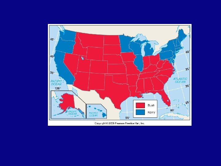
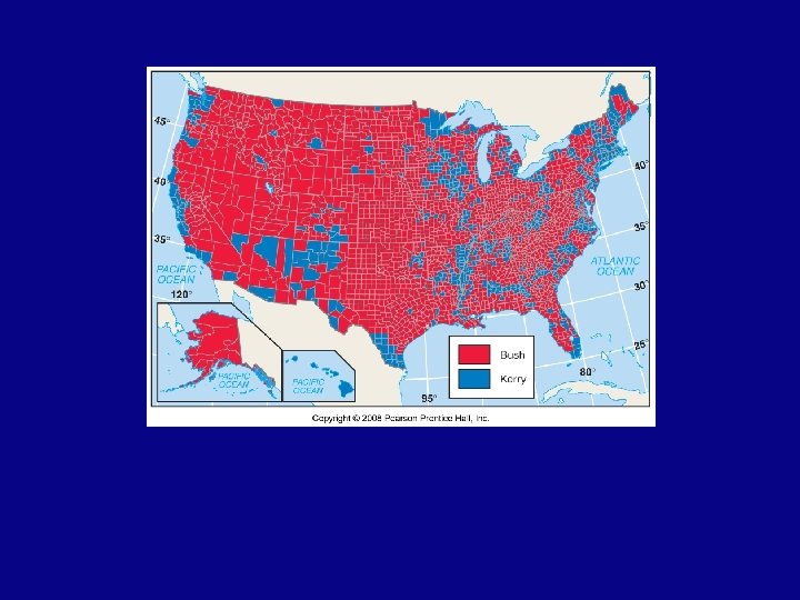
Scale Practice • For the following maps complete a quick map analysis protocol and describe how scale and aggregation affect the impressions that the maps give.
Township & Range System in the US Fig. 1 -4: Principal meridians & east-west baselines of the township system. Townships in northwest Mississippi & topographic map of the area.
Principal Meridians & Baselines U. S. Land Ordinance of 1785
Layers of a GIS Fig. 1 -5: A geographic information system (GIS) stores information about a location in several layers. Each layer represents a different category of information.
Uniqueness of Places & Regions • Place: Unique location of a feature – Toponyms – Site – Situation – Mathematical location • Regions: Areas of unique characteristics – Cultural landscape – Types of regions
Situation: Singapore
World Geographic Grid
World Time Zones
Corn Belt
Formal and Functional Regions
Vernacular Regions – also called perceptual Fig. 1 -12: A number of features are often used to define the South as a vernacular region, each of which identifies somewhat different boundaries.
World Climate Regions Fig. 1 -14: The modified Köppen system divides the world into five main climate regions.
How do the density and concentration of baseball teams change from 1950 -2007?