How Geographers Look at the World Original Mr


")
")
")


- Slides: 41
How Geographers Look at the World Original: Mr. Edwards – SAHS Edited by: Mr. Barkhau - AHS
Geography • Greek word origin “ writing about or describing” the earth. • The study of how people, places, and things relate to each other • Explores the world, cultures, political systems, economy and peoples relationship with the environment
The Geographer’s Tools
The Geographer's Tools Globes and Map Projections • A globe is a scale model of Earth that accurately depicts area, distance, and direction. • Cartographers are mapmakers that convert 3 -D globe images onto flat maps to create a map projection. • There are three types of map projections: planar, cylindrical, and conic.
Planar
Cylindrical (wrapped around a cylinder)
Conic (wrapped around a cone)
Planar (flat view)
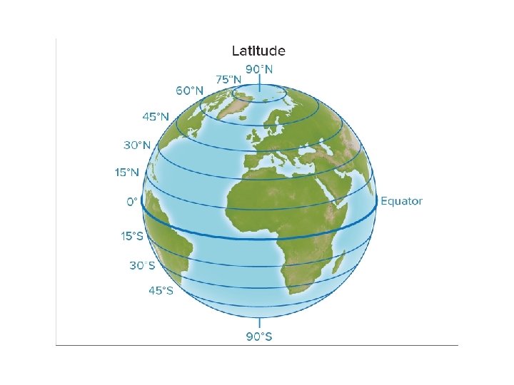
The Geographer's Tools Determining Location • Lines of latitude and longitude create a grid system on Earth's surface that is used to determine location. • The Equator divides Earth in half, creating the Northern and Southern Hemispheres.
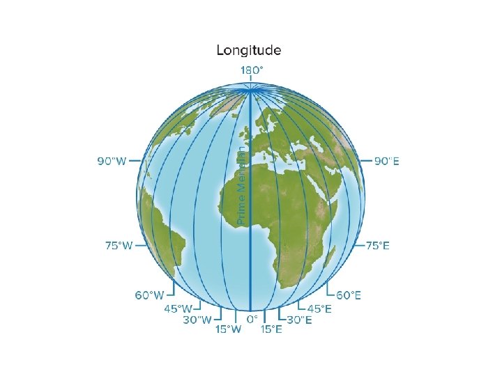
The Geographer's Tools Determining Location • The Prime Meridian splits the globe into the Eastern and Western Hemispheres.
Absolute Location • Aiken, SC is located at 33. 5494° N, 81. 7206° W • Dr. P. Sherman’s dental office: 42 Wallaby Way Sydney, Australia
Relative Location • Kroger is across the street from Odell Weeks. • Boston is 200 miles northeast of New York City.
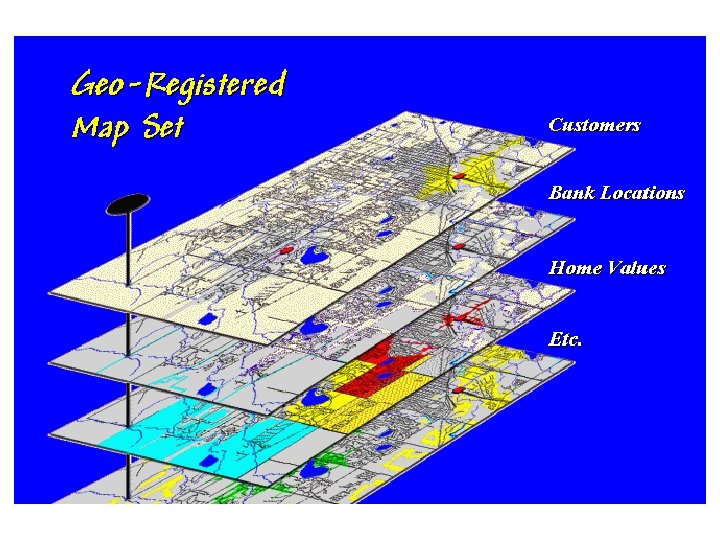
The Geographer's Tools Using Maps • There are many components to a map, including a title, a legend, symbols, and color-coding. • Scale represents the consistent, proportional relationship between the measurements shown on a map and on Earth's surface.
Title Scale Legend
The Geographer's Tools Using Maps • Physical, political, and thematic maps each serve a unique purpose and show different types of information. • A mental map describes an individual's perception of features of Earth's surface.
Physical Map Shows physical features such as elevation
Political Map Shows man-made distinctions, such as countries, states, or cities
Scale • Large scale refers to maps on which objects are relatively large • Small scale refers to maps on which objects are relatively small.
Scale • This means a small scale map actually shows a bigger area than a large scale map • Large scale and small scale are subjective terms
Small scale, because South Carolina is smaller Large scale, because SC is larger
The Geographer’s Craft
The Geographer's Craft A Geographic Perspective • Geographers study the locations and relationships of Earth's physical and living features.
The Geographer's Craft A Geographic Perspective • Spatial perspective – how places, objects, and people are related to one another
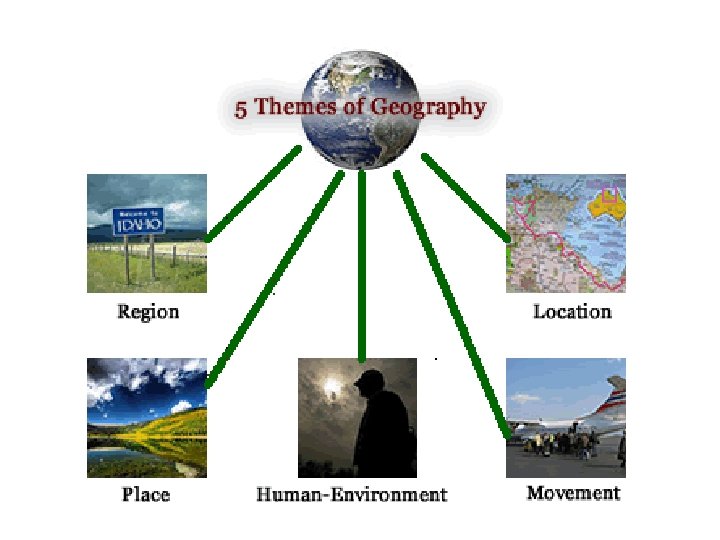
The Geographer's Craft Themes of Geography • There are five themes of geography: • Location • Place • Movement • Region • Human/Environment Interaction
The Geographer's Craft Themes of Geography • Location – where something is • Absolute location • Relative location
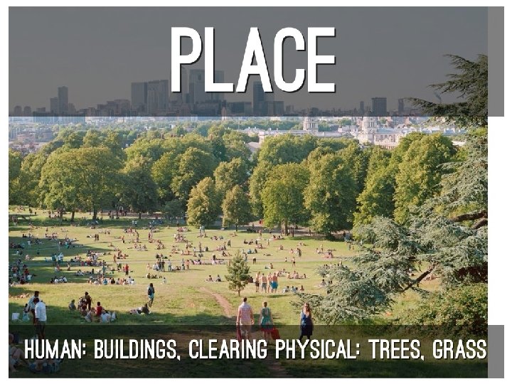
The Geographer's Craft Themes of Geography • Place • Physical Geography = natural features • Human Geography = cultural characteristics
The Geographer's Craft Themes of Geography • Regions: • formal region • functional region • perceptional region
Formal Region • Formal Region – A region defined by a common characteristic, such as production of a product. • Examples include cities, states, and mountain ranges
Functional Region • Functional Region – a central place and the surrounding territory linked to it. • Example – the Charleston Metropolitan Area
Perceptual Regions • Perceptual Region – a region defined by popular feelings and images rather than by objective data.
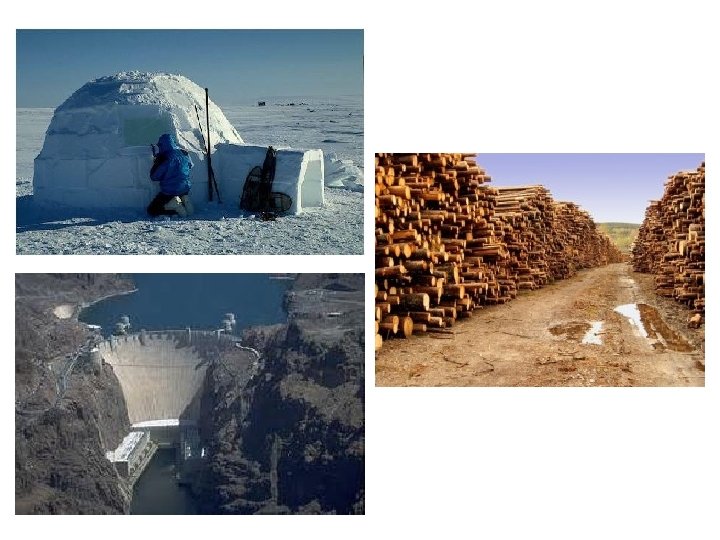
The Geographer's Craft Themes of Geography • Human/Environment Interaction • A relationship exists between people and their environment • People use and change the environment to meet their needs
The Geographer's Craft Themes of Geography • Movement • How People, Goods, and Ideas Get from One Place to Another
The Geographer's Craft Themes of Geography • Movement • Linear distance • Time distance • Psychological distance