What tools do Geographers use to describe the

What tools do Geographers use to describe the exact location of a place?

Draw the places you’ve travelled to in 2015 Who has the biggest scale? Who has the smallest?

Learning Targets 1 A. I can think like a geographer. Explain where things are, why they are there, and why their locations have significance. (1. 1) 1 B. I can explain the concept of map scale. (1. 3) 1 C. I can identify different map projections and their distortions. (1. 3) Formative Assessment vs. Summative Assessment

Scale Reference to area of map in relation to actual size Ratio- ex 1: 24, 000 or 1/24, 000 Means: 1 unit represents 24, 000 of the same units Ratio/Fraction Written- ex “ 1 inch equals 1 mile” Graphic Scale- ex uses bar line

Scale and detail The SMALLER the scale the BIGGER the area in less detail (aka the world) The BIGGER the scale the LESS the area in more detail (your desk) Another way of looking at it is if we have ONE INCH: - For the world: 1/28, 500, 000 - For your desk: ⅕ #Math

Draw the world on this here Clementine

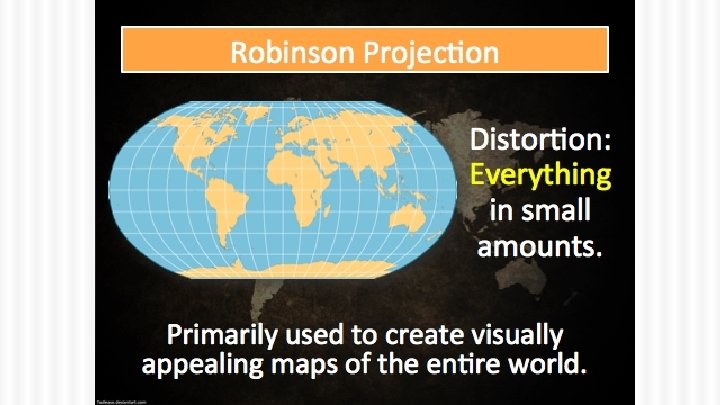
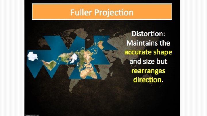
Because the earth is round… …but paper is flat, we have different projections and scales to show what the world looks like Projections: Putting the earth’s round surface on a flat map Problems: 1. Shape; 2. Distance; 3 Relative size


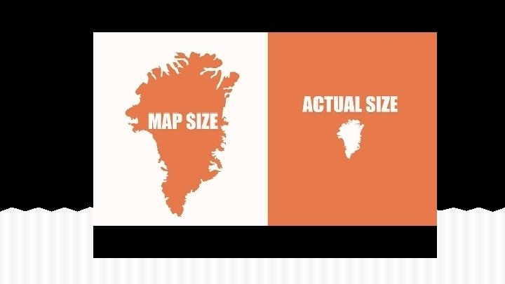
We’ve told you a lie for your entire life… sorry
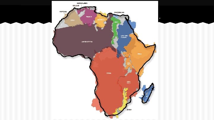

Because the earth is round… …but paper is flat, we have different projections and scales to show what the world looks like Projections: Putting the earth’s round surface on a flat map Problems: 1. Shape; 2. Distance; 3 Relative size; 4. Direction


Cylindrical Maps Taking a round thing and putting it as a square

Gall-Peters Map Elongates countries +Accurate proportions for S Hemisphere - Really long countries esp. near equator
![[az-uh-muh th] Azimuthal (Planar) Gets bigger away +Used by airline pilots -You can only](http://slidetodoc.com/presentation_image_h2/382e9bc0a2195a7a9f254163b0afd5a2/image-19.jpg "[az-uh-muh th] Azimuthal (Planar) Gets bigger away +Used by airline pilots -You can only")
[az-uh-muh th] Azimuthal (Planar) Gets bigger away +Used by airline pilots -You can only see one from poles hemisphere at a time


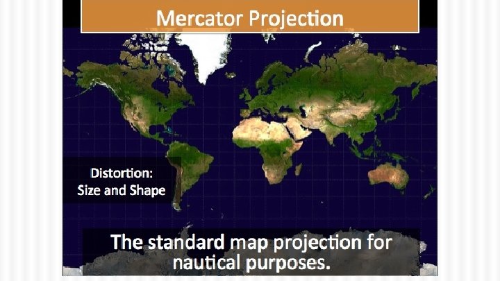
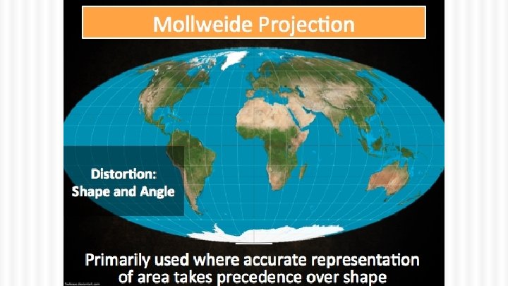
Molliweide Mercader Azimuthal Robinson
- Slides: 23