City GML and 3 D modelling Dave Capstick
- Slides: 33
City. GML and 3 D modelling Dave Capstick, Ordnance Survey Research Department
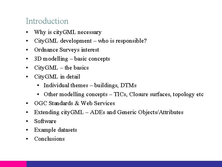
Introduction • • • Why is city. GML necessary City. GML development – who is responsible? Ordnance Surveys interest 3 D modelling – basic concepts City. GML – the basics City. GML in detail • Individual themes – buildings, DTMs • Other modelling concepts – TICs, Closure surfaces, topology etc OGC Standards & Web Services Extending city. GML – ADEs and Generic Objects/Attributes Software Example datasets Conclusions
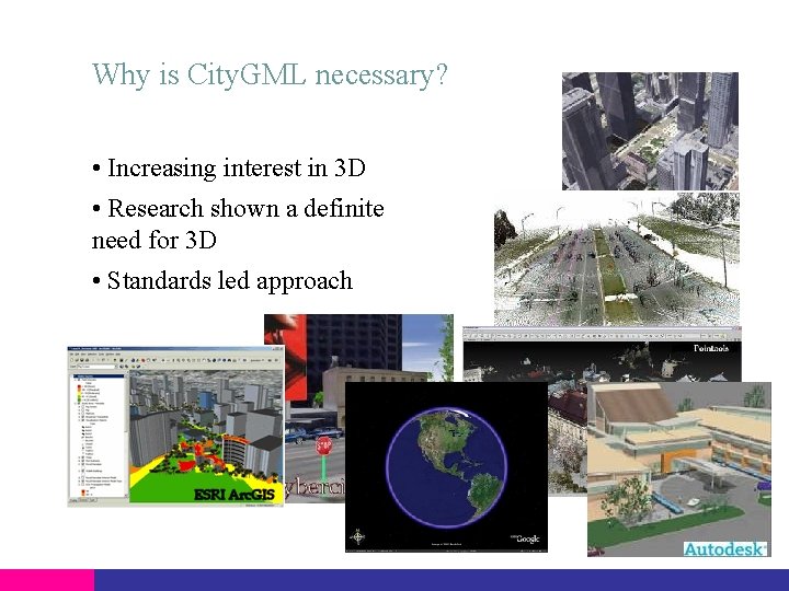
Why is City. GML necessary? • Increasing interest in 3 D • Research shown a definite need for 3 D • Standards led approach
Responsibility for City. GML • Origins are with the Geodata Infrastructure North Rhine. Westphalia – 6 SIG WG • Special Interest Group 3 D (SIG 3 D) • Open group >70 members • Members range from industry, government, municipalities and academia • Participants from Germany, Austria, Switzerland UK • Technical leads are Thomas Kolbe and Gerhard Gröger
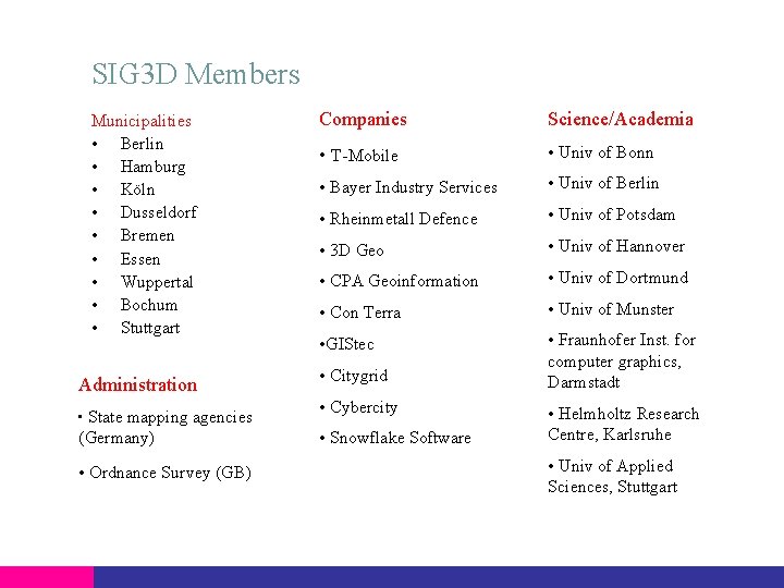
SIG 3 D Members Municipalities • Berlin • Hamburg • Köln • Dusseldorf • Bremen • Essen • Wuppertal • Bochum • Stuttgart Administration • State mapping agencies (Germany) • Ordnance Survey (GB) Companies Science/Academia • T-Mobile • Univ of Bonn • Bayer Industry Services • Univ of Berlin • Rheinmetall Defence • Univ of Potsdam • 3 D Geo • Univ of Hannover • CPA Geoinformation • Univ of Dortmund • Con Terra • Univ of Munster • GIStec • Fraunhofer Inst. for computer graphics, Darmstadt • Citygrid • Cybercity • Snowflake Software • Helmholtz Research Centre, Karlsruhe • Univ of Applied Sciences, Stuttgart
Why is Ordnance Survey interested in city. GML? • OS have had an interest in 3 D for a number of years • Customer research – high level of interest • OS competes with commercial organisations • Thought leader • Extensive research at OS • Requirements from customers • Requirement for a 3 D standard
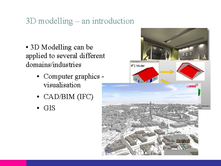
3 D modelling – an introduction • 3 D Modelling can be applied to several different domains/industries • Computer graphics visualisation • CAD/BIM (IFC) • GIS
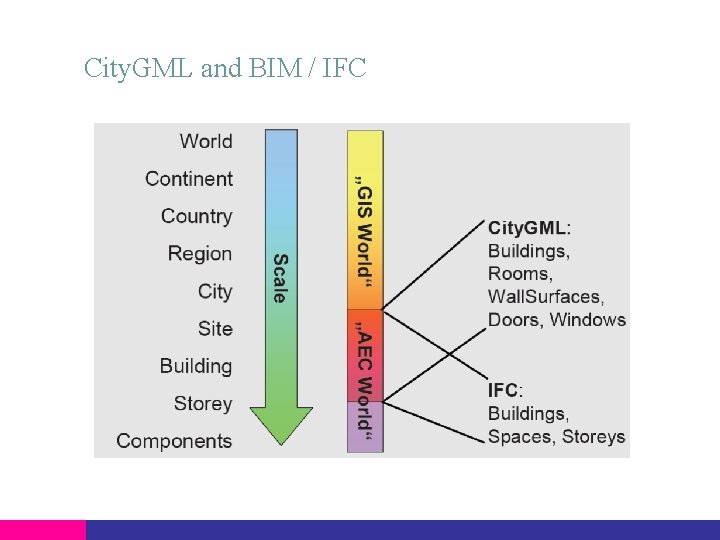
City. GML and BIM / IFC
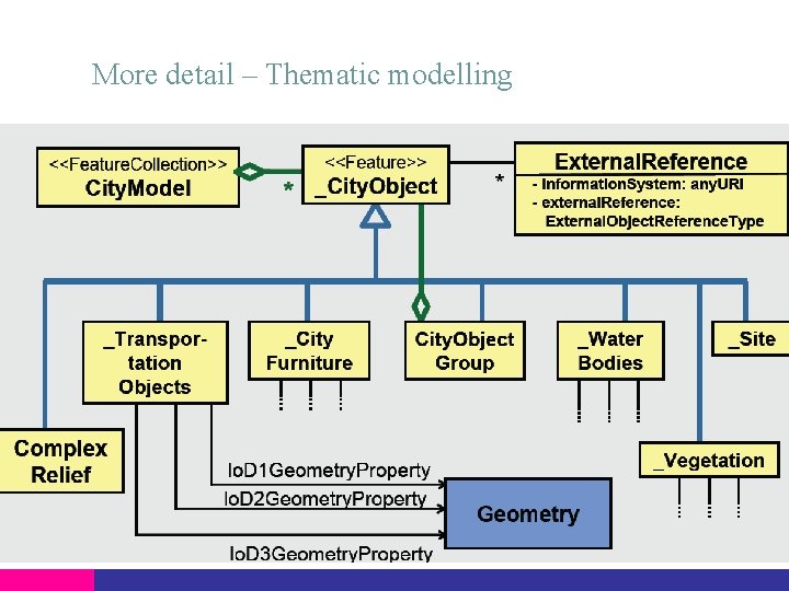
City. GML – the basics • Application independent topographic information model for virtual 3 D city models • Basic set of features defined • Standardised meaning/interpretation of feature types (UML/GML) • Comprises different themes – buildings, relief, water body, vegetation, landuse, appearance, city furniture, generic objects etc • Data model (UML) ISO 191 xx standard family • Exchange format • Realised as a GML 3 application schema • Applications – city planning, architectural design, environmental, telecoms, disaster management, estate management, etc • August 2008 – city. GML version 1. 0. 0 accepted as an official OGC standard
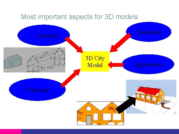
Most important aspects for 3 D models Semantics Geometry 3 D City Model Topology Appearance
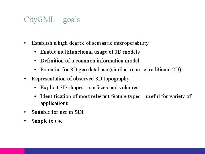
City. GML – goals • Establish a high degree of semantic interoperability • Enable multifunctional usage of 3 D models • Definition of a common information model • Potential for 3 D geo database (similar to more traditional 2 D) • Representation of observed 3 D topography • Explicit 3 D shapes – surfaces and volumes • Identification of most relevant feature types – useful for variety of applications • Suitable for use in SDI • Simple to use
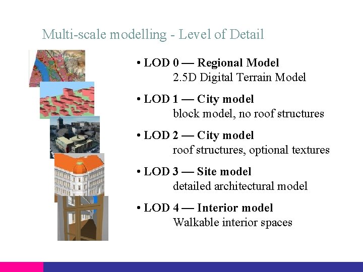
Multi-scale modelling - Level of Detail • LOD 0 — Regional Model 2. 5 D Digital Terrain Model • LOD 1 — City model block model, no roof structures • LOD 2 — City model roof structures, optional textures • LOD 3 — Site model detailed architectural model • LOD 4 — Interior model Walkable interior spaces
More detail – Thematic modelling
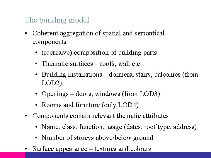
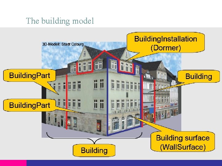
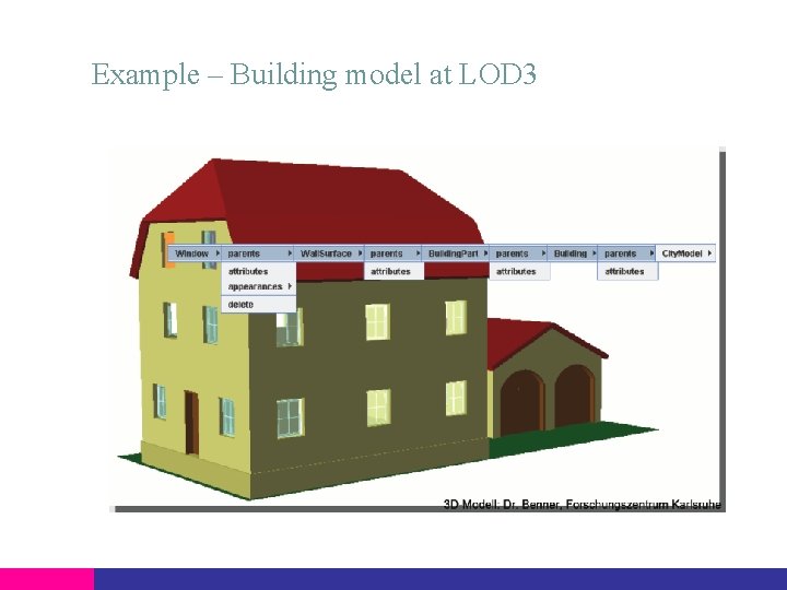
The building model • Coherent aggregation of spatial and semantical components • (recursive) composition of building parts • Thematic surfaces – roofs, wall etc • Building installations – dormers, stairs, balconies (from LOD 2) • Openings – doors, windows (from LOD 3) • Rooms and furniture (only LOD 4) • Components contain relevant thematic attributes • Name, class, function, usage (dates, roof type, address) • Number of storeys above/below ground • Surface appearance – textures and colours
The building model
Example – Building model at LOD 3
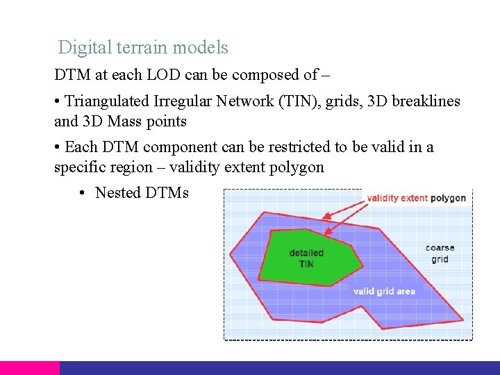
Digital terrain models DTM at each LOD can be composed of – • Triangulated Irregular Network (TIN), grids, 3 D breaklines and 3 D Mass points • Each DTM component can be restricted to be valid in a specific region – validity extent polygon • Nested DTMs
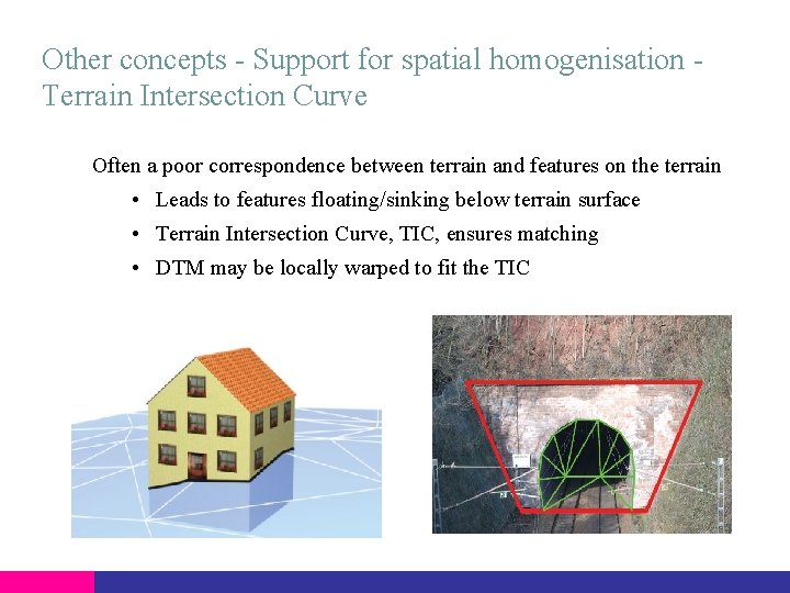
Other concepts - Support for spatial homogenisation Terrain Intersection Curve Often a poor correspondence between terrain and features on the terrain • Leads to features floating/sinking below terrain surface • Terrain Intersection Curve, TIC, ensures matching • DTM may be locally warped to fit the TIC
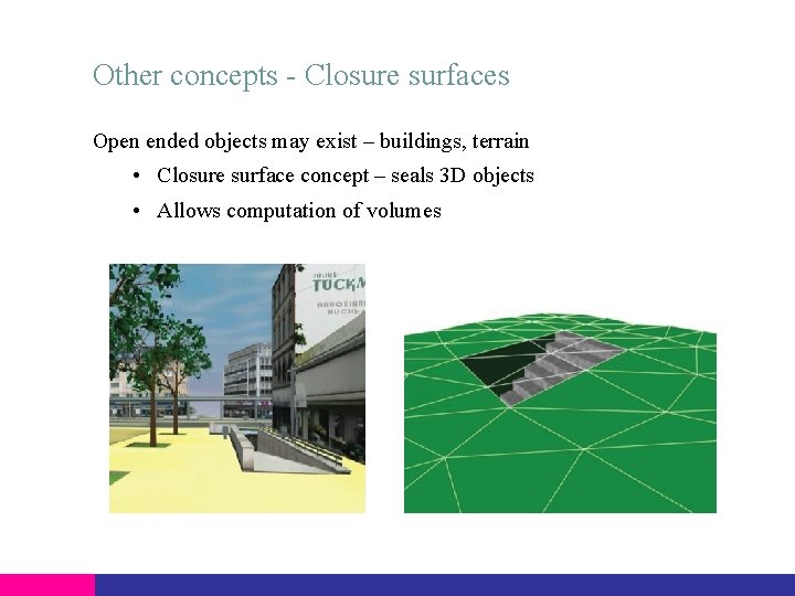
Other concepts - Closure surfaces Open ended objects may exist – buildings, terrain • Closure surface concept – seals 3 D objects • Allows computation of volumes
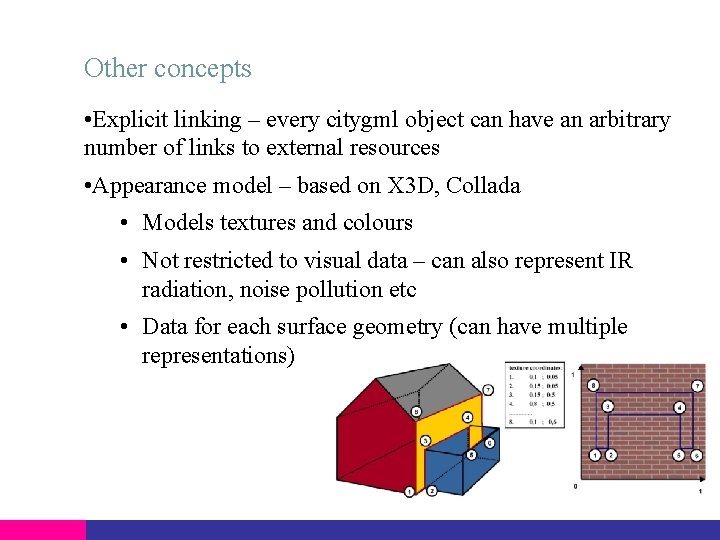
Other concepts • Explicit linking – every citygml object can have an arbitrary number of links to external resources • Appearance model – based on X 3 D, Collada • Models textures and colours • Not restricted to visual data – can also represent IR radiation, noise pollution etc • Data for each surface geometry (can have multiple representations)
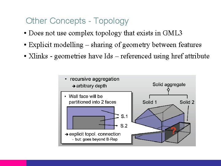
Other Concepts - Topology • Does not use complex topology that exists in GML 3 • Explicit modelling – sharing of geometry between features • Xlinks - geometries have Ids – referenced using href attribute
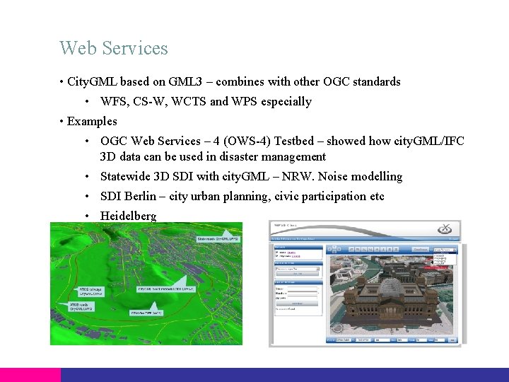
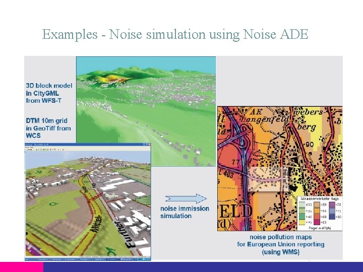
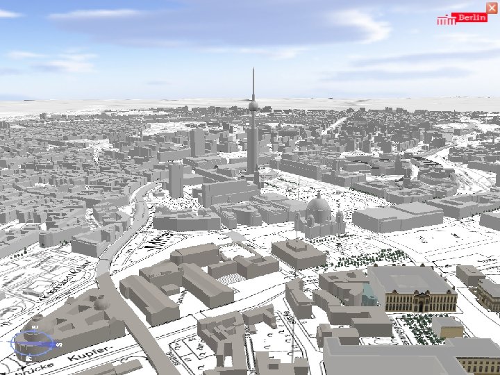
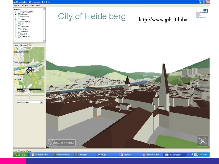
Web Services • City. GML based on GML 3 – combines with other OGC standards • WFS, CS-W, WCTS and WPS especially • Examples • OGC Web Services – 4 (OWS-4) Testbed – showed how city. GML/IFC 3 D data can be used in disaster management • Statewide 3 D SDI with city. GML – NRW. Noise modelling • SDI Berlin – city urban planning, civic participation etc • Heidelberg
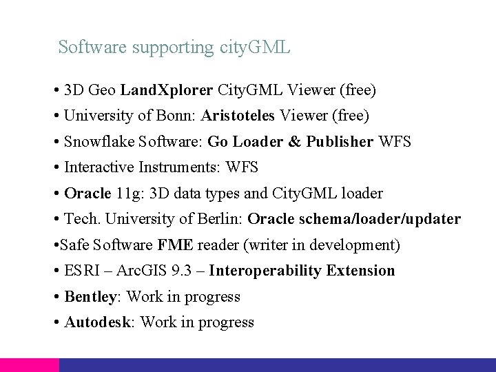
Software supporting city. GML • 3 D Geo Land. Xplorer City. GML Viewer (free) • University of Bonn: Aristoteles Viewer (free) • Snowflake Software: Go Loader & Publisher WFS • Interactive Instruments: WFS • Oracle 11 g: 3 D data types and City. GML loader • Tech. University of Berlin: Oracle schema/loader/updater • Safe Software FME reader (writer in development) • ESRI – Arc. GIS 9. 3 – Interoperability Extension • Bentley: Work in progress • Autodesk: Work in progress
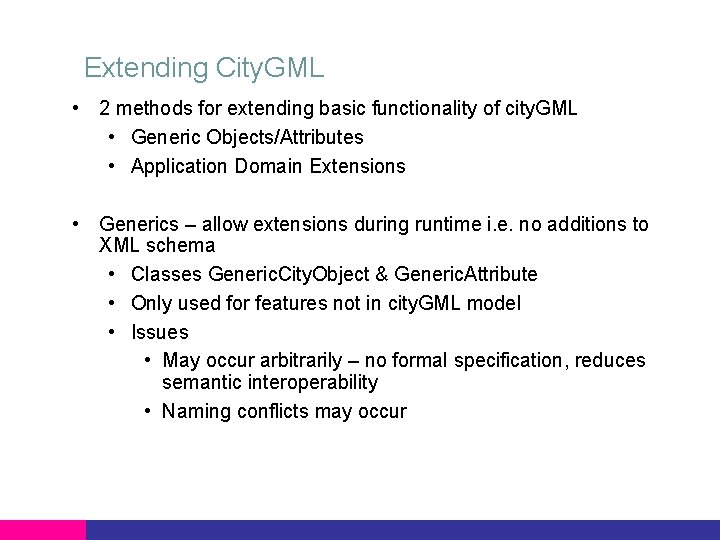
Extending City. GML • 2 methods for extending basic functionality of city. GML • Generic Objects/Attributes • Application Domain Extensions • Generics – allow extensions during runtime i. e. no additions to XML schema • Classes Generic. City. Object & Generic. Attribute • Only used for features not in city. GML model • Issues • May occur arbitrarily – no formal specification, reduces semantic interoperability • Naming conflicts may occur
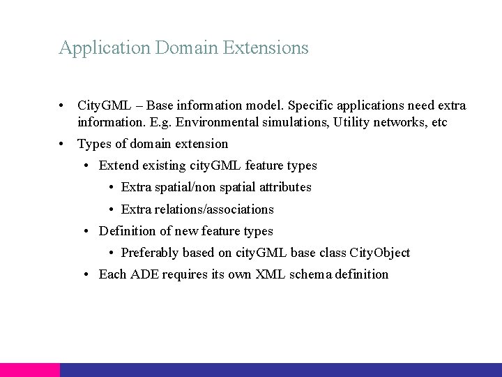
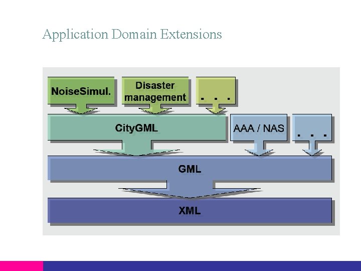
Application Domain Extensions • City. GML – Base information model. Specific applications need extra information. E. g. Environmental simulations, Utility networks, etc • Types of domain extension • Extend existing city. GML feature types • Extra spatial/non spatial attributes • Extra relations/associations • Definition of new feature types • Preferably based on city. GML base class City. Object • Each ADE requires its own XML schema definition
Application Domain Extensions
Examples - Noise simulation using Noise ADE
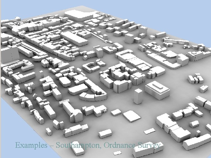
Examples – Southampton, Ordnance Survey
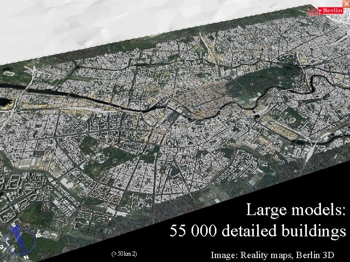
Large models: 55 000 detailed buildings (>50 km 2) Image: Reality maps, Berlin 3 D
City of Heidelberg http: //www. gdi-3 d. de/
Conclusions • City. GML is a Geospatial Information model (based on ISO 191 xx), which can be mapped to a database environment • Exchange format for virtual 3 D city and regional models (realised as a GML 3 Application schema) • City. GML represents geometry, topology, semantics (esp. important ) and appearance • Can be considered as a rich 3 D information source for generation of 3 D visualisations • Not just a tool for visualisations – semantics • Model contains most important core concepts – these can be extended for particular applications • Recently accepted as OGC standard and is creating high level of interest – software being developed, applications etc
Any questions? Dave Capstick Ordnance Survey Romsey Road SOUTHAMPTON United Kingdom SO 16 4 GU Phone: (+44)023 80792802 Email: dave. capstick@ordnancesurvey. co. uk Website: www. ordnancesurvey. co. uk