Chapter 5 A Land of Contrasts United States


- Slides: 23

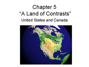
Chapter 5 “A Land of Contrasts” United States and Canada

Ch. 5. 1 “Land Resources” • U. S. and Canada occupy 4/5 of North America • Culturally known as Anglo America • Large land mass + abundance of resources = high probability of econ. success

Varied Landforms • Eastern Lowlands (Coastal Plain) Appalachian Mtns. (highlands) Interior Lowlands • • 1. 2. • Great Plains Canadian Shield West – – 1. Rocky Mountains 2. Continental divide – 3. Sierra Nevada & Cascades • Islands – – – 1. Canadian (Arctic) 2. Aleutian (Alaska) 3. Hawaiian (Pacific)

Islands of Canada Rocky Mtns. • Continental Divide: point where rivers flow E and W.

Oceans 1. 2. • • • Pacific Atlantic Arctic Gulf of Mexico Hudson Bay

Waterways • The Great Lakes • Mississippi River • Mackenzie River: Canada’s longest river

Land Forests • U. S. is the world’s largest food exporter • Most Agricultural land is found in plains and river valleys • Large forest areas – ½ Canada – 1/3 U. S.

Minerals and Fossil Fuels • Both US and Canada have large supplies of both • This allowed both to industrialize rapidly

5. 2 “Climate and Vegetation” • U. S. has more climate zones than Canada • Colder Climates – Arctic Coasts of Alaska and Canada • Permafrost – permanently frozen ground • Moderate Climates – N. Central and N. Eastern U. S. and S. Canada – Prevailing Westerlies: NW U. S. - winds that blow from West to East. • Wet but mild winters

Great Plains

Differences in Climate and Vegetation 1. Milder Climates • Southern States: mild temp + adequate rainfall = long growing season 2. Dry Climates • Great Plains and Northern parts of Great Basin, less than 15 in. of rain per year 3. Tropical Climates • Hawaii and Southern Florida • Everglades: swamp land that covers 4, 000 sq. mi.

Effects of Extreme Weather • Thunderstorms • Tornados • Blizzards Cold air from Canada Warm air from Gulf of Mexico

5. 3 “Human Environment Interaction”

Settlements Alter Land • 1 st Settlers – Nomads: people who move from place to place – Probably came from Asia on land bridge known as Beringia. – Most settled near coastline, rivers and streams.

Agriculture Alters Land • Settlements become permanent after agriculture becomes primary source of food. – Both countries are leading exporters of agriculture

Building Cities • Montreal – Canada’s 2 nd largest city – Major Port – Below 32° 100 days out of year • As consequence many retail centers underground

• Los Angeles – US 2 nd largest city – Rapid population leads to problems • Smog • Inadequate H²O supplies

Overcoming Distance • Land bridges • Europeans settled on E. coast and cut paths (Oregon trail) to west.

Waterways • Erie Canal- Atlantic Ocean to Great Lakes • St. Lawrence Seaway – N. Americas most important deepwater ship route – Uses locks to move ships up & down 600 feet


Transcontinental Railroad • Trains make crossing continent easier • 1 st trans continental RR completed in 1869 • Many natural barriers, canyons, rivers, mountains, had to be overcome

National Highway System • US – 4, 000 miles of roads • Canada – 560, 000
 Chapter 5 a land of contrasts
 Contiguous united states land area
 Monadnocks/uwharries
 Chapter 2 free enterprise in the united states answer key
 Chapter 6 human geography of the united states
 Chapter 5 lesson 1 physical geography of the united states
 Was the united states on the axis powers or allied powers?
 Unit 2: the united states and canada worksheet answers
 36 30 line
 Us pro soccer organization
 United states v. nixon significance
 United states student association
 The united states ought to provide a universal basic income
 Preamble of us constitution
 The united states in the caribbean 1776-1985
 Physical features of the southeast region
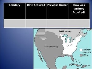
 Expansion of the united states of america 1607 to 1853 map
 Who was nicholas novikov? when did he write this telegram?
 Mexican cession previous owner
 Awake united states author
 Mapp v ohio
 We have pacified some thousands of the islanders
 Chapter 6 lesson 2 guided reading answers
 Midwest region of the united states
