Chapter 20 Weather 20 1 Air Masses Weather
- Slides: 27

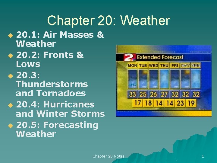
Chapter 20: Weather 20. 1: Air Masses & Weather u 20. 2: Fronts & Lows u 20. 3: Thunderstorms and Tornadoes u 20. 4: Hurricanes and Winter Storms u 20. 5: Forecasting Weather u Chapter 20 Notes 1

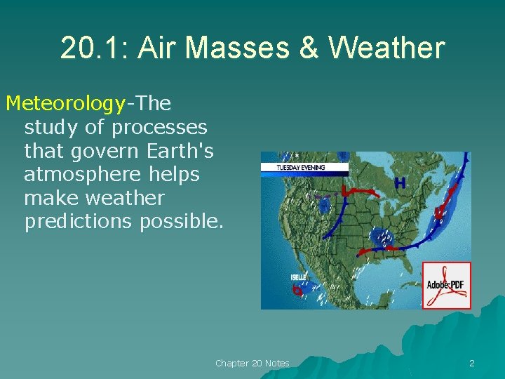
20. 1: Air Masses & Weather Meteorology-The study of processes that govern Earth's atmosphere helps make weather predictions possible. Chapter 20 Notes 2

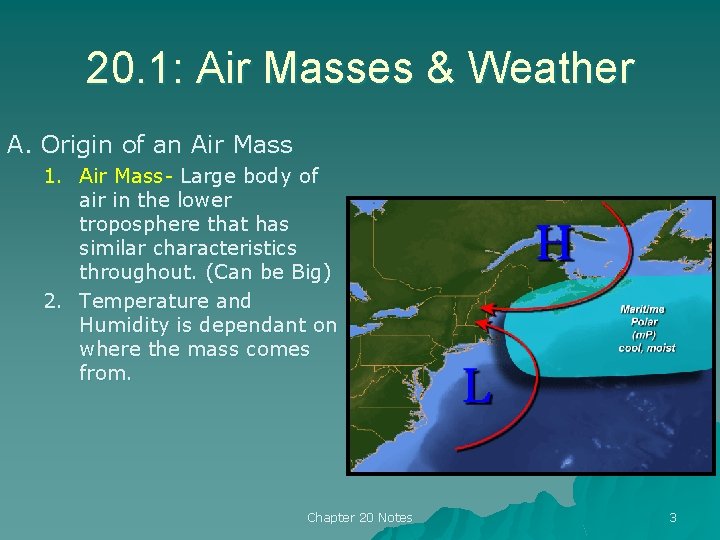
20. 1: Air Masses & Weather A. Origin of an Air Mass 1. Air Mass- Large body of air in the lower troposphere that has similar characteristics throughout. (Can be Big) 2. Temperature and Humidity is dependant on where the mass comes from. Chapter 20 Notes 3

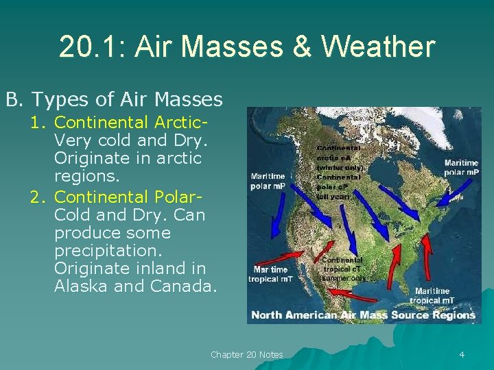
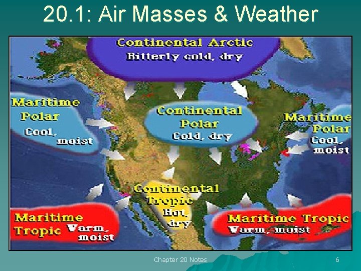
20. 1: Air Masses & Weather B. Types of Air Masses 1. Continental Arctic. Very cold and Dry. Originate in arctic regions. 2. Continental Polar. Cold and Dry. Can produce some precipitation. Originate inland in Alaska and Canada. Chapter 20 Notes 4

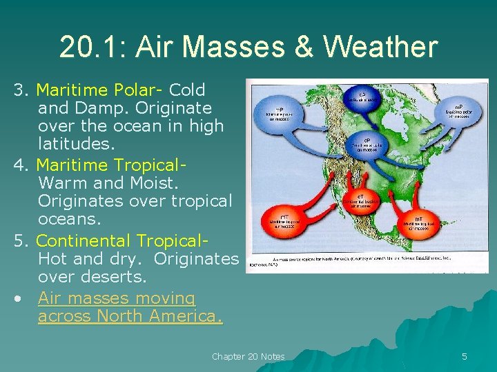
20. 1: Air Masses & Weather 3. Maritime Polar- Cold and Damp. Originate over the ocean in high latitudes. 4. Maritime Tropical. Warm and Moist. Originates over tropical oceans. 5. Continental Tropical. Hot and dry. Originates over deserts. • Air masses moving across North America. Chapter 20 Notes 5

20. 1: Air Masses & Weather Chapter 20 Notes 6

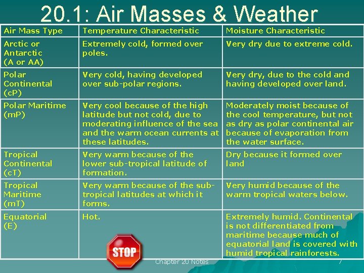
20. 1: Air Masses & Weather Air Mass Type Temperature Characteristic Moisture Characteristic Arctic or Antarctic (A or AA) Extremely cold, formed over poles. Very due to extreme cold. Polar Continental (c. P) Very cold, having developed over sub-polar regions. Very dry, due to the cold and having developed over land. Polar Maritime (m. P) Very cool because of the high latitude but not cold, due to moderating influence of the sea and the warm ocean currents at these latitudes. Moderately moist because of the cool temperature, but not as dry as polar continental air because of evaporation from the water surface. Tropical Continental (c. T) Very warm because of the lower sub-tropical latitude of formation. Dry because it formed over land Tropical Maritime (m. T) Very warm because of the subtropical latitudes at which it forms. Very humid because of the warm tropical waters below. Equatorial (E) Hot. Extremely humid. Continental is not differentiated from maritime because much of equatorial land is covered with humid tropical rainforests. Chapter 20 Notes 7

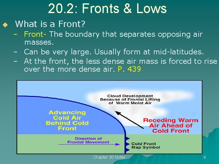
20. 2: Fronts & Lows u What is a Front? – Front- The boundary that separates opposing air masses. – Can be very large. Usually form at mid-latitudes. – At the front, the less dense air mass is forced to rise over the more dense air. P. 439 Chapter 20 Notes 8

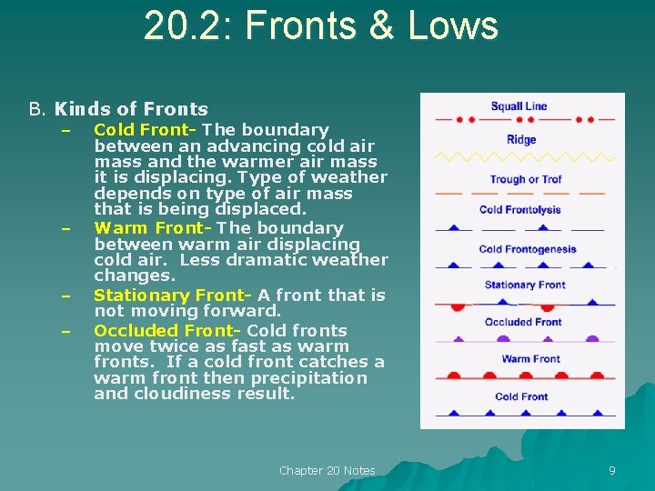
20. 2: Fronts & Lows B. Kinds of Fronts – – Cold Front- The boundary between an advancing cold air mass and the warmer air mass it is displacing. Type of weather depends on type of air mass that is being displaced. Warm Front- The boundary between warm air displacing cold air. Less dramatic weather changes. Stationary Front- A front that is not moving forward. Occluded Front- Cold fronts move twice as fast as warm fronts. If a cold front catches a warm front then precipitation and cloudiness result. Chapter 20 Notes 9

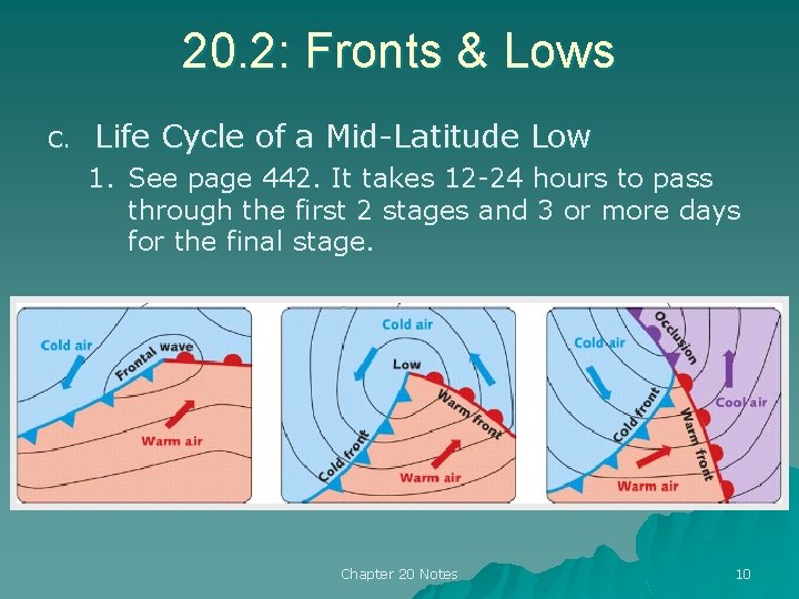
20. 2: Fronts & Lows C. Life Cycle of a Mid-Latitude Low 1. See page 442. It takes 12 -24 hours to pass through the first 2 stages and 3 or more days for the final stage. Chapter 20 Notes 10

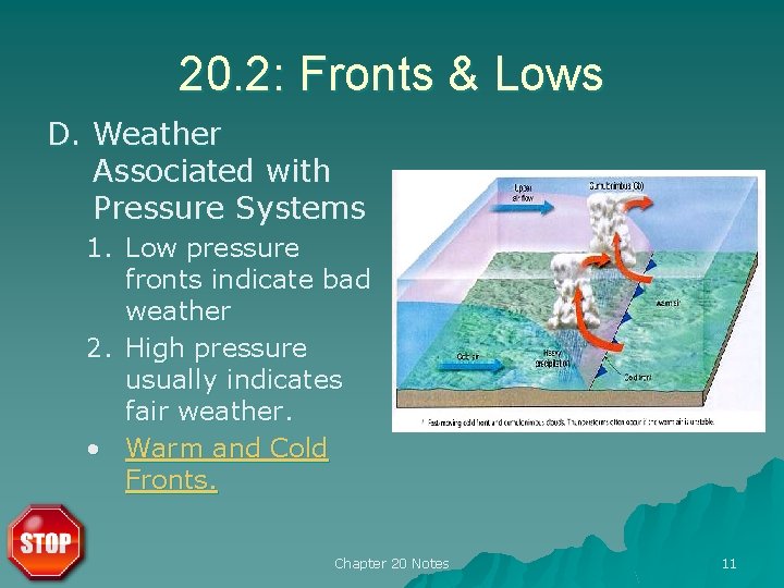
20. 2: Fronts & Lows D. Weather Associated with Pressure Systems 1. Low pressure fronts indicate bad weather 2. High pressure usually indicates fair weather. • Warm and Cold Fronts. Chapter 20 Notes 11

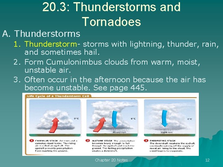
20. 3: Thunderstorms and Tornadoes A. Thunderstorms 1. Thunderstorm- storms with lightning, thunder, rain, and sometimes hail. 2. Form Cumulonimbus clouds from warm, moist, unstable air. 3. Often occur in the afternoon because the air has become unstable. See page 445. Chapter 20 Notes 12

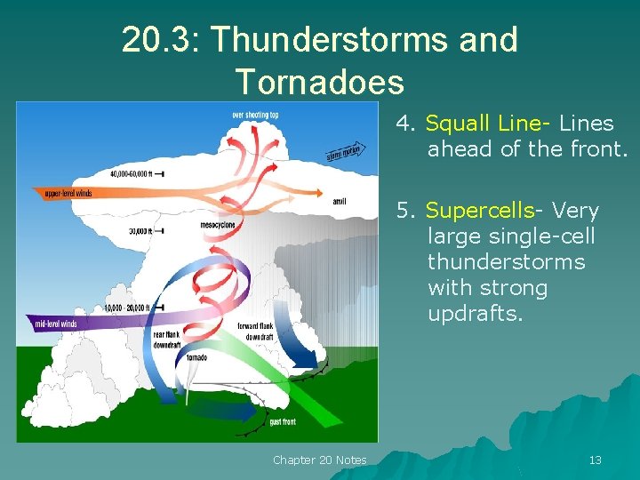
20. 3: Thunderstorms and Tornadoes 4. Squall Line- Lines ahead of the front. 5. Supercells- Very large single-cell thunderstorms with strong updrafts. Chapter 20 Notes 13

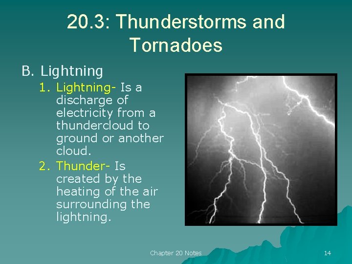
20. 3: Thunderstorms and Tornadoes B. Lightning 1. Lightning- Is a discharge of electricity from a thundercloud to ground or another cloud. 2. Thunder- Is created by the heating of the air surrounding the lightning. Chapter 20 Notes 14

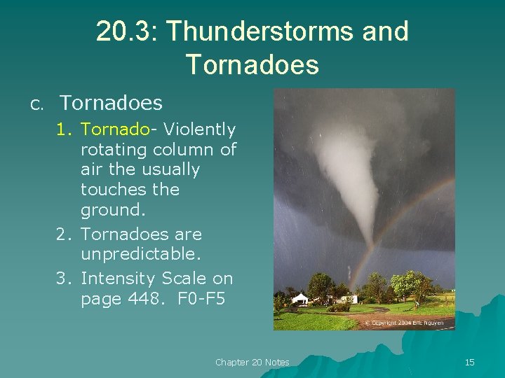
20. 3: Thunderstorms and Tornadoes C. Tornadoes 1. Tornado- Violently rotating column of air the usually touches the ground. 2. Tornadoes are unpredictable. 3. Intensity Scale on page 448. F 0 -F 5 Chapter 20 Notes 15

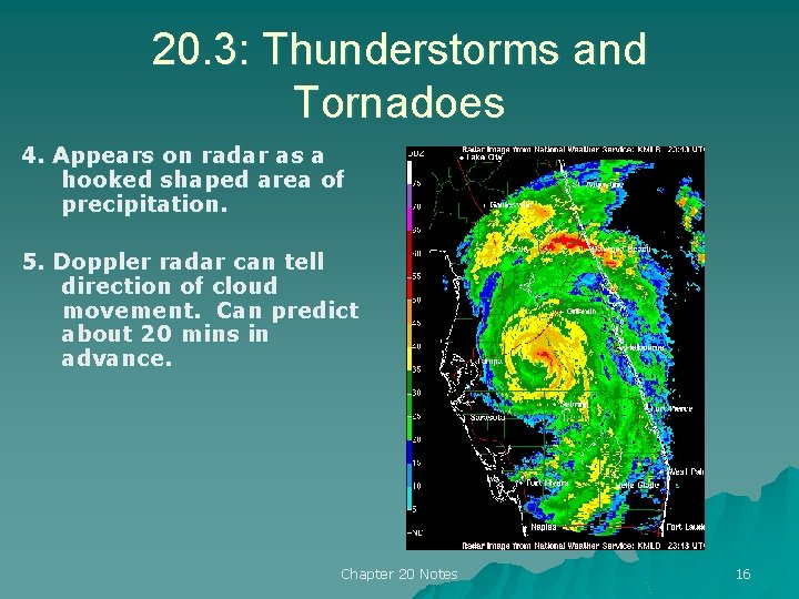
20. 3: Thunderstorms and Tornadoes 4. Appears on radar as a hooked shaped area of precipitation. 5. Doppler radar can tell direction of cloud movement. Can predict about 20 mins in advance. Chapter 20 Notes 16

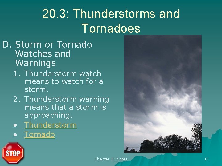
20. 3: Thunderstorms and Tornadoes D. Storm or Tornado Watches and Warnings 1. Thunderstorm watch means to watch for a storm. 2. Thunderstorm warning means that a storm is approaching. • Thunderstorm • Tornado Chapter 20 Notes 17

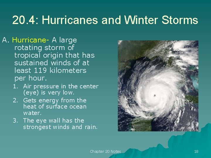
20. 4: Hurricanes and Winter Storms A. Hurricane- A large rotating storm of tropical origin that has sustained winds of at least 119 kilometers per hour. 1. Air pressure in the center (eye) is very low. 2. Gets energy from the heat of surface ocean water. 3. The eye wall has the strongest winds and rain. Chapter 20 Notes 18

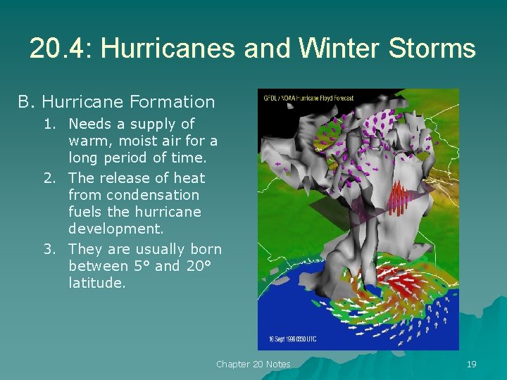
20. 4: Hurricanes and Winter Storms B. Hurricane Formation 1. Needs a supply of warm, moist air for a long period of time. 2. The release of heat from condensation fuels the hurricane development. 3. They are usually born between 5° and 20° latitude. Chapter 20 Notes 19

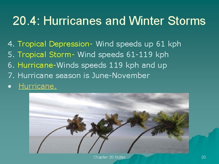
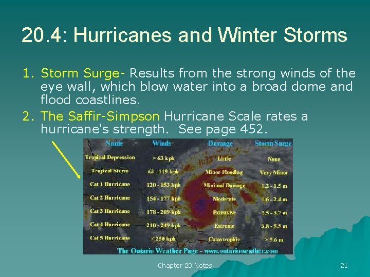
20. 4: Hurricanes and Winter Storms 4. 5. 6. 7. • Tropical Depression- Wind speeds up 61 kph Tropical Storm- Wind speeds 61 -119 kph Hurricane-Winds speeds 119 kph and up Hurricane season is June-November Hurricane. Chapter 20 Notes 20

20. 4: Hurricanes and Winter Storms 1. Storm Surge- Results from the strong winds of the eye wall, which blow water into a broad dome and flood coastlines. 2. The Saffir-Simpson Hurricane Scale rates a hurricane's strength. See page 452. Chapter 20 Notes 21

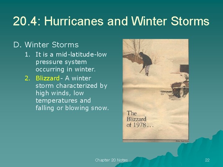
20. 4: Hurricanes and Winter Storms D. Winter Storms 1. It is a mid-latitude-low pressure system occurring in winter. 2. Blizzard- A winter storm characterized by high winds, low temperatures and falling or blowing snow. Chapter 20 Notes 22

20. 4: Hurricanes and Winter Storms 3. Winds must exceed 56 kph 4. The temperature must be -7°C or lower 5. The falling snow must reduce visibility. Chapter 20 Notes 23

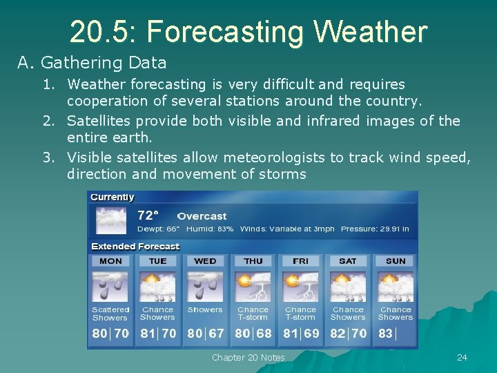
20. 5: Forecasting Weather A. Gathering Data 1. Weather forecasting is very difficult and requires cooperation of several stations around the country. 2. Satellites provide both visible and infrared images of the entire earth. 3. Visible satellites allow meteorologists to track wind speed, direction and movement of storms Chapter 20 Notes 24

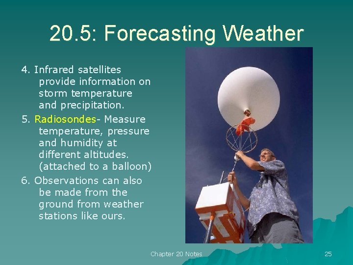
20. 5: Forecasting Weather 4. Infrared satellites provide information on storm temperature and precipitation. 5. Radiosondes- Measure temperature, pressure and humidity at different altitudes. (attached to a balloon) 6. Observations can also be made from the ground from weather stations like ours. Chapter 20 Notes 25

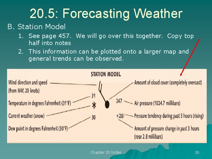
20. 5: Forecasting Weather B. Station Model 1. See page 457. We will go over this together. Copy top half into notes 2. This information can be plotted onto a larger map and general trends can be observed. Chapter 20 Notes 26

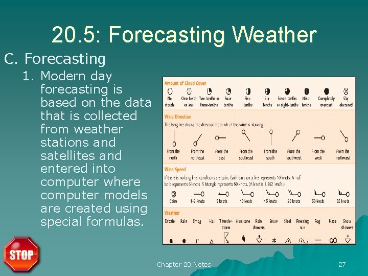
20. 5: Forecasting Weather C. Forecasting 1. Modern day forecasting is based on the data that is collected from weather stations and satellites and entered into computer where computer models are created using special formulas. Chapter 20 Notes 27