Air Masses and Fronts AIR MASSES An air

- Slides: 24

Air Masses and Fronts

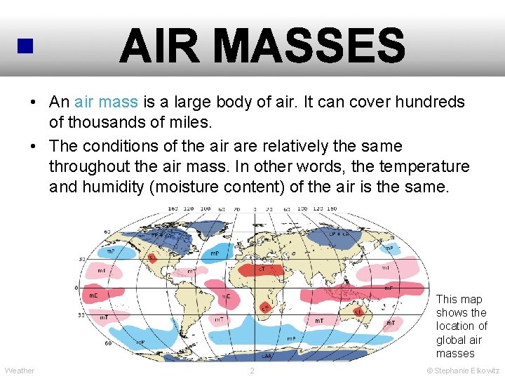
AIR MASSES • An air mass is a large body of air. It can cover hundreds of thousands of miles. • The conditions of the air are relatively the same throughout the air mass. In other words, the temperature and humidity (moisture content) of the air is the same. This map shows the location of global air masses Weather 2 © Stephanie Elkowitz

AIR MASSES • An air mass moves. It moves because of global wind currents. • The direction of its movement depends on where it formed, the direction of wind currents and the position of Earth relative to the sun (Earth’s tilt). • As an air mass moves, it changes the weather conditions of a location. It changes the temperature and humidity of the air. It can also create weather disturbances. Weather 3 © Stephanie Elkowitz

AIR MASSES • There are 4 major types of air masses: 1. Continental Polar (c. P) 2. Continental Tropical (c. T) 3. Maritime Polar (m. P) 4. Maritime Tropical (m. T) Weather 4 © Stephanie Elkowitz

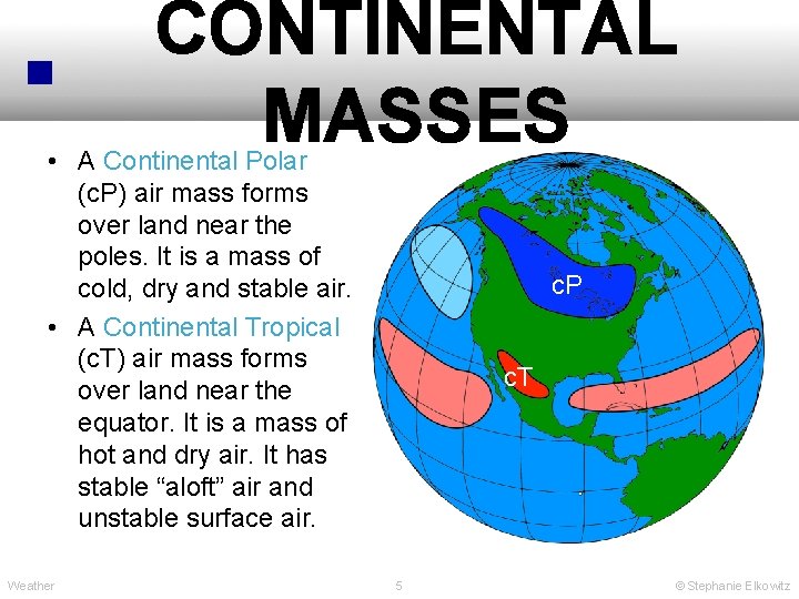
CONTINENTAL MASSES • A Continental Polar (c. P) air mass forms over land near the poles. It is a mass of cold, dry and stable air. • A Continental Tropical (c. T) air mass forms over land near the equator. It is a mass of hot and dry air. It has stable “aloft” air and unstable surface air. Weather c. P c. T 5 © Stephanie Elkowitz

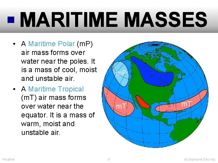
MARITIME MASSES • A Maritime Polar (m. P) air mass forms over water near the poles. It is a mass of cool, moist and unstable air. • A Maritime Tropical (m. T) air mass forms over water near the equator. It is a mass of warm, moist and unstable air. Weather m. P m. T 6 m. T © Stephanie Elkowitz

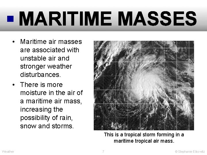
MARITIME MASSES • Maritime air masses are associated with unstable air and stronger weather disturbances. • There is more moisture in the air of a maritime air mass, increasing the possibility of rain, snow and storms. This is a tropical storm forming in a maritime tropical air mass. Weather 7 © Stephanie Elkowitz

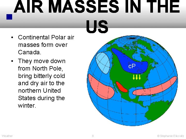
AIR MASSES IN THE US • Continental Polar air masses form over Canada. • They move down from North Pole, bring bitterly cold and dry air to the northern United States during the winter. Weather c. P 8 © Stephanie Elkowitz

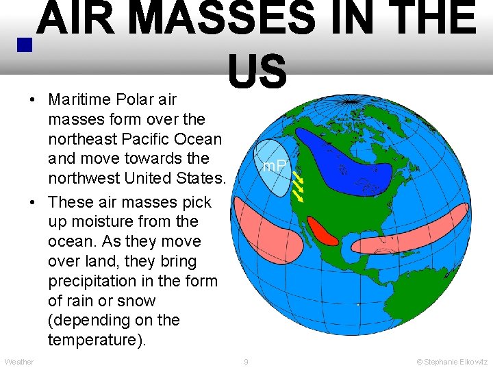
AIR MASSES IN THE US • Maritime Polar air masses form over the northeast Pacific Ocean and move towards the northwest United States. • These air masses pick up moisture from the ocean. As they move over land, they bring precipitation in the form of rain or snow (depending on the temperature). Weather m. P 9 © Stephanie Elkowitz

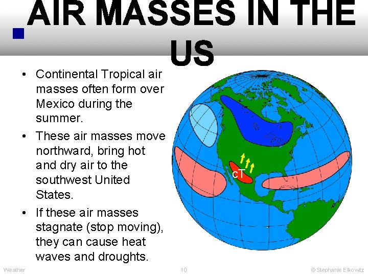
AIR MASSES IN THE US • Continental Tropical air masses often form over Mexico during the summer. • These air masses move northward, bring hot and dry air to the southwest United States. • If these air masses stagnate (stop moving), they can cause heat waves and droughts. Weather c. T 10 © Stephanie Elkowitz

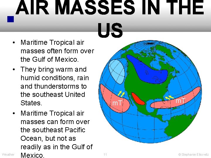
AIR MASSES IN THE US • Maritime Tropical air masses often form over the Gulf of Mexico. • They bring warm and humid conditions, rain and thunderstorms to the southeast United States. • Maritime Tropical air masses can form over the southeast Pacific Ocean, but not as readily as in the Gulf of Weather Mexico. m. T 11 m. T © Stephanie Elkowitz

WEATHER FRONTS • A weather front is the boundary between different air masses. • As an air mass moves, its boundary moves. • Weather disturbances can occur along the boundary. • Weather disturbances occur when one air mass moves towards another air mass because there is a transition from one type of air to another. • There is a change in air density along a weather front. This is most often caused by changes in air temperature. Weather 12 © Stephanie Elkowitz

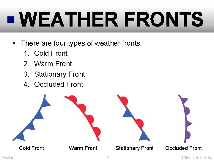
WEATHER FRONTS • There are four types of weather fronts: 1. Cold Front 2. Warm Front 3. Stationary Front 4. Occluded Front Cold Front Weather Stationary Front Warm Front 13 Occluded Front © Stephanie Elkowitz

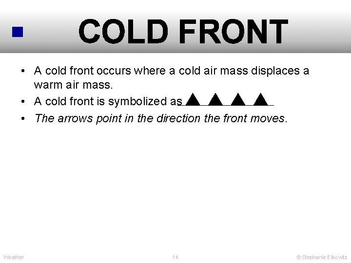
COLD FRONT • A cold front occurs where a cold air mass displaces a warm air mass. • A cold front is symbolized as • The arrows point in the direction the front moves. Weather 14 © Stephanie Elkowitz

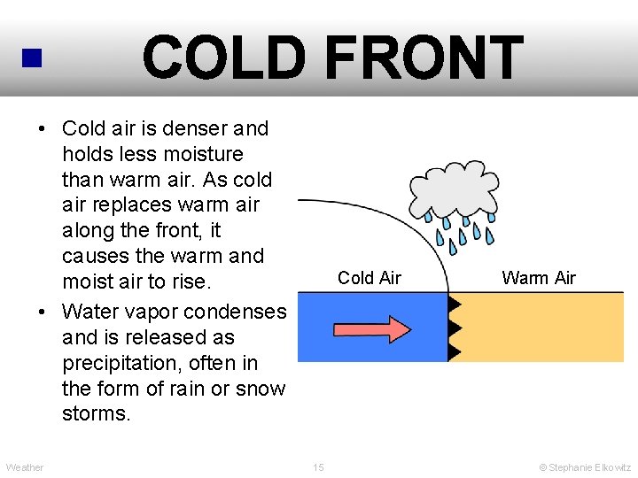
COLD FRONT • Cold air is denser and holds less moisture than warm air. As cold air replaces warm air along the front, it causes the warm and moist air to rise. • Water vapor condenses and is released as precipitation, often in the form of rain or snow storms. Weather Cold Air 15 Warm Air © Stephanie Elkowitz

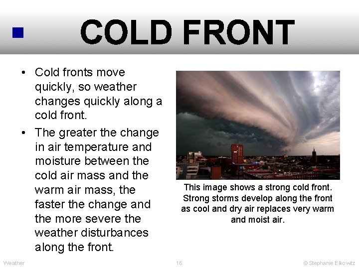
COLD FRONT • Cold fronts move quickly, so weather changes quickly along a cold front. • The greater the change in air temperature and moisture between the cold air mass and the warm air mass, the faster the change and the more severe the weather disturbances along the front. Weather This image shows a strong cold front. Strong storms develop along the front as cool and dry air replaces very warm and moist air. 16 © Stephanie Elkowitz

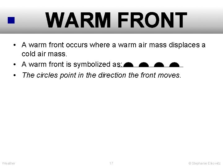
WARM FRONT • A warm front occurs where a warm air mass displaces a cold air mass. • A warm front is symbolized as: • The circles point in the direction the front moves. Weather 17 © Stephanie Elkowitz

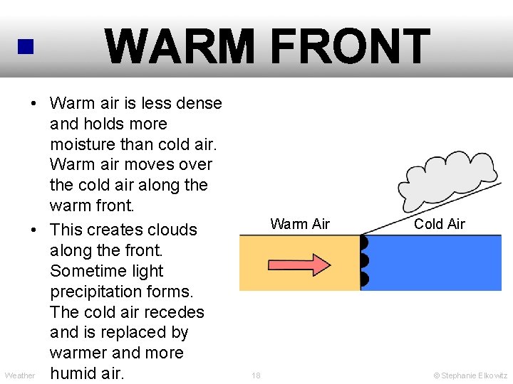
WARM FRONT • Warm air is less dense and holds more moisture than cold air. Warm air moves over the cold air along the warm front. • This creates clouds along the front. Sometime light precipitation forms. The cold air recedes and is replaced by warmer and more Weather humid air. Warm Air 18 Cold Air © Stephanie Elkowitz

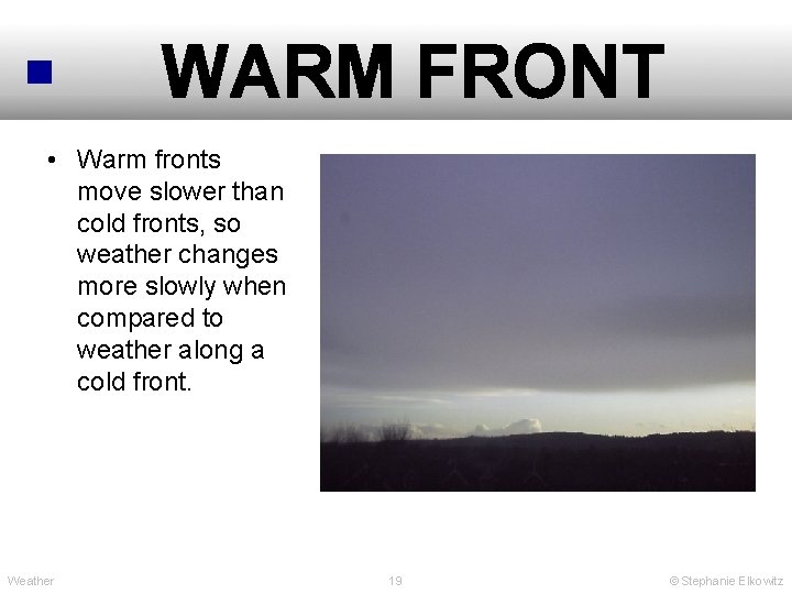
WARM FRONT • Warm fronts move slower than cold fronts, so weather changes more slowly when compared to weather along a cold front. Weather 19 © Stephanie Elkowitz

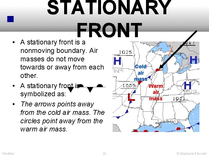
STATIONARY FRONT • A stationary front is a nonmoving boundary. Air masses do not move towards or away from each other. • A stationary front is symbolized as: • The arrows points away from the cold air mass. The circles point away from the warm air mass. Weather 20 Cold air mass Warm air mass © Stephanie Elkowitz

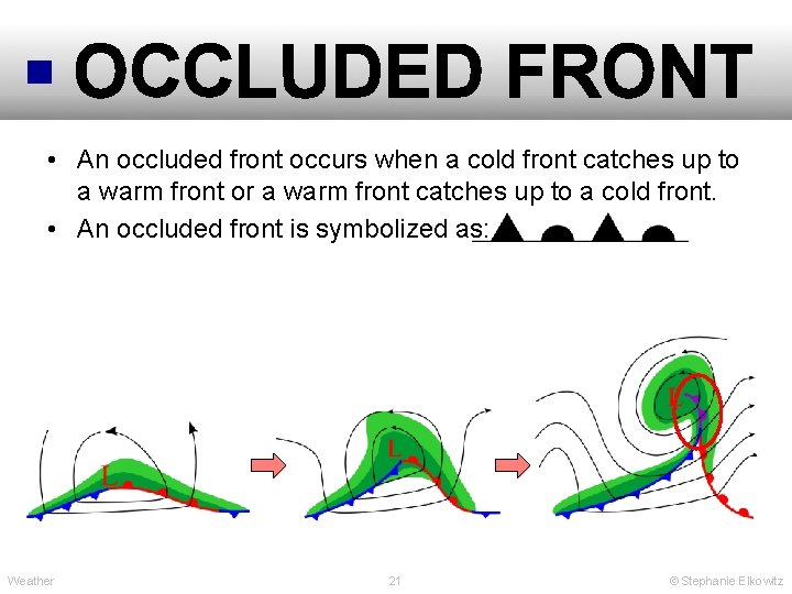
OCCLUDED FRONT • An occluded front occurs when a cold front catches up to a warm front or a warm front catches up to a cold front. • An occluded front is symbolized as: Weather 21 © Stephanie Elkowitz

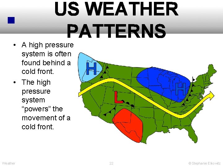
US WEATHER PATTERNS • A high pressure system is often found behind a cold front. • The high pressure system “powers” the movement of a cold front. Weather H L 22 H © Stephanie Elkowitz

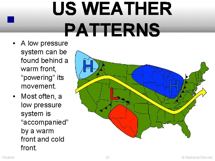
US WEATHER PATTERNS • A low pressure system can be found behind a warm front, “powering” its movement. • Most often, a low pressure system is “accompanied” by a warm front and cold front. Weather H L 23 H © Stephanie Elkowitz

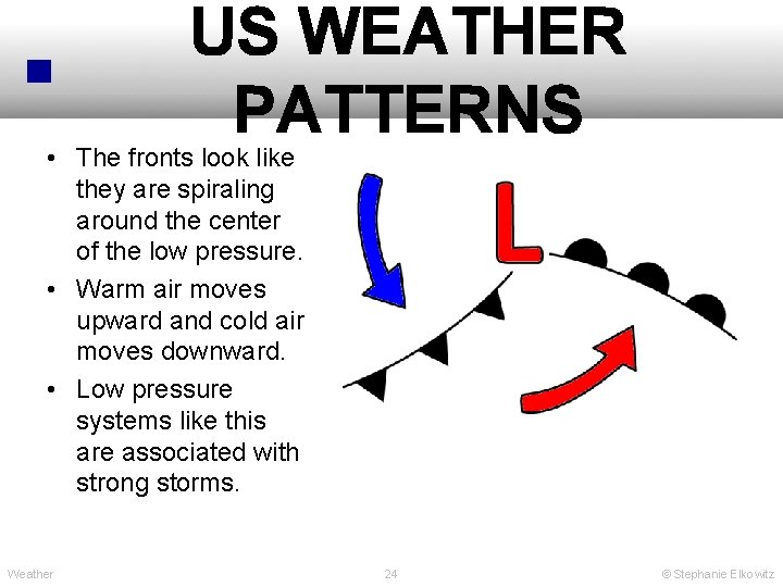
US WEATHER PATTERNS • The fronts look like they are spiraling around the center of the low pressure. • Warm air moves upward and cold air moves downward. • Low pressure systems like this are associated with strong storms. Weather 24 © Stephanie Elkowitz