Air Masses and Fronts Air Masses An air
- Slides: 15

Air Masses and Fronts

Air Masses ► An air mass is a defined as a large body of air with very similar characteristics. ► Air masses are generally defined by temperature and moisture ► Air masses are named based on the source region of the air mass itself

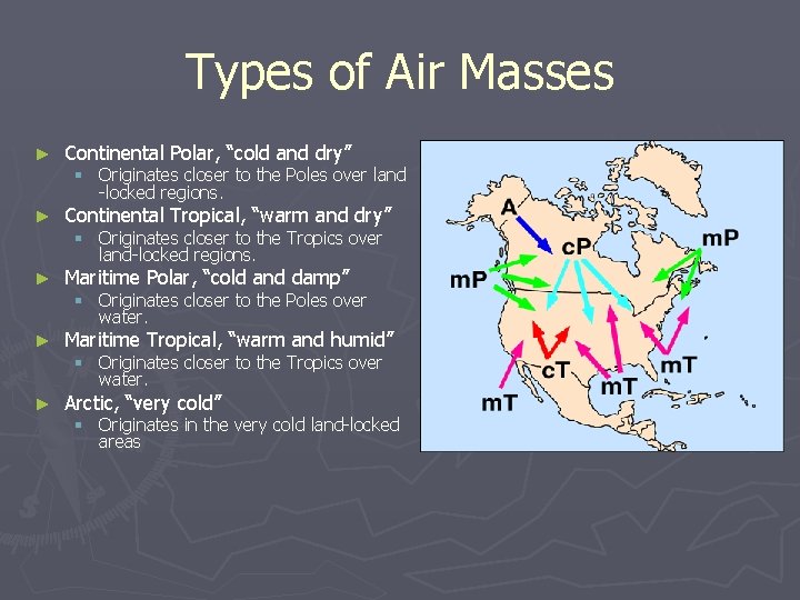
Types of Air Masses ► Continental Polar, “cold and dry” ► Continental Tropical, “warm and dry” ► Maritime Polar, “cold and damp” ► Maritime Tropical, “warm and humid” ► Arctic, “very cold” § Originates closer to the Poles over land -locked regions. § Originates closer to the Tropics over land-locked regions. § Originates closer to the Poles over water. § Originates closer to the Tropics over water. § Originates in the very cold land-locked areas

What is a Front? ► The boundary where two air masses meet. ► Commonly associated with. . § Moisture gradient § Temperature gradient § Wind shift

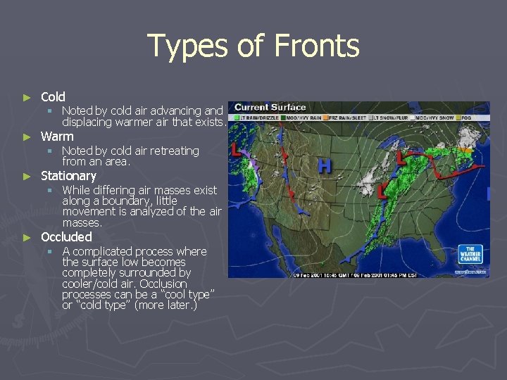
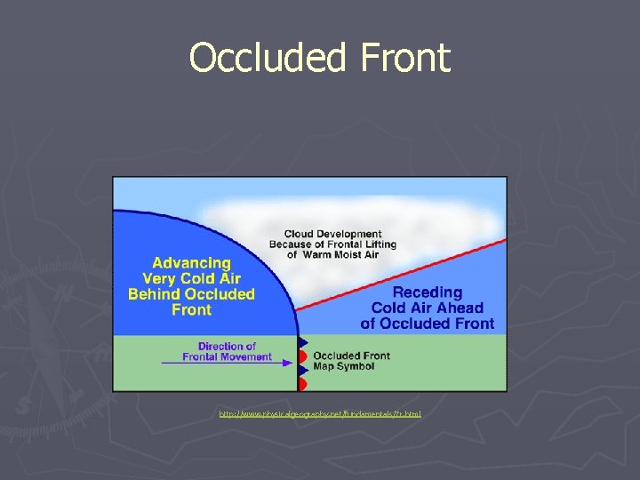
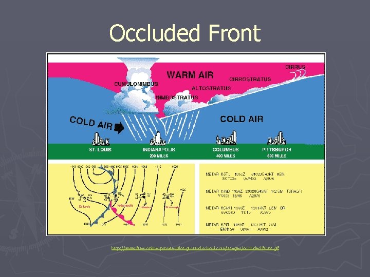
Types of Fronts ► Cold ► Warm ► Stationary ► Occluded § Noted by cold air advancing and displacing warmer air that exists. § Noted by cold air retreating from an area. § While differing air masses exist along a boundary, little movement is analyzed of the air masses. § A complicated process where the surface low becomes completely surrounded by cooler/cold air. Occlusion processes can be a “cool type” or “cold type” (more later. )

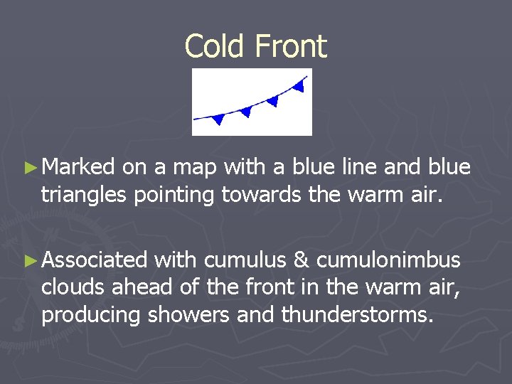
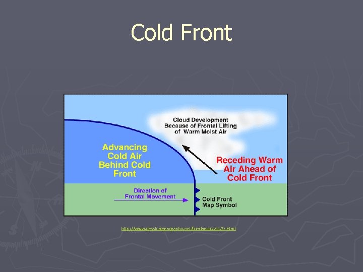
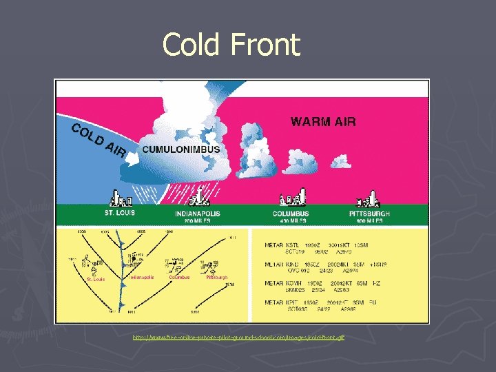
Cold Front ► Marked on a map with a blue line and blue triangles pointing towards the warm air. ► Associated with cumulus & cumulonimbus clouds ahead of the front in the warm air, producing showers and thunderstorms.

Cold Front http: //www. physicalgeography. net/fundamentals/7 r. html

Cold Front http: //www. free-online-private-pilot-ground-school. com/images/cold-front. gif

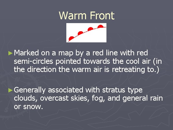
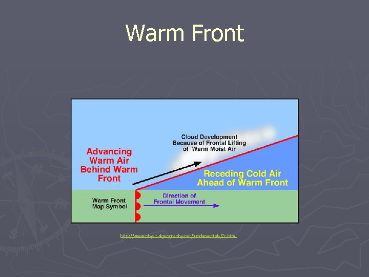
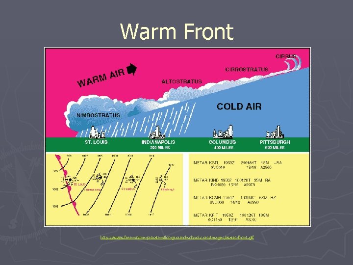
Warm Front ► Marked on a map by a red line with red semi-circles pointed towards the cool air (in the direction the warm air is retreating to. ) ► Generally associated with stratus type clouds, overcast skies, fog, and general rain or snow.

Warm Front http: //www. physicalgeography. net/fundamentals/7 r. html

Warm Front http: //www. free-online-private-pilot-ground-school. com/images/warm-front. gif

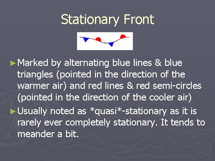
Stationary Front ► Marked by alternating blue lines & blue triangles (pointed in the direction of the warmer air) and red lines & red semi-circles (pointed in the direction of the cooler air) ► Usually noted as *quasi*-stationary as it is rarely ever completely stationary. It tends to meander a bit.

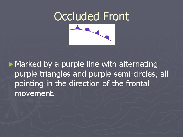
Occluded Front ► Marked by a purple line with alternating purple triangles and purple semi-circles, all pointing in the direction of the frontal movement.

Occluded Front http: //www. physicalgeography. net/fundamentals/7 r. html

Occluded Front http: //www. free-online-private-pilot-ground-school. com/images/occluded-front. gif