Air Masses and Fronts Notes Types of Air


 air mass has")


- Slides: 30
Air Masses and Fronts Notes
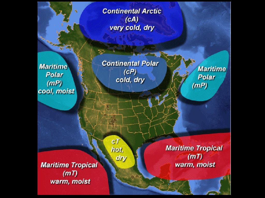
Types of Air Masses • An air mass is a huge body of air. The air at any given height is an air mass and has about the same temperature, humidity, and air pressure. • North America’s weather is influenced by four types of air masses.
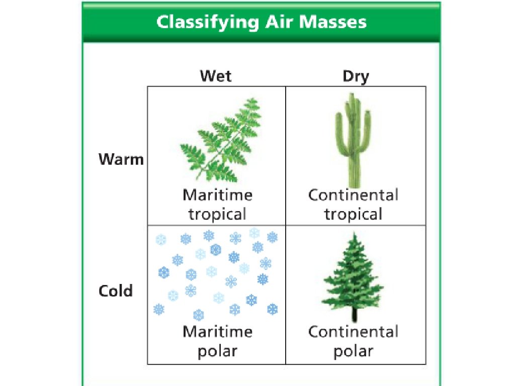
Types of Air Masses • A tropical air mass forms in the tropics. A tropical air mass has warm air. • A polar air mass forms near the poles. A polar air mass has cold air. • A maritime air mass forms over the ocean and has humid air. • A continental air mass forms over land has dry air.
Types of Air Masses • • A maritime tropical (m. T) air mass has warm, humid air. (*impacts Mississippi) A maritime polar (m. P) air mass has cold, humid air. A continental tropical (c. T) air mass has hot, dry air. A continental polar (c. P) air mass has cold, dry air.
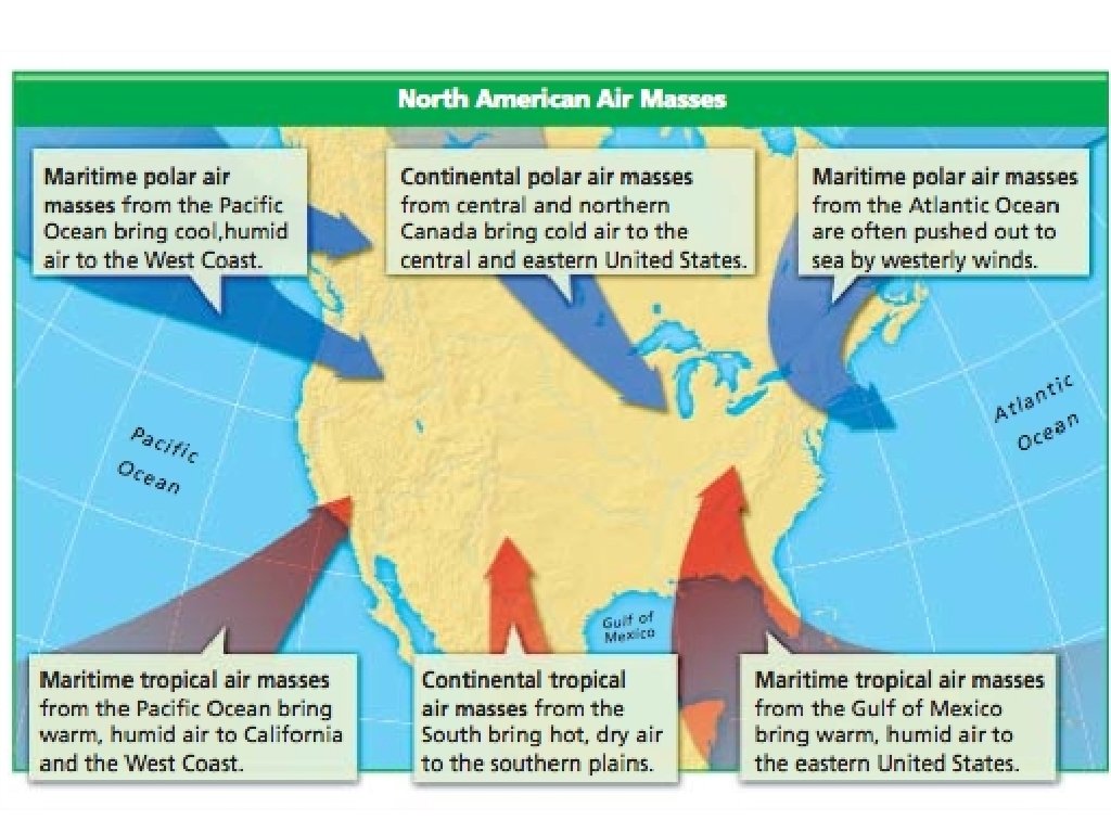
• • • How Air Masses Move These air masses move. Global winds usually move these masses of air from one part of the globe to another. The major wind belts over the United States are the westerlies. These winds usually push air masses from the west to the east across the States. Jet streams also push air masses in the same west-to-east direction.
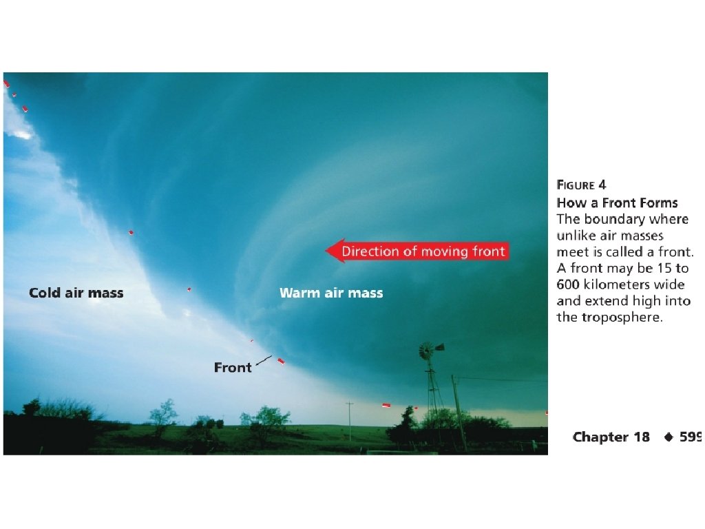
How Air Masses Move • As these air masses move, they will eventually collide with one another. A front is a boundary where two air masses meet. • Storms and other types of weather develop along frontal boundaries.
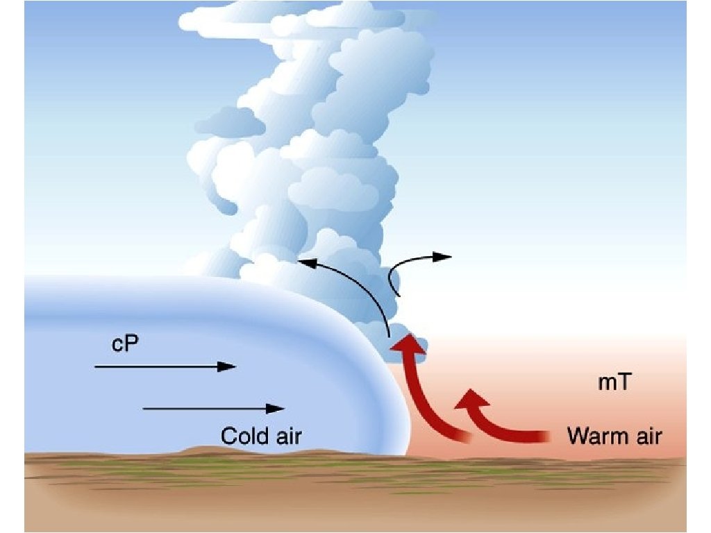
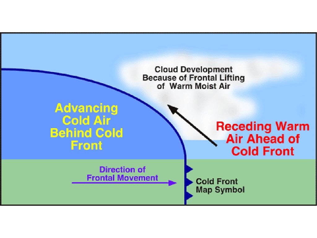
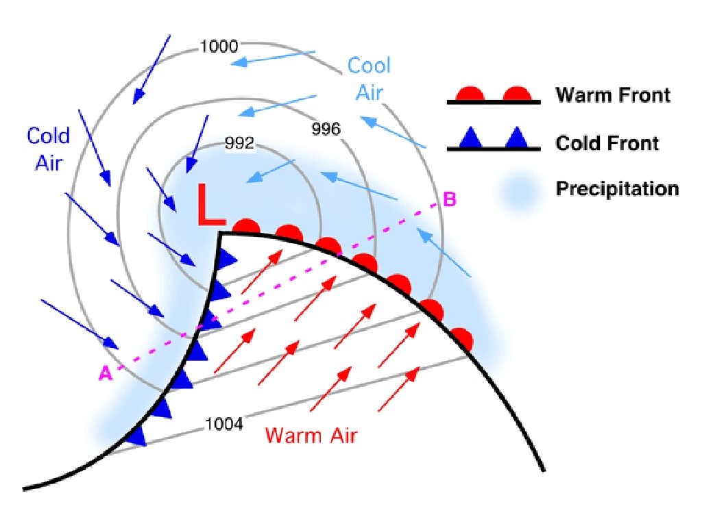
Types of Fronts • • • A cold front forms when a cold air mass slides under a warm air mass, forcing the warm air up very quickly. Remember that warm air will rise up over the cold air because the warm air is less dense. Thunderstorms can occur with cold fronts. Precipitation will usually occur behind the front. A cold front on a weather map is indicated by a blue line with triangles pointed in the direction that the front is moving towards.
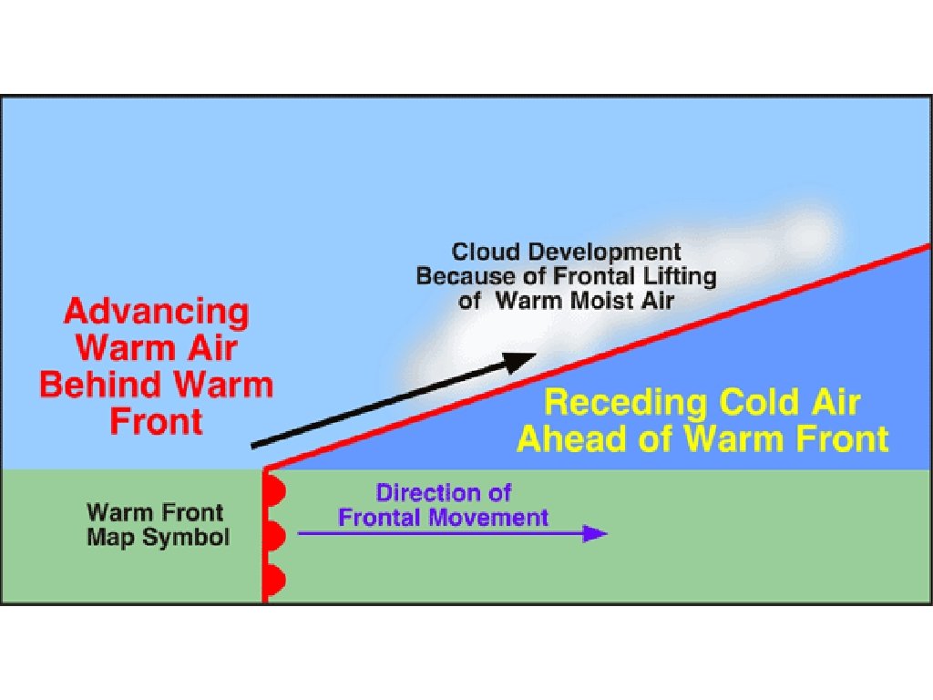
Types of Fronts • • • A warm front forms when a warm air mass moves over a cooler air mass. This lifting is generally much more smooth and slow than a cold front. Light rain or snow may fall. Precipitation will usually occur ahead of the front. On a weather map, this would appear as a red line with semi-circles indicating the direction of movement.
• • • Types of Fronts Sometimes cold and warm air masses meet, but neither air mass moves over or under the other, they may even travel parallel to the frontal boundary. This is known as a stationary front. A stationary front can bring many days of clouds and precipitation. A stationary front on a weather map is indicated by inverting blue/red triangles/semicircles.
Types of Fronts • • • A warm air mass sometimes is caught between two cooler air masses. OR a cold front catches up to a slower-moving warm front. This forms an occluded front. In an occluded front, the warm air mass is cut off from the ground as it is lifted above the two other air masses. The weather may turn cloudy, and rain or snow may fall. These are shown as purple lines of alternating triangles and semicircles.
Step 1 Step 2
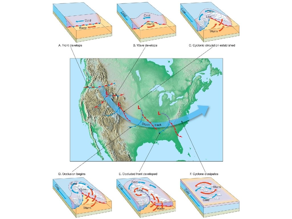
Types of Fronts • In some cases, one front can eventually turn into another. And in the strongest cases, this will turn into a mid-latitude cyclone, as the westerlies, the Coriolis effect, and rising air all combine into a severe weather system.
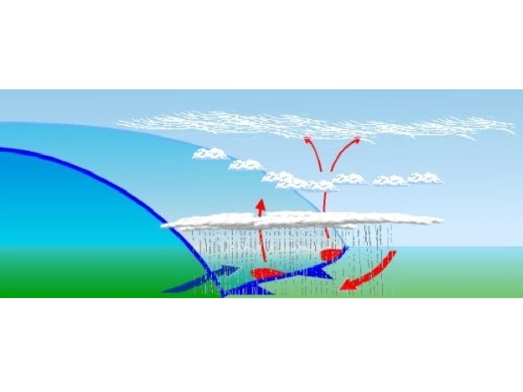
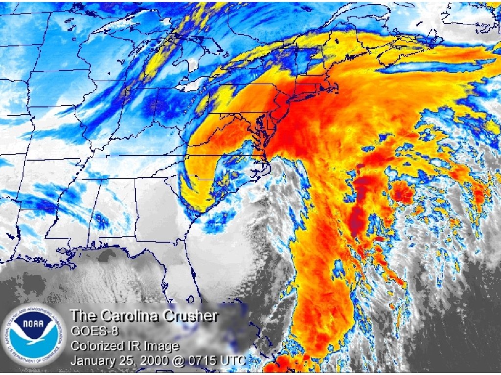
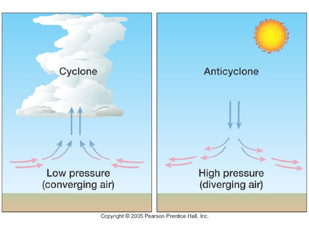
• • Cyclones and Anticyclones A cyclone is a swirling center of low air pressure. The winds in a cyclone spiral around a center. In a cyclone, winds spiral inwards towards the lowpressure center. The Coriolis effect makes winds spin counterclockwise in a Northern Hemisphere cyclone. Air spins upward in a cyclone due to the airs converging at the base. The result is lifting air that will condense into clouds, extreme wind shifts, and precipitation. Cyclones play a large part in weather of the United States.
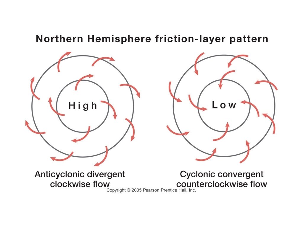
Cyclones and Anticyclones • An anticyclone is a high-pressure center of dry air. An anticyclone is the opposite of a cyclone. In an anticyclone, winds spin outward away from the high-pressure center. • • The Coriolis effect makes winds spin clockwise in a Northern Hemisphere anticyclone. The air spins downward in an anticyclone due to the divergence of air at the base. The result is dry, clear weather.
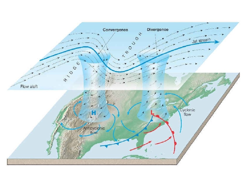
High Pressure System • A high pressure system is a whirling mass of cool, dry air that generally brings fair weather and light winds. When viewed from above, winds spiral out of a high-pressure center in a clockwise rotation in the Northern Hemisphere. These bring sunny skies.
Low Pressure System • A low pressure system is a whirling mass of warm, moist air that generally brings stormy weather with strong winds. When viewed from above, winds spiral into a low-pressure center in a counterclockwise rotation in the Northern Hemisphere. A low pressure system is represented as a big, red L.