AIR MASSES AND FRONTS Chapter 16 Section 2
- Slides: 27
AIR MASSES AND FRONTS Chapter 16 Section 2 1
Humidity • the amount of water vapor in the air 2
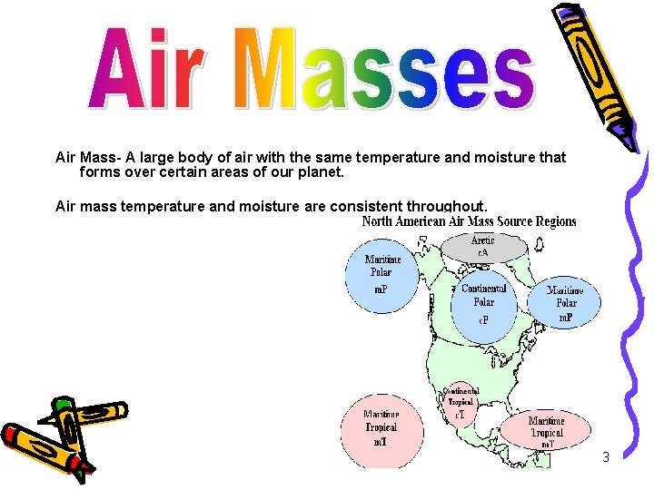
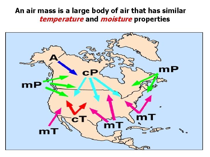
Air Mass- A large body of air with the same temperature and moisture that forms over certain areas of our planet. Air mass temperature and moisture are consistent throughout. 3
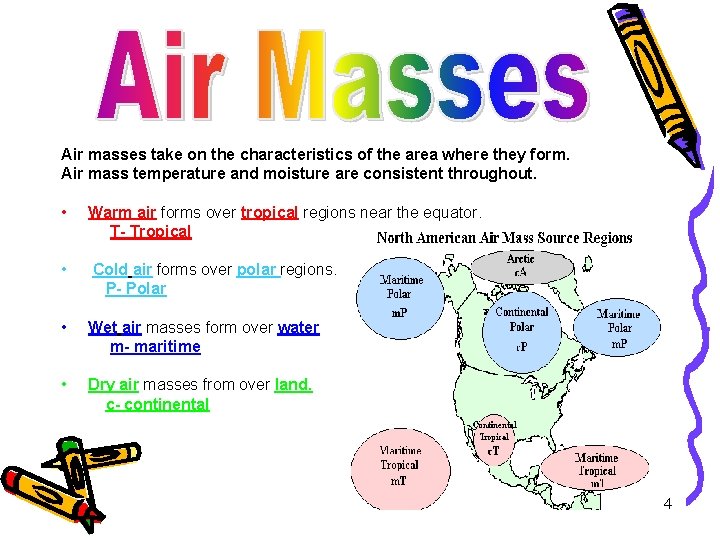
Air masses take on the characteristics of the area where they form. Air mass temperature and moisture are consistent throughout. • Warm air forms over tropical regions near the equator. T- Tropical • Cold air forms over polar regions. P- Polar • Wet air masses form over water m- maritime • Dry air masses from over land. c- continental 4
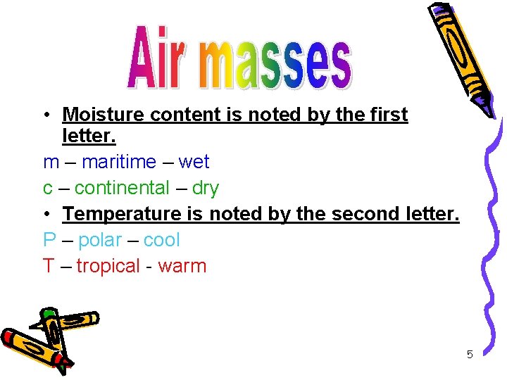
• Moisture content is noted by the first letter. m – maritime – wet c – continental – dry • Temperature is noted by the second letter. P – polar – cool T – tropical - warm 5
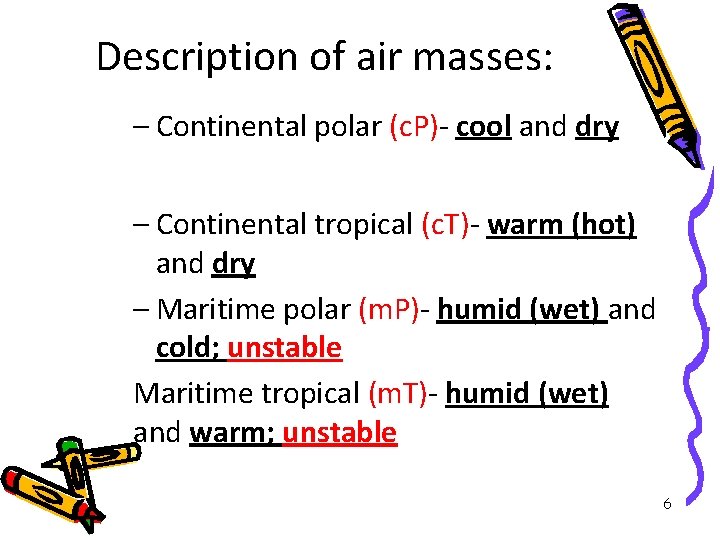
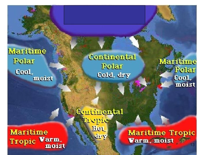
Description of air masses: – Continental polar (c. P)- cool and dry • Continental arctic-type of continental polar mass that is much colder-forms in the arctic circle – Continental tropical (c. T)- warm (hot) and dry – Maritime polar (m. P)- humid (wet) and cold; unstable Maritime tropical (m. T)- humid (wet) and warm; unstable 6
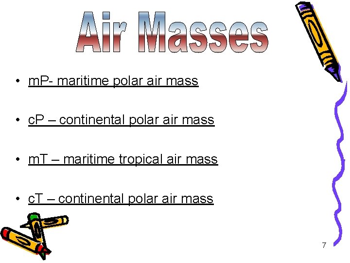
• m. P- maritime polar air mass • c. P – continental polar air mass • m. T – maritime tropical air mass • c. T – continental polar air mass 7
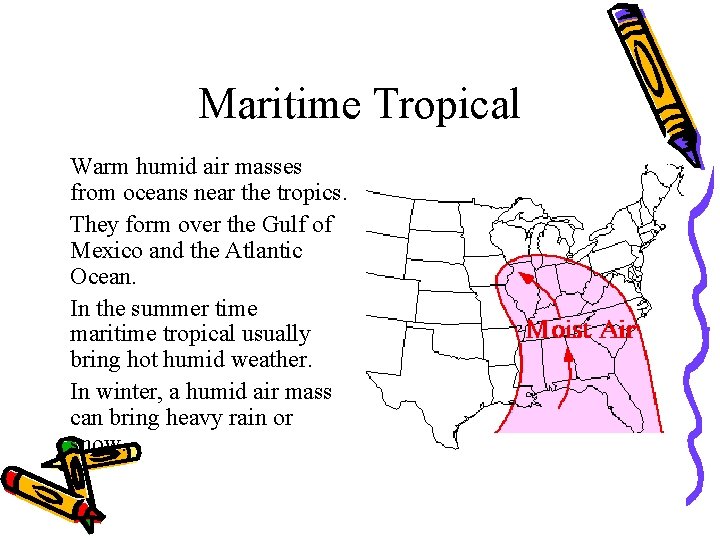
Maritime Tropical • Warm humid air masses from oceans near the tropics. • They form over the Gulf of Mexico and the Atlantic Ocean. • In the summer time maritime tropical usually bring hot humid weather. • In winter, a humid air mass can bring heavy rain or snow.
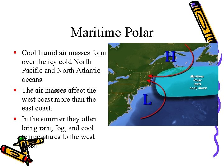
Maritime Polar § Cool humid air masses form over the icy cold North Pacific and North Atlantic oceans. § The air masses affect the west coast more than the east coast. § In the summer they often bring rain, fog, and cool temperatures to the west coast.
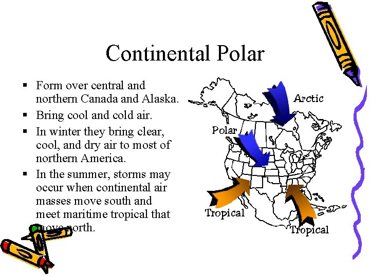
Continental Polar § Form over central and northern Canada and Alaska. § Bring cool and cold air. § In winter they bring clear, cool, and dry air to most of northern America. § In the summer, storms may occur when continental air masses move south and meet maritime tropical that move north.
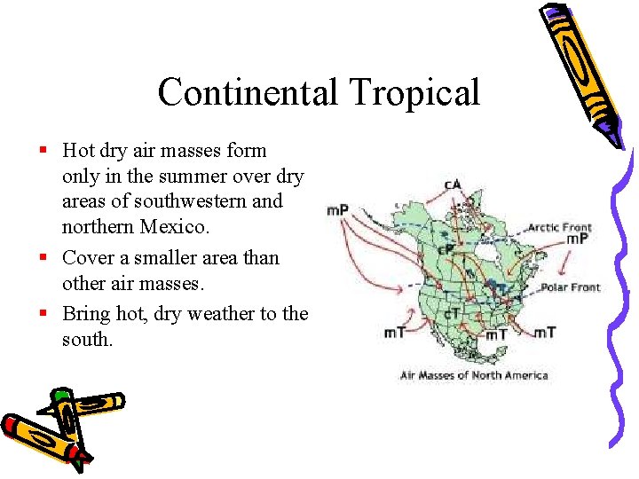
Continental Tropical § Hot dry air masses form only in the summer over dry areas of southwestern and northern Mexico. § Cover a smaller area than other air masses. § Bring hot, dry weather to the south.
An air mass is a large body of air that has similar temperature and moisture properties
13
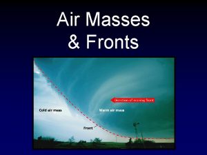
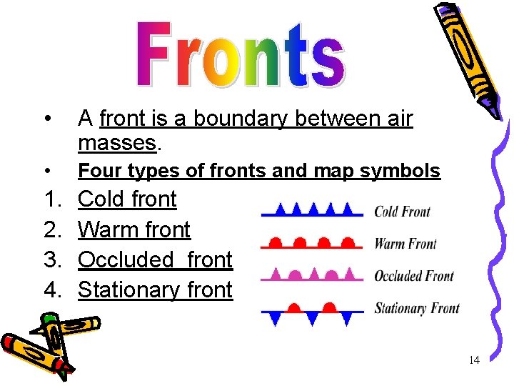
• A front is a boundary between air masses. • Four types of fronts and map symbols 1. 2. 3. 4. Cold front Warm front Occluded front Stationary front 14
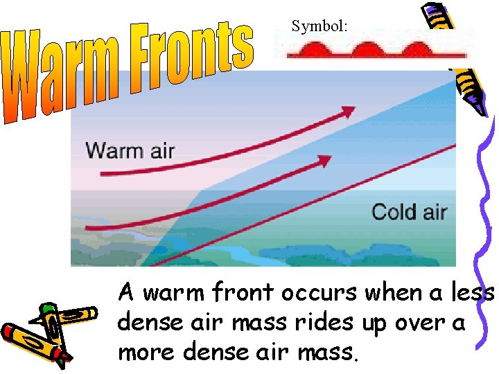
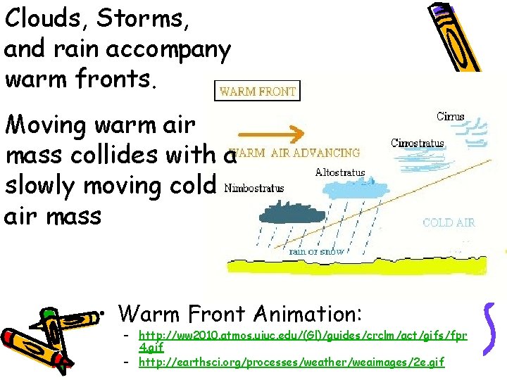
WARM FRONT • Warm air mass meets a cold air mass and pushes the cold air mass out of the way. • Brings drizzly precipitation. • Followed by clear warm weather. 15
Symbol: A warm front occurs when a less dense air mass rides up over a more dense air mass.
Clouds, Storms, and rain accompany warm fronts. Moving warm air mass collides with a slowly moving cold air mass • Warm Front Animation: – http: //ww 2010. atmos. uiuc. edu/(Gl)/guides/crclm/act/gifs/fpr 4. gif – http: //earthsci. org/processes/weather/weaimages/2 e. gif
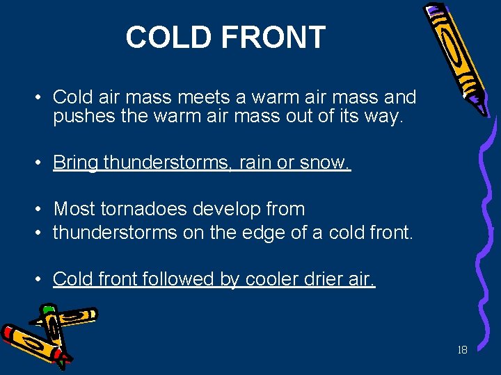
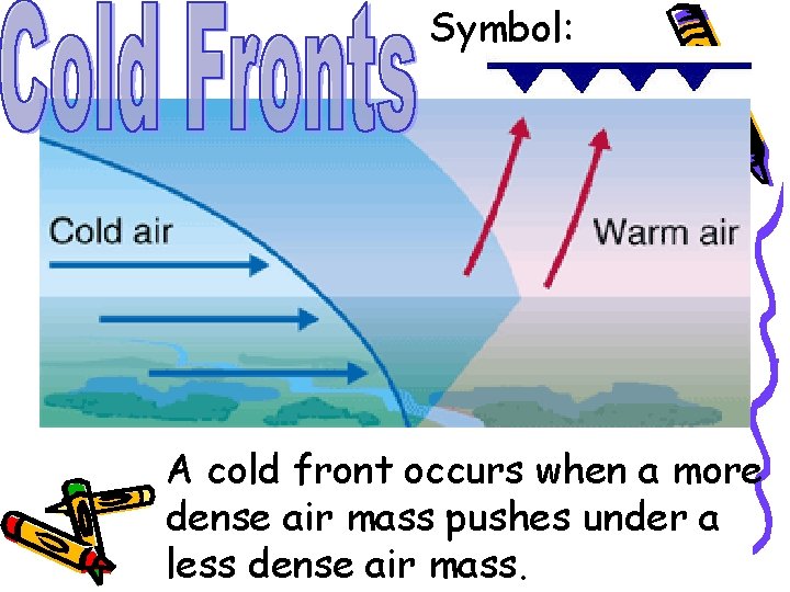
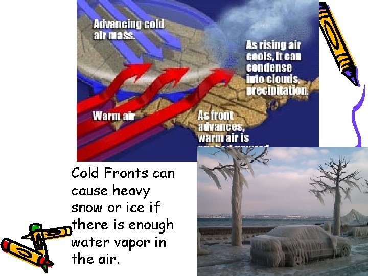
COLD FRONT • Cold air mass meets a warm air mass and pushes the warm air mass out of its way. • Bring thunderstorms, rain or snow. • Most tornadoes develop from • thunderstorms on the edge of a cold front. • Cold front followed by cooler drier air. 18
Symbol: A cold front occurs when a more dense air mass pushes under a less dense air mass.
Cold Fronts can cause heavy snow or ice if there is enough water vapor in the air.
STATIONARY FRONT • Cold air meets warm air. • Not enough force to move either front. • Many days of cloudy, wet weather. 21
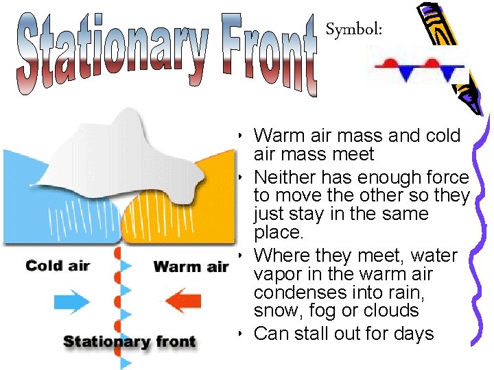
Symbol: • Warm air mass and cold air mass meet • Neither has enough force to move the other so they just stay in the same place. • Where they meet, water vapor in the warm air condenses into rain, snow, fog or clouds • Can stall out for days
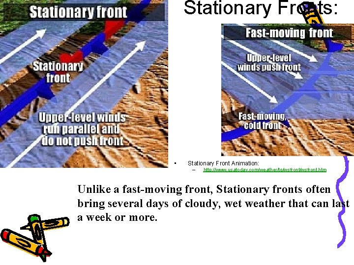
Stationary Fronts: • Stationary Front Animation: – http: //www. usatoday. com/weather/tg/wsfront. htm Unlike a fast-moving front, Stationary fronts often bring several days of cloudy, wet weather that can last a week or more.
OCCLUDED FRONT • Warm air caught between two cold air masses. • Brings cool temperatures with large amounts of rain or snow 24
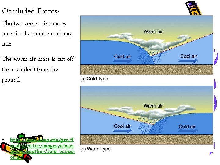
Occcluded Fronts: The two cooler air masses meet in the middle and may mix. The warm air mass is cut off (or occluded) from the ground. • http: //www. uwsp. edu/geo/f aculty/ritter/images/atmos phere/weather/cold_occlusi on. gif
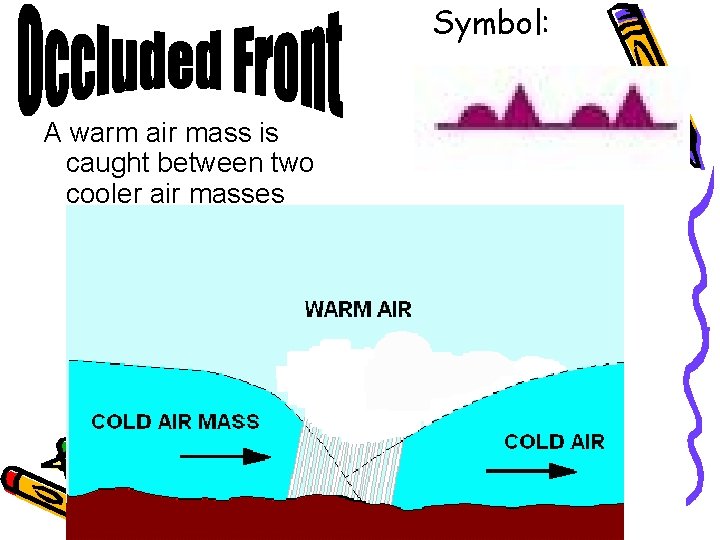
Symbol: A warm air mass is caught between two cooler air masses
Cold Front, Warm Front and Occluded Front Animation • http: //www. 3 villagecsd. k 12. ny. us/Murphy/me dina/weather. html • http: //www. classzone. com/books/earth_scien ce/terc/content/visualizations/es 2002 page 01. cfm? chapter_no=visualization • Click on the above links. 27