Applied Cartography and Introduction to GIS GEOG 2017


- Slides: 47
Applied Cartography and Introduction to GIS GEOG 2017 EL Lecture-4 Chapters 7 and 8
Location Errors • Location errors refer to the geometric inaccuracies of digitized features. • Location errors can be examined by referring to the data source for digitizing.
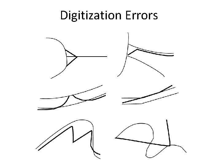
Digitization Errors
Spatial Data Accuracy Standards • In the United States, the development of spatial data accuracy • standards has gone through three phases. 1. U. S. National Map Accuracy Standard, revised and adopted in 1947 2. Accuracy standards for large-scale maps proposed by the American Society for Photogrammetry and Remote Sensing in 1990 3. National Standard for Spatial Data Accuracy established by the Federal Geographic Data Committee in 1998
Topological Errors Topological errors violate the topological relationships either required by a GIS package or defined by the user.
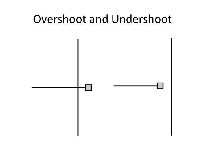
Topological Errors with Geometric Features • • • Undershoot Overshoot Dangling node Pseudo node Direction error Label error
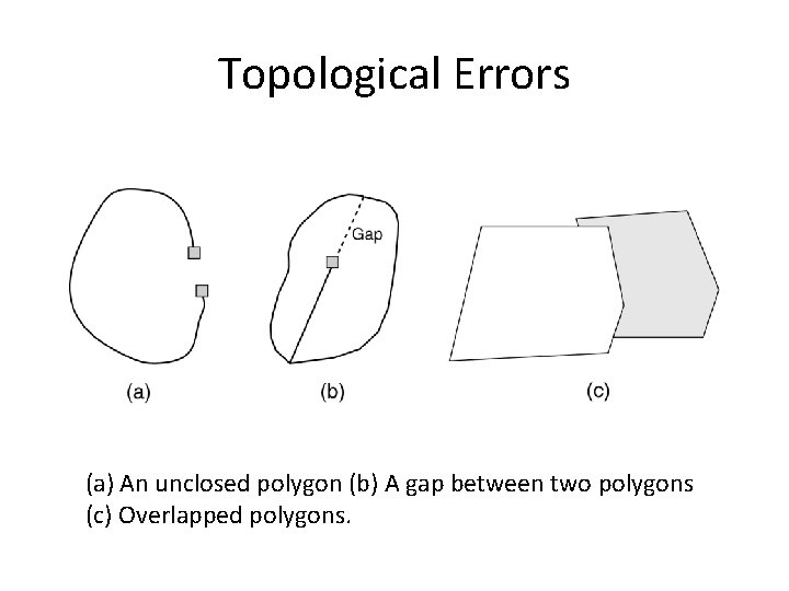
Topological Errors (a) An unclosed polygon (b) A gap between two polygons (c) Overlapped polygons.
Overshoot and Undershoot
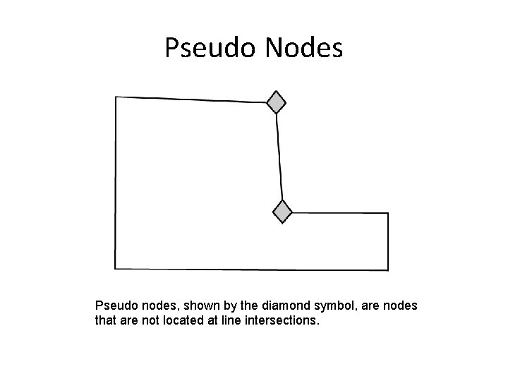
Pseudo Nodes Pseudo nodes, shown by the diamond symbol, are nodes that are not located at line intersections.
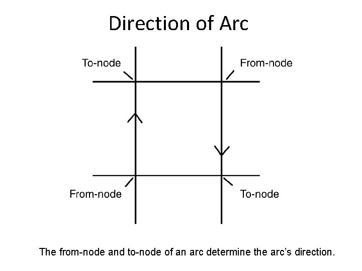
Direction of Arc The from-node and to-node of an arc determine the arc’s direction.
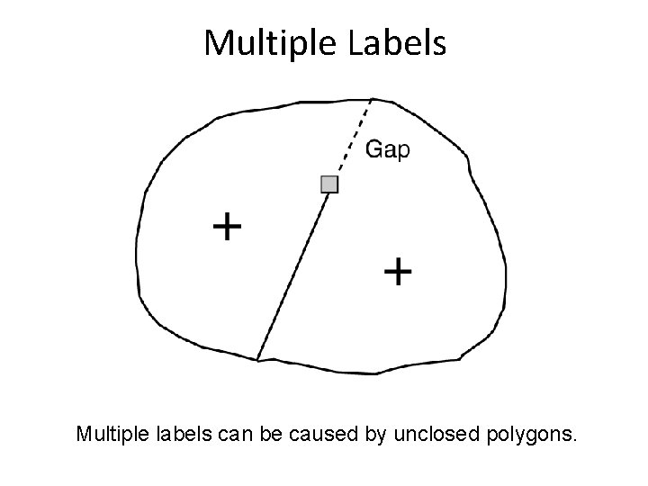
Multiple Labels Multiple labels can be caused by unclosed polygons.
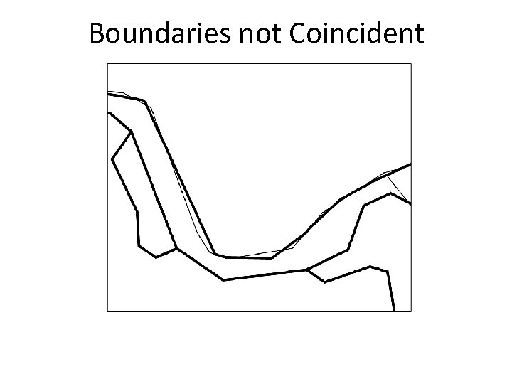
Errors between Layers • Boundaries not coincident • Lines not connected at end points • Overlapping line features
Boundaries not Coincident
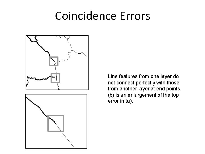
Coincidence Errors Line features from one layer do not connect perfectly with those from another layer at end points. (b) is an enlargement of the top error in (a).
Topological Editing • Topological editing ensures that digitized spatial features follow the topological relationships that are either built into a data model or specified by the user. 1. Topological Editing on Coverages 2. Editing Using Map Topology 3. Editing Using Topology Rules
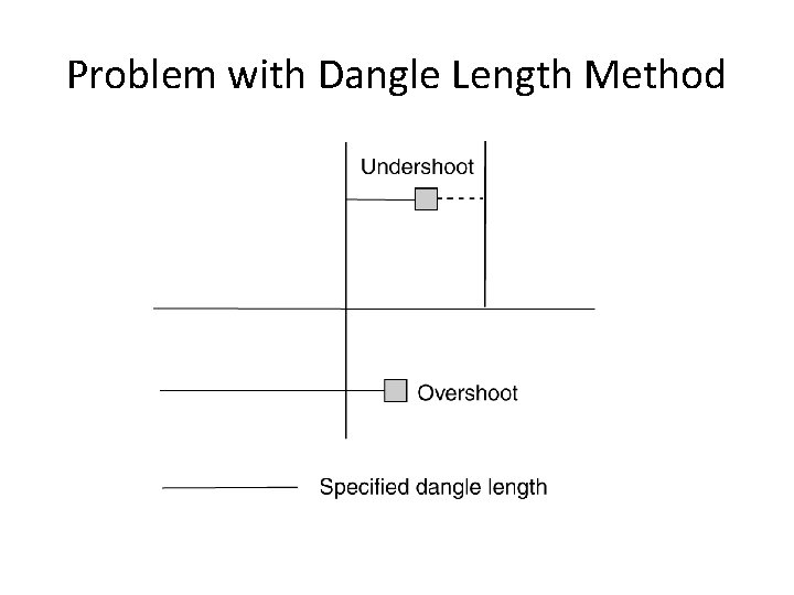
Using Dangle Length
Problem with Dangle Length Method
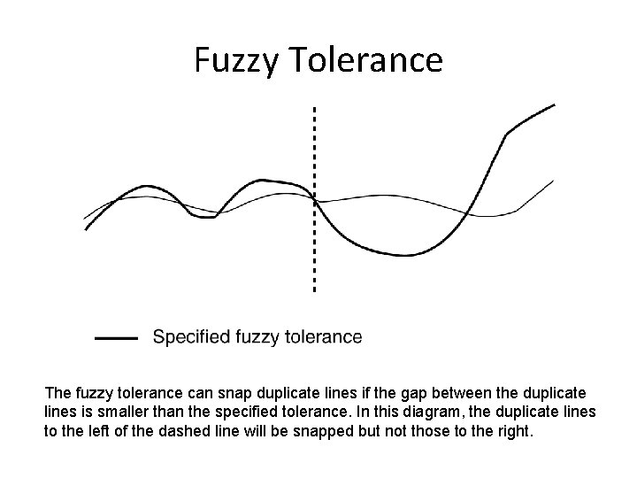
Fuzzy Tolerance The fuzzy tolerance can snap duplicate lines if the gap between the duplicate lines is smaller than the specified tolerance. In this diagram, the duplicate lines to the left of the dashed line will be snapped but not those to the right.
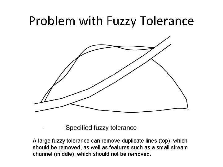
Problem with Fuzzy Tolerance A large fuzzy tolerance can remove duplicate lines (top), which should be removed, as well as features such as a small stream channel (middle), which should not be removed.
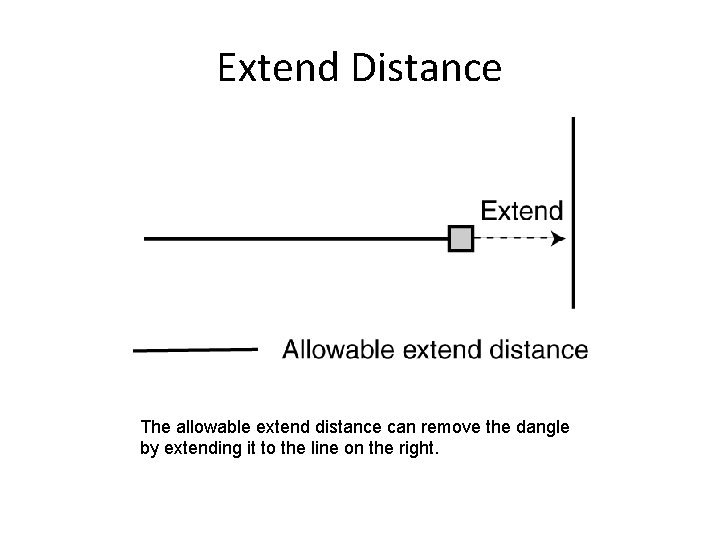
Extend Distance The allowable extend distance can remove the dangle by extending it to the line on the right.
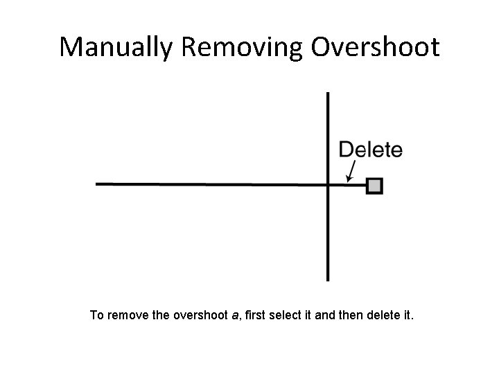
Manually Removing Overshoot To remove the overshoot a, first select it and then delete it.
Non-Topological Editing Non-topological editing refers to a variety of basic editing operations that modify simple features and create new features from existing features.
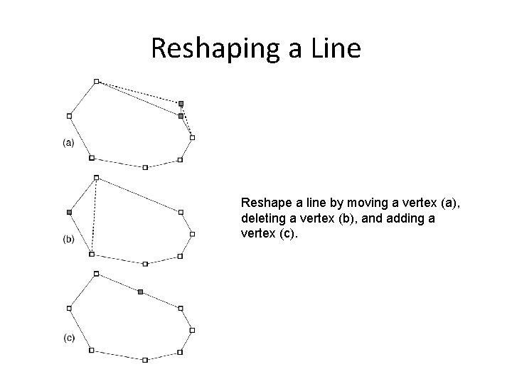
Reshaping a Line Reshape a line by moving a vertex (a), deleting a vertex (b), and adding a vertex (c).
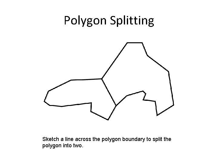
Polygon Splitting Sketch a line across the polygon boundary to split the polygon into two.
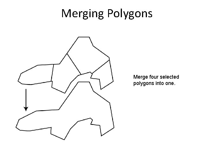
Merging Polygons Merge four selected polygons into one.
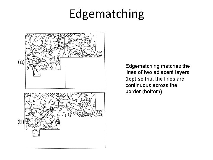
Edgematching matches lines along the edge of a layer to lines of an adjacent layer so that the lines are continuous across the border between two layers.
Edgematching matches the lines of two adjacent layers (top) so that the lines are continuous across the border (bottom).
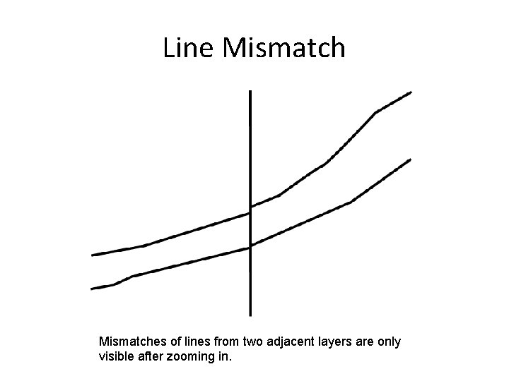
Line Mismatches of lines from two adjacent layers are only visible after zooming in.
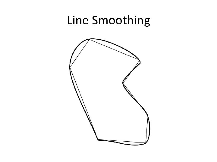
Line Simplification and Smoothing • Line simplification refers to the process of simplifying or generalizing a line by removing some of its points. • Line smoothing refers to the process of reshaping lines by using some mathematical functions such as splines.
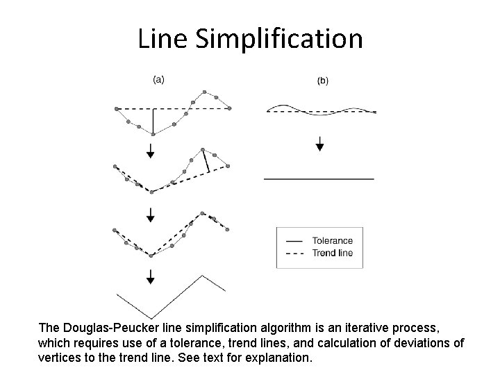
Line Simplification The Douglas-Peucker line simplification algorithm is an iterative process, which requires use of a tolerance, trend lines, and calculation of deviations of vertices to the trend line. See text for explanation.
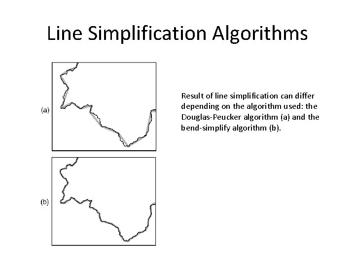
Line Simplification Algorithms Result of line simplification can differ depending on the algorithm used: the Douglas-Peucker algorithm (a) and the bend-simplify algorithm (b).
Line Smoothing
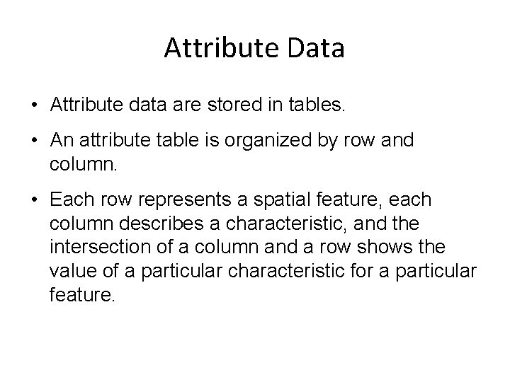
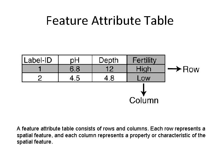
Attribute Data • Attribute data are stored in tables. • An attribute table is organized by row and column. • Each row represents a spatial feature, each column describes a characteristic, and the intersection of a column and a row shows the value of a particular characteristic for a particular feature.
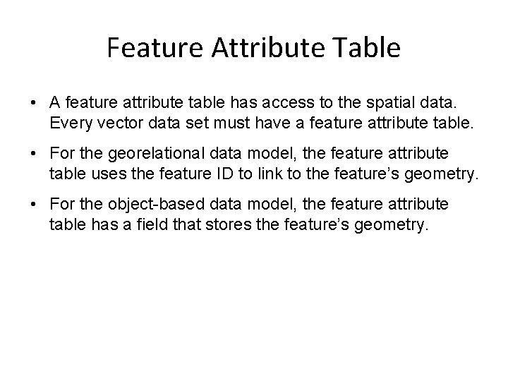
Feature Attribute Table • A feature attribute table has access to the spatial data. Every vector data set must have a feature attribute table. • For the georelational data model, the feature attribute table uses the feature ID to link to the feature’s geometry. • For the object-based data model, the feature attribute table has a field that stores the feature’s geometry.
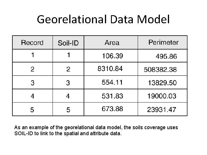
Georelational Data Model As an example of the georelational data model, the soils coverage uses SOIL-ID to link to the spatial and attribute data.
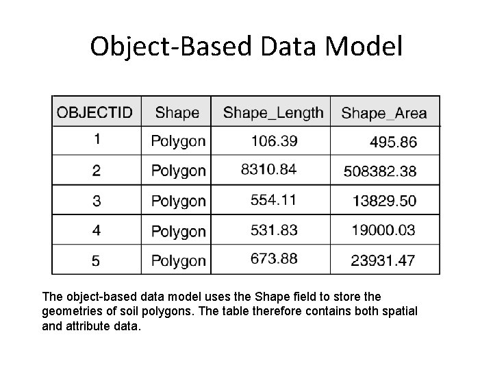
Object-Based Data Model The object-based data model uses the Shape field to store the geometries of soil polygons. The table therefore contains both spatial and attribute data.
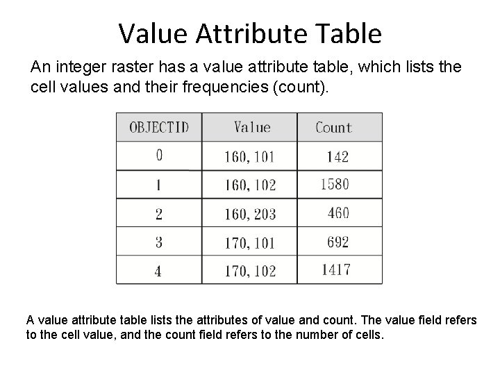
Value Attribute Table An integer raster has a value attribute table, which lists the cell values and their frequencies (count). A value attribute table lists the attributes of value and count. The value field refers to the cell value, and the count field refers to the number of cells.
Feature Attribute Table A feature attribute table consists of rows and columns. Each row represents a spatial feature, and each column represents a property or characteristic of the spatial feature.
Types of Database Design There at least four types of database designs that have been proposed in the literature: Flat file Hierarchical Network Relational
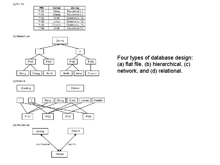
Four types of database design: (a) flat file, (b) hierarchical, (c) network, and (d) relational.
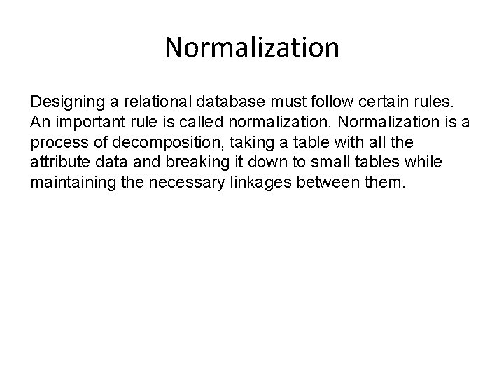
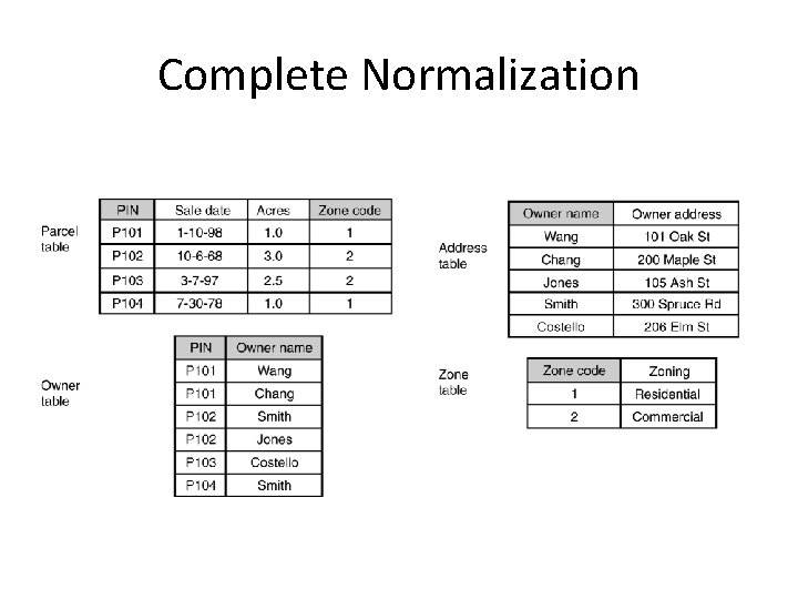
Normalization Designing a relational database must follow certain rules. An important rule is called normalization. Normalization is a process of decomposition, taking a table with all the attribute data and breaking it down to small tables while maintaining the necessary linkages between them.
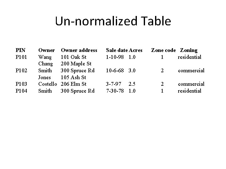
Un-normalized Table PIN P 101 P 102 P 103 P 104 Owner Wang Chang Smith Jones Costello Smith Owner address 101 Oak St 200 Maple St 300 Spruce Rd 105 Ash St 206 Elm St 300 Spruce Rd Sale date Acres 1 -10 -98 1. 0 Zone code Zoning 1 residential 10 -6 -68 3. 0 2 commercial 3 -7 -97 2. 5 7 -30 -78 1. 0 2 1 commercial residential
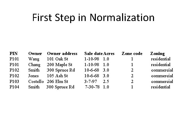
First Step in Normalization PIN P 101 P 102 P 103 P 104 Owner Wang Chang Smith Jones Costello Smith Owner address 101 Oak St 200 Maple St 300 Spruce Rd 105 Ash St 206 Elm St 300 Spruce Rd Sale date Acres 1 -10 -98 1. 0 10 -6 -68 3. 0 3 -7 -97 2. 5 7 -30 -78 1. 0 Zone code 1 1 2 2 2 1 Zoning residential commercial residential
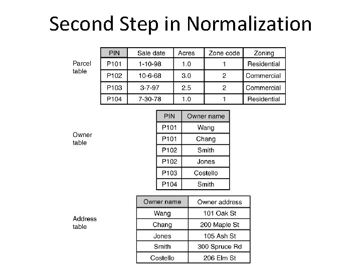
Second Step in Normalization
Complete Normalization
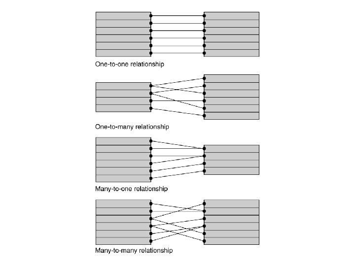
Relationship Types • A relational database may contain four types of relationships (also called cardinalities) between tables, or more precisely, between records in tables: – one-to-one – one-to-many – many-to-one – many-to-many