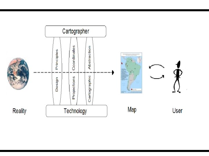
DIGITAL CARTOGRAPHY ALIAS COMPUTER CARTOGRAPHY Digital Cartography defined

 is � the process by")


 is a space- � based satellite")


- Slides: 37
DIGITAL CARTOGRAPHY ALIAS “COMPUTER CARTOGRAPHY”
Digital Cartography defined……. Digital mapping (also called digital cartography) is � the process by which a collection of data is compiled and formatted into a virtual image. OR The generation, storage and editing of maps using a computer
HISTORY The revolution of cartography is caused by the persistent use of electronics and in particular computers. Society and cartographers have been using computers for decades but today computers individualized rather than institutionalized Analog cartography was technically demanding and not available to society at large, since the mapping public did not have ready access to analog mapping technologies their ability to create mapping products was rather limited
Transition to Digital Cartography This however is not true in the context of digital � cartography. Electronic mapping systems are available to anyone non ۔ with a desktop computer making it easy for even -specialists to create cartographic products
Advantages of D. C over A. C �Storage Medium Digital Databases �Editing / Updating • Spatial and non-spatial data Updating a single feature can easily be achieved by simply selecting that feature and manipulating it according o users desire. A software enables a user to easily remove, add , delete or even edit a features spatial and non-spatial attributes without having to create the map again from scratch. �Data Access: With the advent of computer cartography access to cartographic is not limited to only professionals but any layman having access to a desktop computer can easily produce maps.
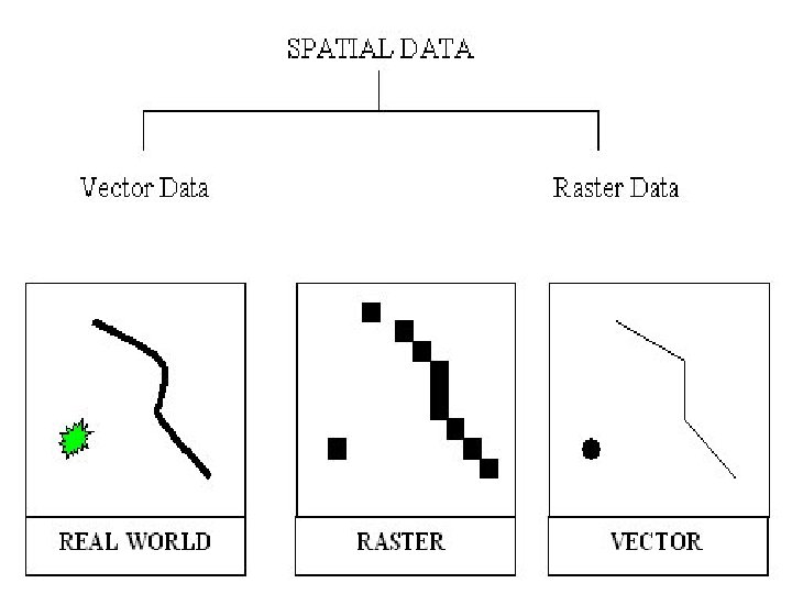
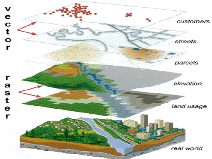
DIGITAL DATABASES A digital database allows storage of spatial and non- � spatial properties of objects in an organized effective way. Printed maps of yesterday have now been replaced my digital databases. Spatial Data: Any physical object on earth that has some positional values Non-Spatial data: All the non physical characteristics of spatial objects e. g. name , length , Height , Phone number are known as non-spatial or attribute data.
Editing
Processes �Data Collection �Data Manipulation �Data Analysis : Added Advantage of Digital Cartography �Data Representation
Data Collection �Primary Data Sources § § § Remote sensing Aerial photography GPS �Secondary Data Sources Scanning Digitizing
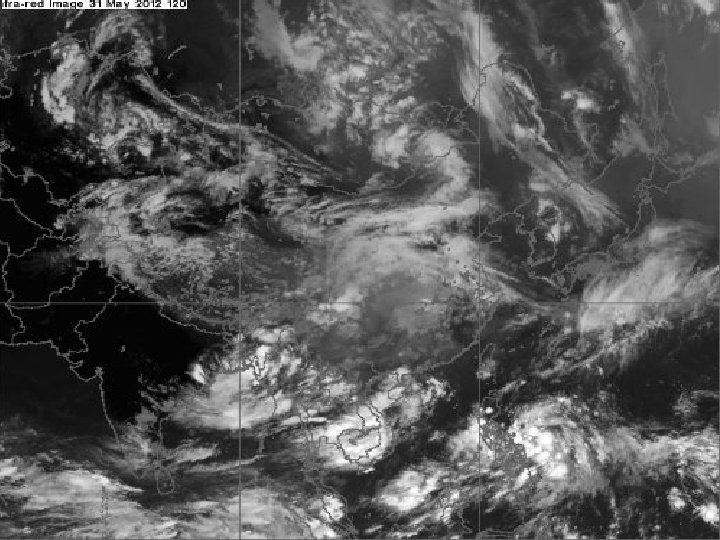
Remote Sensing Remote sensing is the acquisition of information � about an object or phenomenon without making physical contact with the object. In modern usage, the term generally refers to the use of aerial sensor technologies to detect and classify objects on Earth (both on the surface, and in the atmosphere and oceans) by means of propagated signals (e. g. electromagnetic radiation emitted from aircraft � or satellites)
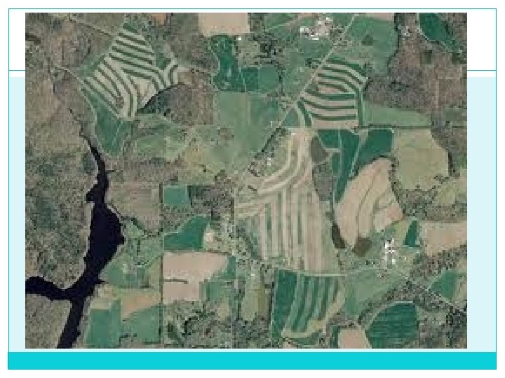
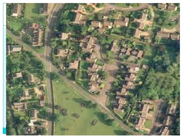
Aerial Photography Aerial photography is the taking of photographs � of the ground from an elevated position. The term usually refers to images in which the camera is not supported by a ground-based structure. Cameras may be hand held or mounted, and photographs may be taken by a photographer, triggered remotely or triggered automatically.
Photogrametry Photogrammetry has played a very important role in � mapping. In earlier times the most commonly used tool was plane table for land-use mapping now Photogrammetry is the practice of determining � the geometric properties of objects from photographic images. Photogrammetry is as old as modern photography and � can be dated to the mid-nineteenth century. In the simplest example, the distance between two points � that lie on a plane parallel to the photographic image plane can be determined by measuring their distance on the image, if the scale (s) of the image is known methods of Tachometry are used. �
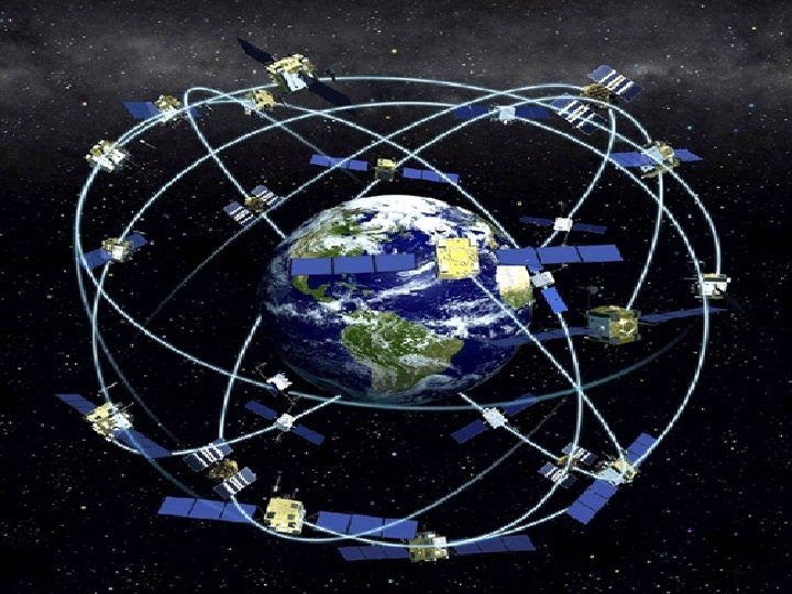
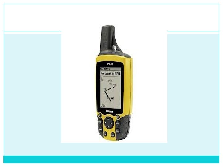
Global Positioning System The Global Positioning System (GPS) is a space- � based satellite navigation system that provides location and time information in all weather conditions, anywhere on or near the Earth where there is an unobstructed line of sight to four or more GPS satellites.
Scanning “Process of converting analog data into a digital form”
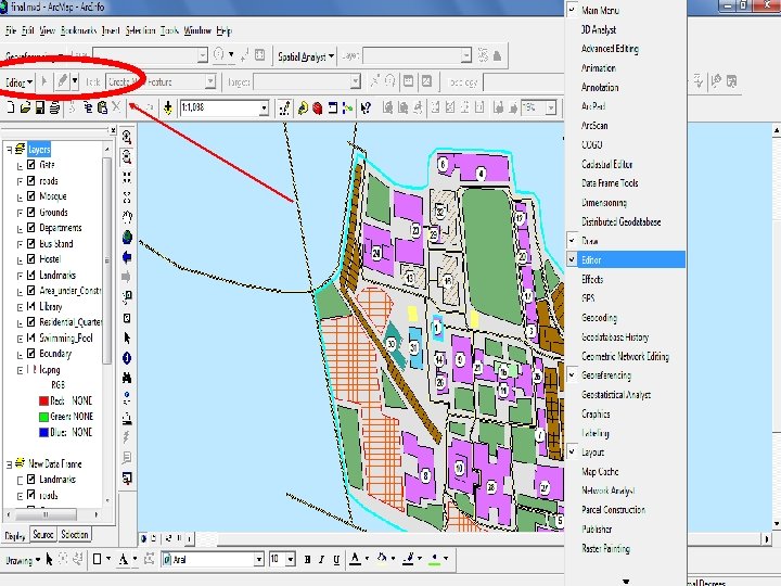
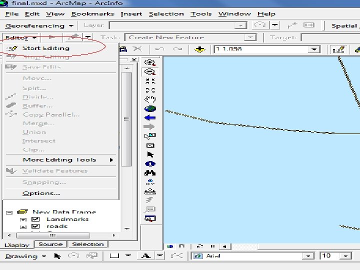
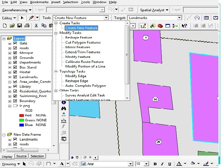
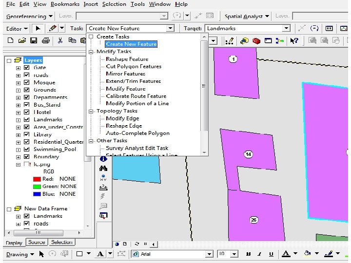
Digitizing The art of converting features into point, Line or � polygons depending upon the spatial dimension of the spatial object. In order for a map to be edited and updated it needs � to be digitized in the form compatible with the software.
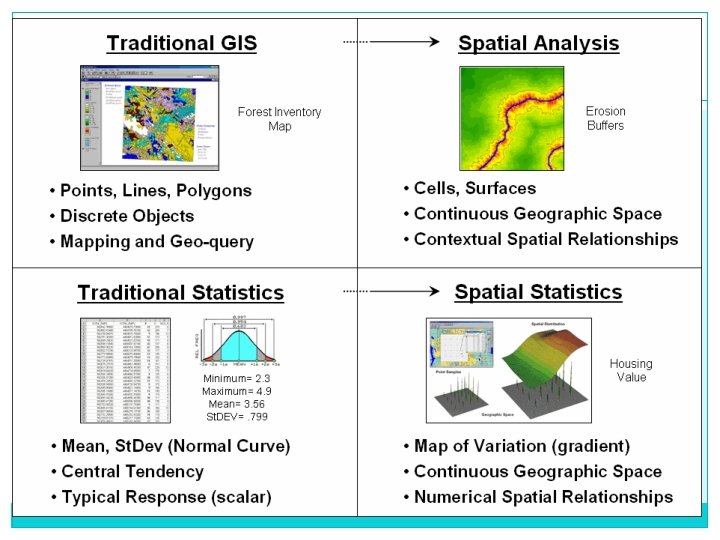
Data Analysis of data is a process of inspecting, � cleaning, transforming, and modeling data, suggesting conclusions, and supporting decision making. In computer cartography desired results can be � obtained by querying the spatial databases and applying spatial analysis tools.
GIS as a tool for Digital Cartography GIS is a collection of hardware software and people � Geographic information system is a computerized � system that facilitates with the phases of data entry, data analysis and data presentation
Data Representation
THANK YOU! �