AI for Disaster Response Detect Damaged Buildings Detect

AI for Disaster Response Detect Damaged Buildings, Detect Damaged Roads, & Allocate Resources

The Unique Challenges of Coordinating Response • Limited time and resources • Need human analysis of large areas of imagery • Multiple elements involved (detection, routing, monitoring) • We propose an A. I augmented pipeline that provides an end-toend solution

Detect damaged structures An A. I model runs on aerial imagery and outputs a feature class of damaged and undamaged structures Detect damaged roads I am not a criminologist! We are working with a police department to help solve their resource allocation challenges. An A. I model runs on aerial imagery + road layer and outputs a feature class of damaged and undamaged roads This will never supersede human expertise, but rather inform decision makers. This is not Skynet; but we think it is pretty cool Optimal routing Arc. GIS Network Analyst consumes the damaged structures and blocked roads feature classes, and creates an optimal route from a base (fire station, shelter etc. ) to all the damaged structures, accounting for blocked roadways Operational dashboard Utilizing the Esri Workforce mobile app, we can assign each responder a set of structures to inspect and use Operations Dashboard to monitor their progress and other key metrics
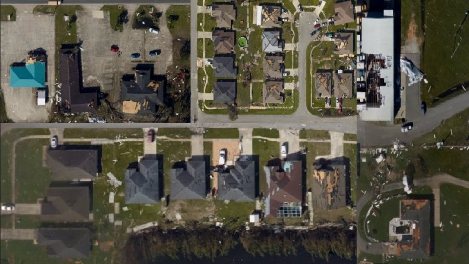
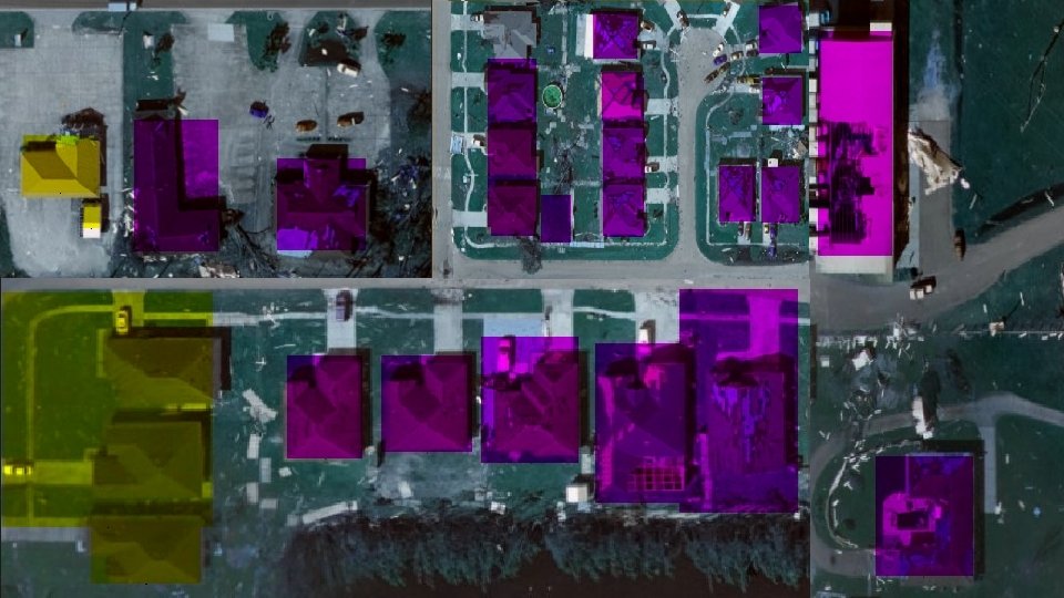

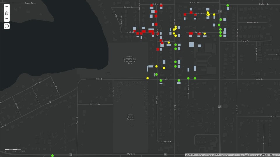
Damaged Structure Detection • We train two A. I models, one to identify building footprints and another to classify them as damaged/undamaged • Optionally, an existing building footprints layer can be passed in, and only the second model will run on the areas specified by the footprint • We also provide a training interface, so the model can be retrained against new data and also trained to classify other building features by pointing it to a folder of relevant positive/negative example images
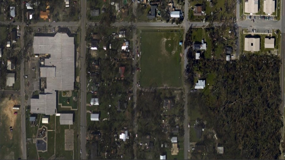
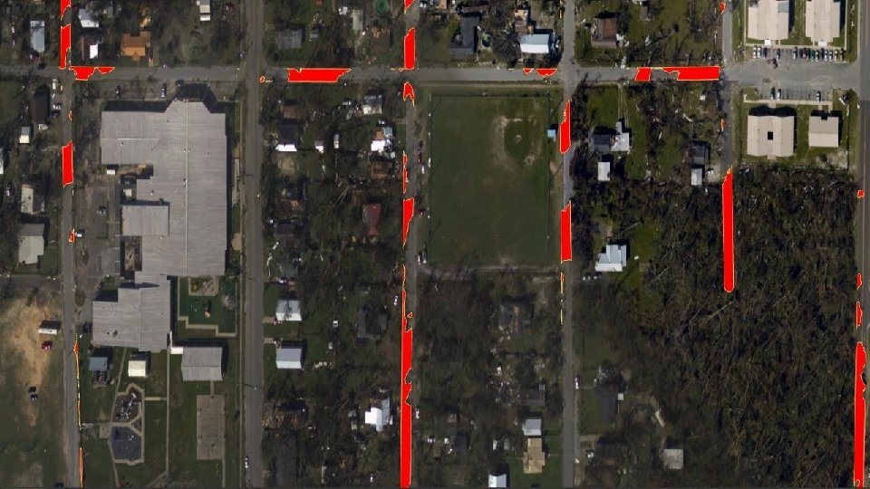

Blocked Roads Detection • We train an A. I model to detect road debris and run it against an imagery layer consisting of roads (this requires having the underlying road network) • The model will output a feature class highlighting road debris – we can utilize this directly with Arc. GIS Network Analyst to place barriers and route optimally around the blocked roads
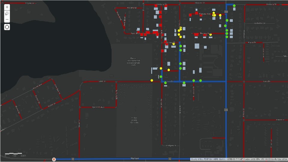

Optimal Routing • Once we have layers for the damaged structures and blocked roads, we can designate a base of operations and create an optimal route for first responders • Utilizing Network Analyst, we can designate the blocked roads as barriers and build an optimal route to all the accessible damaged structures accounting for these. We can also build separate routes to the blocked roads themselves to allow for clearing operations
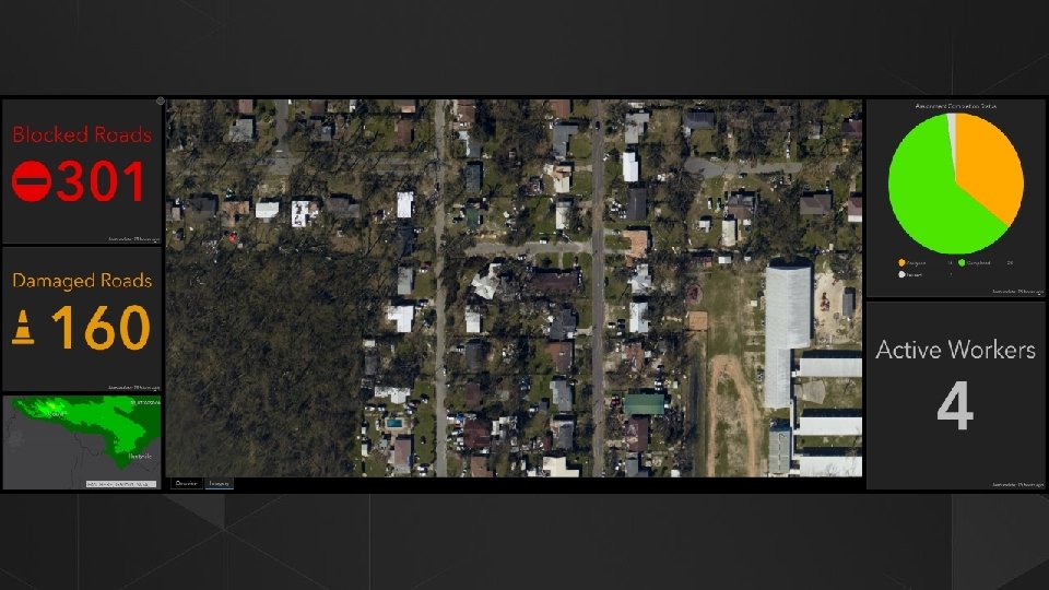
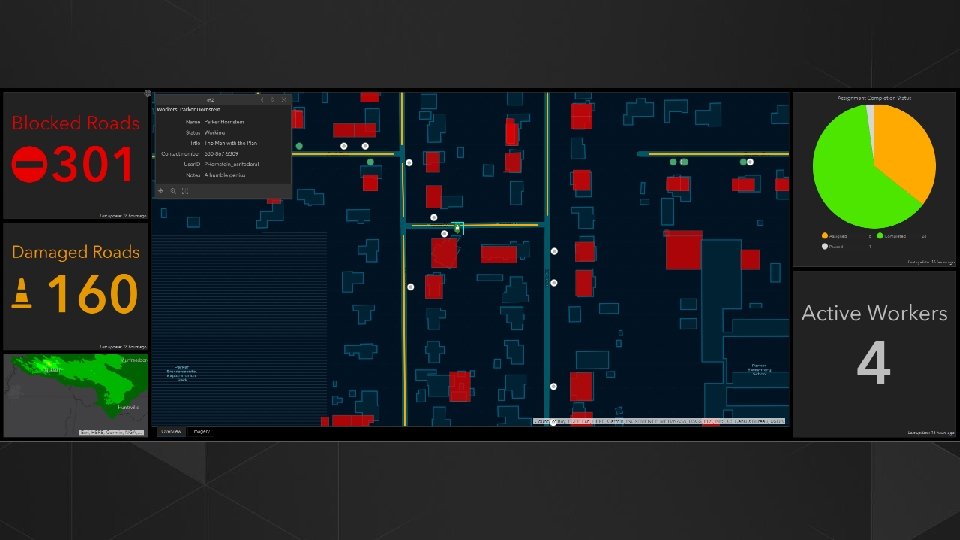

Operations Dashboard • We can push the routes discovered by Network Analyst to multiple first responder teams using Esri’s Workforce mobile app • The Workforce app can monitor real time location of responders as well as allow them to view their routes and make updates to structures after they’ve been inspected • These updates are pushed back to a central operations dashboard (and eventually to the underlying model to retrain), where a command center can monitor the current response and push new directions as needed

- Slides: 16