Weather Forecasts for Helicopters operating in the North





- Slides: 30
Weather Forecasts for Helicopters operating in the North Sea John Mitchell, Thursday 6 November 2014 "More than 62 million passengers flew to and from offshore installations in the British North Sea by helicopter between 1976 and 2012. " © Crown copyright Met Office
Outline of Presentation • The Met Office Aberdeen • Forecasting for the North Sea How forecasts are made • Helicopter Forecast Services Regulated services Rig /platform marine forecasts • Climatological Services Planning and Feasibility • Challenges to the Industry Helicopters Future capability © Crown copyright Met Office
Met Office © Crown copyright Met Office
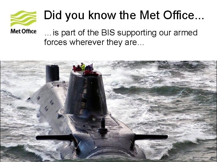
Did you know the Met Office. . . …is part of the BIS supporting our armed forces wherever they are… © Crown copyright Met Office
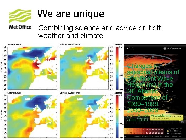
We are unique Combining science and advice on both weather and climate Changes in seasonal means of Significant Wave Height (m) in the NE Atlantic Comparison of 1990– 1999 2080– 2089. (UK Climate Projections June 2009) © Crown copyright Met Office
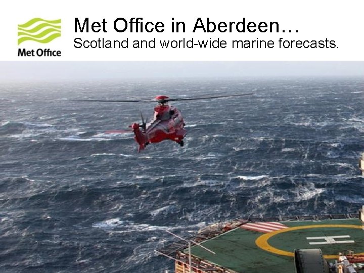
Met Office in Aberdeen… Scotland world-wide marine forecasts. © Crown copyright Met Office
Overview of marine forecasting support © Crown copyright Met Office
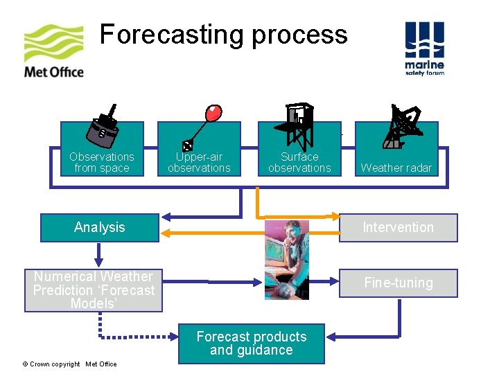
Forecasting process Observations from space Upper-air observations Surface observations Analysis Intervention Numerical Weather Prediction ‘Forecast Models’ Fine-tuning Forecast products and guidance © Crown copyright Met Office Weather radar
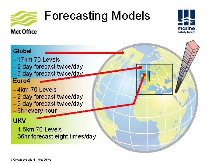
Forecasting Models Forecast Mo Global – 17 km 70 Levels – 2 day forecast twice/day – 5 day forecast twice/day Euro 4 – 4 km 70 Levels – 2 day forecast twice/day – 5 day forecast twice/day – 6 hr every hour UKV – 1. 5 km 70 Levels – 36 hr forecast eight times/day © Crown copyright Met Office
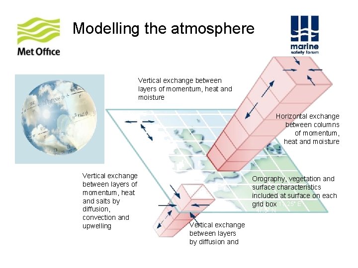
Modelling the atmosphere Vertical exchange between layers of momentum, heat and moisture 15° W 60° N 3. 75° Horizontal exchange between columns of momentum, heat and moisture 2. 5° Vertical exchange between layers of momentum, heat and salts by diffusion, convection and upwelling Orography, vegetation and surface characteristics included at surface on each grid box 11. 25° E 47. 5° N Vertical exchange between layers by diffusion and advection
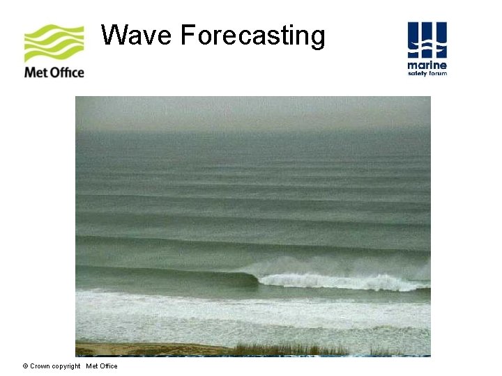
Wave Forecasting © Crown copyright Met Office
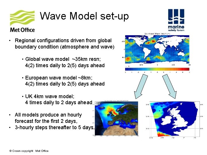
Wave Model set-up • Regional configurations driven from global boundary condition (atmosphere and wave) • Global wave model ~35 km resn; 4(2) times daily to 2(5) days ahead • European wave model ~8 km; 4(2) times daily to 2(5) days ahead • UK 4 km wave model; 4 times daily to 2 days ahead • All models produce an hourly forecast for the first 2 days, • 3 -hourly steps thereafter to 5 days. © Crown copyright Met Office
Computer upgrade 2012 IBM Power 775 supercomputer • Peak performance is now 1, 200, 000, 000 (1, 200 trillion) calculations per second • Equivalent to about 30, 000 desktop PCs • Storage for 40, 000 gigabytes of data • Equivalent to 50 million CDs or 750 million 4 -drawer filing cabinets Computer Upgrade 2014 CRAY XC 40 Supercomputer • 16, 000 calculations per second • 14 times more powerful © Crown copyright Met Office
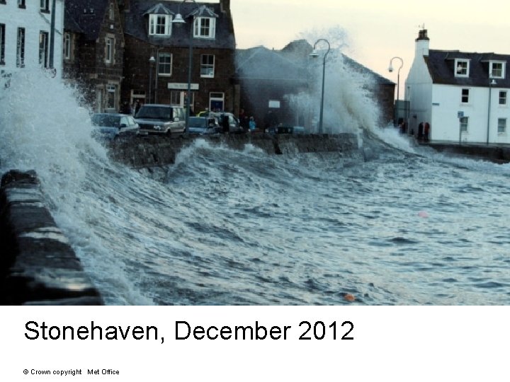
Stonehaven, December 2012 © Crown copyright Met Office
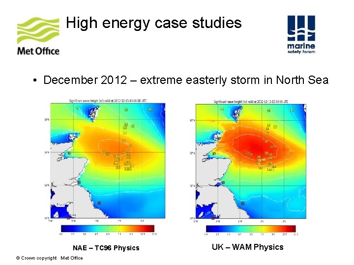
High energy case studies • December 2012 – extreme easterly storm in North Sea NAE – TC 96 Physics © Crown copyright Met Office UK – WAM Physics
Helicopter Forecast services Forecast products © Crown copyright Met Office
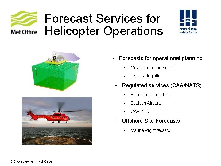
Forecast Services for Helicopter Operations • Forecasts for operational planning • Movement of personnel • Material logistics • Regulated services (CAA/NATS) • Helicopter Operators • Scottish Airports • CAP 1145 • Offshore Site Forecasts • © Crown copyright Met Office Marine Rig forecasts
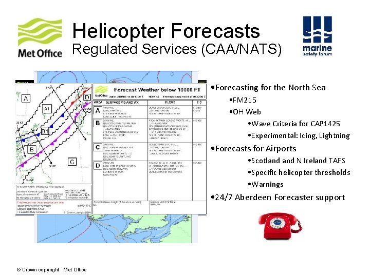
Helicopter Forecasts Regulated Services (CAA/NATS) • Forecasting for the North Sea • FM 215 • OH Web • Wave Criteria for CAP 1425 • Experimental: Icing, Lightning • Forecasts for Airports • Scotland N Ireland TAFS • Specific helicopter thresholds • Warnings • 24/7 Aberdeen Forecaster support © Crown copyright Met Office
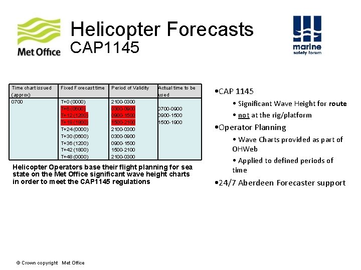
Helicopter Forecasts CAP 1145 Time chart issued (approx) 0700 Fixed Forecast time Period of Validity T+0 (0000) T+6 (0600) T+12 (1200) T+18 (1800) T+24 (0000) T+30 (0600) T+36 (1200) T+42 (1800) T+48 (0000) 2100 -0300 -0900 -1500 -2100 -0300 Actual time to be used 0700 -0900 -1500 -1900 Helicopter Operators base their flight planning for sea state on the Met Office significant wave height charts in order to meet the CAP 1145 regulations © Crown copyright Met Office • CAP 1145 • Significant Wave Height for route • not at the rig/platform • Operator Planning • Wave Charts provided as part of OHWeb • Applied to defined periods of time • 24/7 Aberdeen Forecaster support
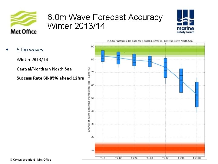
6. 0 m Wave Forecast Accuracy Winter 2013/14 • 6. 0 m waves Winter 2013/14 Central/Northern North Sea Success Rate 80 -85% ahead 12 hrs © Crown copyright Met Office
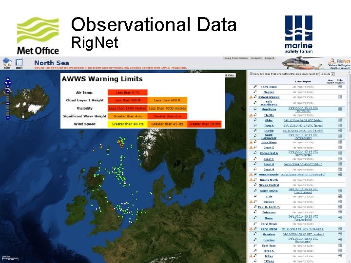
Observational Data Rig. Net © Crown copyright Met Office
Marine Forecasts: 5 Day Tabular and Graphical Forecast © Crown copyright Met Office
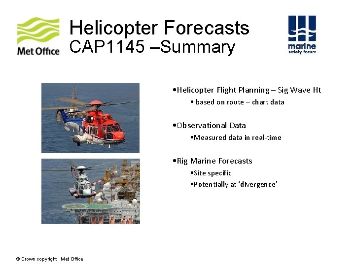
Helicopter Forecasts CAP 1145 –Summary • Helicopter Flight Planning – Sig Wave Ht • based on route – chart data • Observational Data • Measured data in real-time • Rig Marine Forecasts • Site specific • Potentially at ‘divergence’ © Crown copyright Met Office
Planning: Climatological Services What logistics strategy shall we take? © Crown copyright Met Office
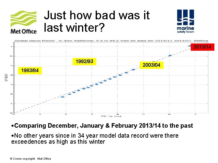
Just how bad was it last winter? 2013/14 1992/93 2003/04 1983/84 Comparing December, January & February 2013/14 to the past No other years since in 34 year model data record were there exceedences as high as this winter © Crown copyright Met Office
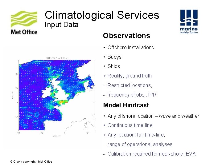
Climatological Services Input Data Observations • Offshore Installations • Buoys • Ships + Reality, ground truth - Restricted locations, - frequency of obs. , IPR Model Hindcast • Any offshore location – wave and weather • Continuous time-line + Any location, full time-line, range of operational analyses - Calibration required for near-shore, EVA © Crown copyright Met Office
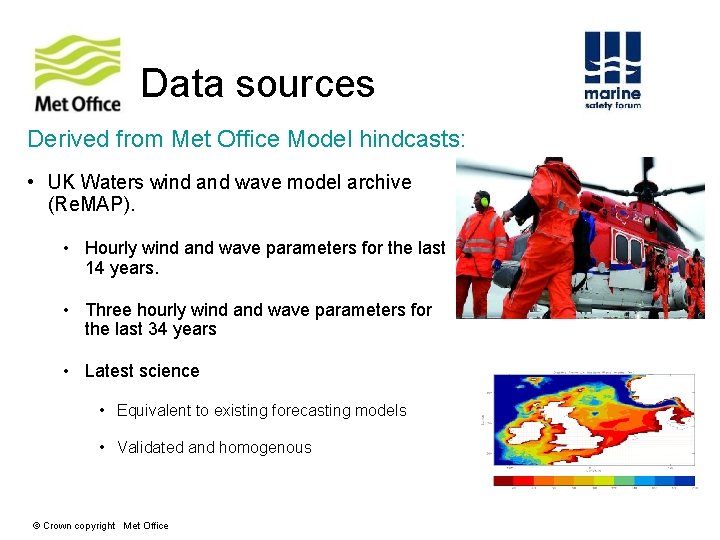
Data sources Derived from Met Office Model hindcasts: • UK Waters wind and wave model archive (Re. MAP). • Hourly wind and wave parameters for the last 14 years. • Three hourly wind and wave parameters for the last 34 years • Latest science • Equivalent to existing forecasting models • Validated and homogenous © Crown copyright Met Office
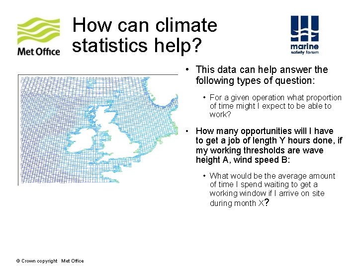
How can climate statistics help? • This data can help answer the following types of question: • For a given operation what proportion of time might I expect to be able to work? • How many opportunities will I have to get a job of length Y hours done, if my working thresholds are wave height A, wind speed B: • What would be the average amount of time I spend waiting to get a working window if I arrive on site during month X? © Crown copyright Met Office
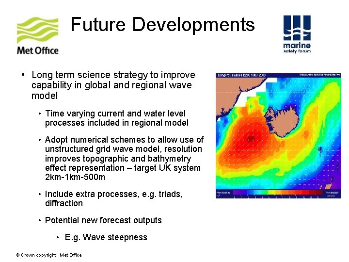
Future Developments • Long term science strategy to improve capability in global and regional wave model • Time varying current and water level processes included in regional model • Adopt numerical schemes to allow use of unstructured grid wave model, resolution improves topographic and bathymetry effect representation – target UK system 2 km-1 km-500 m • Include extra processes, e. g. triads, diffraction • Potential new forecast outputs • E. g. Wave steepness © Crown copyright Met Office
For More Information please contact: Laura Seenan - Account Manager (Oil & Gas) Tel: Fax: Mob: +44 (0)1224 629812 +44 (0)1224 611926 +44 (0) 7917000365