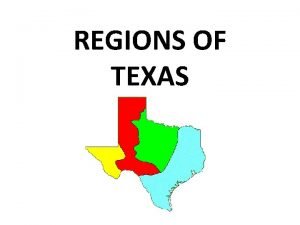
REGIONS OF TEXAS GREAT PLAINS NORTH CENTRAL PLAINS


- Slides: 22

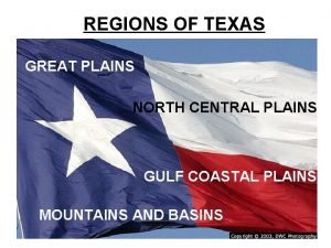
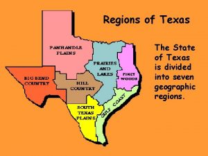
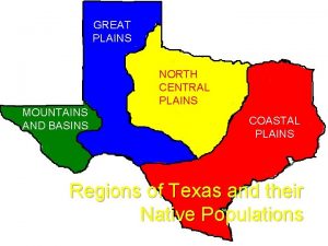
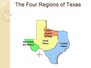
REGIONS OF TEXAS GREAT PLAINS NORTH CENTRAL PLAINS GULF COASTAL PLAINS MOUNTAINS AND BASINS

REGIONS OF TEXAS GREAT PLAINS CENTRAL PLAINS MOUNTAINS AND BASINS GULF COASTAL PLAINS

Coastal Plains • • • Location Climate/Weather Main Agriculture Other Resources Major Cities Houston is 3 rd largest seaport & is connected to roads, railroads, and airlines Gulf Intracoastal Waterway

Coastal Plains • Location – Borders Mexico in the south – Borders the Red River in the north – Bordered by the Balcones Escarpment to the west – Bordered by Louisiana to the east

Coastal Plains • Climate/Weather – Warm in the South – Cold in the North – More rain and violent storms than any other region – 30 -55 inches of rainfall a year

Coastal Plains • Main Agriculture – Timber, dairy, cattle, hogs, poultry, grain, sorghum, cotton, corn, peanuts, roses, fruits, hay, fish, sheep, wheat, vegetables, rice, citrus, and shrimp • Other Resources – People, lots of rain, rivers, lumber and paper mills, chemical plants, ports, and oil

Coastal Plains • Major Cities – Austin – Brownsville – Dallas – Houston – San Antonio – Tyler

North Central Plains • • • Location Climate/Weather Main Agriculture Other Resources Major Cities

North Central Plains • Location – Center part of the state – Hill Country in the southern part – Bordered by the Cap Rock Escarpment on the west – Bordered by the Balcones Escarpment on the east

North Central Plains • Climate/Weather – Cold winters – Hottest summer temperatures in the state – 20 -30 inches of rainfall a year – Violent storms and tornadoes

North Central Plains • Main Agriculture – Cattle, goats, sheep, cotton, grain sorghum, oats, pecans, hay, peaches, cedar trees, wheat, corn, peanuts • Other Resources – Fertile soil, beef, wool, mohair from angora goats, oil in some areas

North Central Plains • Major Cities – Abilene – San Angelo – Fredericksburg – Waco – Wichita Falls

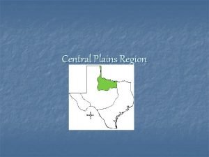
Central Plains • • • Location Climate/Weather Main Agriculture Other Resources Major Cities

Central Plains • Location – Texas Panhandle to the north – Cap Rock Escarpment on the east

Central Plains • Climate/Weather – Windy – Dry – Very cold in the winter – Very hot in the summer – Coldest region of Texas – 15 -20 inches of rainfall a year – Violent sand, snow, and rain storms

Central Plains • Main Agriculture – Wheat, cotton, grain sorghum, corn, cattle, and hay • Other Resources – Fertile soil with the help of irrigation

Central Plains • Major Cities – Amarillo – Lubbock – Midland – Odessa

Mountains and Basins • • • Location Climate/Weather Main Agriculture Other Resources Major Cities

Mountains and Basins • Location – Pecos River on the east – Mexico on the west – Mountains – Basins

Mountains and Basins • Climate/Weather – Driest area of the state – 0 -16 inches of rainfall a year – Warm most of the time – Never stays cold for long

Mountains and Basins • Main Agriculture – Cattle, dairy, hogs, cotton, wheat, hay, alfalfa, goats, sheep, some fruits and vegetables • Other Resources – Beef cattle ranches, trade with Mexico, Big Bend National Park

Mountains and Basins • Major Cities – Alpine – El Paso – Fort Stockton
 Mountains and basins subregions
 Subregions of the north central plains
 North central plains on a map
 Texas mountains and basins agriculture
 Landmarks in the north central plains of texas
 Subregions of texas
 Texas state regions
 Central plains location
 Central plains important cities
 North central plains vegetation
 Great plains texas landforms
 North central texas regional certification agency
 Map of texas landforms
 Texas ecoregion
 Texas map with cities and rivers
 Texas regions
 Mountains and basins region animals
 Regions of texas
 Regions of texas
 Blanco blind salamander
 South texas plains deposition
 Texas coastal plains
 Coastal region of texas
