Russia and Central Asia Physical Characteristics The most


 is found in the Steppe climate")


 The Jewel of Siberia It’s the deepest Lake in the WORLD")

 • Separates Asia from North America • It froze during the")


 – Western part")
- Slides: 25
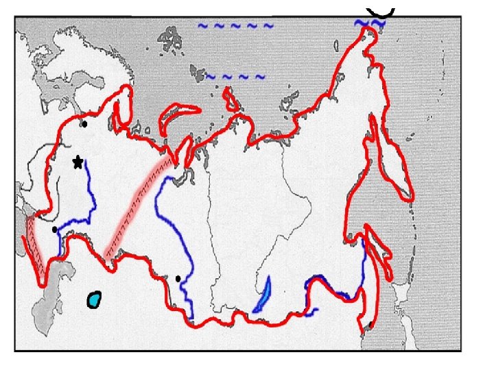
Russia and Central Asia Physical Characteristics
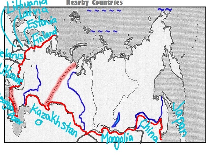
The most important countries of Russia and Central Asia are Russia, Kazakhstan, Turkmenistan, and Uzbekistan.
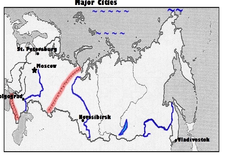
Land Size in asia • Russia covers 2 continents - Europe and Asia • 25% of Russia is located in Europe and 80% of it’s population live there This area is named “Russian Federation” and shortened to “Russia” • Russia spans 11 time zones!
Chernozem found in the Steppes • Chernozem (chur-NO-zum) is found in the Steppe climate region. • Chernozem is Slavic for “black earth” Dark Soil on Top • This steppe, or grassland region of Southwest Asia has become one of the worlds major wheat producing areas because the soil is very fertile.
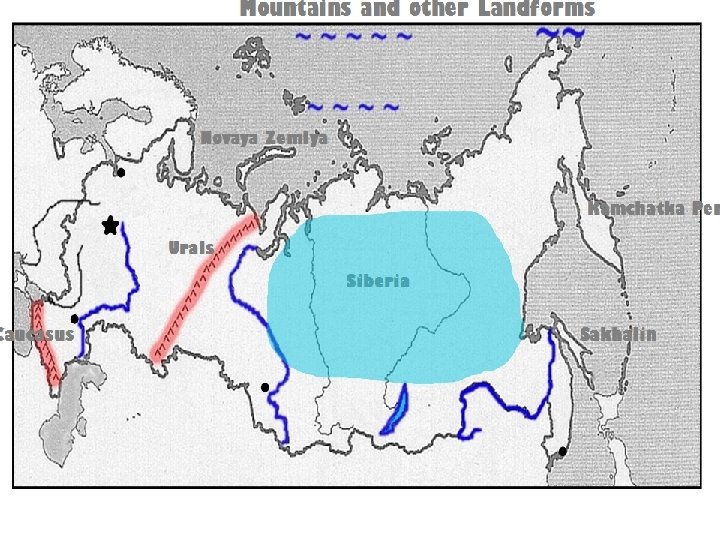
Siberia • Siberia is the land that lies east of the Ural Mountains. • It means “sleeping land”. • Known for its harsh & cold climates. • Natural resources: many minerals, natural gas, oil, and mining Video to show! Located in the flash drive in same Folder as this Power Point!
Mountains The Ural Mts divide Europe from Asia Caucasus Mountains from space The Caucasus Mountains divide Russia from Southwest Asia
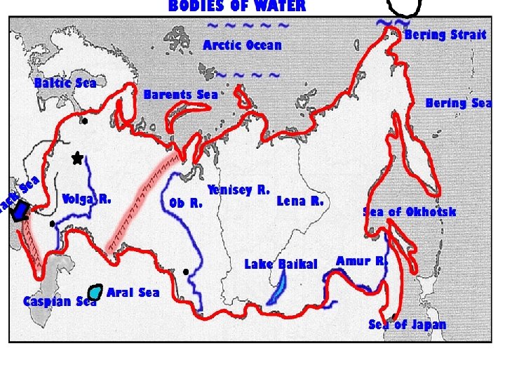
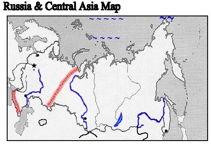
RIVERS The Volga River flows south. It is very important for transportation and hydroelectric power. Amur River is the most important waterway of the Russian far-east. It creates a border between Russia and China. The River Ob (rhymes with globe) is a major Siberian River that flows north into the Arctic Ocean.
Lake Baikal (bye-call) The Jewel of Siberia It’s the deepest Lake in the WORLD - over 5, 000 feet deep! The lake holds 1/6 th of the world’s freshwater!!! Video to show! Located in the flash drive in same Folder as this Power Point!
Bering Strait (bear-ing) • Separates Asia from North America • It froze during the Ice Age which allowed humans to cross over to the Americas Bering Strait Kamchatka Peninsula Alaska
Climates vary because the region is so large! TUNDRA – in the extreme northern regions. Remember PERMAFROST! SUBARCTIC – TAIGA(huge forests of coniferous trees) Mostly in Siberia.
Climate cont… Climates vary because the region is so large! HUMID CONTINENTAL – SEASONS! SEMI-ARID(STEPPE) – Temperate grassland found mostly in Central Asia. Chernozem soil helps to make this area an area of high agricultural activity.
Climate cont… Climates vary because the region is so large! ARID(DESERT) – Western part of Central Asia. Kara Kum and Kyzyl Kum.