Recent Surveys in Samoa and French Polynesia Hugh

- Slides: 40
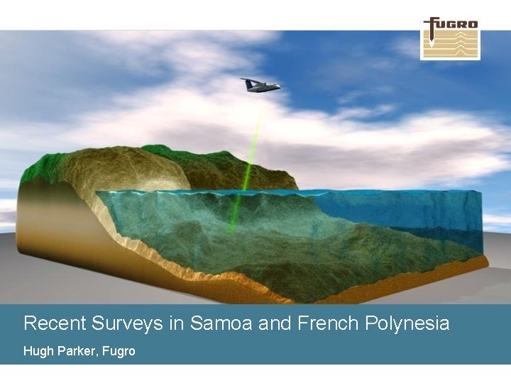
Recent Surveys in Samoa and French Polynesia Hugh Parker, Fugro
Overview 1. Background and overview of sensors 2. Surveys undertaken in the region A. French Polynesian Government, Service de l’Urbanisme (SAU) B. Samoan Government, Ministry of Natural Resources and Environment (MNRE) 2 www. fugro. com
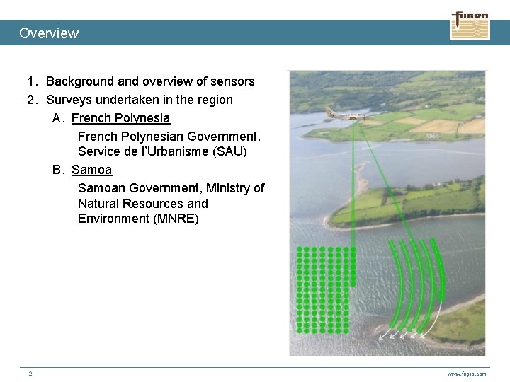
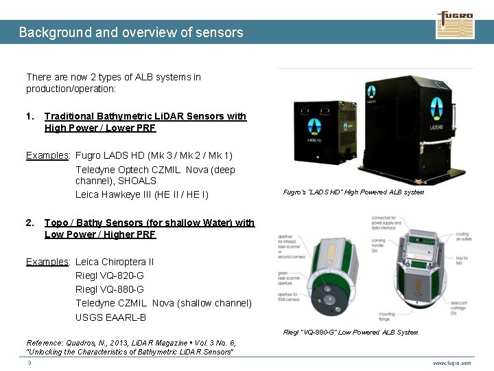
Background and overview of sensors There are now 2 types of ALB systems in production/operation: 1. Traditional Bathymetric Li. DAR Sensors with High Power / Lower PRF Examples: Fugro LADS HD (Mk 3 / Mk 2 / Mk 1) Teledyne Optech CZMIL Nova (deep channel), SHOALS Leica Hawkeye III (HE II / HE I) 2. Fugro’s “LADS HD” High Powered ALB system Topo / Bathy Sensors (for shallow Water) with Low Power / Higher PRF Examples: Leica Chiroptera II Riegl VQ-820 -G Riegl VQ-880 -G Teledyne CZMIL Nova (shallow channel) USGS EAARL-B Riegl “VQ-880 -G” Low Powered ALB System Reference: Quadros, N. , 2013, Li. DAR Magazine • Vol. 3 No. 6, “Unlocking the Characteristics of Bathymetric Li. DAR Sensors” 3 www. fugro. com
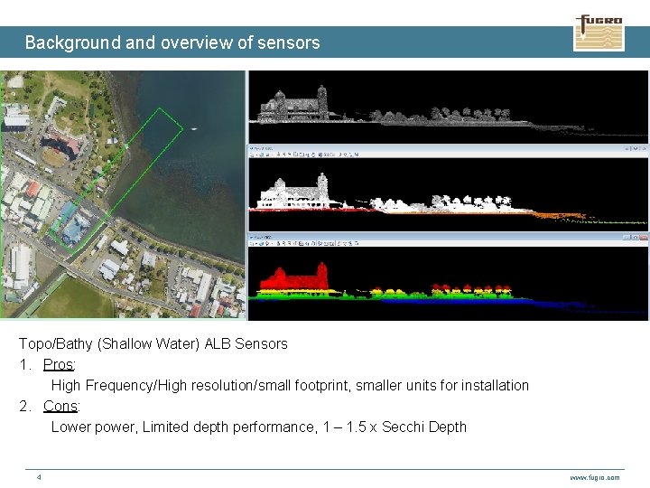
Background and overview of sensors Topo/Bathy (Shallow Water) ALB Sensors 1. Pros: High Frequency/High resolution/small footprint, smaller units for installation 2. Cons: Lower power, Limited depth performance, 1 – 1. 5 x Secchi Depth 4 www. fugro. com
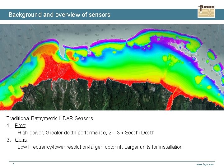
Background and overview of sensors Traditional Bathymetric Li. DAR Sensors 1. Pros: High power, Greater depth performance, 2 – 3 x Secchi Depth 2. Cons: Low Frequency/lower resolution/larger footprint, Larger units for installation 5 www. fugro. com
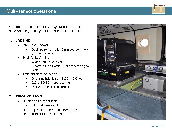
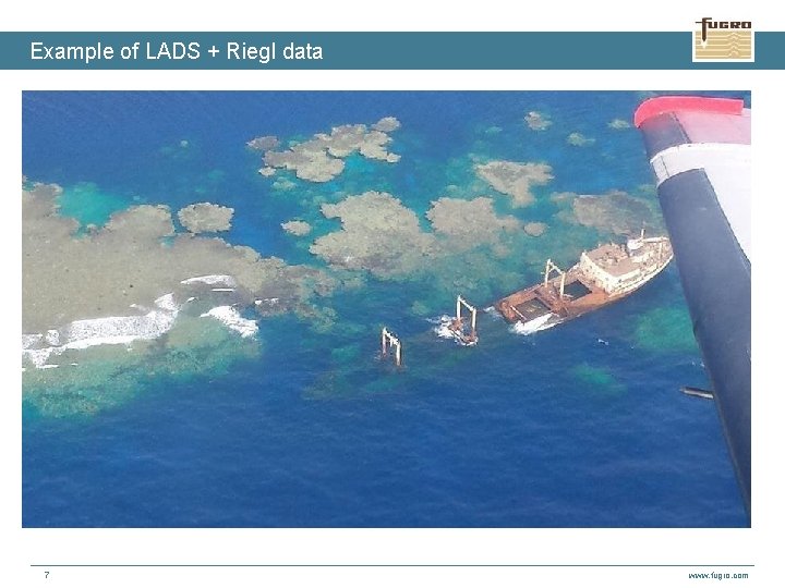
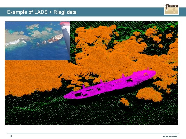
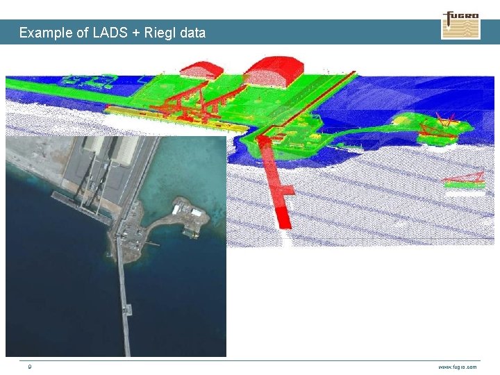
Multi-sensor operations Common practice is to nowadays undertake ALB surveys using both type of sensors, for example: 1. LADS HD • 7 mj Laser Power • • High Data Quality • • • Operating heights from 1200 – 3000 feet 2 x 2 to 3. 5 x 3. 5 m spot spacing; Roll and off-track compensation RIEGL VQ-820 -G • High spatial resolution • • 6 Wide Aperture Receiver Automatic Gain Control - for optimised signal return Efficient data collection • • • 2. Depth performance to 80 m in best conditions (3 x Secchi disk) Up to ~8 points / m 2 Depth performance to 10 -15 m in best conditions (1 x Secchi disk) LADS HD RIEGL www. fugro. com
Example of LADS + Riegl data 7 www. fugro. com
Example of LADS + Riegl data 8 www. fugro. com
Example of LADS + Riegl data 9 www. fugro. com
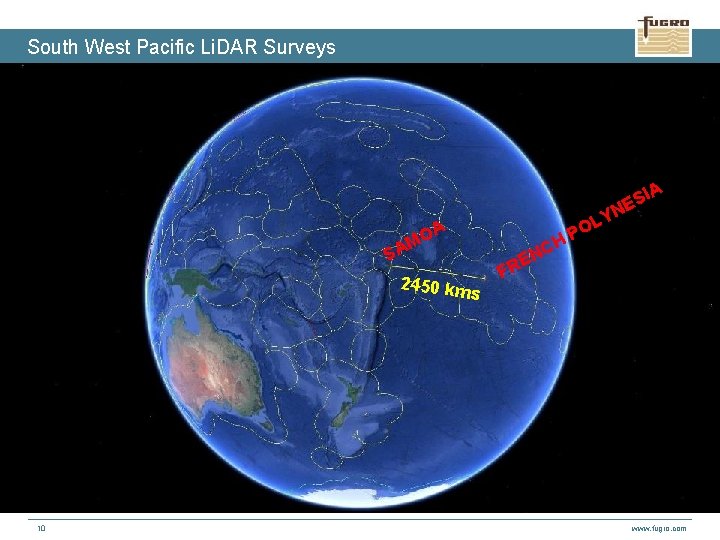
South West Pacific Li. DAR Surveys IA S NE OA M SA 2450 km 10 H s NC E FR LY O P www. fugro. com
French Polynesia Survey - Requirement The French Polynesian Government Service de l’Urbanisme (SAU) needed to assess the vulnerability of land to climate change at a local level. With SHOM, developed a project to produce a seamless, precise topographic and bathymetric model utilising ALB technology to survey areas of interest in French Polynesia Uses: 1. Hazard & Risk assessment for tsunamis, floods, landslides & earthquakes (creation of Prevention Plans for Natural Hazards) 2. Improve nautical charting in the region for general shipping and tourism industries 3. Other: planning for agriculture improvements, infrastructure upgrades, fisheries management … Additional Stakeholders: Direction de l’Equipment – Additional area in Tahiti Moorea Coral Reef - Long Term Ecological Research / US National Science Foundation Long Term Ecological Research Program 11 www. fugro. com
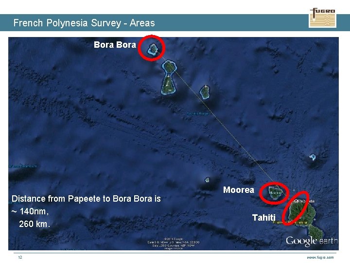
French Polynesia Survey - Areas The … Bora Distance from Papeete to Bora is ~ 140 nm, 260 km. 12 Moorea Tahiti www. fugro. com
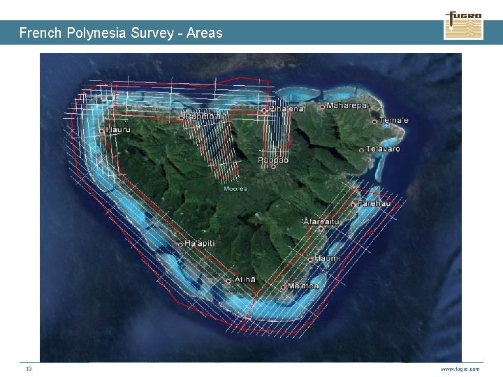
French Polynesia Survey - Areas Bora Moorea Tahiti 13 www. fugro. com
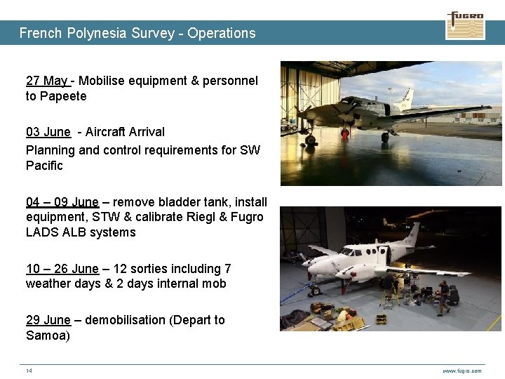
French Polynesia Survey - Operations 27 May - Mobilise equipment & personnel to Papeete 03 June - Aircraft Arrival Planning and control requirements for SW Pacific 04 – 09 June – remove bladder tank, install equipment, STW & calibrate Riegl & Fugro LADS ALB systems 10 – 26 June – 12 sorties including 7 weather days & 2 days internal mob 29 June – demobilisation (Depart to Samoa) 14 www. fugro. com
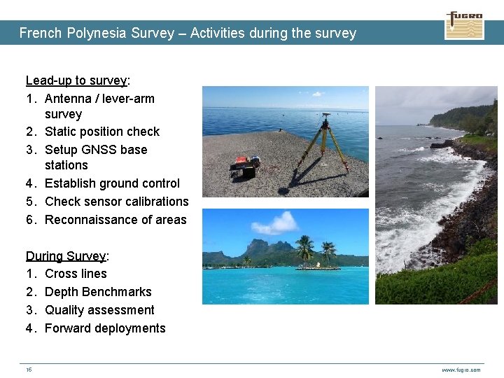
French Polynesia Survey – Activities during the survey Lead-up to survey: 1. Antenna / lever-arm survey 2. Static position check 3. Setup GNSS base stations 4. Establish ground control 5. Check sensor calibrations 6. Reconnaissance of areas During Survey: 1. Cross lines 2. Depth Benchmarks 3. Quality assessment 4. Forward deployments 15 www. fugro. com
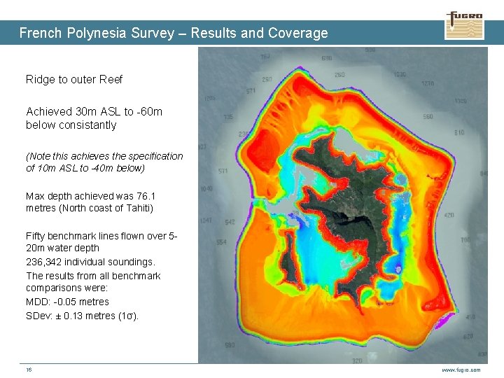
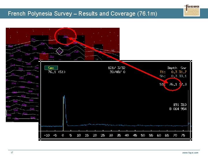
French Polynesia Survey – Results and Coverage Ridge to outer Reef Achieved 30 m ASL to -60 m below consistantly (Note this achieves the specification of 10 m ASL to -40 m below) Max depth achieved was 76. 1 metres (North coast of Tahiti) Fifty benchmark lines flown over 520 m water depth 236, 342 individual soundings. The results from all benchmark comparisons were: MDD: -0. 05 metres SDev: ± 0. 13 metres (1σ). 16 www. fugro. com
French Polynesia Survey – Results and Coverage (76. 1 m) 17 www. fugro. com
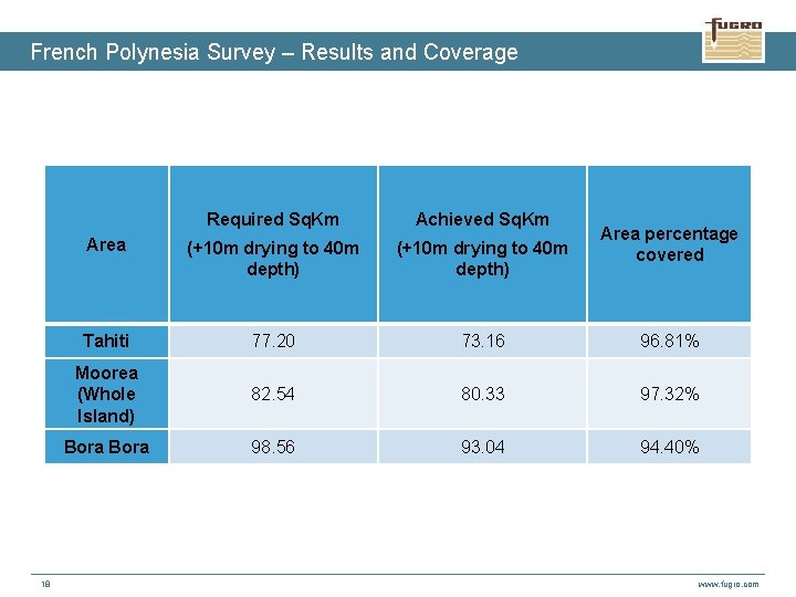
French Polynesia Survey – Results and Coverage 18 Required Sq. Km Achieved Sq. Km Area (+10 m drying to 40 m depth) Tahiti 77. 20 73. 16 96. 81% Moorea (Whole Island) 82. 54 80. 33 97. 32% Bora 98. 56 93. 04 94. 40% Area percentage covered www. fugro. com
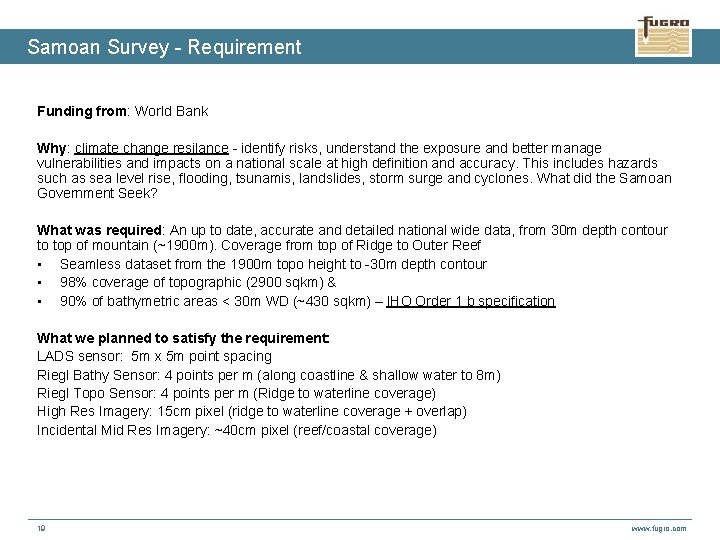
Samoan Survey - Requirement Funding from: World Bank Why: climate change resilance - identify risks, understand the exposure and better manage vulnerabilities and impacts on a national scale at high definition and accuracy. This includes hazards such as sea level rise, flooding, tsunamis, landslides, storm surge and cyclones. What did the Samoan Government Seek? What was required: An up to date, accurate and detailed national wide data, from 30 m depth contour to top of mountain (~1900 m). Coverage from top of Ridge to Outer Reef • Seamless dataset from the 1900 m topo height to -30 m depth contour • 98% coverage of topographic (2900 sqkm) & • 90% of bathymetric areas < 30 m WD (~430 sqkm) – IHO Order 1 b specification What we planned to satisfy the requirement: LADS sensor: 5 m x 5 m point spacing Riegl Bathy Sensor: 4 points per m (along coastline & shallow water to 8 m) Riegl Topo Sensor: 4 points per m (Ridge to waterline coverage) High Res Imagery: 15 cm pixel (ridge to waterline coverage + overlap) Incidental Mid Res Imagery: ~40 cm pixel (reef/coastal coverage) 19 www. fugro. com
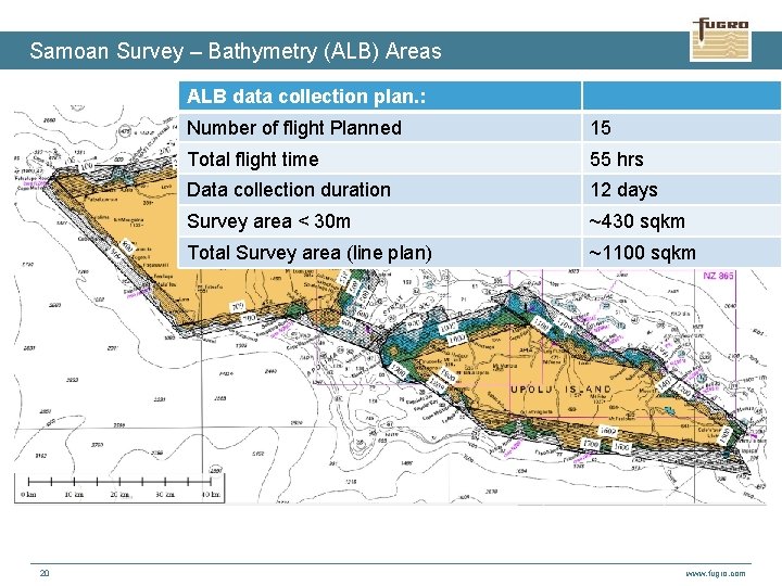
Samoan Survey – Bathymetry (ALB) Areas ALB data collection plan. : 20 Number of flight Planned 15 Total flight time 55 hrs Data collection duration 12 days Survey area < 30 m ~430 sqkm Total Survey area (line plan) ~1100 sqkm www. fugro. com
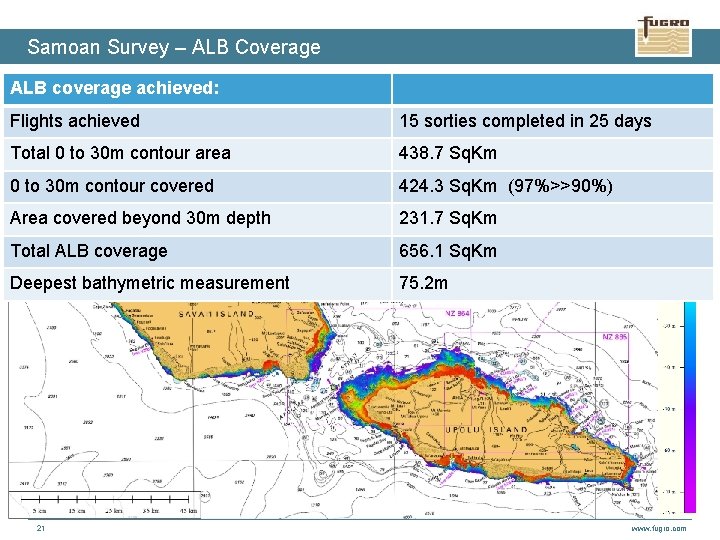
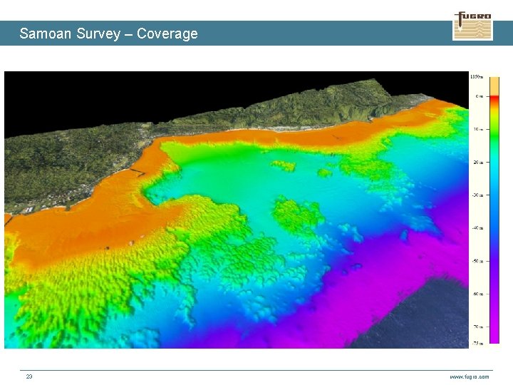
Samoan Survey – ALB Coverage ALB coverage achieved: Flights achieved 15 sorties completed in 25 days Total 0 to 30 m contour area 438. 7 Sq. Km 0 to 30 m contour covered 424. 3 Sq. Km (97%>>90%) Area covered beyond 30 m depth 231. 7 Sq. Km Total ALB coverage 656. 1 Sq. Km Deepest bathymetric measurement 75. 2 m 21 www. fugro. com
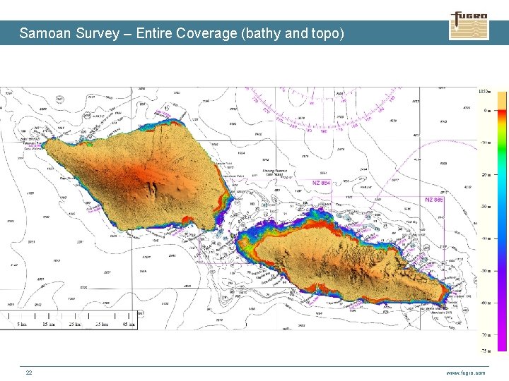
Samoan Survey – Entire Coverage (bathy and topo) 22 www. fugro. com
Samoan Survey – Coverage 23 www. fugro. com
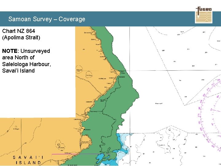
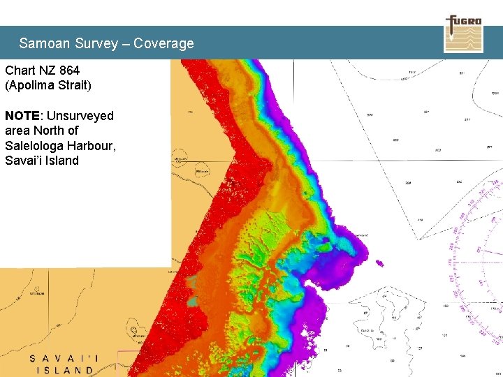
Samoan Survey – Coverage Chart NZ 864 (Apolima Strait) NOTE: Unsurveyed area North of Salelologa Harbour, Savai’i Island 24 www. fugro. com
Samoan Survey – Coverage Chart NZ 864 (Apolima Strait) NOTE: Unsurveyed area North of Salelologa Harbour, Savai’i Island 25 www. fugro. com
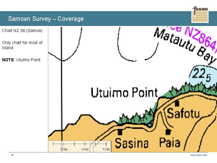
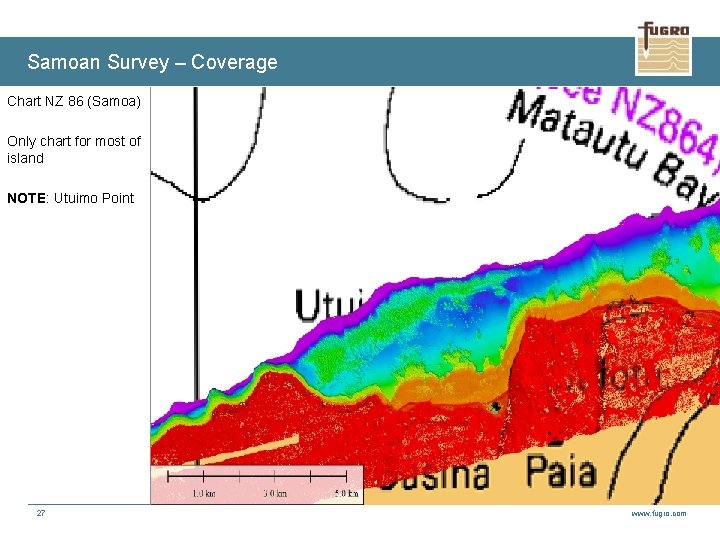
Samoan Survey – Coverage Chart NZ 86 (Samoa) Only chart for most of island NOTE: Utuimo Point 26 www. fugro. com
Samoan Survey – Coverage Chart NZ 86 (Samoa) Only chart for most of island NOTE: Utuimo Point 27 www. fugro. com
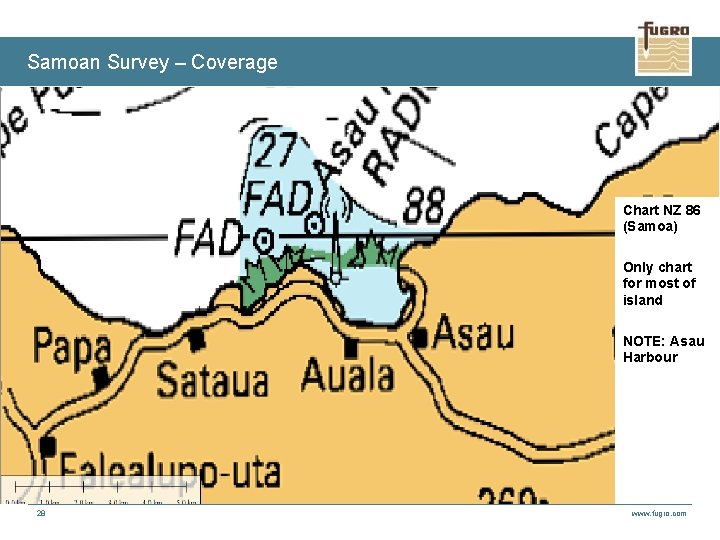
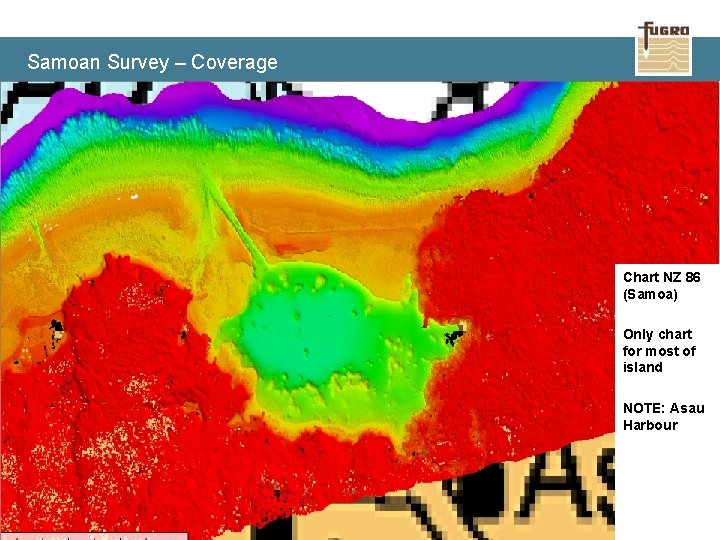
Samoan Survey – Coverage Chart NZ 86 (Samoa) Only chart for most of island NOTE: Asau Harbour 28 www. fugro. com
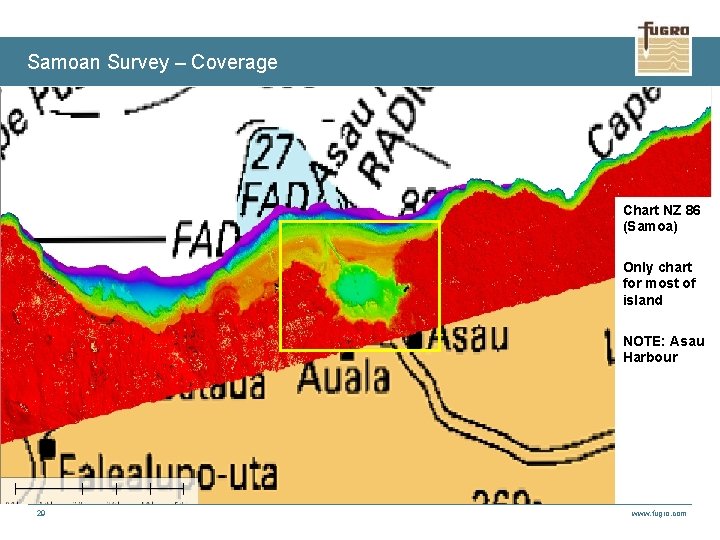
Samoan Survey – Coverage Chart NZ 86 (Samoa) Only chart for most of island NOTE: Asau Harbour 29 www. fugro. com
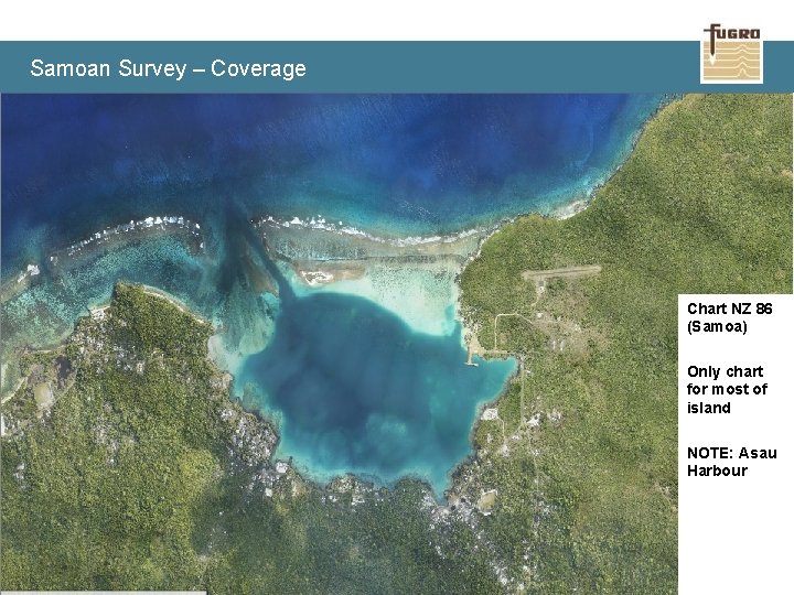
Samoan Survey – Coverage Chart NZ 86 (Samoa) Only chart for most of island NOTE: Asau Harbour 30 www. fugro. com
Samoan Survey – Coverage Chart NZ 86 (Samoa) Only chart for most of island NOTE: Asau Harbour 31 www. fugro. com
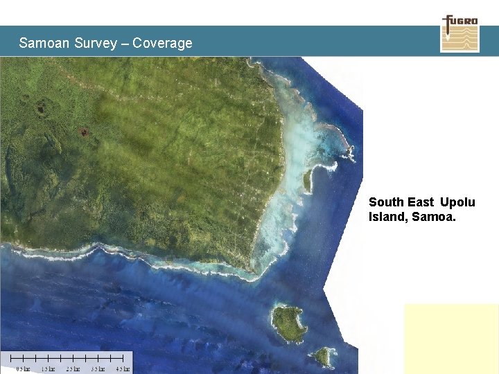
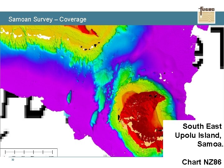
Samoan Survey – Coverage South East Upolu Island, Samoa. 32 www. fugro. com
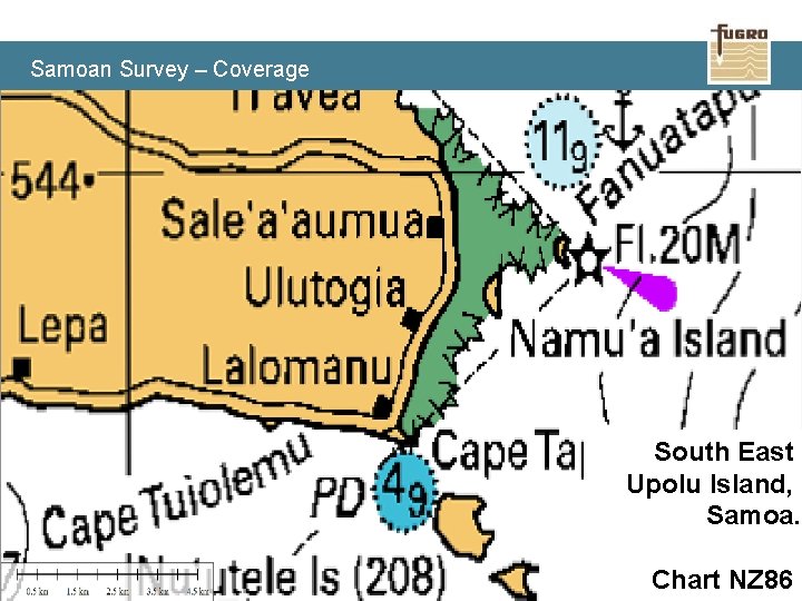
Samoan Survey – Coverage South East Upolu Island, Samoa. 33 Chart NZ 86 www. fugro. com
Samoan Survey – Coverage South East Upolu Island, Samoa. 34 Chart NZ 86 www. fugro. com
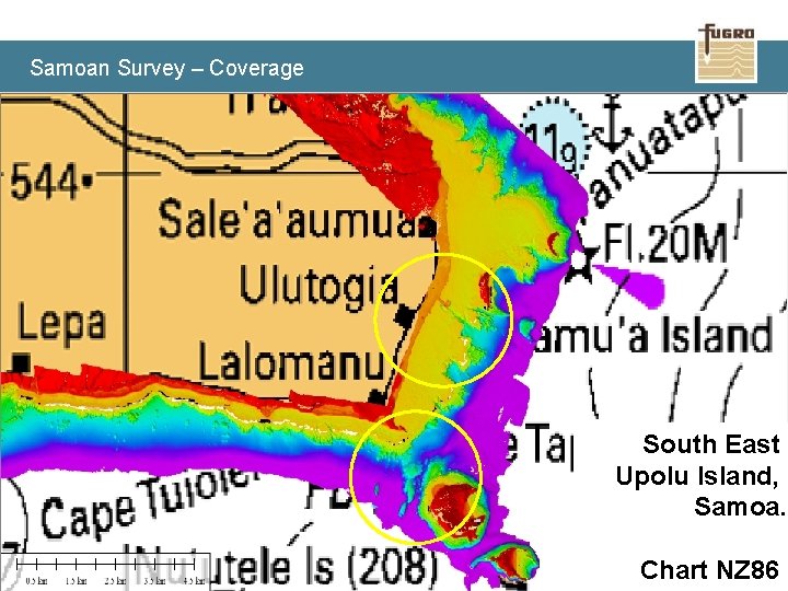
Samoan Survey – Coverage South East Upolu Island, Samoa. 35 Chart NZ 86 www. fugro. com
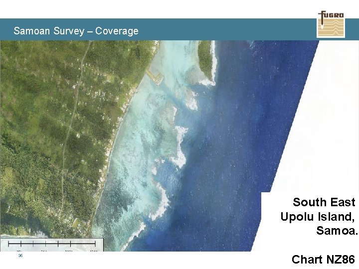
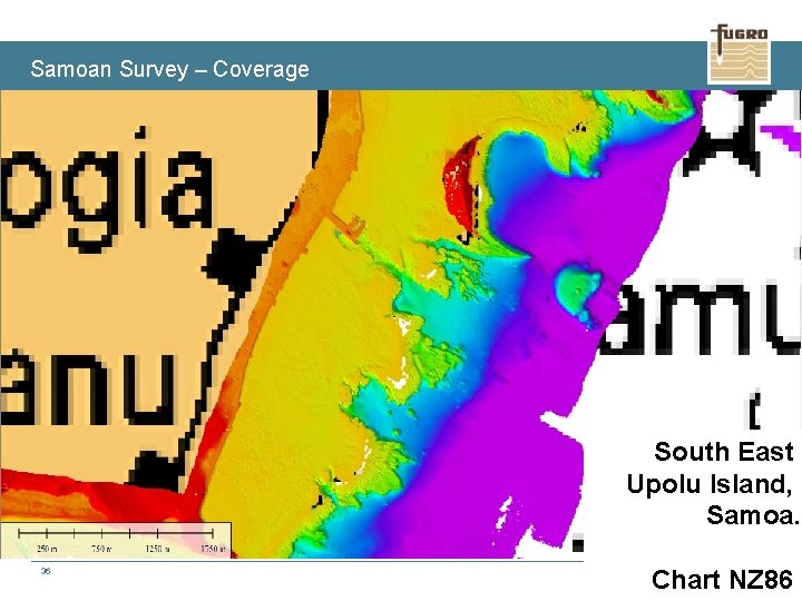
Samoan Survey – Coverage South East Upolu Island, Samoa. 36 Chart NZ 86 www. fugro. com
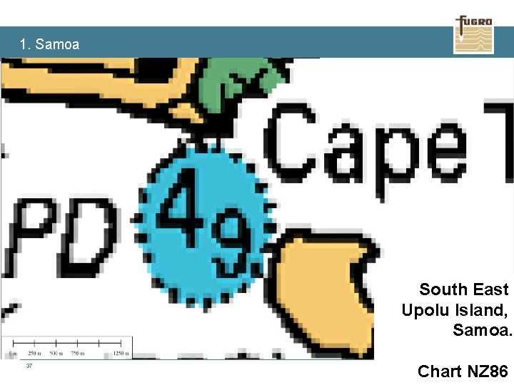
1. Samoa South East Upolu Island, Samoa. 37 Chart NZ 86 www. fugro. com
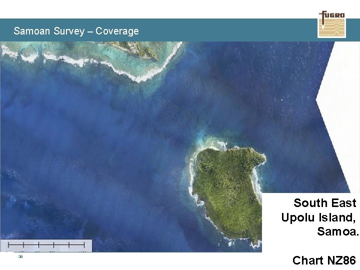
Samoan Survey – Coverage South East Upolu Island, Samoa. 38 Chart NZ 86 www. fugro. com
Samoan Survey – Coverage South East Upolu Island, Samoa. 39 Chart NZ 86 www. fugro. com
Thankyou Questions? Hugh Parker Hydrographic Business Development Manager Fugro LADS Corporation Pty. Ltd. Email: h. parker@fugro. com