Interagency Strategic Research Plan For Tropical Cyclones A

- Slides: 17

Interagency Strategic Research Plan For Tropical Cyclones – A View from The Top 61 st Interdepartmental Hurricane Conference Kim Curry Deputy Technical Director Oceanographer of the Navy

Bottom Line Up Front Question: What are Navy strengths in Tropical Cyclone Research? - Development of Navy models NOGAPS / COAMPS - Funding of academia, industry and federal laboratories - Vigorous research program in coupled ocean and atmosphere models - Efficient end-to-end research to operations transition Question: Which research priorities detailed in the inter-agency strategic research plan is Navy addressing? - Coupled ocean-atmosphere modeling and data assimilation - Quantitative use of remote sensing observations - Impact of Tropical Cyclones on the maritime domain Question: What resources can Navy bring to bear on TC research? - Basic research (6. 1) ~ $3. 5 M / yr - Applied research (6. 2) ~ $2 M / yr - Transition to Operations (6. 4) ~ $600 K / yr

BLUF (Cont) Question: From the policy perspective, how can Navy help gain inter-agency support for TC research through individual agency budgets and on Capitol Hill? Navy will continue to participate at the appropriate mission level in Joint development programs and interagency activities

59 th IHC -Operational Requirements 2005 • Validated 14 Operational Requirements of the TC Forecast and Warning Centers • Department of Defense emphasized their top three Operational Requirements (OR): 1. Improved track forecasts out to 5 days 2. Improved structure forecasts: radius of 50 -kt and 35 -kt wind radii 3. More accurate forecasts of wave heights and radius of 12 foot seas

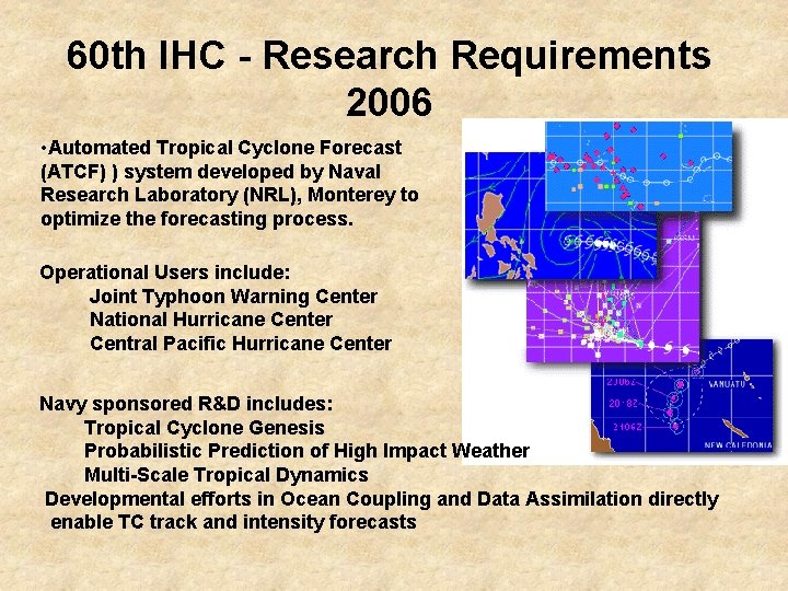
60 th IHC - Research Requirements 2006 • Automated Tropical Cyclone Forecast (ATCF) ) system developed by Naval Research Laboratory (NRL), Monterey to optimize the forecasting process. Operational Users include: Joint Typhoon Warning Center National Hurricane Center Central Pacific Hurricane Center Navy sponsored R&D includes: Tropical Cyclone Genesis Probabilistic Prediction of High Impact Weather Multi-Scale Tropical Dynamics Developmental efforts in Ocean Coupling and Data Assimilation directly enable TC track and intensity forecasts

Office of Naval Research Basic and Applied The Impact of Storm-Scale Processes on the Predictability of Western Pacific Typhoons POCs: Ronald J. Ferek, Ph. D. & CDR Daniel Eleuterio, Ph. D. ONR 322 MM A new ONR Department Research Initiative (DRI) beginning in FY 08 -First major WESTPAC field experiment since TCM 93 - $10 M over 5 years (basic research), leveraging T-PARC -Focus on lack of understanding of storm scale processes (the biggest knowledge gap) GOALS: - Increase the predictability of the environmental forcing, formation, outer wind structure and intensity of TCs over the western North Pacific - Reduce errors in TC structure and intensity forecasts by 50% within a decade

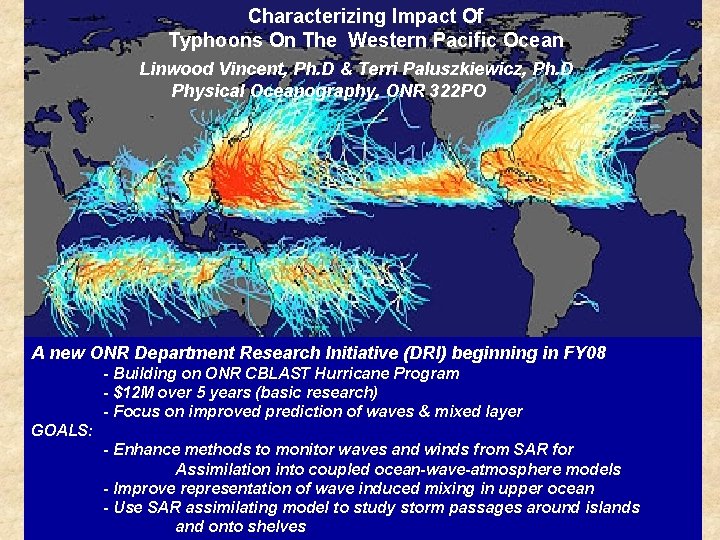
Characterizing Impact Of Typhoons On The Western Pacific Ocean Linwood Vincent, Ph. D & Terri Paluszkiewicz, Ph. D Physical Oceanography, ONR 322 PO A new ONR Department Research Initiative (DRI) beginning in FY 08 - Building on ONR CBLAST Hurricane Program - $12 M over 5 years (basic research) - Focus on improved prediction of waves & mixed layer GOALS: - Enhance methods to monitor waves and winds from SAR for Assimilation coupled ocean-wave-atmosphere An Ocean Parallelinto to Dr. Ferek’s WESTPAC Typhoonmodels Proposal - Improve representation of wave induced mixing in upper ocean - Use SAR assimilating model to study storm. Explore passages Ouraround Planet islands Website Tropical Cyclones 1850 -2006 and onto shelves

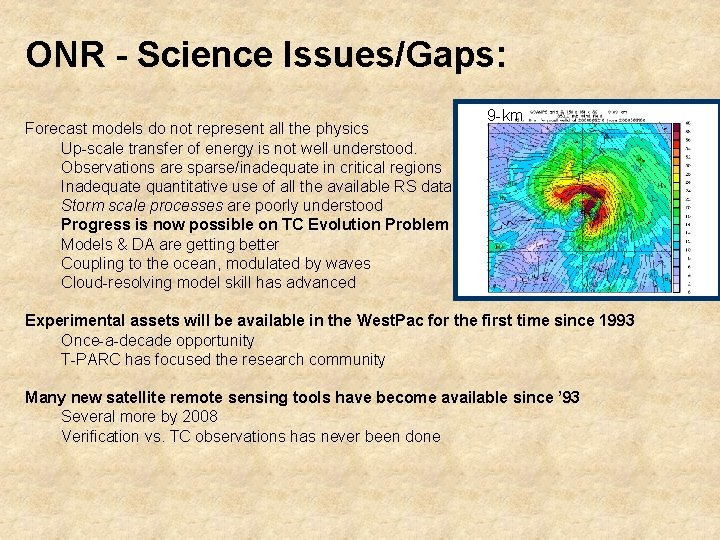
ONR - Science Issues/Gaps: Forecast models do not represent all the physics Up-scale transfer of energy is not well understood. Observations are sparse/inadequate in critical regions Inadequate quantitative use of all the available RS data Storm scale processes are poorly understood Progress is now possible on TC Evolution Problem Models & DA are getting better Coupling to the ocean, modulated by waves Cloud-resolving model skill has advanced 9 -km Experimental assets will be available in the West. Pac for the first time since 1993 Once-a-decade opportunity T-PARC has focused the research community Many new satellite remote sensing tools have become available since ’ 93 Several more by 2008 Verification vs. TC observations has never been done

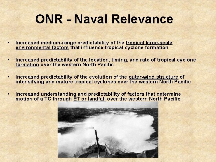
ONR - Naval Relevance • Increased medium-range predictability of the tropical large-scale environmental factors that influence tropical cyclone formation • Increased predictability of the location, timing, and rate of tropical cyclone formation over the western North Pacific • Increased predictability of the evolution of the outer-wind structure of intensifying and mature tropical cyclones over the western North Pacific • Increased understanding and predictability of factors that determine motion of a TC through ET or landfall over the western North Pacific

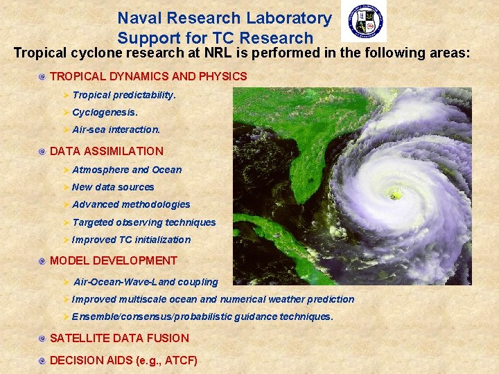
Naval Research Laboratory Support for TC Research Tropical cyclone research at NRL is performed in the following areas: TROPICAL DYNAMICS AND PHYSICS Ø Tropical predictability. Ø Cyclogenesis. Ø Air-sea interaction. DATA ASSIMILATION Ø Atmosphere and Ocean Ø New data sources Ø Advanced methodologies Ø Targeted observing techniques Ø Improved TC initialization MODEL DEVELOPMENT Ø Air-Ocean-Wave-Land coupling Ø Improved multiscale ocean and numerical weather prediction Ø Ensemble/consensus/probabilistic guidance techniques. SATELLITE DATA FUSION DECISION AIDS (e. g. , ATCF)

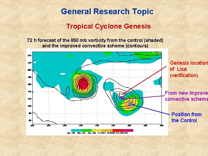
General Research Topic Tropical Cyclone Genesis 72 h forecast of the 850 mb vorticity from the control (shaded) and the improved convective scheme (contours) Genesis location of Lisa (verification) LN C From new improve convective scheme Position from the Control

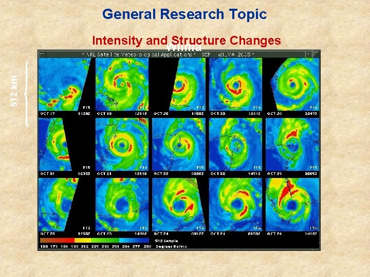
General Research Topic 512 km Intensity and. Wilma Structure Changes

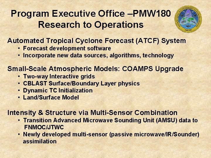
Program Executive Office –PMW 180 Research to Operations Automated Tropical Cyclone Forecast (ATCF) System • Forecast development software • Incorporate new data sources, algorithms, technology Small-Scale Atmospheric Models: COAMPS Upgrade • • Two-way Interactive grids CBLAST Surface/Boundary Layer physics Dynamic TC Initialization Land/Surface Model Intensity & Structure via Multi-Sensor Combination • Transition Advanced Microwave Sounding Unit (AMSU) data to FNMOC/JTWC • Newly developed multi-sensor (passive microwave/IR/Sounder) assimilation


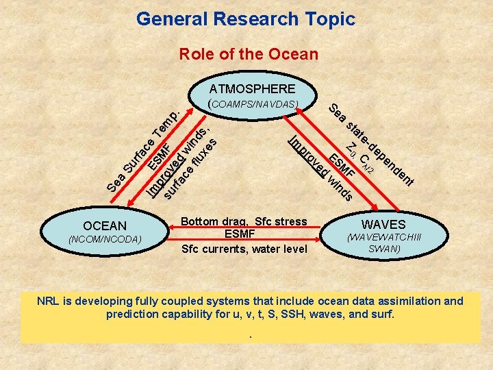
General Research Topic Role of the Ocean rfa ce E Su a M F λ/ 2 nd en t ds in w Se st at e Z -de ES 0, C pe ed (NCOM/NCODA) ov pr OCEAN Se a Im Im pr SM Te m su ov F p. rfa ed ce w flu ind xe s, s ATMOSPHERE (COAMPS/NAVDAS) Bottom drag, Sfc stress ESMF Sfc currents, water level WAVES (WAVEWATCHIII SWAN) NRL is developing fully coupled systems that include ocean data assimilation and prediction capability for u, v, t, S, SSH, waves, and surf. .

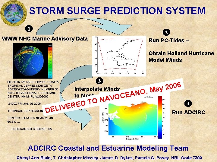
STORM SURGE PREDICTION SYSTEM 1 2 WWW NHC Marine Advisory Data Run PC-Tides – Obtain Holland Hurricane Model Winds 000 WTNT 25 KNHC 062031 TCMAT 5 TROPICAL DEPRESSION ZETA FORECAST/ADVISORY NUMBER 30 NWS TPC/NATIONAL HURRICANE CENTER MIAMI FL AL 302005 2100 Z FRI JAN 06 2006 TROPICAL DEPRESSION 3 Interpolate Winds , O N A to Mesh OCE ER V I L E D V A N O ED T 6 0 0 2 y Ma 4 Run ADCIRC CENTER LOCATED NEAR 23. 4 N 50. 3 W … … FORECASTER STEWART $$ ADCIRC Coastal and Estuarine Modeling Team Cheryl Ann Blain, T. Christopher Massey, James D. Dykes, Pamela G. Posey NRL Code 7300

Questions?