Tropical Cyclones Heat Momentum Structures Tropical Cyclones Primary
- Slides: 32

Tropical Cyclones Heat & Momentum Structures

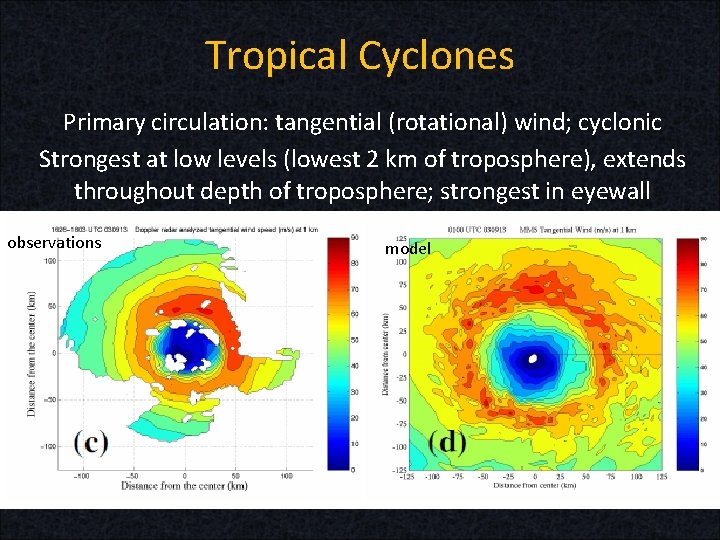
Tropical Cyclones Primary circulation: tangential (rotational) wind; cyclonic Strongest at low levels (lowest 2 km of troposphere), extends throughout depth of troposphere; strongest in eyewall observations model

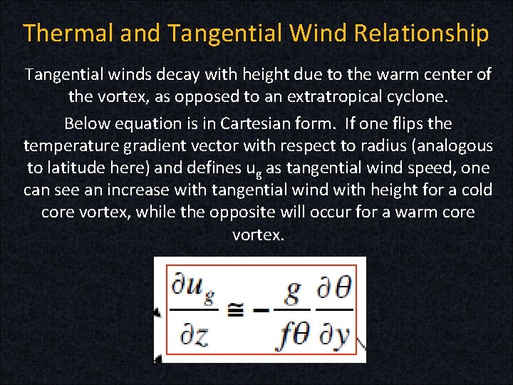
Thermal and Tangential Wind Relationship Tangential winds decay with height due to the warm center of the vortex, as opposed to an extratropical cyclone. Below equation is in Cartesian form. If one flips the temperature gradient vector with respect to radius (analogous to latitude here) and defines ug as tangential wind speed, one can see an increase with tangential wind with height for a cold core vortex, while the opposite will occur for a warm core vortex.

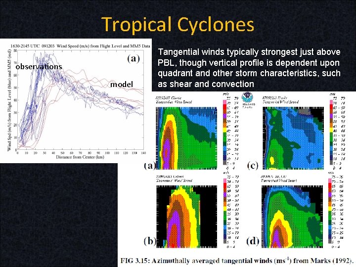
Tropical Cyclones observations model Tangential winds typically strongest just above PBL, though vertical profile is dependent upon quadrant and other storm characteristics, such as shear and convection

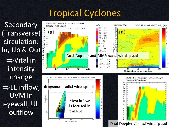
Tropical Cyclones Secondary (Transverse) circulation: In, Up & Out ÞVital in intensity change ÞLL inflow, UVM in eyewall, UL outflow Dual Doppler and MM 5 radial wind speed dropsonde radial wind speed Most inflow is focused in the PBL Dual Doppler vertical wind speed

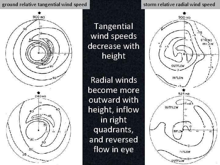
ground relative tangential wind speed storm relative radial wind speed Tangential wind speeds decrease with height Radial winds become more outward with height, inflow in right quadrants, and reversed flow in eye

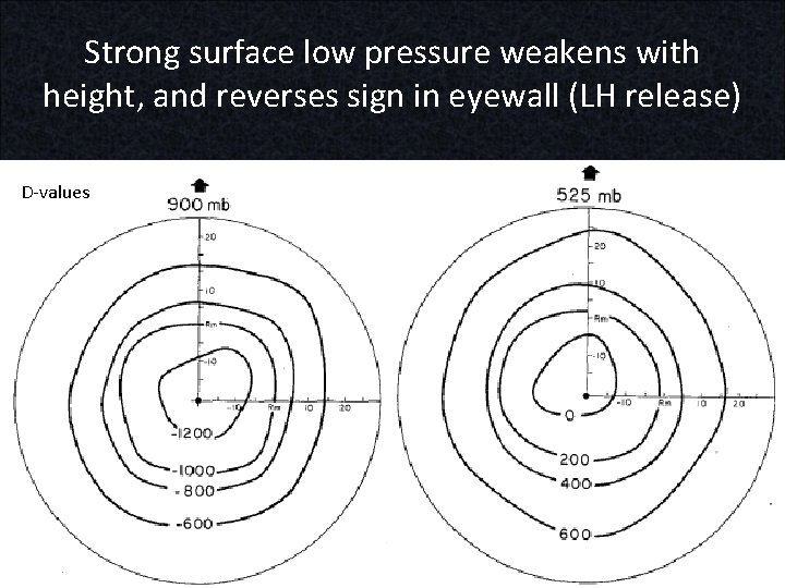
Strong surface low pressure weakens with height, and reverses sign in eyewall (LH release) D-values

Tropical Cyclones Response to heat and momentum sources: Strongly stratified air in the vertical (high static stability) is resistant to vertical motion. Air moves radially. Areas of high inertial stability are resistant to horizontal motion. Air moves vertically.

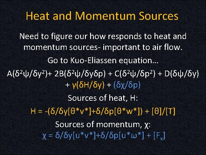
Heat and Momentum Sources Need to figure our how responds to heat and momentum sources- important to air flow. Go to Kuo-Eliassen equation… A(δ 2ψ/δy 2)+ 2 B(δ 2ψ/δyδp) + C(δ 2ψ/δp 2) + D(δψ/δy) + γ(δH/δy) + (δχ/δp) Sources of heat, H: H = -(δ/δy[θ*v*]+δ/δp[θ*w*]) + [θ]/[T] Sources of momentum, χ: χ = δ/δy[u*v*]+δ/δp[u*ω*] + [Fx]

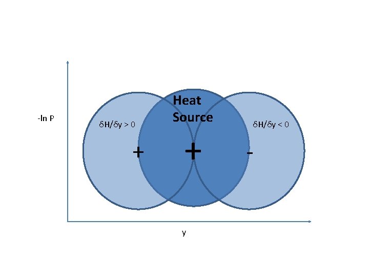
Heat and Momentum Sources We will now examine air flow in response to heat and momentum sources via diagrams…

-ln P δH/δy > 0 + Heat Source + y δH/δy < 0 -

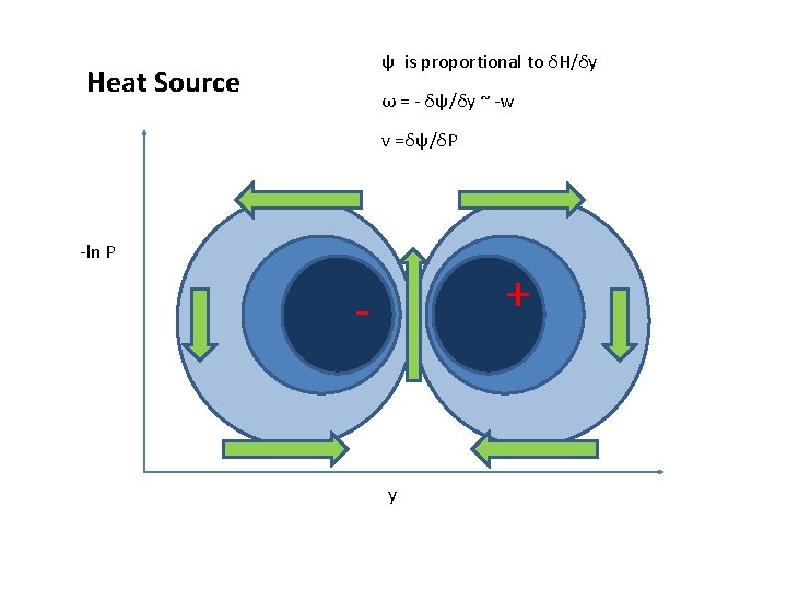
ψ is proportional to δH/δy Heat Source ω = - δψ/δy ~ -w v =δψ/δP -ln P - + y +

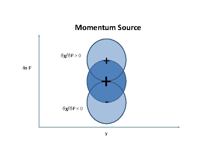
Momentum Source δχ/δP > 0 -ln P + + δχ/δP < 0 y

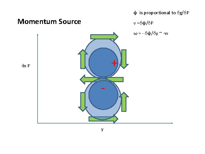
ψ is proportional to δχ/δP Momentum Source v =δψ/δP ω = - δψ/δy ~ -w + -ln P y

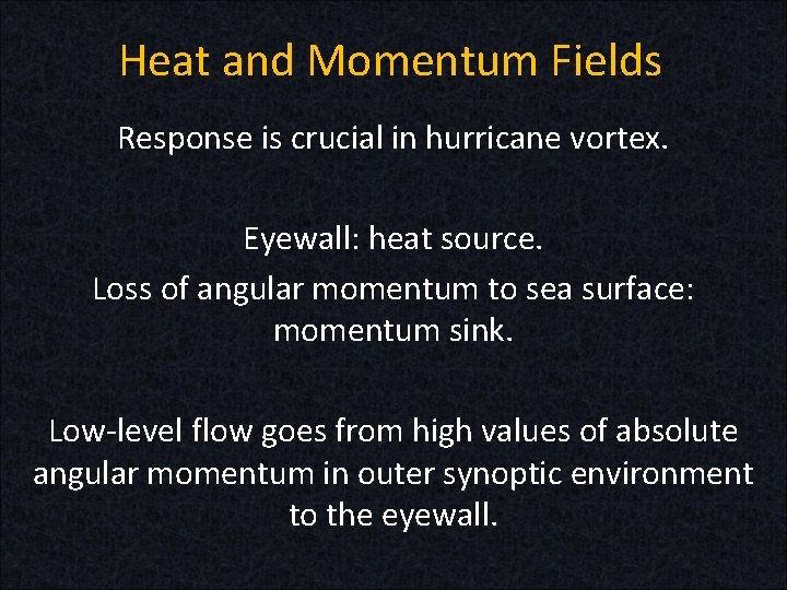
Heat and Momentum Fields Response is crucial in hurricane vortex. Eyewall: heat source. Loss of angular momentum to sea surface: momentum sink. Low-level flow goes from high values of absolute angular momentum in outer synoptic environment to the eyewall.

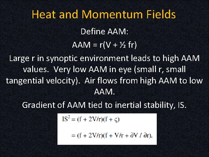
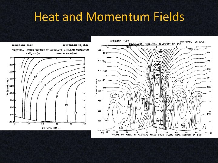
Heat and Momentum Fields Define AAM: AAM = r(V + ½ fr) Large r in synoptic environment leads to high AAM values. Very low AAM in eye (small r, small tangential velocity). Air flows from high AAM to low AAM. Gradient of AAM tied to inertial stability, IS.

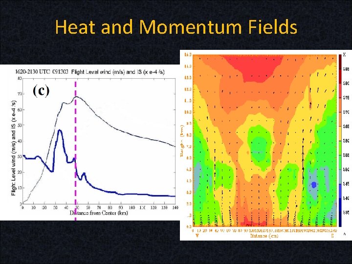
Heat and Momentum Fields Low level flow well away from the eyewall is in an environment of low inertial stability and, thus, moves horizontally. As low level flow from the outer environment approaches the eyewall, winds increase dramatically. Just inside of radius of maximum winds (RMW), inertial stability is often maximized. So, air turns upward in the eyewall but hits the high static stability of the tropopause. Then, it will transition from moving upward to outwards, where inertial stability is weaker. General UL outflow results.

Heat and Momentum Fields

Heat and Momentum Fields

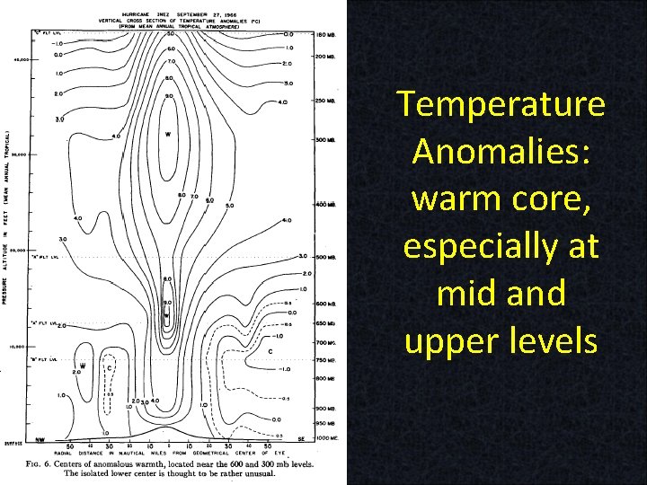
Temperature Anomalies: warm core, especially at mid and upper levels

CISK and WISHE CISK = Conditional Instability of the Second Kind -Need a disturbance -Braking mechanisms include low-mid level dry air, high VWS, low SST/OHC -If latent heat release has less energy than frictional deceleration causing the convergence, that will also cause weakening

CISK Frictional inflow and Ekman pumping help to lift air to LCL As the air rises thereafter, it releases LH Temperature increases, air column expands SLP drops, especially if deep convection near center Pressure gradient increases Tangential wind speed increases and inflow increases Increased inflow increases frictional convergence Increased moisture convergence and LH release, etc …see a tendency for a positive feedback loop

CISK and WISHE = Wind Induced Surface Heat Exchange Air moves isothermally, crossing angular momentum surfaces as it heads inwards in PBL and outwards at UL Moves along constant AAM surface in the eyewall, moving upwards and moist adiabatically Isothermal in PBL, even though P and q – heat added from conduction and frictional deceleration of wind due to sea surface

WISHE Temperature gradient between SST and tropopause is potential energy Potential Intensity (PI) of storm can be calculated knowing those temperatures Moist convection can help convert potential energy into kinetic energy by altering pressure fields, which then affect wind

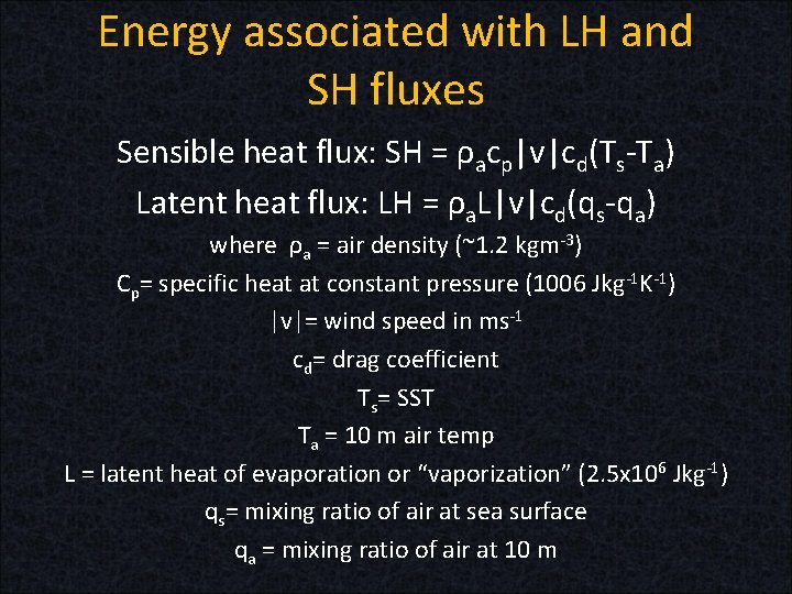
Energy associated with LH and SH fluxes Sensible heat flux: SH = ρacp|v|cd(Ts-Ta) Latent heat flux: LH = ρa. L|v|cd(qs-qa) where ρa = air density (~1. 2 kgm-3) Cp= specific heat at constant pressure (1006 Jkg-1 K-1) |v|= wind speed in ms-1 cd= drag coefficient Ts= SST Ta = 10 m air temp L = latent heat of evaporation or “vaporization” (2. 5 x 10⁶ Jkg-1) qs= mixing ratio of air at sea surface qa = mixing ratio of air at 10 m

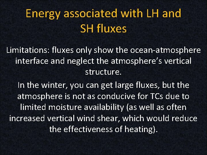
Energy associated with LH and SH fluxes Limitations: fluxes only show the ocean-atmosphere interface and neglect the atmosphere’s vertical structure. In the winter, you can get large fluxes, but the atmosphere is not as conducive for TCs due to limited moisture availability (as well as often increased vertical wind shear, which would reduce the effectiveness of heating).

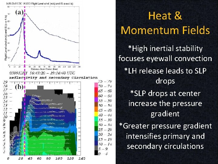
Heat & Momentum Fields *High inertial stability focuses eyewall convection *LH release leads to SLP drops *SLP drops at center increase the pressure gradient *Greater pressure gradient intensifies primary and secondary circulations

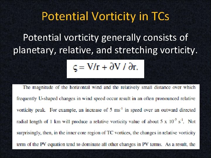
Potential Vorticity in TCs Potential vorticity generally consists of planetary, relative, and stretching vorticity.

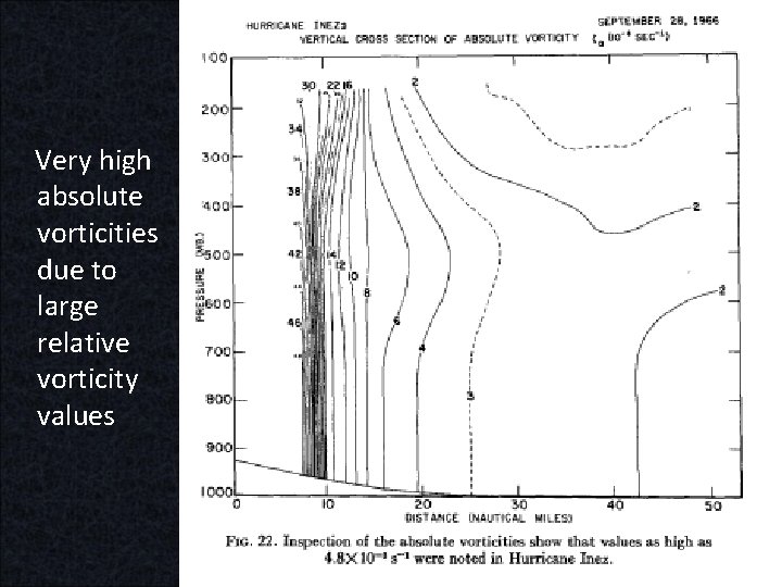
Very high absolute vorticities due to large relative vorticity values

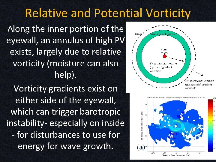
Relative and Potential Vorticity Along the inner portion of the eyewall, an annulus of high PV exists, largely due to relative vorticity (moisture can also help). Vorticity gradients exist on either side of the eyewall, which can trigger barotropic instability- especially on inside - for disturbances to use for energy for wave growth.

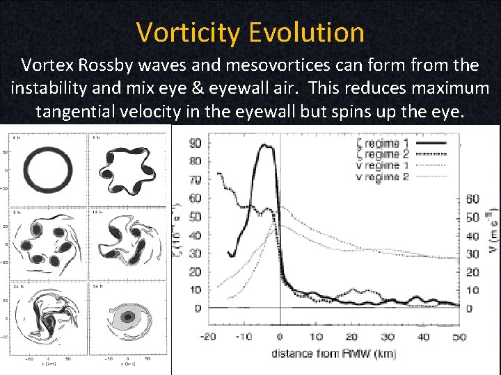
Vorticity Evolution Vortex Rossby waves and mesovortices can form from the instability and mix eye & eyewall air. This reduces maximum tangential velocity in the eyewall but spins up the eye.

END Next powerpoint includes intensification and weakening of TCs, as well as formation of eye and evolution of hurricane inner core.