Hydraulic Modeling of the Floodplain in Sanderson TX

- Slides: 20
Hydraulic Modeling of the Floodplain in Sanderson, TX Rachel Chisolm CE 394 K- Surface Water Hydrology Dr. Maidment 5/6/10
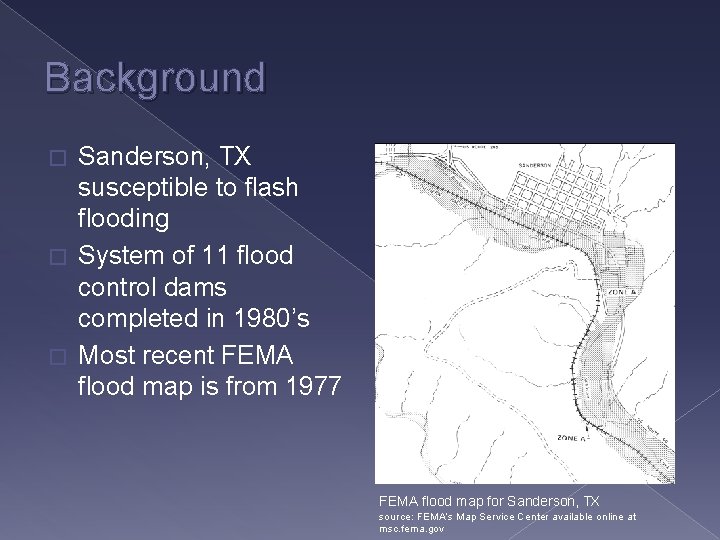
Background Sanderson, TX susceptible to flash flooding � System of 11 flood control dams completed in 1980’s � Most recent FEMA flood map is from 1977 � FEMA flood map for Sanderson, TX source: FEMA’s Map Service Center available online at msc. fema. gov
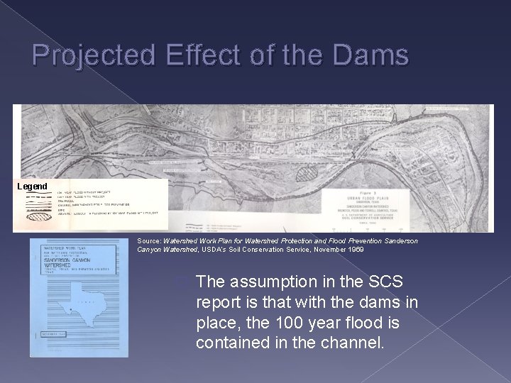
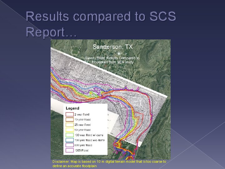
Projected Effect of the Dams Legend Source: Watershed Work Plan for Watershed Protection and Flood Prevention Sanderson Canyon Watershed, USDA’s Soil Conservation Service, November 1969 � The assumption in the SCS report is that with the dams in place, the 100 year flood is contained in the channel.
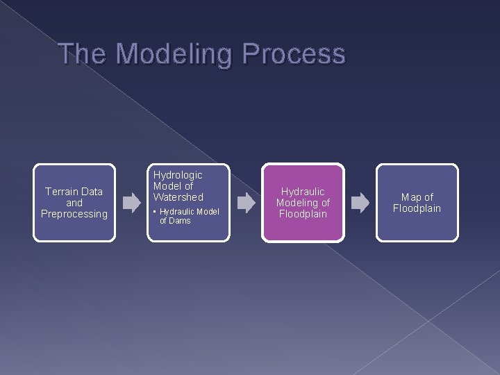
The Modeling Process Terrain Data and Preprocessing Hydrologic Model of Watershed • Hydraulic Model of Dams Hydraulic Modeling of Floodplain Map of Floodplain
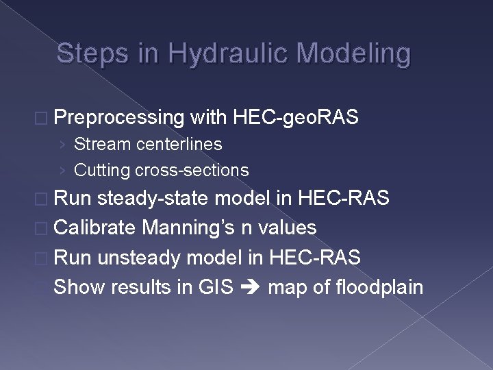
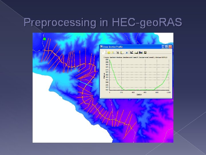
Steps in Hydraulic Modeling � Preprocessing with HEC-geo. RAS › Stream centerlines › Cutting cross-sections � Run steady-state model in HEC-RAS � Calibrate Manning’s n values � Run unsteady model in HEC-RAS � Show results in GIS map of floodplain
Preprocessing in HEC-geo. RAS
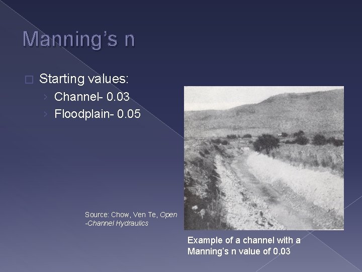
Manning’s n � Starting values: › Channel- 0. 03 › Floodplain- 0. 05 Source: Chow, Ven Te, Open -Channel Hydraulics Example of a channel with a Manning’s n value of 0. 03
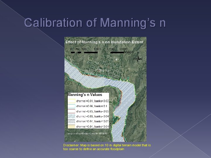
Calibration of Manning’s n Disclaimer: Map is based on 10 m digital terrain model that is too coarse to define an accurate floodplain
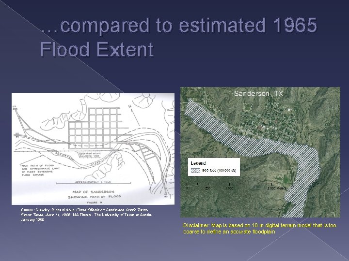
…compared to estimated 1965 Flood Extent Source: Crawley, Richard Alvin. Flood Effects on Sanderson Creek Trans. Pecos Texas, June 11, 1965. MA Thesis , The University of Texas at Austin, January 1969 Disclaimer: Map is based on 10 m digital terrain model that is too coarse to define an accurate floodplain
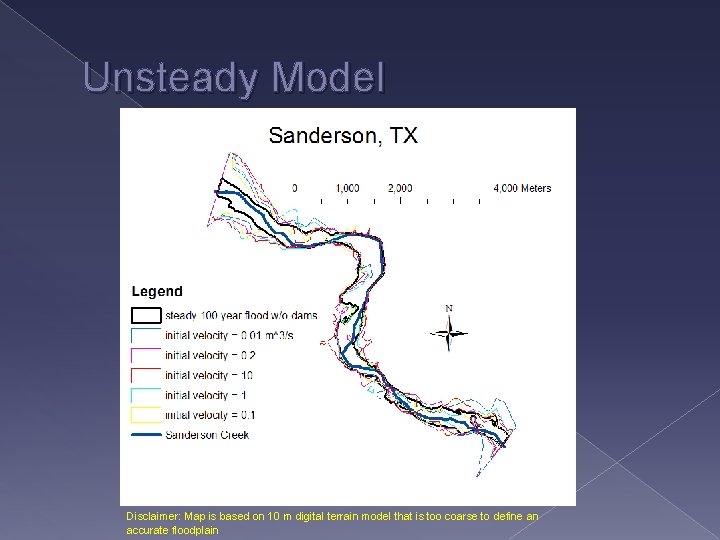
Unsteady Model Disclaimer: Map is based on 10 m digital terrain model that is too coarse to define an accurate floodplain
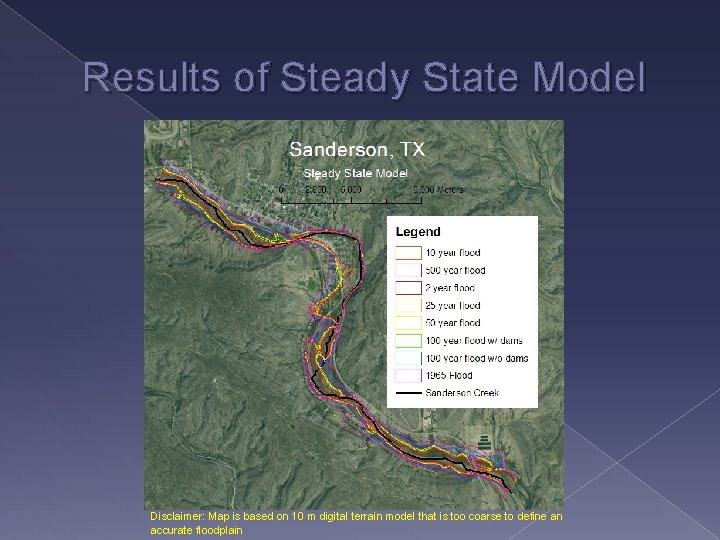
Results of Steady State Model Disclaimer: Map is based on 10 m digital terrain model that is too coarse to define an accurate floodplain
Results compared to SCS Report… Disclaimer: Map is based on 10 m digital terrain model that is too coarse to define an accurate floodplain
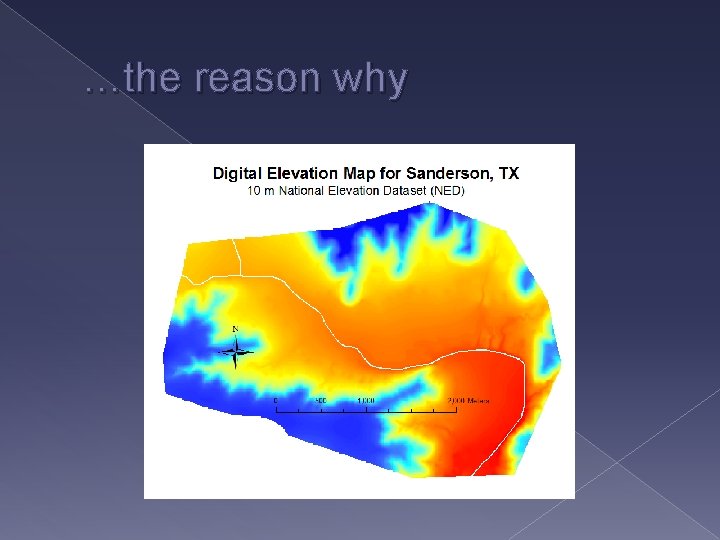
…the reason why
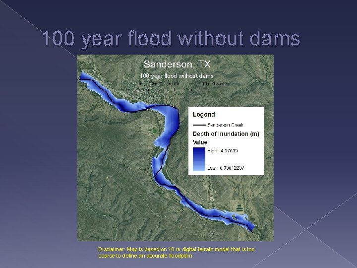
100 year flood without dams Disclaimer: Map is based on 10 m digital terrain model that is too coarse to define an accurate floodplain
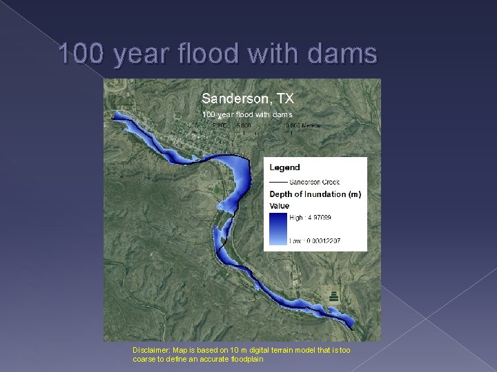
100 year flood with dams Disclaimer: Map is based on 10 m digital terrain model that is too coarse to define an accurate floodplain
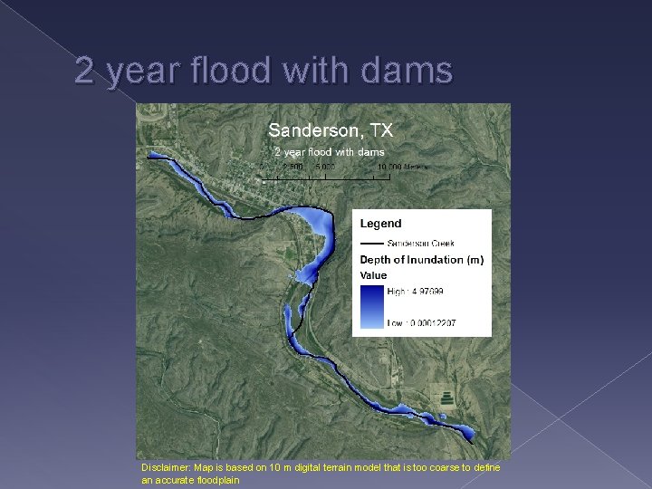
2 year flood with dams Disclaimer: Map is based on 10 m digital terrain model that is too coarse to define an accurate floodplain
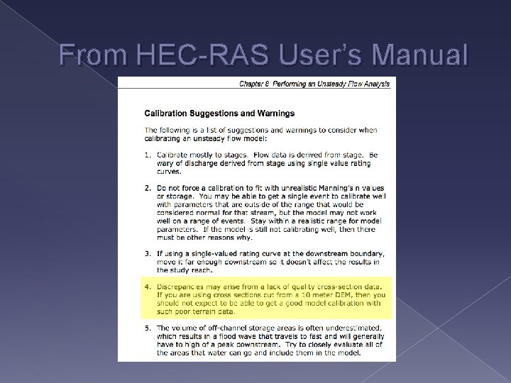
Conclusions � We need LIDAR data!!! › Channel is not well defined with NED › Streamlines delineated from NED do not match up with imagery and NHD flowlines � Differences in depth of inundation can be seen for floods of different return periods
From HEC-RAS User’s Manual
Acknowledgements � Glenn Wright and others from AEcom � Darrel Seidel, Trent Street and others from the NRCS � Melinda Luna- TNRIS � Dr. Maidment � Laura Hurd, Cody Hudson, and Marcelo Somos
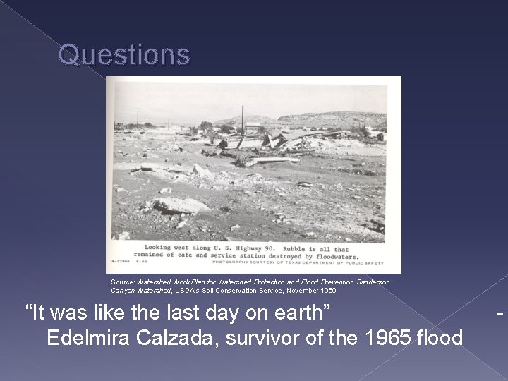
Questions Source: Watershed Work Plan for Watershed Protection and Flood Prevention Sanderson Canyon Watershed, USDA’s Soil Conservation Service, November 1969 “It was like the last day on earth” Edelmira Calzada, survivor of the 1965 flood -