Geography Continents and Oceans Continents The world is


- Slides: 26

Geography Continents and Oceans

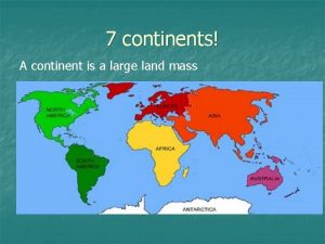
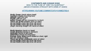
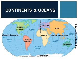
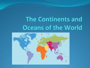
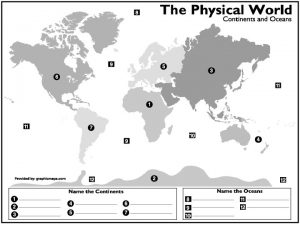
Continents • The world is divided into 7 major continents

1) North America • 9. 5 million square miles – Ranked #3 out of 7 • 565 million people (7. 5%) – Ranked #4 out of 7 • 23 different countries

2) South America • 6. 9 million square miles – Ranked #4 out of 7 • 375 million people (5%) – Ranked #5 out of 7 • 12 different countries

3) Africa • 11. 7 million square miles – Ranked #2 out of 7 • 1. 1 billion people (15%) – Ranked #2 out of 7 • 54 different countries

4) Europe • 3. 9 million square miles – Ranked #6 out of 7 • 745 million people (11%) – Ranked #3 out of 7 • 50 different countries

5) Asia • 17. 2 million square miles – Ranked #1 out of 7 • 4. 3 billion people (60%) – Ranked #1 out of 7 • 49 different countries

6) Australia • 3. 3 million square miles – Ranked #7 out of 7 • 36 million people – Ranked #6 out of 7 (1%) • 4 countries

7) Antarctica • 5. 4 million square miles – Ranked #5 out of 7 – 98% is covered by ice • No permanent population – Ranked #7 out of 7 • No countries

Oceans • There are 4 major oceans in the world – Some sources might say there are 5 or 6 – In this class, we will only deal with the Atlantic, Pacific, and Indian Oceans

8) Pacific Ocean • This is the largest ocean in the world • It covers 1/3 of the earth’s surface • The Pacific Ocean is bigger than the land area of all of the continents combined! The Pacific Ocean borders 4 continents!

9) Atlantic Ocean • The second largest ocean in the world • It covers 1/5 of the earth’s surface • The Atlantic Ocean is Sshaped and borders 4 continents.

10) Indian Ocean • The third largest ocean in the world. • It covers about 1/7 of the earth’s surface. • The Indian Ocean gets its name from the Indian subcontinent. It borders 3 continents.

11) Arctic Ocean • Located near the North Pole • This is the world’s smallest ocean • In the winter-time it is mostly covered by sea ice

12) Southern Ocean • Located around Antarctica and the South Pole • Sometimes, geographers say that the Southern Ocean isn’t an ocean by itself, but part of the Pacific, Atlantic, and Indian

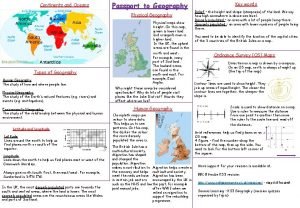
Longitude • Lines that go north and south (up and down) on a map to specify an East or West point on the earth’s surface • 0 – 180 (East or West)

Prime Meridian • The Prime Meridian divides the earth into East and West

Prime Meridian • The degrees give you a measurement of how far to go from the Prime Meridian and in which direction (East or West)

Latitude • Lines that go east and west (left and right) on a map to and specifies an North or South point on the earth’s surface • 0 -90 (North or South)

Equator • The Equator divides the earth into North and South

Equator • The degrees give you a measurement of how far to go from the Equator and in which direction (North or South)

Absolute Location • Coordinates where LONGITUDE and LATITUDE intersect gives an exact location! • Example: 100 degrees East and 40 degrees North

Scale • Scale is what is used to measure distances on maps • Usually, one inch will represent a certain number of miles on the map • On larger maps, one inch will represent hundreds of miles

Cardinal Directions • 4 Cardinal Directions – – North South East West • 4 Intermediate Directions – – Northeast Northwest Southeast Southwest

• Lubbock, Texas to Charlotte, North Carolina – what direction are you travelling – how many miles (approximately)?

• You travel approximately 1, 000 miles 500 x 2= 1000 • You are traveling northeast
 Slidetodoc.com
 Map of seven continents and five oceans
 Outline map of continents and oceans
 Continents and ocean
 What are the 7 continents and 5 oceans
 Continents and oceans
 Continents and oceans
 Continents and oceans jeopardy
 Continents and oceans jeopardy
 France 5 themes of geography
 5 oceans in the world
 Morraine glacier
 Ap human geography frq examples
 5 themes of geography ap human geography
 Stateless nation
 World history final exam study guide
 World geography today
 Biggest to smallest oceans
 Importance of pacific ocean
 Ocean floor features
 Are all the oceans connected
 Oceans apart day after day
 Pacific garbage patch
 Oceans 7/11
 Chapter 15 earth's oceans study guide answer key
 Oceans in the eastern hemisphere
 Oceans
