Design Charrette and Detailing Legazpi City Coaching and


- Slides: 12

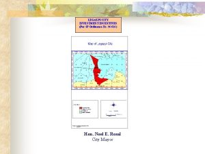
Design Charrette and Detailing Legazpi City Coaching and Mentoring Workshop 3 May 2019

Explore developing a climate resilient urban design guide Area North Southeast Near South Urban Specific CC-related design issue (multidimensional) Design strategy What to promote What to avoid Specific actions

Elements of Urban Design a. b. c. d. e. f. g. Urban Structure Urban Grain Density + mix Height + massing Streetscape + Landscape Façade + Interface Details + Materials Source: HLURB Technical Planning Assistance on CLUP Preparation

Elements of Urban Design URBAN STRUCTURE The overall framework of a region, town or zones or district, showing relationships between zones of built forms, land forms, natural environments, activities and open spaces. It encompasses broader systems including transport and infrastructure networks.

Elements of Urban Design URBAN GRAIN The balance of open space to built form, and the nature and extent of subdividing an area into smaller parcels or blocks. It takes into consideration the hierarchy of street types, the physical linkages and movement between locations, and modes of transport.

Elements of Urban Design DENSITY + MIX The intensity of development and the range of different uses (such as residential, commercial, institutional or recreational uses).

Elements of Urban Design HEIGHT + MASSING The scale of buildings in relation to height and floor area, and how they relate to surrounding land forms, buildings and streets. It also incorporates building envelope, site coverage and solar orientation. Height and massing create the sense of openness or enclosure, and affect the amenity of streets, spaces and other buildings.

Elements of Urban Design STREETSCAPE + LANDSCAPE The design of public spaces such as streets, open spaces and pathways, and includes landscaping, and planting.

Elements of Urban Design FACADE + INTERFACE The relationship of buildings to the site, street and neighbouring buildings (alignment, setbacks, boundary treatment) and the architectural expression of their facades (projections, openings, patterns and materials).

Elements of Urban Design DETAILS + MATERIALS The close-up appearance of objects and surfaces and the selection of materials in terms of detail, craftsmanship, texture, colour, durability, sustainability and treatment. It includes street furniture, paving, lighting and signage. It contributes to human comfort, safety and enjoyment of the public domain.

Charette - CRUS Using a map, tracing paper and colored pens, develop ideas layer by layer, using the policy objectives/strategies. Sketch and describe in text: a. Water: How to address drainage/flooding? Think of drainage patterns, high-low points, drainage choke points, volume, future scenarios, etc. b. Temperature: Where to introduce shade? Ventilation? Greening? Think of solar orientation, wind patterns, wind tunnels/shadows, future development patterns, horizontal and vertical, etc. c. Connectivity: How to link spaces? Think about mobility, multisector impacts (social, economic, environmental), etc. d. Spaces, Buildings and infrastructure: What to do with the spaces Requirements for new development? Redevelopment? Think of zoning, height and massing, façade and interface, etc.

SLR affected areas Using a map, tracing paper and colored pens, develop ideas layer by layer, using the policy objectives/strategies. Sketch and describe in text: a. Water: How to address sea level rise? Will you advance/hold/accommodate/retreat? Think of the weak points, inundation patterns, future development, etc. b. Land spaces: Where to introduce open spaces? Areas for protection? Areas for development? Think future development patterns, zoning, vulnerable population, etc. c. Connectivity: How to link spaces? Think about mobility, multisector impacts (social, economic, environmental), etc. d. Buildings and infrastructure: Where do you want new development? Redevelopment? What type of infrastructure can respond to SLR? Think of zoning and site regulations, building features, etc.
 Charrette protocol
 Charrette
 Ang pagdating ni miguel lopez de legazpi sa cebu
 Bbn detailing - mobile
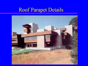
 Coping details parapet walls
 Staircase starter bar
 Reinforcement details of beam
 Stamm auto detailing
 Eurocode 2 lap length table
 Detailing connect
 Academic detailing dalhousie
 Mark receives a score report detailing his performance
 Sds 2 software


