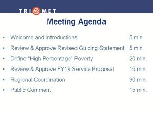
Agenda 1 Opening of the Meeting Transition to


- Slides: 23

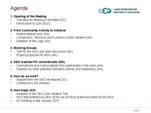
Agenda 1. Opening of the Meeting • Transition to Steering Committee (DC) • Introduction to LDN (BJO) 2. From Community Activity to Initiative • Implementation plan (SA) • Composition, Structure and Functions of the Initiative (AH) • Adoption of the Logo (SA) 3. Working Groups • To. R for the WGs and open discussion (SA) • Project proposals for WGs (AH) 4. GEO member/PO commitments (WS) • Commitment and contact details from participants in the room (AH) • Outreach to other potential members (names and institutions) (AH) 5. How do we work? • Support from the GEO secretariat (DC) • Conference calls (Webex) 6. Next steps (AH) • Adoption of the GEO LDN Initiative To. R • WGs teleconferences (Nov 2018 -Jan 2019) to draft work plans for the WGs • SC meeting in late January 2019 Page 1

2. From community activity to initiative: Terms of Reference Vision: National and local actors in all countries use Earth observation (EO) to achieve land degradation neutrality (LDN). Mission: The GEO LDN Initiative will promote the collaborative development, and support the provision and use, of EO datasets, quality standards, analytical tools and capacity building to avoid, reduce, and reverse land degradation with the aim of achieving LDN in all countries by 2030 (SDG 15. 3). The Initiative will help connect data providers to data users, including researchers, decision-makers, land use planners, commercial sector, donors/investors and other stakeholders in order to optimize the use of EO datasets for LDN assessment, planning, implementation, monitoring and reporting. Page 2

2. From community activity to initiative: Terms of Reference Steering Committee: The main decisionmaking body, responsible for providing strategic direction and coordinating GEO LDN Initiative activities, identifying and, where possible, contributing resources. Management and Functional Support Unit: The unit responsible for managing the daily operations and logistical support for the Steering Committee and its activities, and providing scientific and technical coordination for the activities of the working groups. Page 3

2. From community activity to initiative: Functional Support Unit Composition: GEO Secretariat, secondments and contributing shareholders/stakeholders. A small number of members-at-large (preferably no more than 3) may be appointed by the Steering Committee to fill gaps in geographical representation and/or expertise. Operation: regular e-mail correspondence and conference calls every two weeks Page 4

2. From community activity to initiative: Functional Support Unit Function: Responsible for managing the day-to-day operations and ensuring that activities are kept on schedule. Provide scientific and technical coordination for Working Groups as well as logistical support for GEO LDN Initiative activities. • • Provide scientific and technical coordination for Working Groups; Provide day-to-day logistical support for the GEO LDN Initiative; Support the Steering Committee in the coordination of the GEO LDN Initiative deliverables; Promote the GEO LDN Initiative in the international arena; Report to the GEO Secretariat on behalf of the GEO LDN Initiative; Support the organisation of the GEO LDN Initiative meetings and events; Manage the GEO LDN Initiative communications. Page 5

2. From community activity to initiative: The Steering Committee Composition: Co-chairs, country members, POs, (Co-)leads of WGs, other stakeholders and shareholders. It is anticipated that between one-third and one-half of the SC will consist of representatives of user communities. Operation: Monthly teleconferences; yearly meetings Page 6

2. From community activity to initiative: The Steering Committee Functions: • • • Provide oversight and strategic direction; Promote the Initiative; Review and endorse the Implementation Plan and Annual Work Plans; Monitor and evaluate institutional effectiveness; Conduct user needs assessment and represent stakeholder interests to the greatest extent possible; Provide guidance and support to the Working Groups and monitor their progress; Coordinate the production of deliverables for reporting to the GEO Secretariat; Work with the Management and Functional Support Unit to identify new stakeholders that would contribute to and benefit from the GEO LDN Initiative; Identify opportunities for collaboration between and among stakeholders; Facilitate and coordinate relevant activities and mobilize resources when opportunities arise. Page 7

Page 8

Tasks of the Capacity Building Working Group The three main tasks are: A. Increase the involvement of partner countries and other organizations. B. Develop innovative and fit-for-purpose training curricula and learning modules. C. Organize and implement of training on the use of available tools for accessing, processing, analyzing and interpreting data as well as validation techniques. Activities under task (A) include: • Identify partners countries and sub-regions for workshops, capacity building, trainings; • Identify partners countries for data availability reviews including the ways and means to improve and increase in situ data collection; and • Contact institutions and other organizations and GEO initiatives to identify and develop relevant collaboration opportunities. Page 9

Activities under task (B) include: • Review and improve UNCCD and other capacity building materials for regional, national and sub-national deployment, including the Good Practice Guidance for SDG indicator 15. 3. 1; • Further develop learning modules on the use of tools and data for (a) UNCCD and SDG reporting, (b) land use and spatial planning frameworks to implement measures to achieve LDN, and (c) other target systems and reporting obligations at national level to maximize synergies and avoid duplication of efforts; and • Develop curricula and repository of information that can be tailored to the specific needs of partner countries. Activities under task (C) include: • Issue a call for proposals from GEO members and POs to host sub-regional capacity building workshops, in collaboration with National Statistical Offices (NSOs), specialized agencies and the “main reporting entity” for the UNCCD (focal points) and SDG reporting, to provide training on the use of available tools for accessing and interpreting data as well as validation techniques; and • Collaborate with (sub) national agencies and actors that are planning and implementing measures to reach LDN. Page 10

Tasks of the Data Quality Standards Working Group The main task is: • Develop minimum data quality standards and specifications (e. g. , resolution, time series, classification systems) for the underlying methodology, data, algorithms, and tools needed for estimating SDG indicator 15. 3. 1 and its sub-indicators. Activities include: • Undertake a stock-taking review of existing data quality standards and initiatives (e. g. , ISO standards) in line with the Quality Assurance for Earth Observation (QA 4 EO) initiative which has produced a number of guidelines that have been adopted as GEOSS ‘best practice’ documents; • Organize a global consultation in 2019 to update the Good Practice Guidance for SDG indicator 15. 3. 1 including applicability to other relevant monitoring and reporting processes; • Explore possible platforms that would encourage a more harmonized approach to ensuring data quality standards and specifications. Page 11

Tasks of the Data Analytics Working Group The main task is: • Work towards establishing a federated collaborative platform with high computing capacities and big data analytics tools (e. g. data aggregators such as open source EO data cubes) using relevant OGC and ISO standards that would allow countries to easily select, access, process, analyse, interpret and quality control large EO datasets while at the same time ensuring national ownership Activities include: • Review existing standards and interoperability issues on federated collaborative platforms; • Develop fundable projects demonstrating use of EO in responding to LDN needs and challenges, aligned with LDN Vision, Mission and Implementation Plan. Projects should be well-defined with limited life-span and concrete deliverables (pre-operational global applications/services) involving local actors/institutions. Starting point could be 3 sub-indicators of SDG 15. 3. 1 (land cover, land productivity and carbon stocks). Page 12

3. Working Groups – Project Proposals WG 1 (Capacity Building) Financing: No specific commitment yet. Partly SEN 4 LDN (ESA Invitation for Tender). • Capacity development in measuring, monitoring and reporting land degradation neutrality (LDN): the use of EOs in LDN reporting in Africa (ICRAF, ISRIC) Page 13

3. Working Groups – Project Proposals WG 2 (Data quality standards) Financing: 100. 000€ German contribution to the trust fund • Development of recommendations / best practices for EO and linking relevant initiatives to the LDN monitoring and mapping requirements (DLR) • Assessment of land data interoperability: what needs to be the same to allow other things to differ? (FAO) Page 14

3. Working Groups – Project Proposals WG 3 (Data Analytics) Financing: SEN 4 LDN (ESA Invitation for Tender) – 1 -1. 5 M€; Countries (e. g. Benin) Global Proposals • Improving the EO-based assessment of LDN indicators and assessing scaling issues to bridge the gap between national and local scale based on existing and future EO missions (DLR) • Developing Guidance and a Web-based Tool to Support Local Experts in Measuring and Monitoring Soil Organic Carbon in LDN Enhancing Projects (ISRIC and partners) • An Earth Observation Based Toolbox for Planning and Monitoring LDN Implementation at Local and National Levels (WOCAT, CI, WUR) Page 15

3. Working Groups – Project Proposals WG 3 (Data Analytics) Regional Proposals • Providing reliable low-cost evidence to support land restoration strategies and LDN targets setting in NENA (North Africa and Near East) arid regions. (ICARDA) • Crowdsensing based in-situ monitoring in support to Land Degradation Neutrality (LDN) - African context (OSS and partners) Page 16

3. Working Groups – Project Proposals WG 3 (Data Analytics) National Proposals – Monitoring LDN • SDG 15. 3. 1 spatial datasets calculated for Australia (CSIRO, Geoscience Australia) • From Land to “Clouds”, operationalizing national and local LDN monitoring system in Madagascar (Ministry of Environment, Ecology and Forest; University of Antananarivo; Local farmers) Page 17

3. Working Groups – Project Proposals WG 3 (Data Analytics) National-Local: Implementing LDN • Assessing the Risks of Land Degradation and Implementing a Behavior Change Communication Plan (BCCP) in Land Use and land cover in Benin (NFP Benin, CENATEL) • Restoring land for water and livelihoods in Ethiopian Rift Valley (ICRAF) • EO-based pasture monitoring for sustainable management of pastures in the Kyrgyz Republic (American University of Central Asia; National Pasture Users Association; Department of Pastures under the Ministry of Agriculture) Page 18

4. GEO member / PO commitments: WG 1 Capacity Building WG Lead: ? Co-Chair supporting the WG: Amos Kabobah (University of Energy and Natural Resources, Ghana) WG members: Joost Teuben, GEO CB support with vision of the WG (not formal membership) Silvia Giamberini, CNR, Organize WS and trainings, connect people Alfari Issifou, Agrhymet will provide name later (DG) Dr. Patrice Sanou, Isestel, Burkina Faso, Focal point for West Africa, train local government institution on implementation of LULC Andiswa, SANSA will provide name Page 19

4. GEO member / PO commitments: WG 2 Data Quality Standards WG Lead: Barron Orr and Fabian Löw (details tbd) Co-Chair supporting the WG: Antje Hecheltjen (GIZ) WG members: Cf. Slide 22 Page 20

4. GEO member / PO commitments: WG 3 Data Analytics WG Lead: Alex Zwollev CI/trends. earth Co-Chair supporting the WG: Neil Sims (CSIRO) WG members: Norman Mueller, Geoscience Australia (Land Cover, LD) Palma Blonda, CNR, Italy (LCLU, LCLCC) Amadou Moctar Dieye, SERVIR, Senegal Page 21

4. GEO member / PO commitments: Outreach to other potential members names, institutions WG 1 (Capacity Building): NASA (Nancy Searby) WG 2 (Data Quality Standards): Adam Lewis, CEOS, LSI-VC Ecopotential Consortium (H 2020 project, CNR is coordinator) Laetitia Navarro, GEO-BON (data task force) and GEO-BON/Soil BON Vincent Pircher, MTES, France, (will explore possible participation, e. g. Of Institute for Research and Development or similar) Martin Herold, WUR (proposed by Ruud Grim) WGGI Marc Paganini (proposed by Chu, Argie) Chu Ishida, JAXA (gets back to us) Ivan Hascic, OECD (will confirm) Jaon Maso, CREAF, Spain (Doug will contact) WG 3 (Data Analytics): Richard Lucas, University of Wales (Palma Blonda will contact him) Carmela Marangi, CNR (modelling for degradation) Brian Killough, NASA/CEOS (Open Data Cube) Earth critical zones observatorie network (geologists, soil scientists, American network Noel Gorelick, Google Earth Engine (Doug will contact) Andiswa, SANSA will provide name Petteri Veheeara, Finland, LD report Land. PKS, GMES in Africa Page 22

6. Next steps • • Adoption of the GEO LDN Initiative To. R WGs teleconferences (Nov 2018 -Jan 2019) to draft work plans for the WGs Open call for SC members; election of SC by interim SC SC meeting in late January 2019 Page 23
 Transition meeting agenda
 Blessing a taonga
 Sample prayer before meeting
 Koiri pattern
 Opening prayer for class reporting
 Karakia timatanga
 Prayer for school opening
 Agenda sistemica y agenda institucional
 Coach parent meeting agenda
 American legion riders meeting agenda
 Football coaches meeting agenda
 Meeting agenda welcome and introductions
 Iep meeting agenda
 Close out meeting agenda
 Distributor meeting agenda
 Baseball parent meeting agenda
 Agenda for parents meeting
 Iep meeting agenda
 Agenda welcome and introductions
 Steering committee meeting agenda sample
 Vista
Vista Agenda welcome and introductions
 Validation meeting agenda
 Volleyball parent meeting agenda
