Using Quantitative Precipitation Estimates in Flash Flood Forecasting

- Slides: 31
Using Quantitative Precipitation Estimates in Flash Flood Forecasting Scott Sinclair, Geoff Pegram, Théo Vischel School of Civil Engineering, Surveying and Construction Management University of Kwa. Zulu-Natal, Howard College, Durban, South Africa WRC
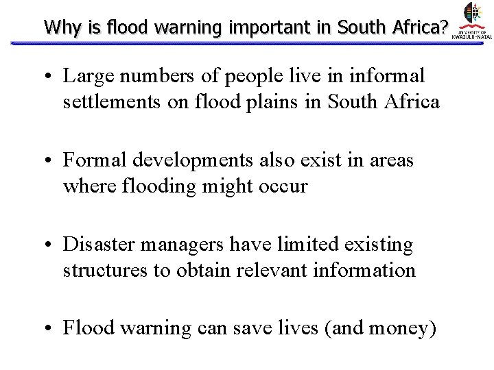
Why is flood warning important in South Africa? • Large numbers of people live in informal settlements on flood plains in South Africa • Formal developments also exist in areas where flooding might occur • Disaster managers have limited existing structures to obtain relevant information • Flood warning can save lives (and money)
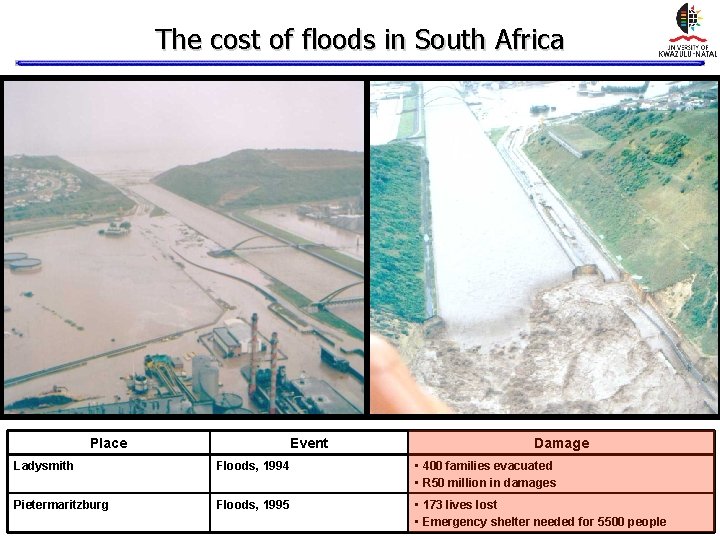
The cost of floods in South Africa Place Event Damage Ladysmith Floods, 1994 • 400 families evacuated • R 50 million in damages Pietermaritzburg Floods, 1995 • 173 lives lost • Emergency shelter needed for 5500 people
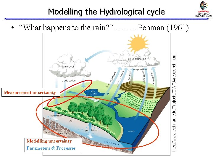
Modelling the Hydrological cycle Measurement uncertainty Modelling uncertainty Parameters & Processes http: //www. cet. nau. edu/Projects/SWRA/research. html • “What happens to the rain? ”………Penman (1961)
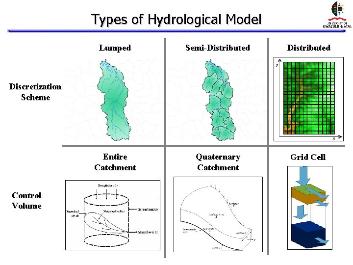
Types of Hydrological Model Lumped Semi-Distributed Entire Catchment Quaternary Catchment Grid Cell Discretization Scheme Control Volume
Rainfall data requirements for Flood Forecasting • • • Real-time data Robust data transfer mechanisms Suitable temporal resolution Suitable spatial resolution Accurate validated accumulations in space and time • Forecasts (Nowcasting & NWP models)
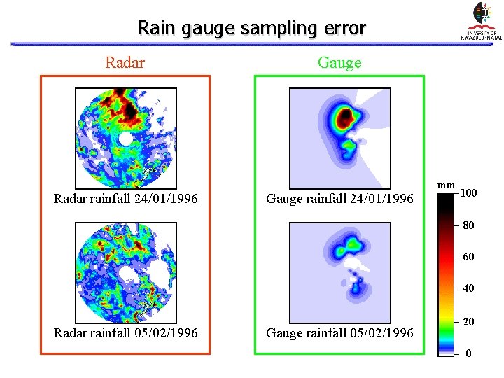
Rain gauge sampling error Radar rainfall 24/01/1996 Gauge rainfall 24/01/1996 mm 100 80 60 40 Radar rainfall 05/02/1996 Gauge rainfall 05/02/1996 20 0
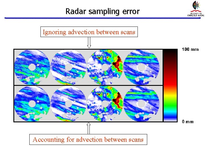
Radar sampling error Ignoring advection between scans Accounting for advection between scans
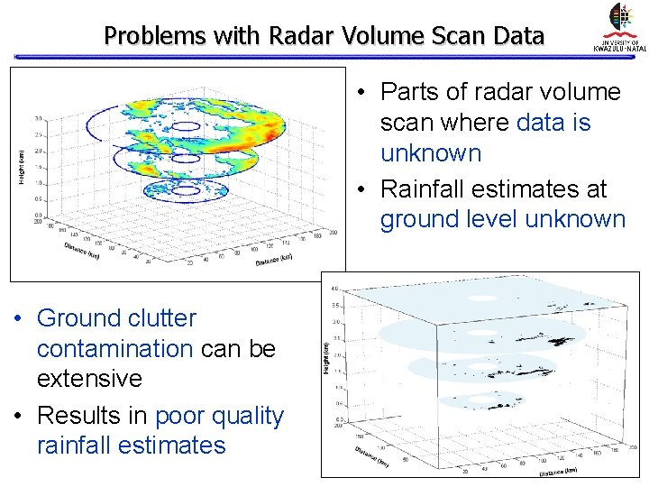
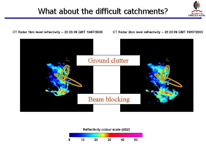
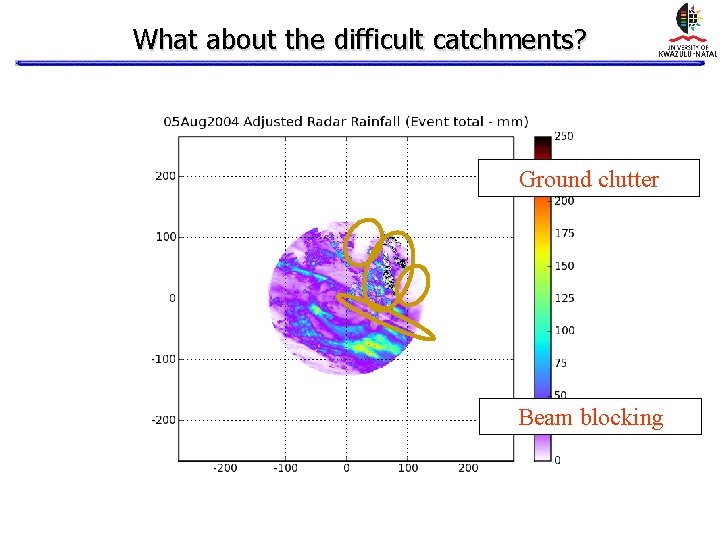
Problems with Radar Volume Scan Data • Parts of radar volume scan where data is unknown • Rainfall estimates at ground level unknown • Ground clutter contamination can be extensive • Results in poor quality rainfall estimates
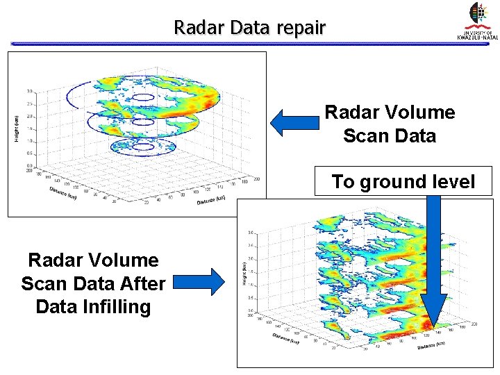
Radar Data repair Radar Volume Scan Data To ground level Radar Volume Scan Data After Data Infilling
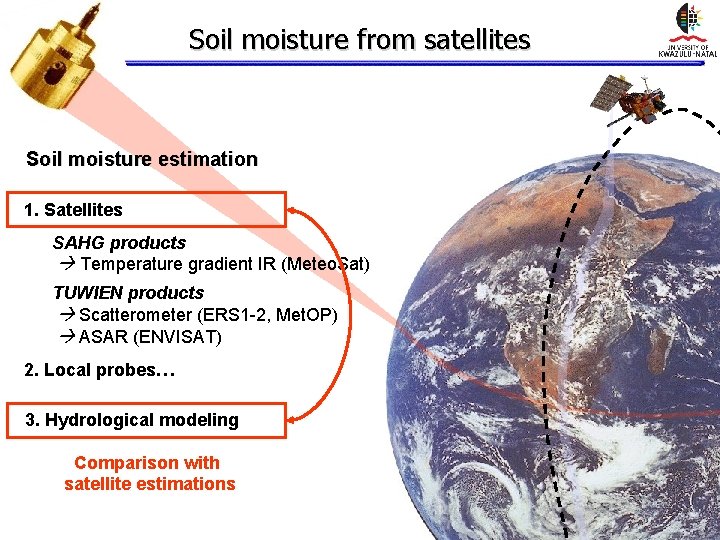
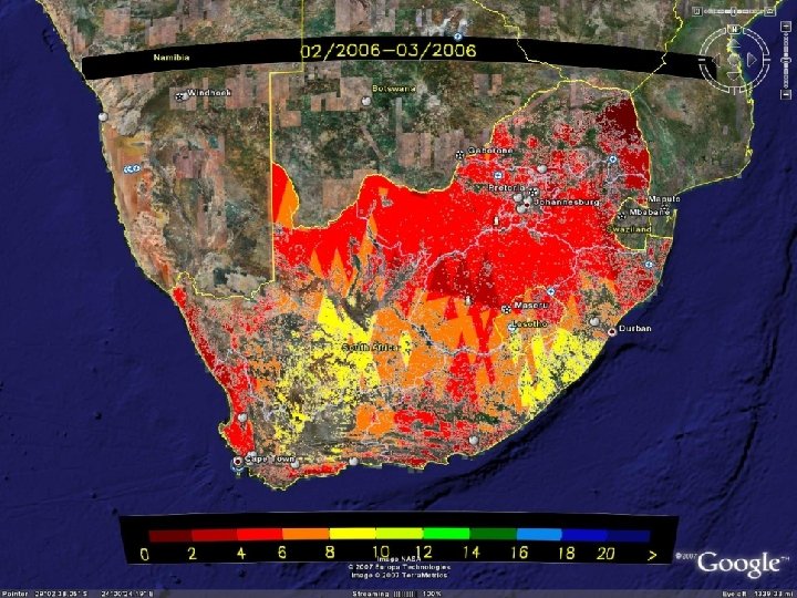
Soil moisture from satellites Soil moisture estimation 1. Satellites SAHG products Temperature gradient IR (Meteo. Sat) TUWIEN products Scatterometer (ERS 1 -2, Met. OP) ASAR (ENVISAT) 2. Local probes… 3. Hydrological modeling Comparison with satellite estimations
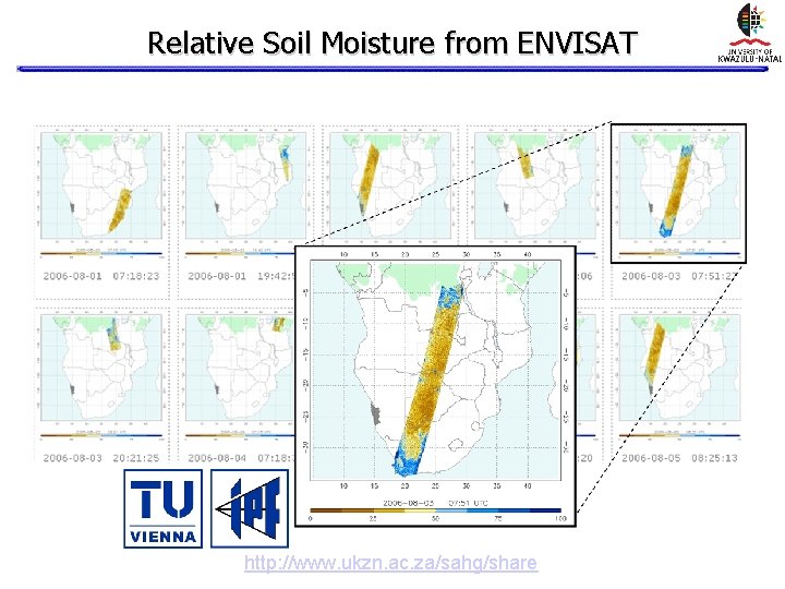
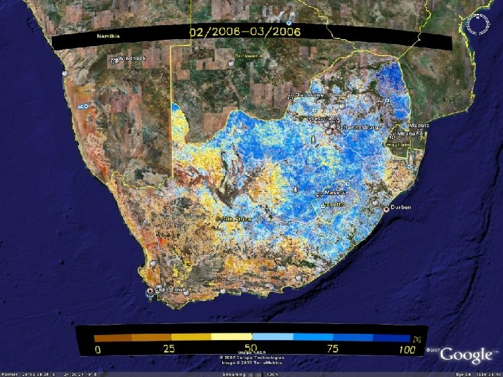
Relative Soil Moisture from ENVISAT http: //www. ukzn. ac. za/sahg/share
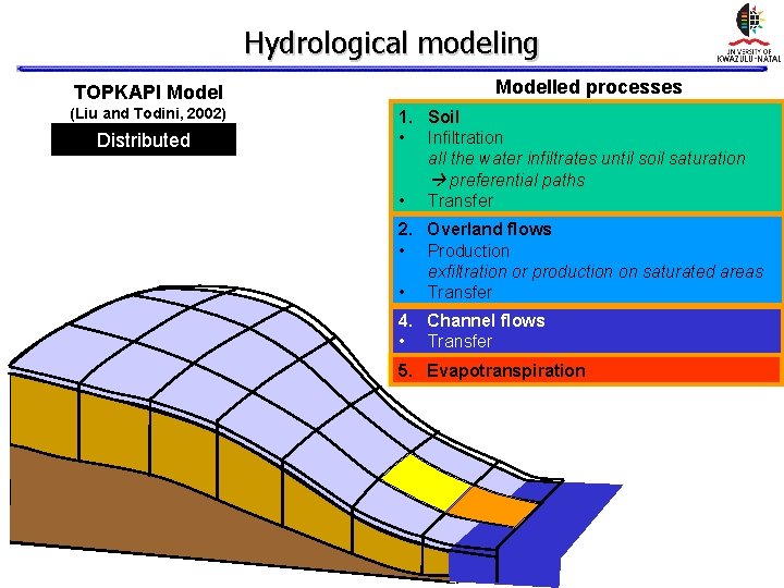
Hydrological modeling TOPKAPI Model (Liu and Todini, 2002) Distributed Modelled processes 1. Soil • Infiltration all the water infiltrates until soil saturation preferential paths • Transfer 2. Overland flows • Production exfiltration or production on saturated areas • Transfer 4. Channel flows • Transfer 5. Evapotranspiration
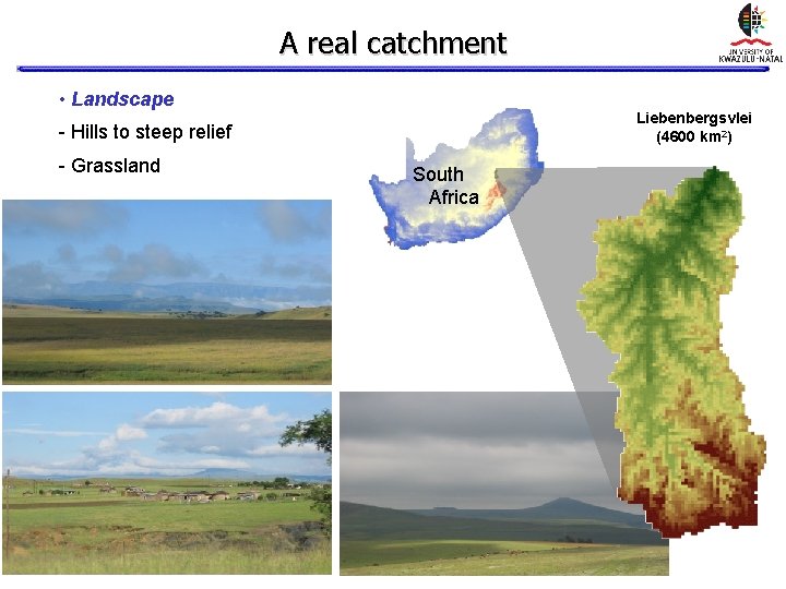
A real catchment • Landscape Liebenbergsvlei (4600 km 2) - Hills to steep relief - Grassland South Africa
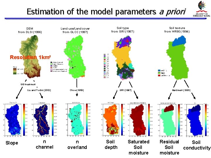
Estimation of the model parameters a priori DEM from DLSI (1996) Land use/Land cover from GLCC (1997) Soil type from SIRI (1987) Soil texture from WR 90 (1994) Resolution 1 km² GIS treatment Liu and Todini (2002) Slope n channel Chow (1959) n overland SIRI (1987) Soil depth Saturated Soil moisture Maidment (1993) Residual Soil conductivity moisture
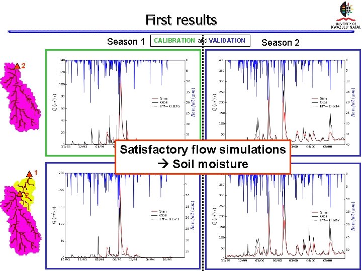
First results Season 1 CALIBRATION and VALIDATION Season 2 2 1 2 Satisfactory flow simulations Soil moisture
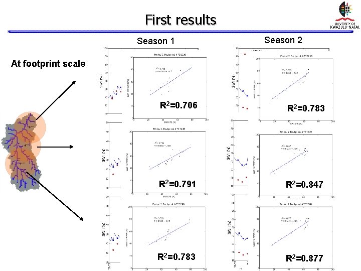
First results Season 1 Season 2 At footprint scale R 2=0. 706 R 2=0. 783 R 2=0. 791 R 2=0. 847 R 2=0. 783 R 2=0. 877
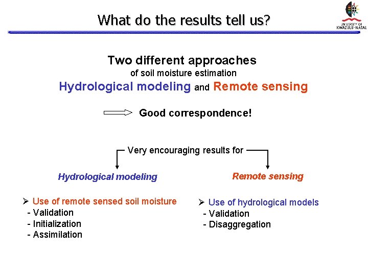
What do the results tell us? Two different approaches of soil moisture estimation Hydrological modeling and Remote sensing Good correspondence! Very encouraging results for Hydrological modeling Ø Use of remote sensed soil moisture - Validation - Initialization - Assimilation Remote sensing Ø Use of hydrological models - Validation - Disaggregation
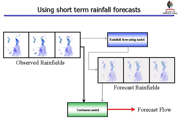
Using short term rainfall forecasts Rainfield forecasting model Observed Rainfields Forecast Rainfields Catchment model Forecast Flow
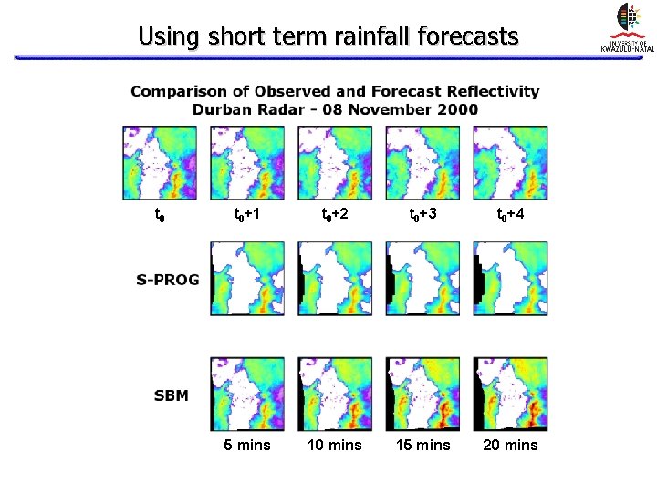
Using short term rainfall forecasts t 0+1 t 0+2 t 0+3 t 0+4 5 mins 10 mins 15 mins 20 mins
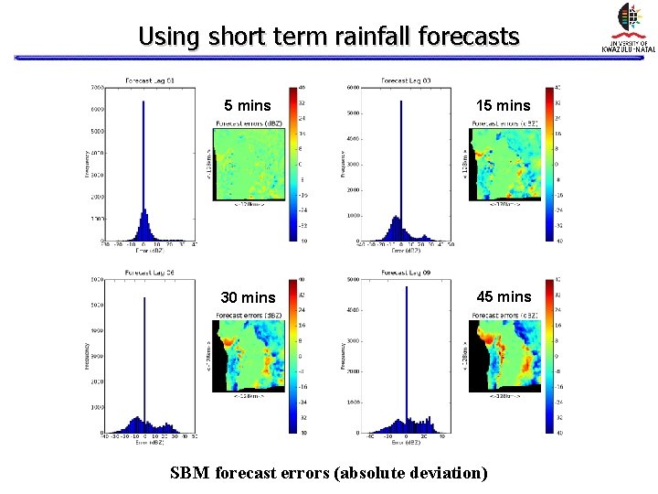
Using short term rainfall forecasts 5 mins 15 mins 30 mins 45 mins SBM forecast errors (absolute deviation)
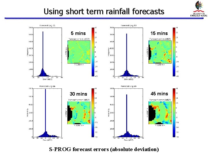
Using short term rainfall forecasts 5 mins 15 mins 30 mins 45 mins S-PROG forecast errors (absolute deviation)
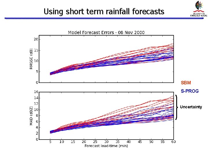
Using short term rainfall forecasts SBM S-PROG Uncertainty
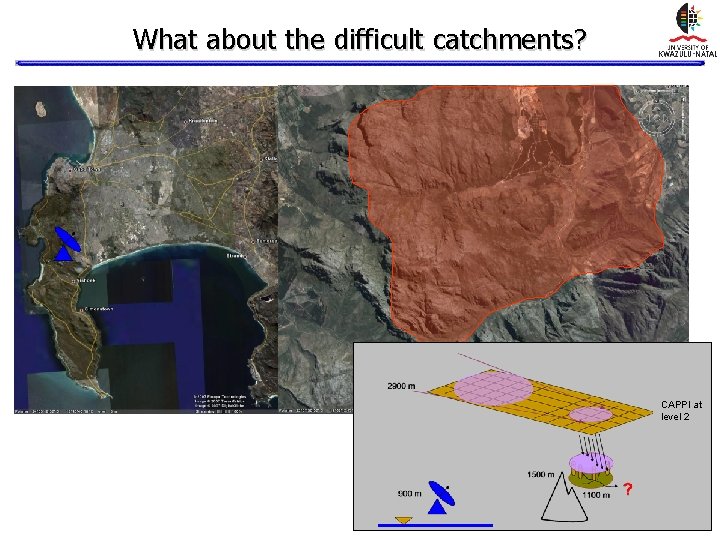
What about the difficult catchments? CAPPI at level 2
What about the difficult catchments? Ground clutter Beam blocking
What about the difficult catchments? Ground clutter Beam blocking
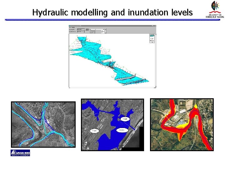
Hydraulic modelling and inundation levels
Summary • Floods cannot be prevented (impacts can be managed given sufficient warning) • Robust real-time rainfall estimation is critical to flood warning systems • Hydrologic and Hydraulic models can only be as good as the available data and expertise • Essential for organizations to collaborate meaningfully • Important to maintain international links in an advanced technical field
Credits • Professor Geoff Pegram • Dr Théo Vischel • Stephen Wesson • Mohamed Parak • Nokuphumula Mkwananzi • Ntokozo Nxumalo WRC