NOAA NWS NCEP CLIMATE PREDICTION CENTER El Nio
- Slides: 16

NOAA NWS • NCEP • CLIMATE PREDICTION CENTER El Niño Prediction and Impacts Mike Halpert SARP Briefing: February 2016

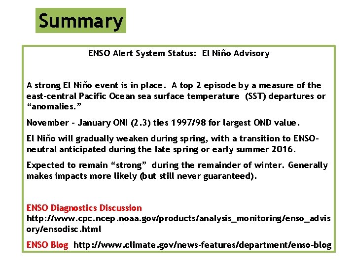
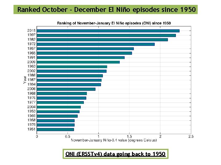
Summary ENSO Alert System Status: El Niño Advisory A strong El Niño event is in place. A top 2 episode by a measure of the east-central Pacific Ocean sea surface temperature (SST) departures or “anomalies. ” November – January ONI (2. 3) ties 1997/98 for largest OND value. El Niño will gradually weaken during spring, with a transition to ENSOneutral anticipated during the late spring or early summer 2016. Expected to remain “strong” during the remainder of winter. Generally makes impacts more likely (but still never guaranteed). ENSO Diagnostics Discussion http: //www. cpc. ncep. noaa. gov/products/analysis_monitoring/enso_advis ory/ensodisc. html ENSO Blog http: //www. climate. gov/news-features/department/enso-blog

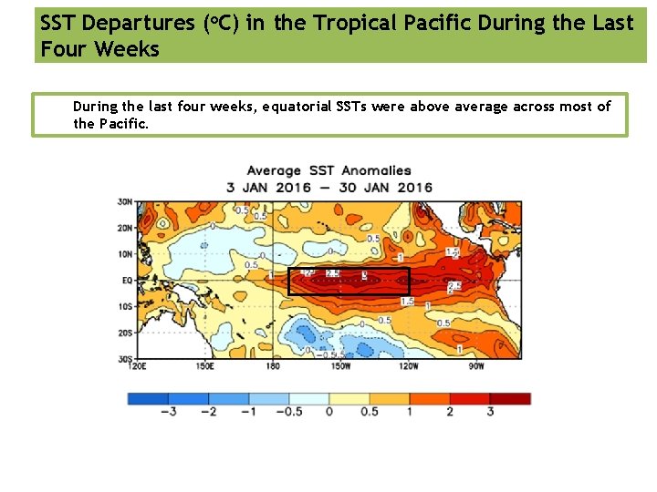
SST Departures (o. C) in the Tropical Pacific During the Last Four Weeks During the last four weeks, equatorial SSTs were above average across most of the Pacific.

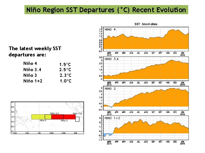
Niño Region SST Departures (°C) Recent Evolution The latest weekly SST departures are: Niño 4 3 1+2 1. 5ºC 2. 3ºC 1. 0ºC

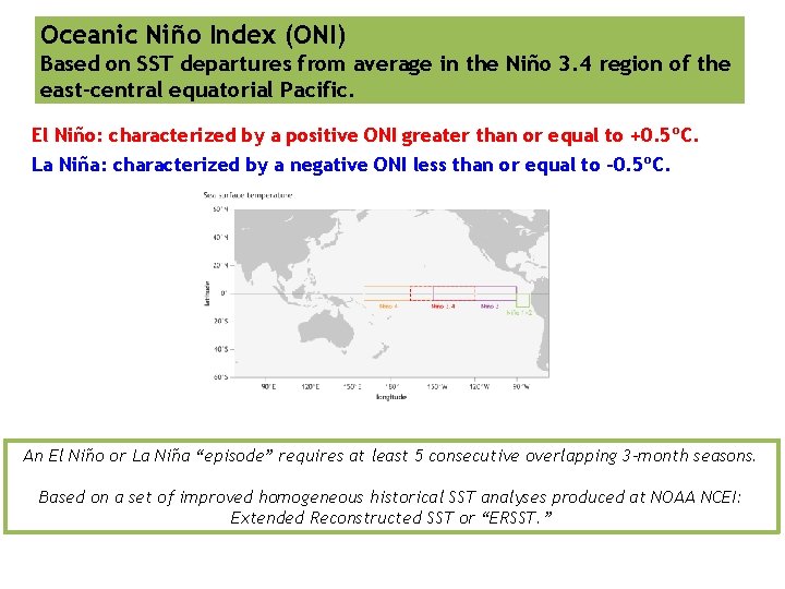
Oceanic Niño Index (ONI) Based on SST departures from average in the Niño 3. 4 region of the east-central equatorial Pacific. El Niño: characterized by a positive ONI greater than or equal to +0. 5ºC. La Niña: characterized by a negative ONI less than or equal to -0. 5ºC. An El Niño or La Niña “episode” requires at least 5 consecutive overlapping 3 -month seasons. Based on a set of improved homogeneous historical SST analyses produced at NOAA NCEI: Extended Reconstructed SST or “ERSST. ”

Ranked October - December El Niño episodes since 1950 ONI (ERSSTv 4) data going back to 1950

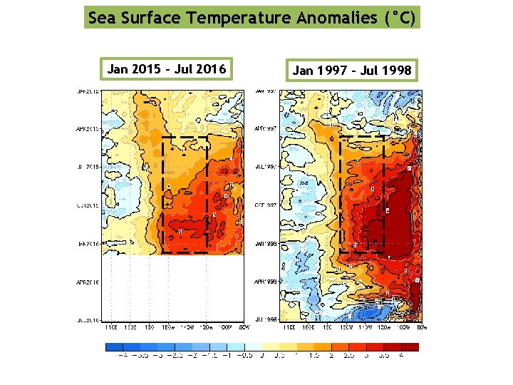
Sea Surface Temperature Anomalies (°C) Jan 2015 – Jul 2016 Jan 1997 – Jul 1998

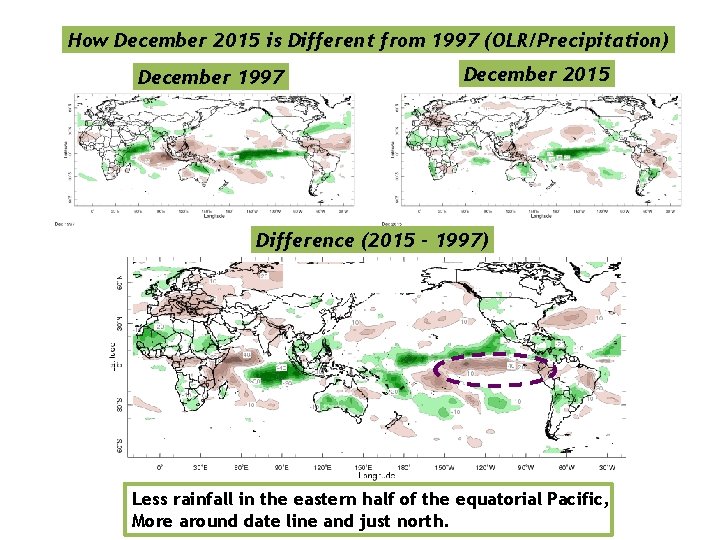
How December 2015 is Different from 1997 (OLR/Precipitation) December 1997 December 2015 Difference (2015 – 1997) Less rainfall in the eastern half of the equatorial Pacific, More around date line and just north.

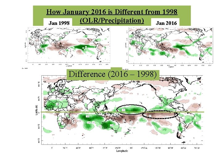
How January 2016 is Different from 1998 (OLR/Precipitation) Jan 1998 Jan 2016 Difference (2016 – 1998)

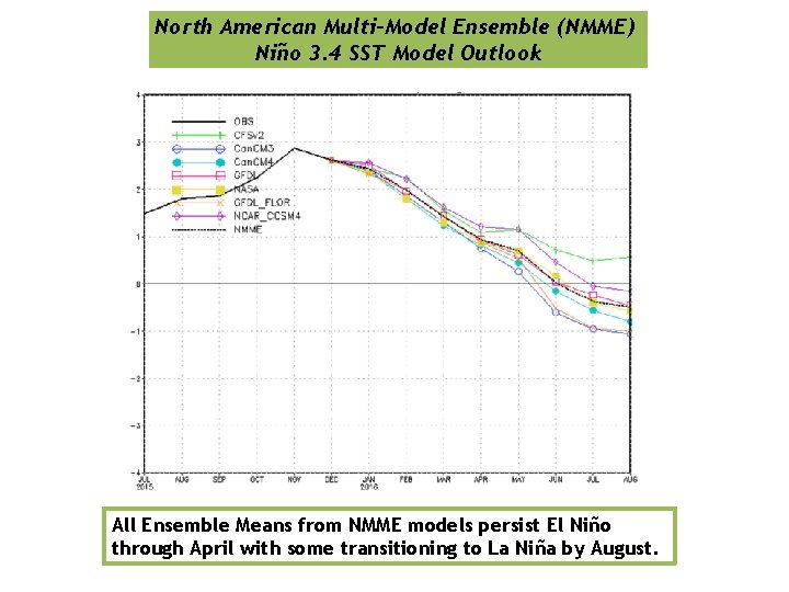
North American Multi-Model Ensemble (NMME) Niño 3. 4 SST Model Outlook All Ensemble Means from NMME models persist El Niño through April with some transitioning to La Niña by August.

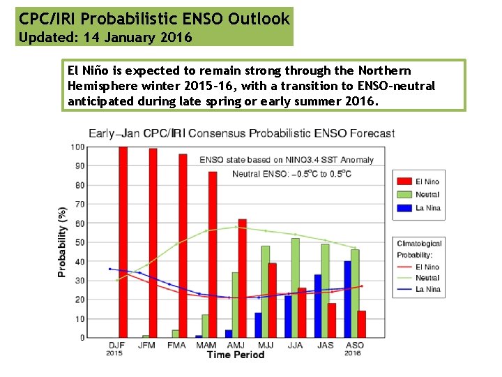
CPC/IRI Probabilistic ENSO Outlook Updated: 14 January 2016 El Niño is expected to remain strong through the Northern Hemisphere winter 2015 -16, with a transition to ENSO-neutral anticipated during late spring or early summer 2016.

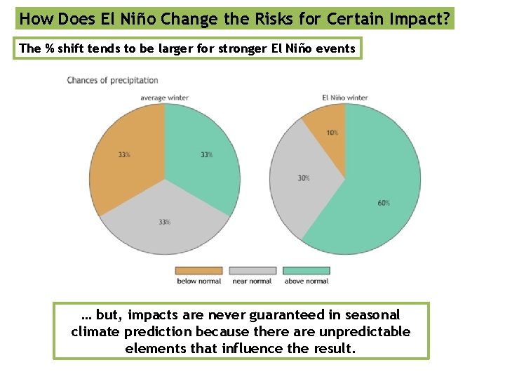
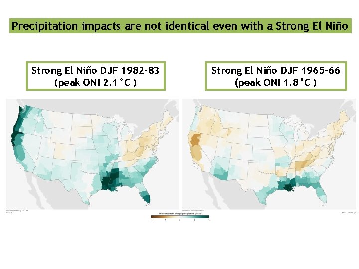
How Does El Niño Change the Risks for Certain Impact? The % shift tends to be larger for stronger El Niño events … but, impacts are never guaranteed in seasonal climate prediction because there are unpredictable elements that influence the result.

Precipitation impacts are not identical even with a Strong El Niño DJF 1982 -83 (peak ONI 2. 1°C ) Strong El Niño DJF 1965 -66 (peak ONI 1. 8°C )

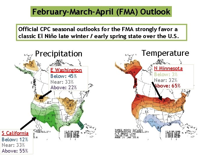
February-March-April (FMA) Outlook Official CPC seasonal outlooks for the FMA strongly favor a classic El Niño late winter / early spring state over the U. S. Precipitation E Washington Below: 45% Near: 33% Above: 22% S California Below: 12% Near: 33% Above: 55% Temperature N Minnesota Below: 3% Near: 32% Above: 65%

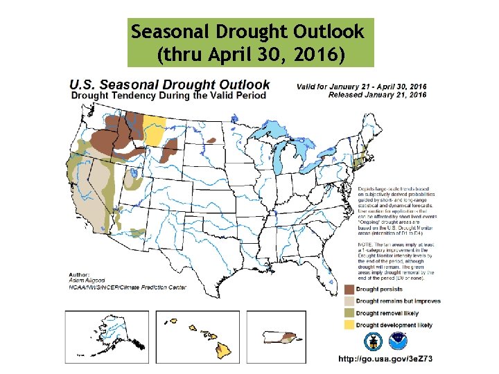
Seasonal Drought Outlook (thru April 30, 2016)

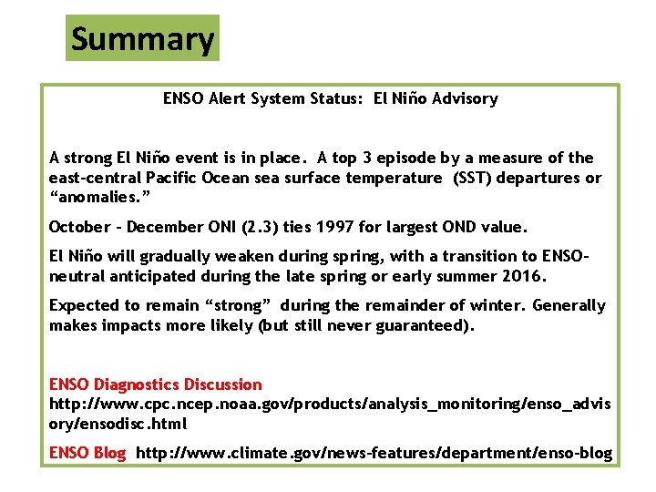
Summary ENSO Alert System Status: El Niño Advisory A strong El Niño event is in place. A top 3 episode by a measure of the east-central Pacific Ocean sea surface temperature (SST) departures or “anomalies. ” October – December ONI (2. 3) ties 1997 for largest OND value. El Niño will gradually weaken during spring, with a transition to ENSOneutral anticipated during the late spring or early summer 2016. Expected to remain “strong” during the remainder of winter. Generally makes impacts more likely (but still never guaranteed). ENSO Diagnostics Discussion http: //www. cpc. ncep. noaa. gov/products/analysis_monitoring/enso_advis ory/ensodisc. html ENSO Blog http: //www. climate. gov/news-features/department/enso-blog