National Centers for Environmental Prediction NCEP Hydrometeorlogical Prediction


- Slides: 75

National Centers for Environmental Prediction (NCEP) Hydrometeorlogical Prediction Center (HPC) Forecast Operations Branch Dan Petersen Hydrometeorological Prediction Center DOC/NOAA/NWS/NCEP Dan. Petersen@noaa. gov 301 -763 -8201 With assistance from Joshua Scheck and Mike Schichtel

Goals of Presentation • Review HPC Products • HPC Quantitative Precipitation Forecast (QPF) methodology • HPC winter weather desk and temperature biases • HPC medium range forecasts and performance verification • NCEP modeling system update • Answer questions

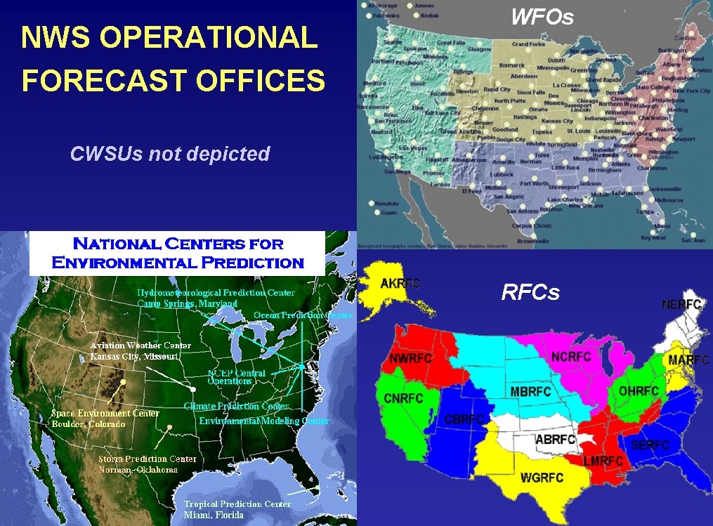
NWS OPERATIONAL FORECAST OFFICES WFOs CWSUs not depicted RFCs

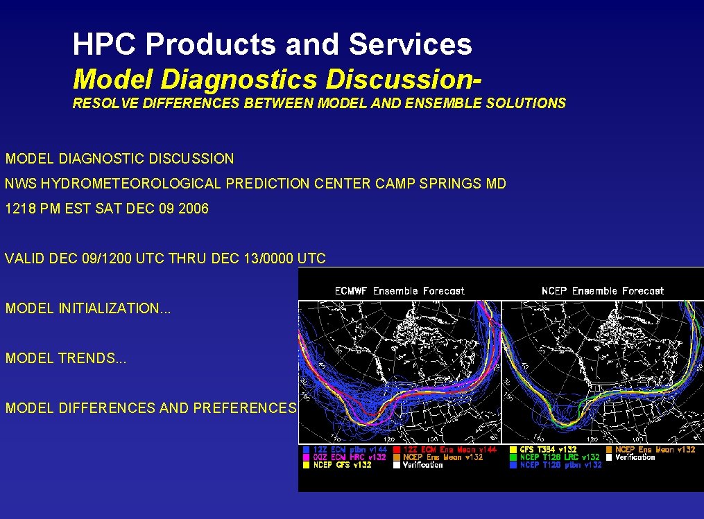
HPC Products and Services Model Diagnostics Discussion. RESOLVE DIFFERENCES BETWEEN MODEL AND ENSEMBLE SOLUTIONS MODEL DIAGNOSTIC DISCUSSION NWS HYDROMETEOROLOGICAL PREDICTION CENTER CAMP SPRINGS MD 1218 PM EST SAT DEC 09 2006 VALID DEC 09/1200 UTC THRU DEC 13/0000 UTC MODEL INITIALIZATION. . . MODEL TRENDS. . . MODEL DIFFERENCES AND PREFERENCES. . .

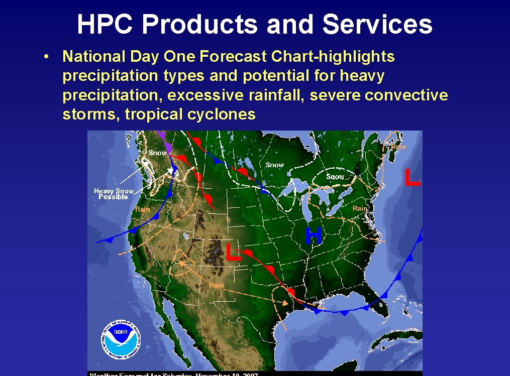
HPC Products and Services • National Day One Forecast Chart-highlights precipitation types and potential for heavy precipitation, excessive rainfall, severe convective storms, tropical cyclones

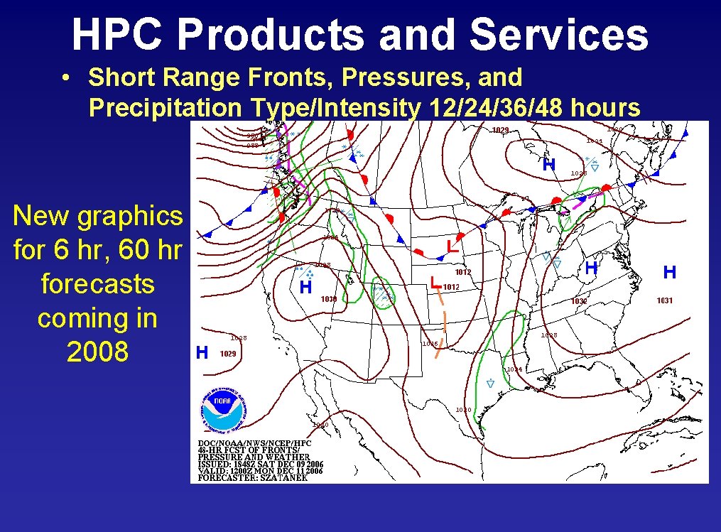
HPC Products and Services • Short Range Fronts, Pressures, and Precipitation Type/Intensity 12/24/36/48 hours New graphics for 6 hr, 60 hr forecasts coming in 2008

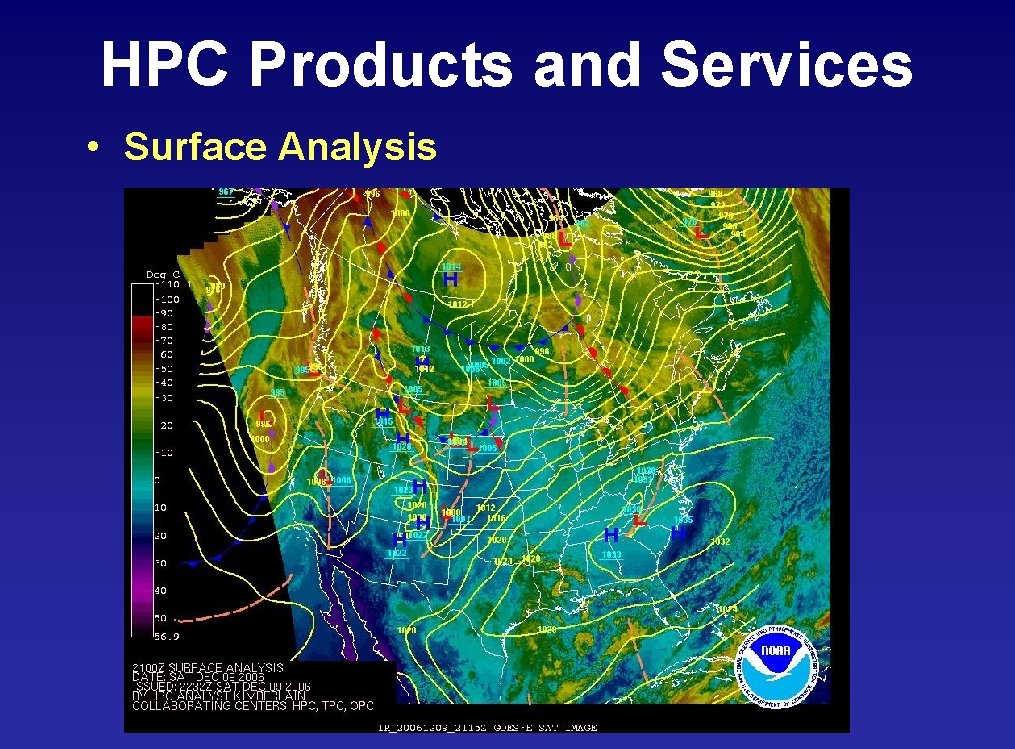
HPC Products and Services • Surface Analysis

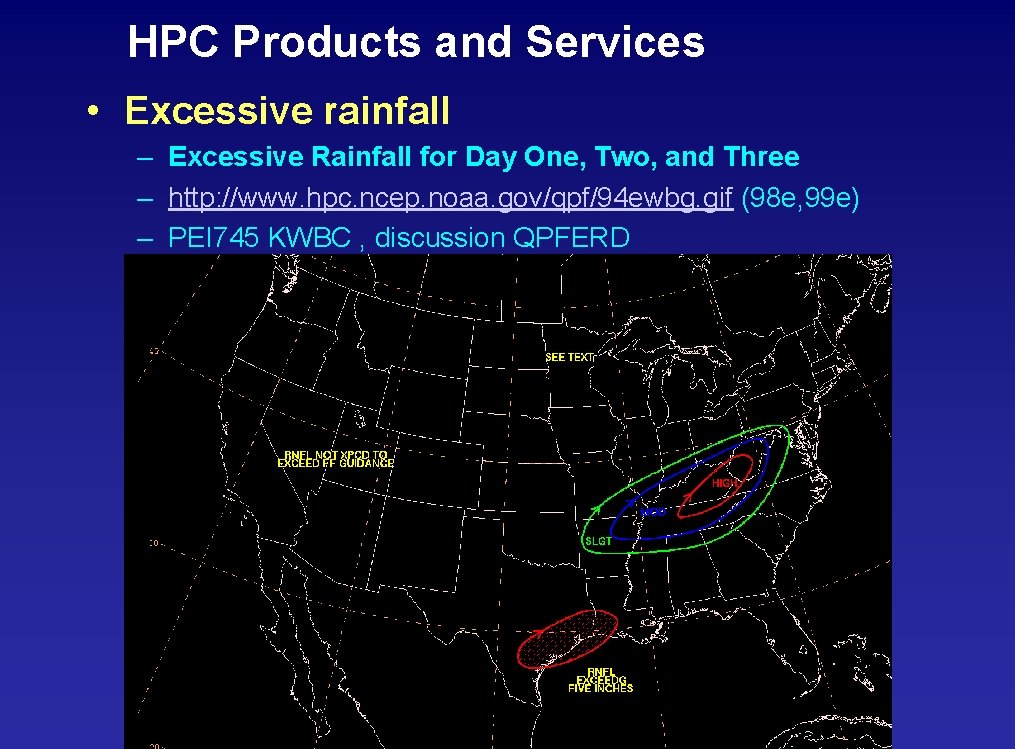
HPC Products and Services • Excessive rainfall – Excessive Rainfall for Day One, Two, and Three – http: //www. hpc. ncep. noaa. gov/qpf/94 ewbg. gif (98 e, 99 e) – PEI 745 KWBC , discussion QPFERD

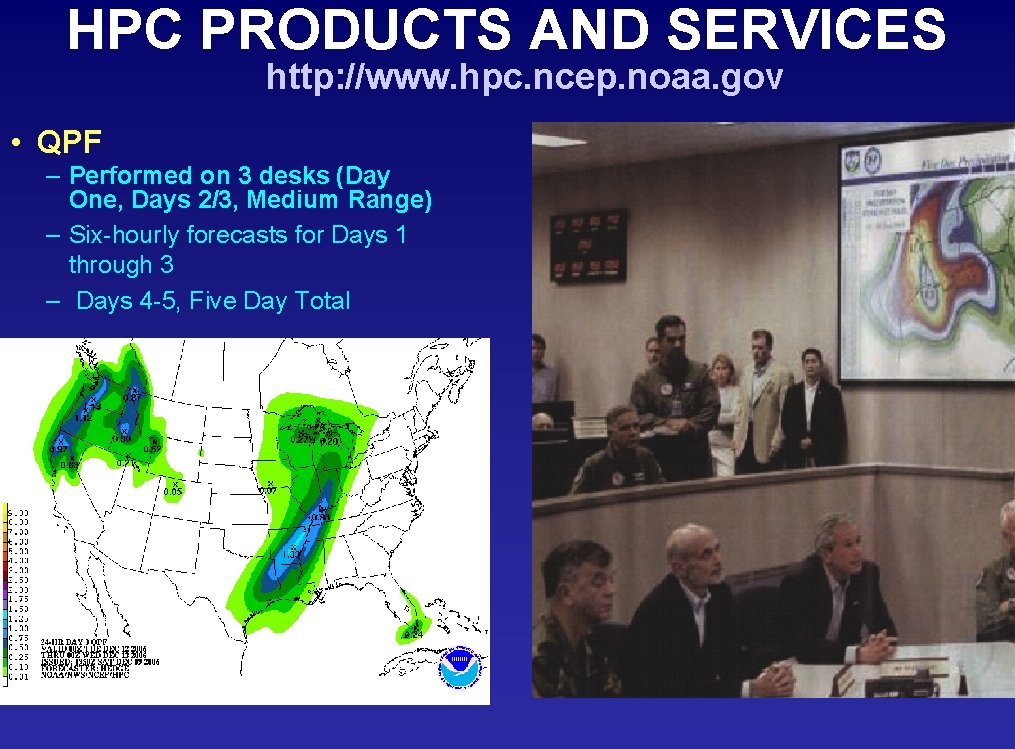
HPC PRODUCTS AND SERVICES http: //www. hpc. ncep. noaa. gov • QPF – Performed on 3 desks (Day One, Days 2/3, Medium Range) – Six-hourly forecasts for Days 1 through 3 – Days 4 -5, Five Day Total

HPC Products and Services QPF Methodology

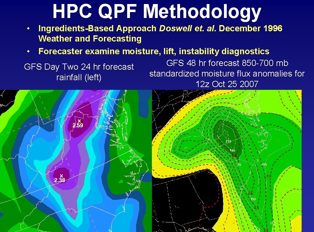
HPC QPF Methodology • Ingredients-Based Approach Doswell et. al. December 1996 Weather and Forecasting • Forecaster examine moisture, lift, instability diagnostics GFS 48 hr forecast 850 -700 mb GFS Day Two 24 hr forecast standardized moisture flux anomalies for rainfall (left) 12 z Oct 25 2007

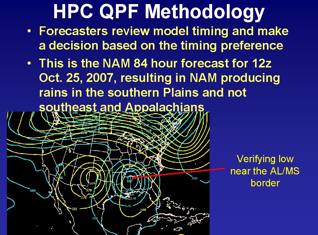
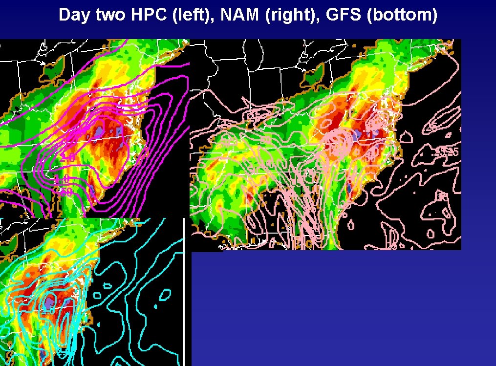
HPC QPF Methodology • Forecasters review model timing and make a decision based on the timing preference • This is the NAM 84 hour forecast for 12 z Oct. 25, 2007, resulting in NAM producing rains in the southern Plains and not southeast and Appalachians Verifying low near the AL/MS border

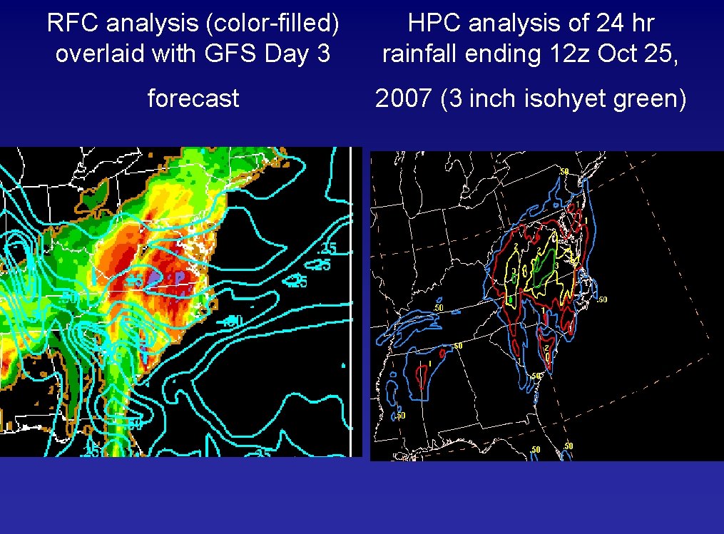
RFC analysis (color-filled) overlaid with GFS Day 3 forecast HPC analysis of 24 hr rainfall ending 12 z Oct 25, 2007 (3 inch isohyet green)

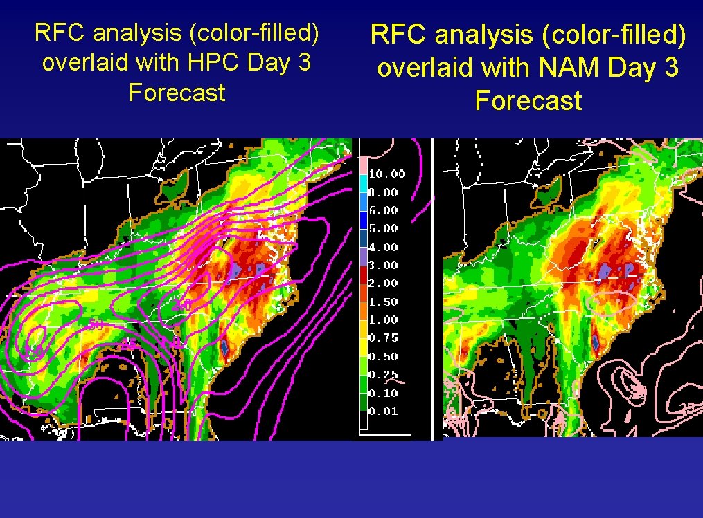
RFC analysis (color-filled) overlaid with HPC Day 3 Forecast RFC analysis (color-filled) overlaid with NAM Day 3 Forecast

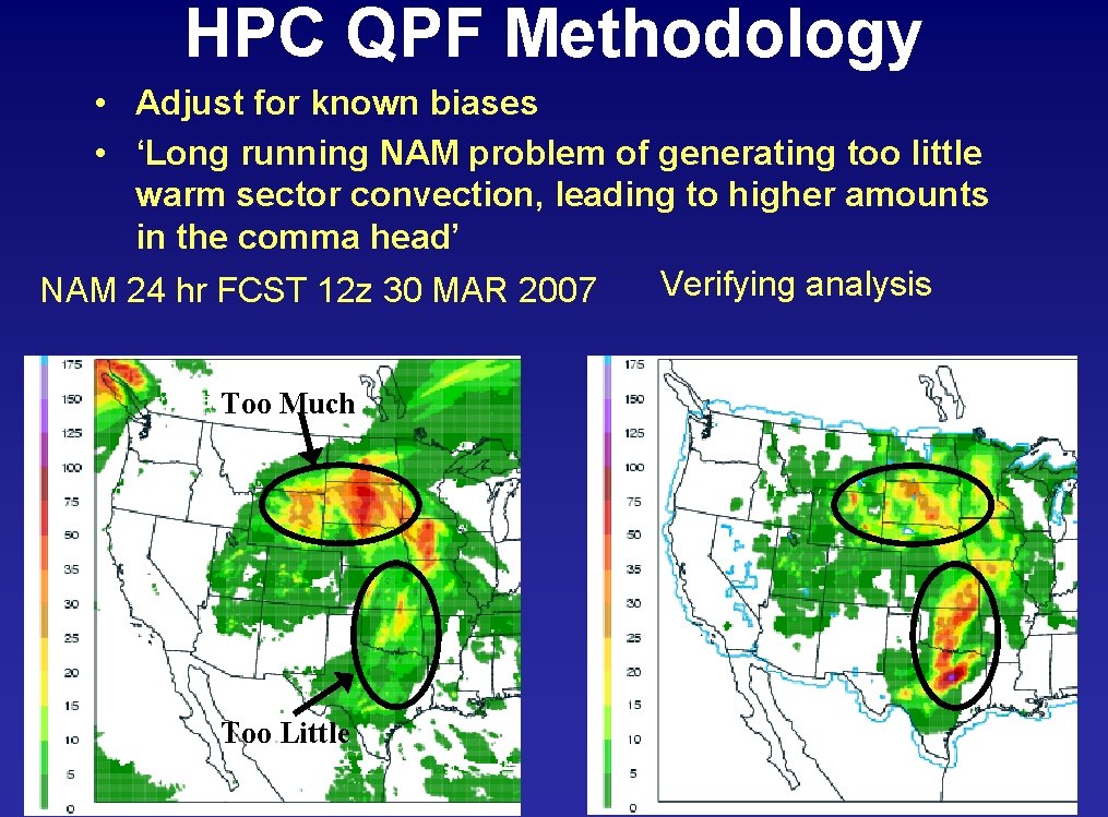
HPC QPF Methodology • Adjust for known biases • ‘Long running NAM problem of generating too little warm sector convection, leading to higher amounts in the comma head’ Verifying analysis hr FCST 12 z 30 MAR 2007 NAM 24 Too Much Too Little

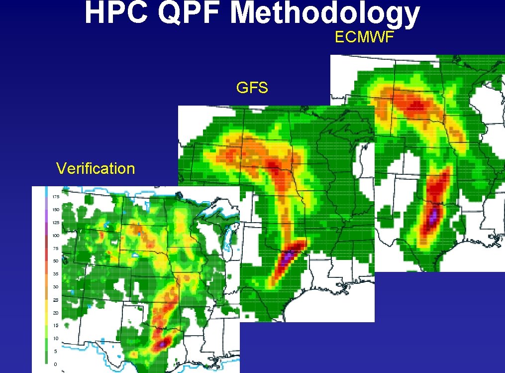
HPC QPF Methodology ECMWF GFS Verification

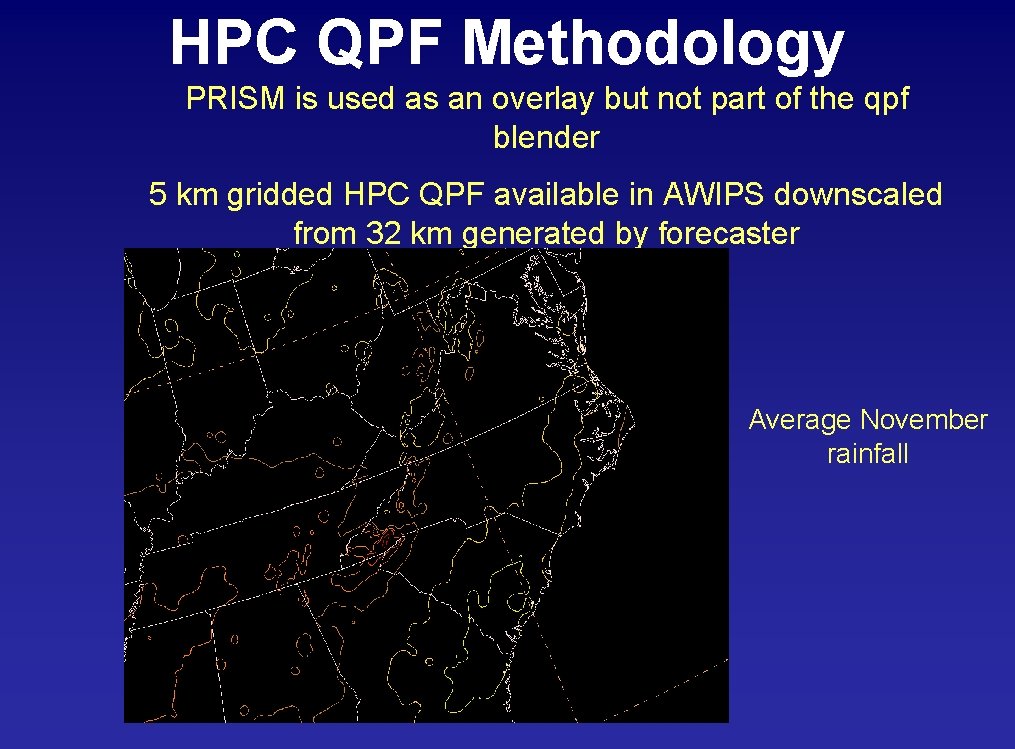
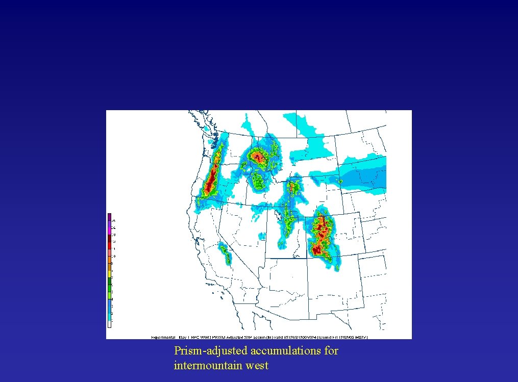
HPC QPF Methodology PRISM is used as an overlay but not part of the qpf blender 5 km gridded HPC QPF available in AWIPS downscaled from 32 km generated by forecaster Average November rainfall

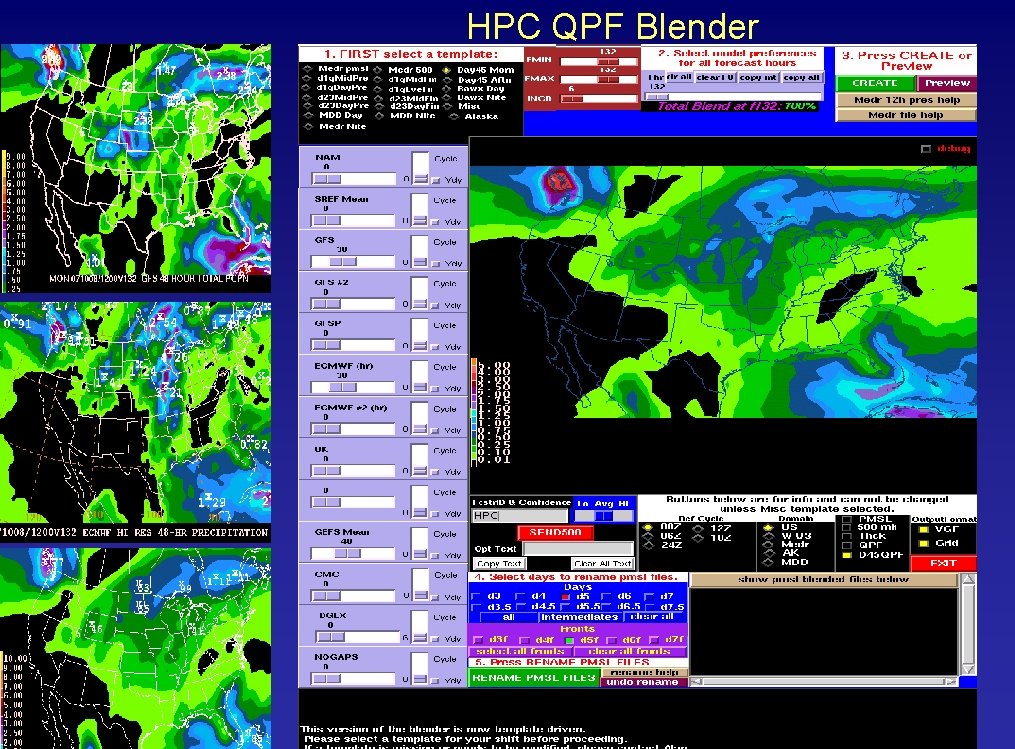
HPC QPF Blender

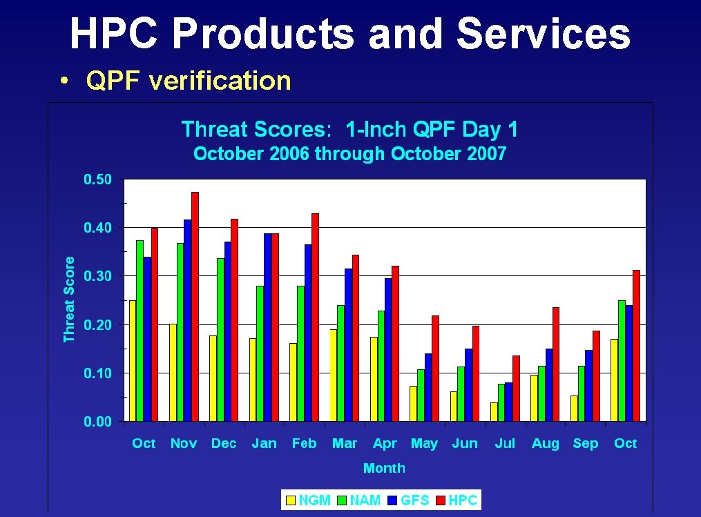
HPC Products and Services • QPF verification

HPC Products and Services Winter Weather Desk

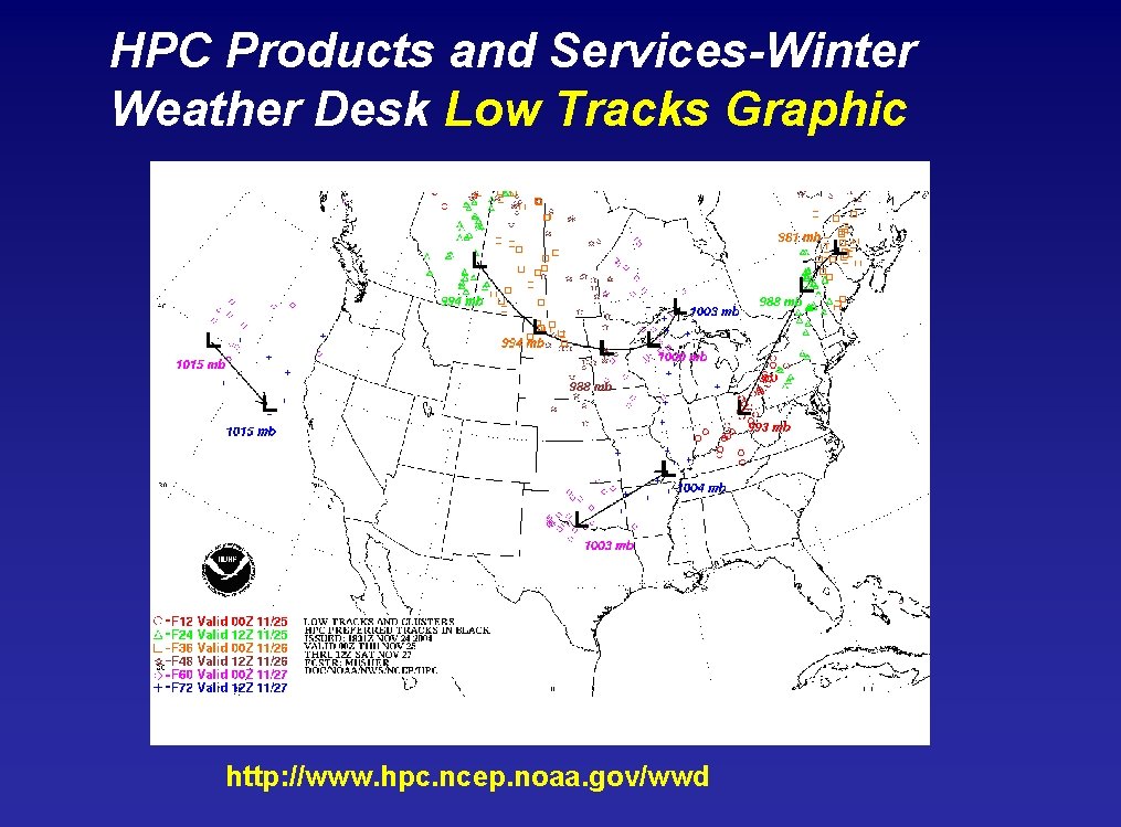
HPC Winter Weather Desk • Twice daily issuance of product suite based on new model guidance 9/15 -5/15 – 24 hour Snow and Ice accumulation probability graphic for days 1 through 3. – Public and technical versions of low tracks graphic depicting synoptic scale surface low tracks associated with heavy snow or ice. – Heavy Snow and Ice Discussion • Intended to complement the deterministic short term snow and ice forecasts issued by local Weather Forecast Offices

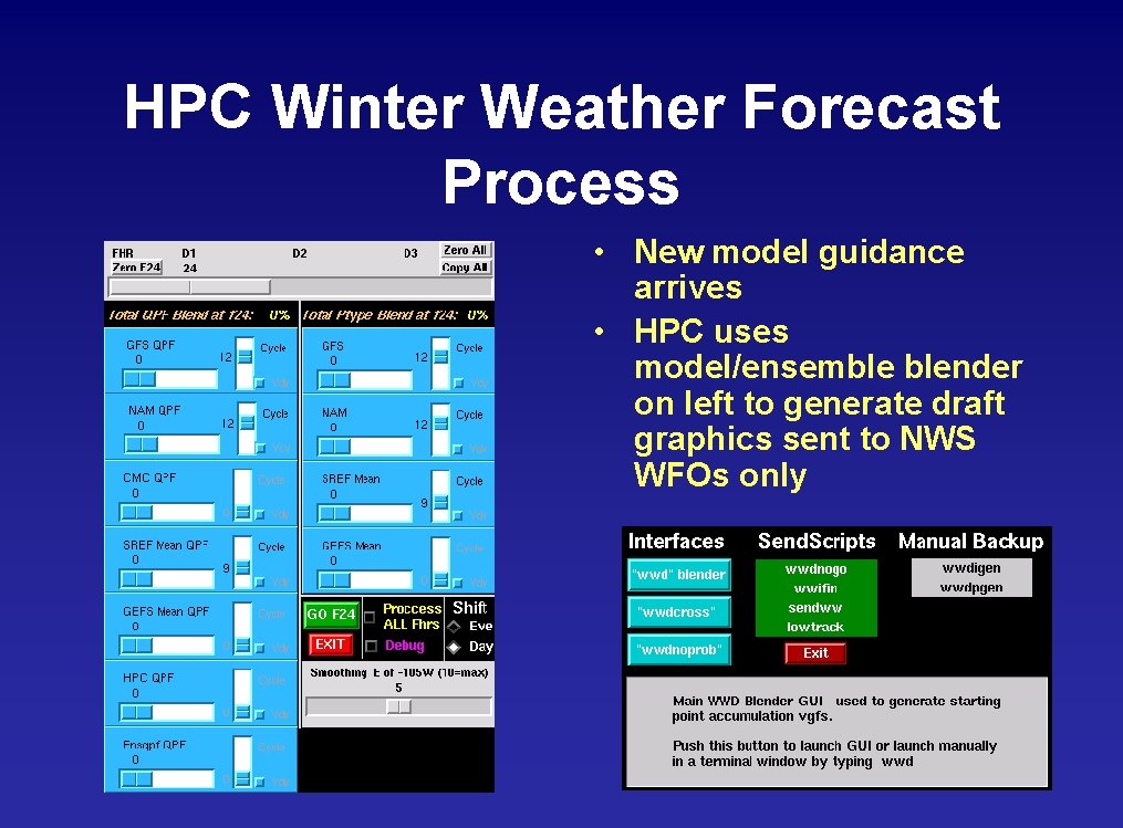
HPC Winter Weather Forecast Process • New model guidance arrives • HPC uses model/ensemble blender on left to generate draft graphics sent to NWS WFOs only

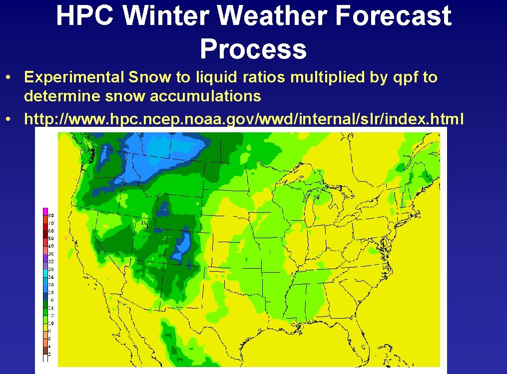
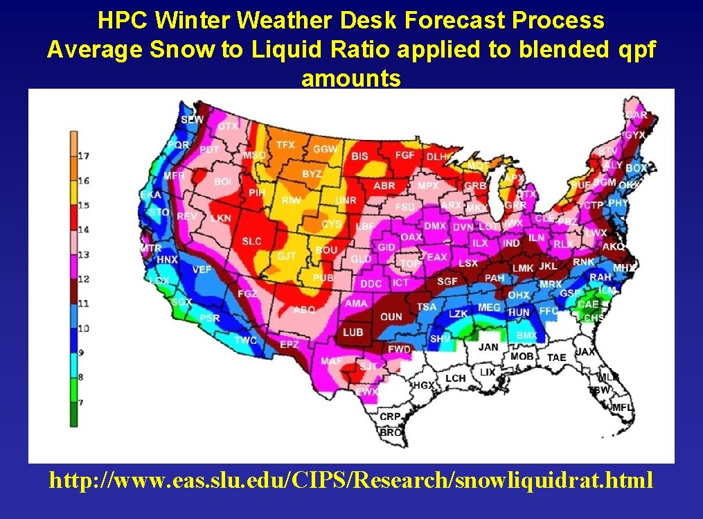
HPC Winter Weather Forecast Process • Experimental Snow to liquid ratios multiplied by qpf to determine snow accumulations • http: //www. hpc. ncep. noaa. gov/wwd/internal/slr/index. html

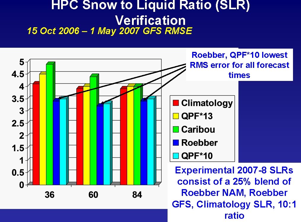
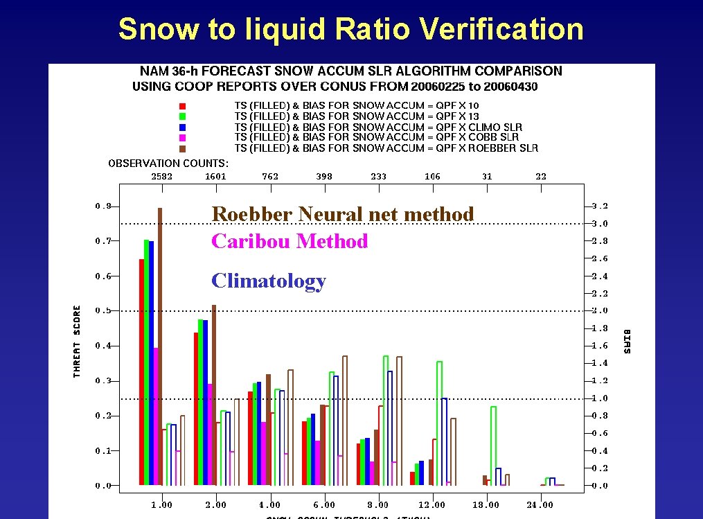
HPC Snow to Liquid Ratio (SLR) Verification 15 Oct 2006 – 1 May 2007 GFS RMSE Roebber, QPF*10 lowest RMS error for all forecast times Experimental 2007 -8 SLRs consist of a 25% blend of Roebber NAM, Roebber GFS, Climatology SLR, 10: 1 ratio

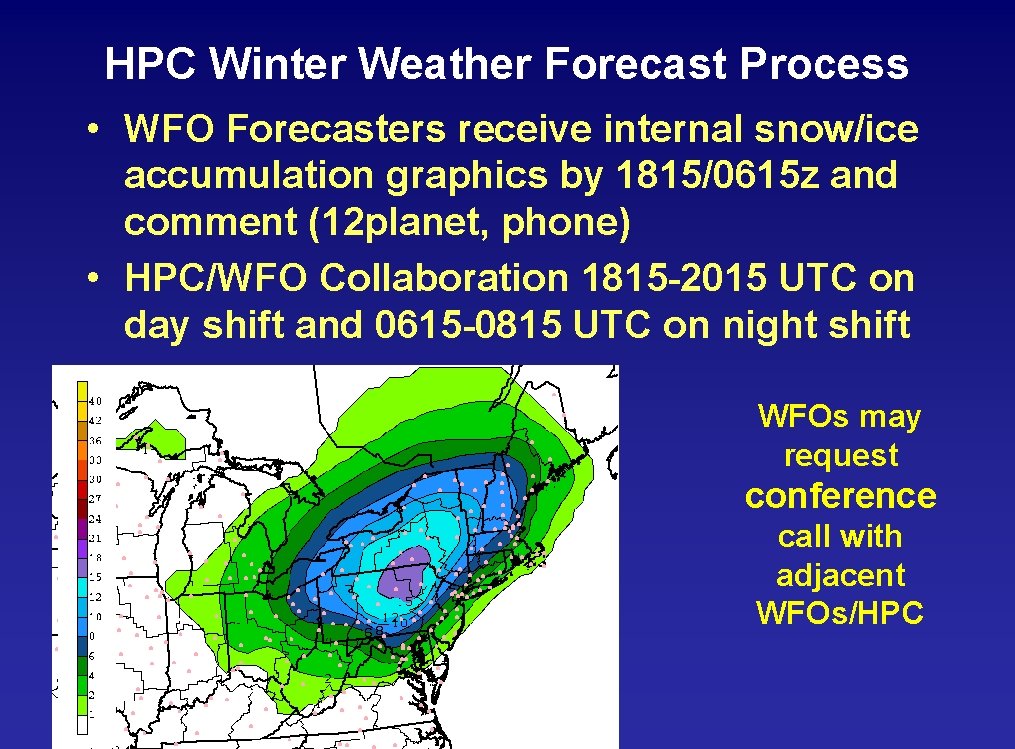
HPC Winter Weather Forecast Process • WFO Forecasters receive internal snow/ice accumulation graphics by 1815/0615 z and comment (12 planet, phone) • HPC/WFO Collaboration 1815 -2015 UTC on day shift and 0615 -0815 UTC on night shift WFOs may request conference call with adjacent WFOs/HPC

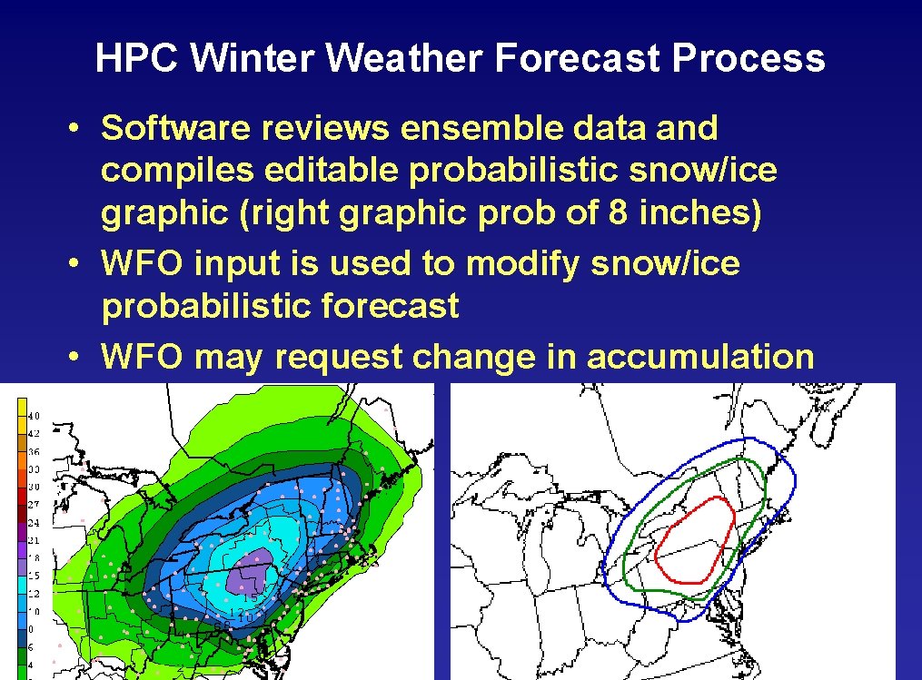
HPC Winter Weather Forecast Process • Software reviews ensemble data and compiles editable probabilistic snow/ice graphic (right graphic prob of 8 inches) • WFO input is used to modify snow/ice probabilistic forecast • WFO may request change in accumulation

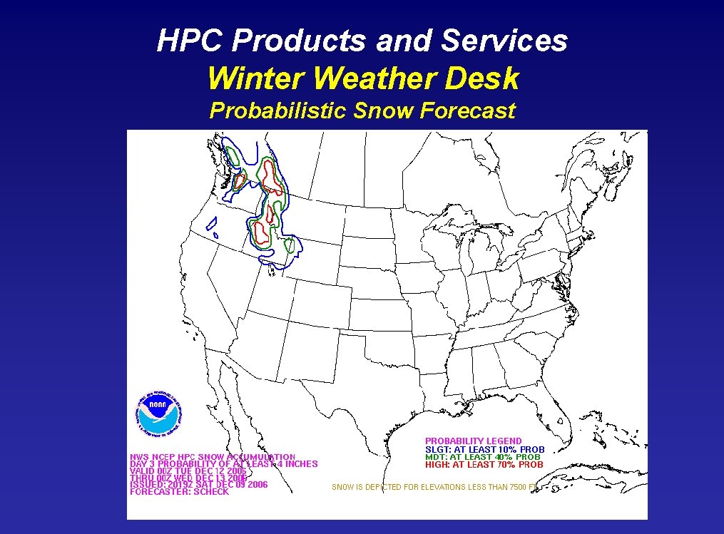
HPC Products and Services Winter Weather Desk Probabilistic Snow Forecast

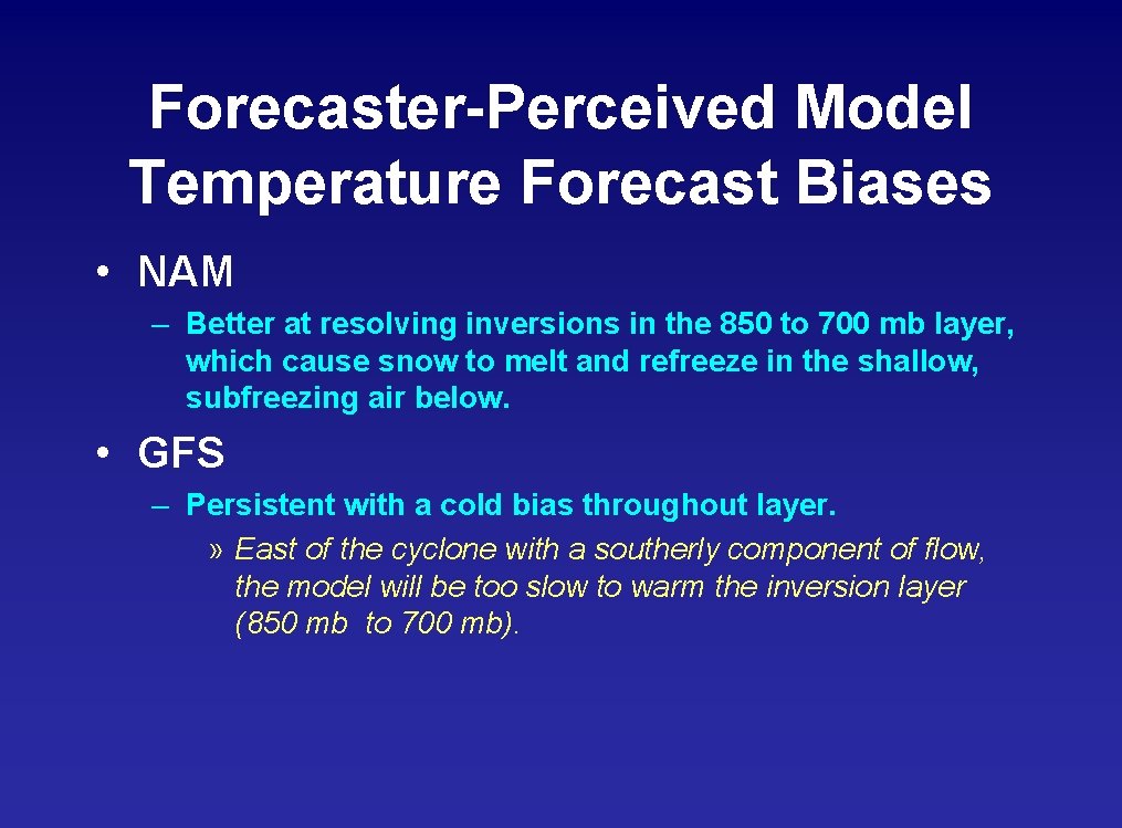
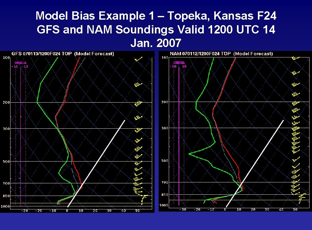
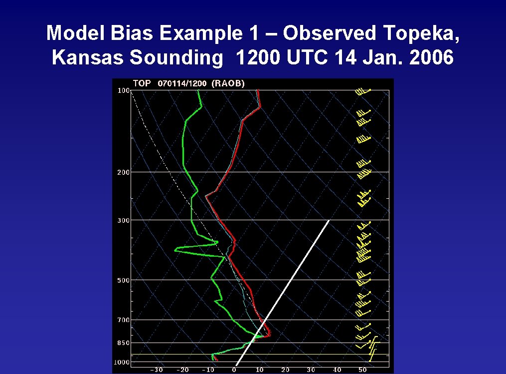
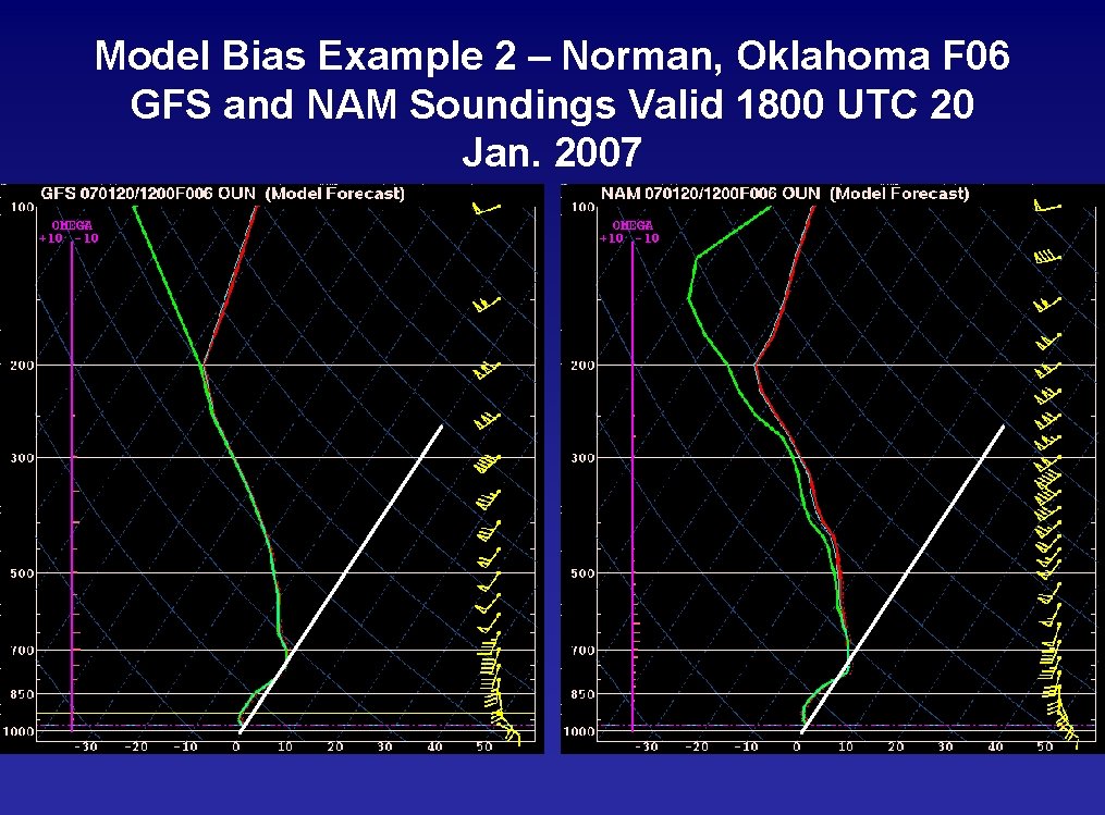
Forecaster-Perceived Model Temperature Forecast Biases • NAM – Better at resolving inversions in the 850 to 700 mb layer, which cause snow to melt and refreeze in the shallow, subfreezing air below. • GFS – Persistent with a cold bias throughout layer. » East of the cyclone with a southerly component of flow, the model will be too slow to warm the inversion layer (850 mb to 700 mb).

Model Bias Example 1 – Topeka, Kansas F 24 GFS and NAM Soundings Valid 1200 UTC 14 Jan. 2007

Model Bias Example 1 – Observed Topeka, Kansas Sounding 1200 UTC 14 Jan. 2006

Model Bias Example 2 – Norman, Oklahoma F 06 GFS and NAM Soundings Valid 1800 UTC 20 Jan. 2007

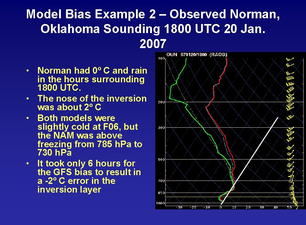
Model Bias Example 2 – Observed Norman, Oklahoma Sounding 1800 UTC 20 Jan. 2007 • Norman had 0º C and rain in the hours surrounding 1800 UTC. • The nose of the inversion was about 2º C • Both models were slightly cold at F 06, but the NAM was above freezing from 785 h. Pa to 730 h. Pa • It took only 6 hours for the GFS bias to result in a -2º C error in the inversion layer

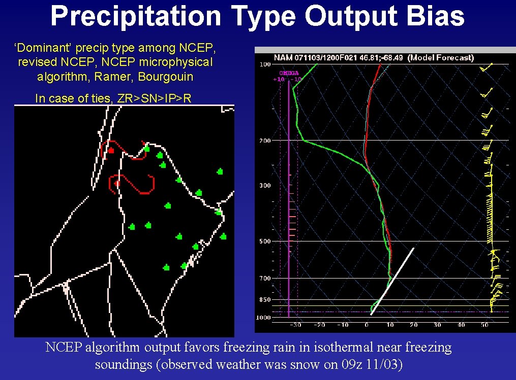
Precipitation Type Output Bias ‘Dominant’ precip type among NCEP, revised NCEP, NCEP microphysical algorithm, Ramer, Bourgouin In case of ties, ZR>SN>IP>R NCEP algorithm output favors freezing rain in isothermal near freezing soundings (observed weather was snow on 09 z 11/03)

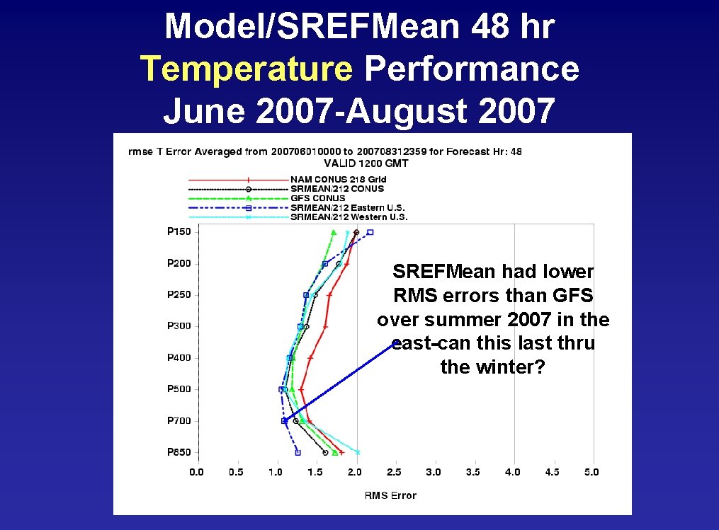
Model/SREFMean 48 hr Temperature Performance June 2007 -August 2007 SREFMean had lower RMS errors than GFS over summer 2007 in the east-can this last thru the winter?

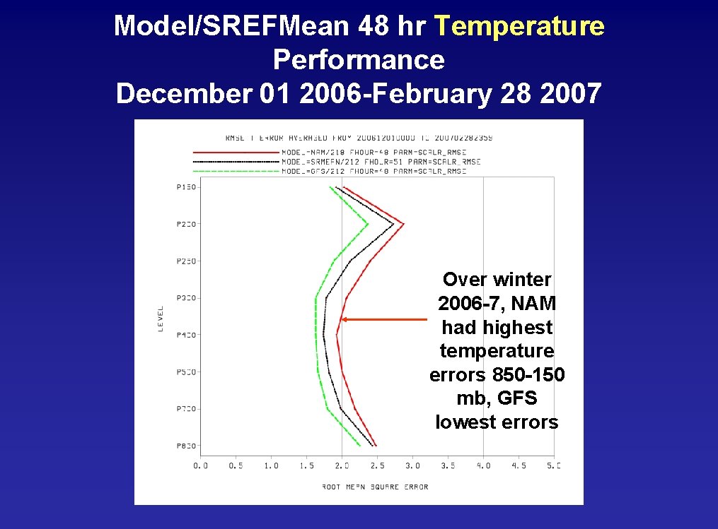
Model/SREFMean 48 hr Temperature Performance December 01 2006 -February 28 2007 Over winter 2006 -7, NAM had highest temperature errors 850 -150 mb, GFS lowest errors

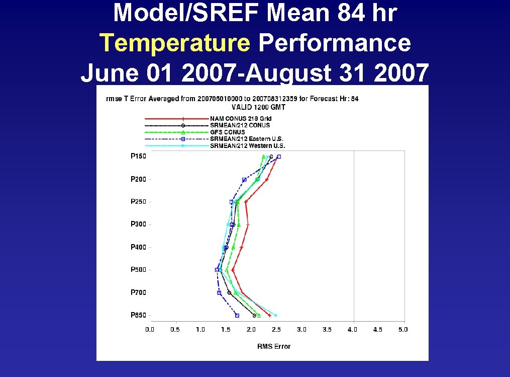
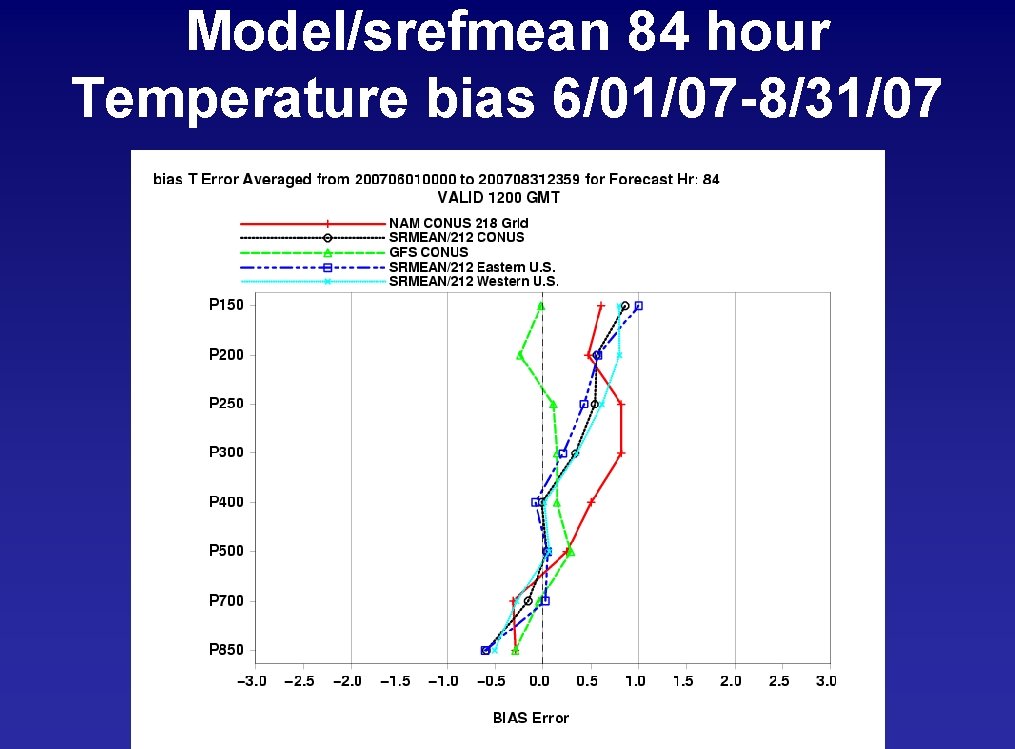
Model/SREF Mean 84 hr Temperature Performance June 01 2007 -August 31 2007

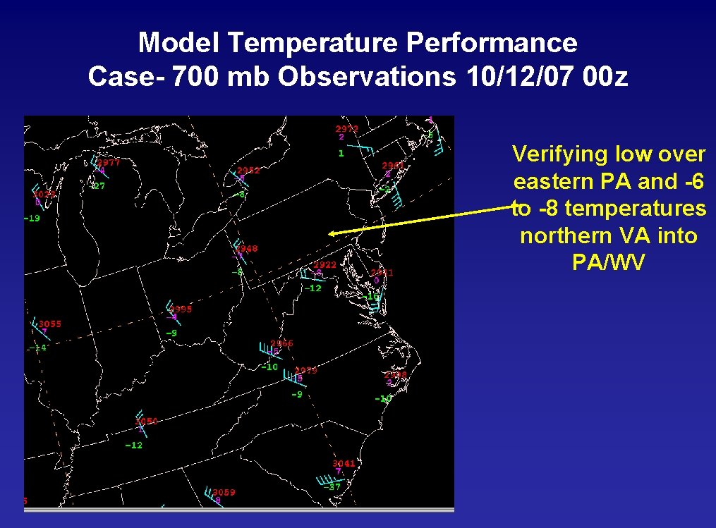
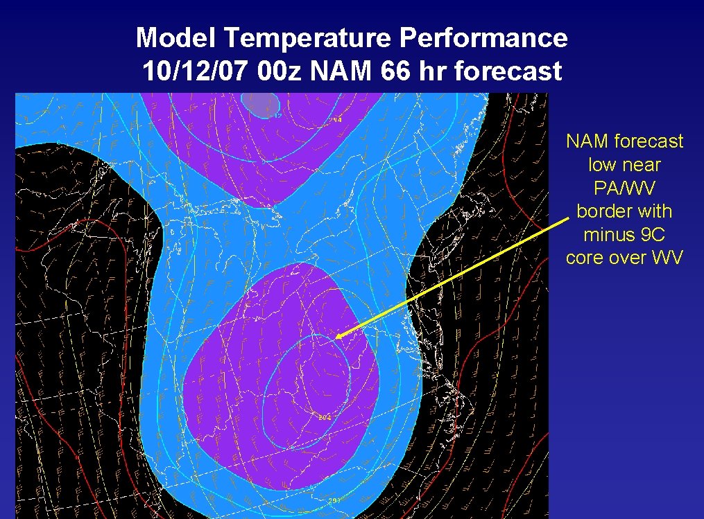
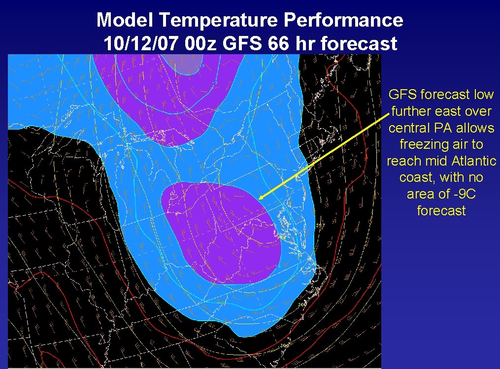
Model Temperature Performance Case- 700 mb Observations 10/12/07 00 z Verifying low over eastern PA and -6 to -8 temperatures northern VA into PA/WV

Model Temperature Performance 10/12/07 00 z NAM 66 hr forecast NAM forecast low near PA/WV border with minus 9 C core over WV

Model Temperature Performance 10/12/07 00 z GFS 66 hr forecast GFS forecast low further east over central PA allows freezing air to reach mid Atlantic coast, with no area of -9 C forecast

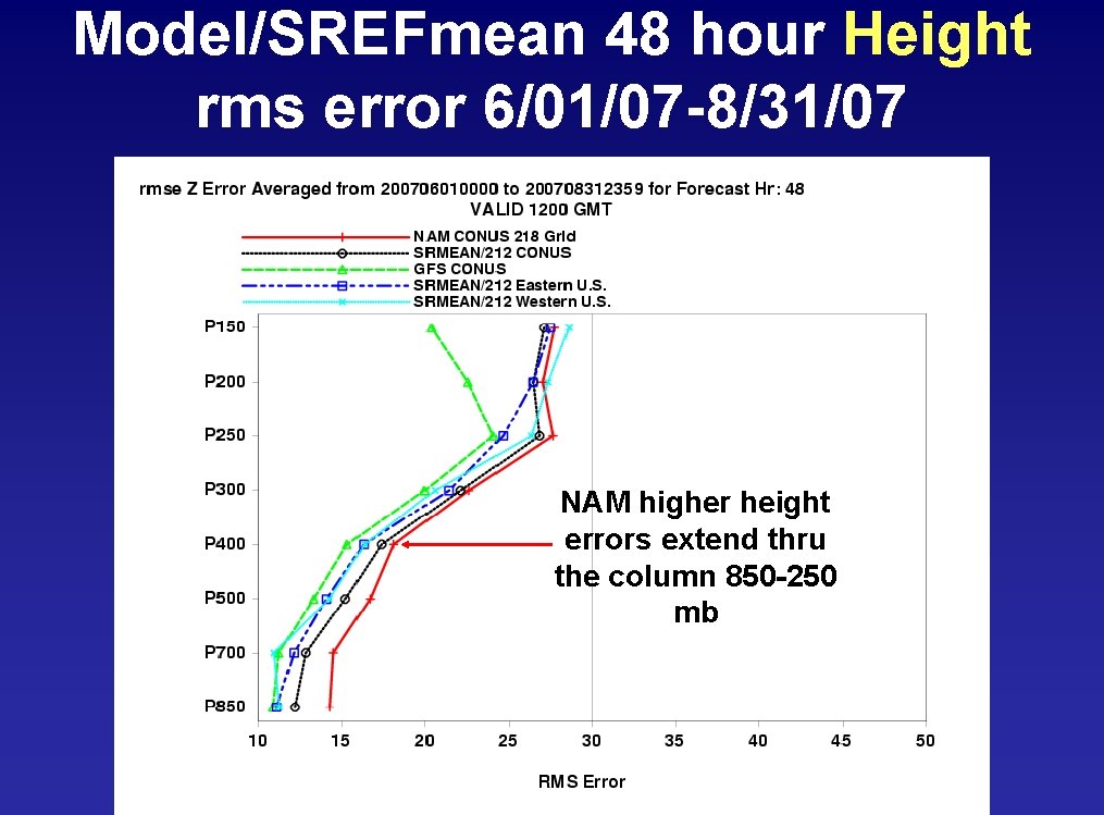
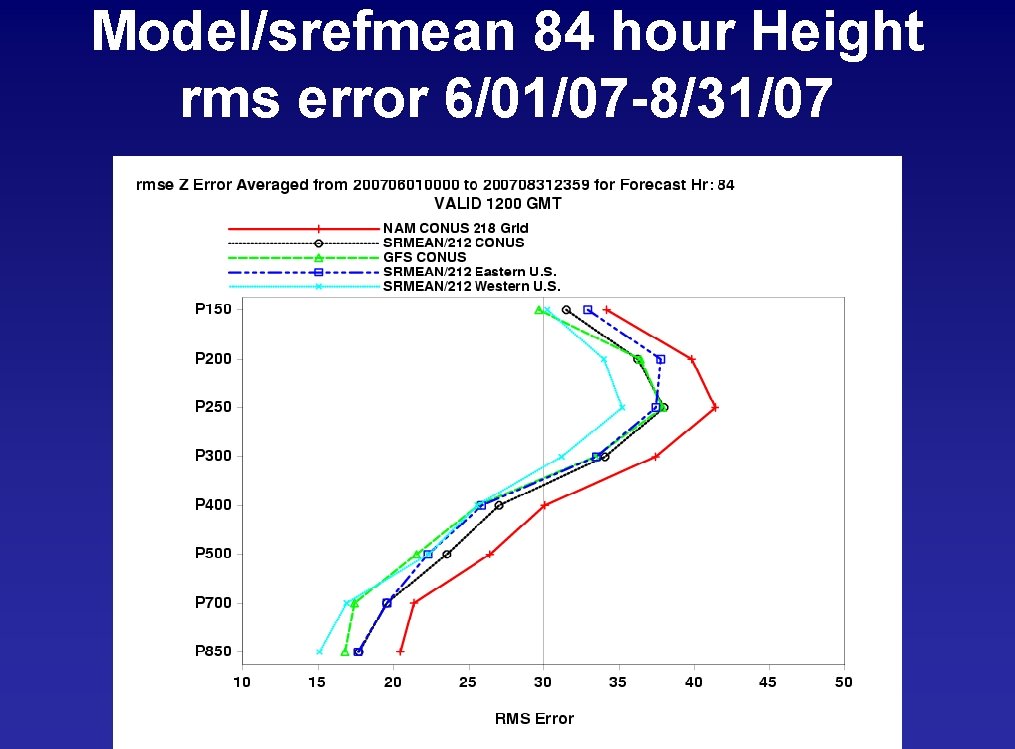
Model/SREFmean 48 hour Height rms error 6/01/07 -8/31/07 NAM higher height errors extend thru the column 850 -250 mb

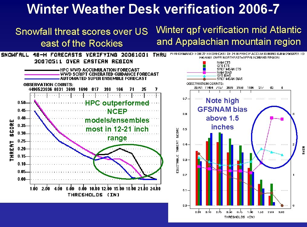
Winter Weather Desk verification 2006 -7 Snowfall threat scores over US Winter qpf verification mid Atlantic and Appalachian mountain region east of the Rockies HPC outperformed NCEP models/ensembles most in 12 -21 inch range Note high GFS/NAM bias above 1. 5 inches

HPC Products and Services-Winter Weather Desk Low Tracks Graphic http: //www. hpc. ncep. noaa. gov/wwd

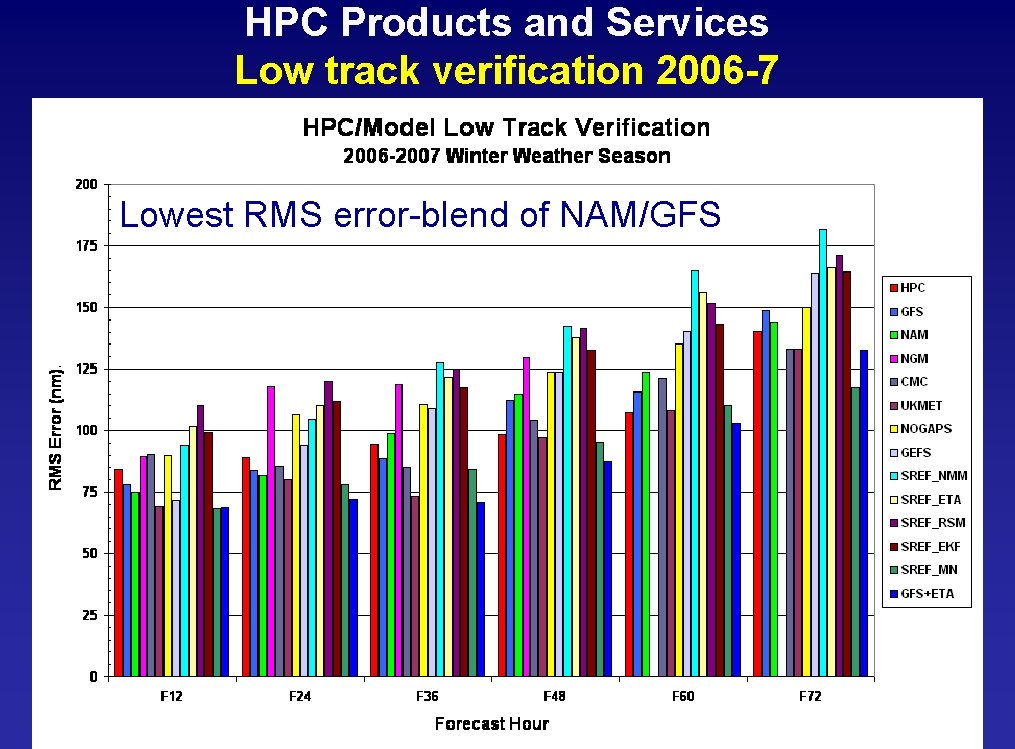
HPC Products and Services Low track verification 2006 -7 Lowest RMS error-blend of NAM/GFS

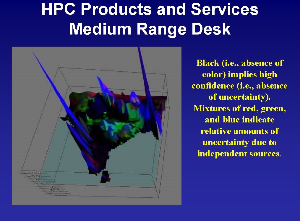
HPC Products and Services Medium Range Desk Black (i. e. , absence of color) implies high confidence (i. e. , absence of uncertainty). Mixtures of red, green, and blue indicate relative amounts of uncertainty due to independent sources.

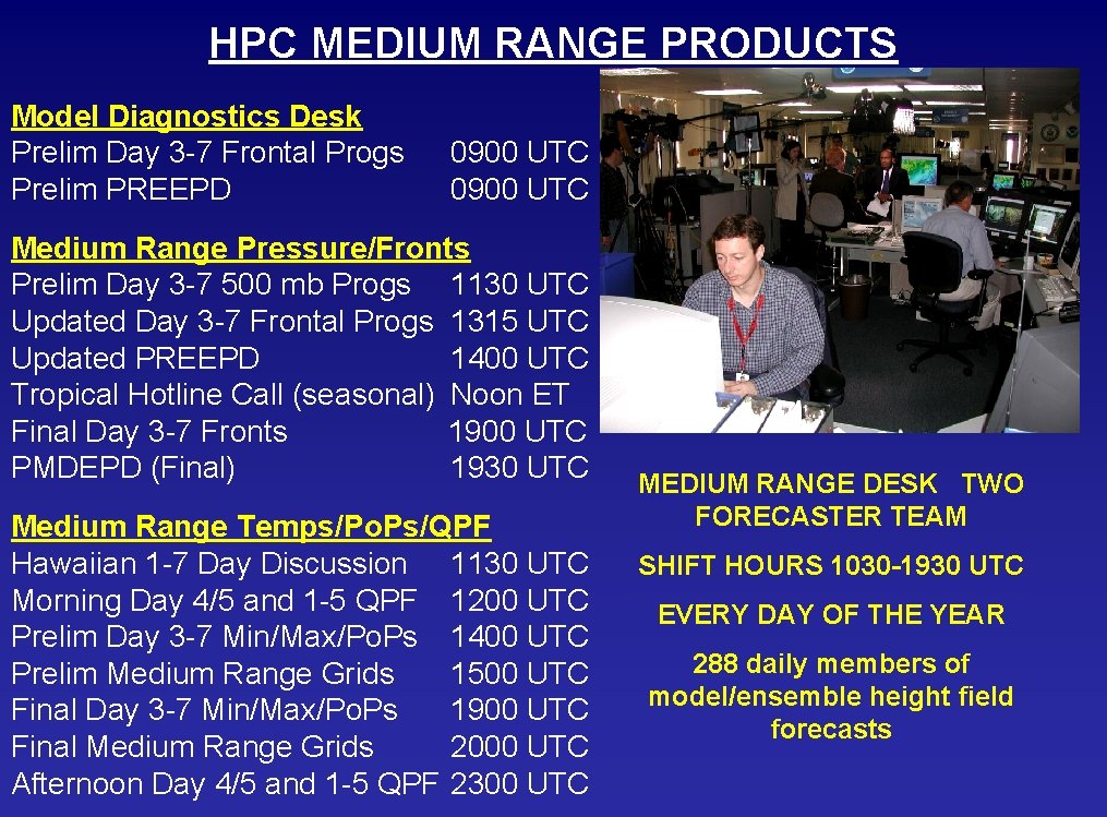
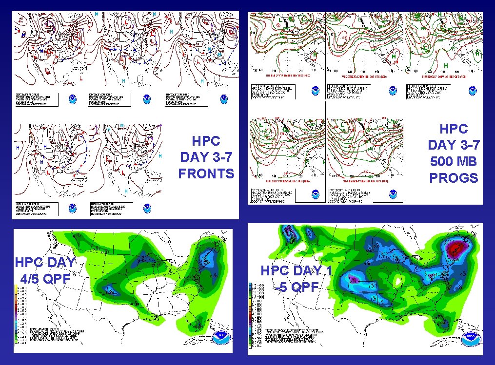
HPC MEDIUM RANGE PRODUCTS Model Diagnostics Desk Prelim Day 3 -7 Frontal Progs Prelim PREEPD 0900 UTC Medium Range Pressure/Fronts Prelim Day 3 -7 500 mb Progs 1130 UTC Updated Day 3 -7 Frontal Progs 1315 UTC Updated PREEPD 1400 UTC Tropical Hotline Call (seasonal) Noon ET Final Day 3 -7 Fronts 1900 UTC PMDEPD (Final) 1930 UTC Medium Range Temps/Po. Ps/QPF Hawaiian 1 -7 Day Discussion 1130 UTC Morning Day 4/5 and 1 -5 QPF 1200 UTC Prelim Day 3 -7 Min/Max/Po. Ps 1400 UTC Prelim Medium Range Grids 1500 UTC Final Day 3 -7 Min/Max/Po. Ps 1900 UTC Final Medium Range Grids 2000 UTC Afternoon Day 4/5 and 1 -5 QPF 2300 UTC MEDIUM RANGE DESK TWO FORECASTER TEAM SHIFT HOURS 1030 -1930 UTC EVERY DAY OF THE YEAR 288 daily members of model/ensemble height field forecasts

HPC DAY 3 -7 500 MB PROGS HPC DAY 3 -7 FRONTS HPC DAY 4/5 QPF HPC DAY 1 -5 QPF

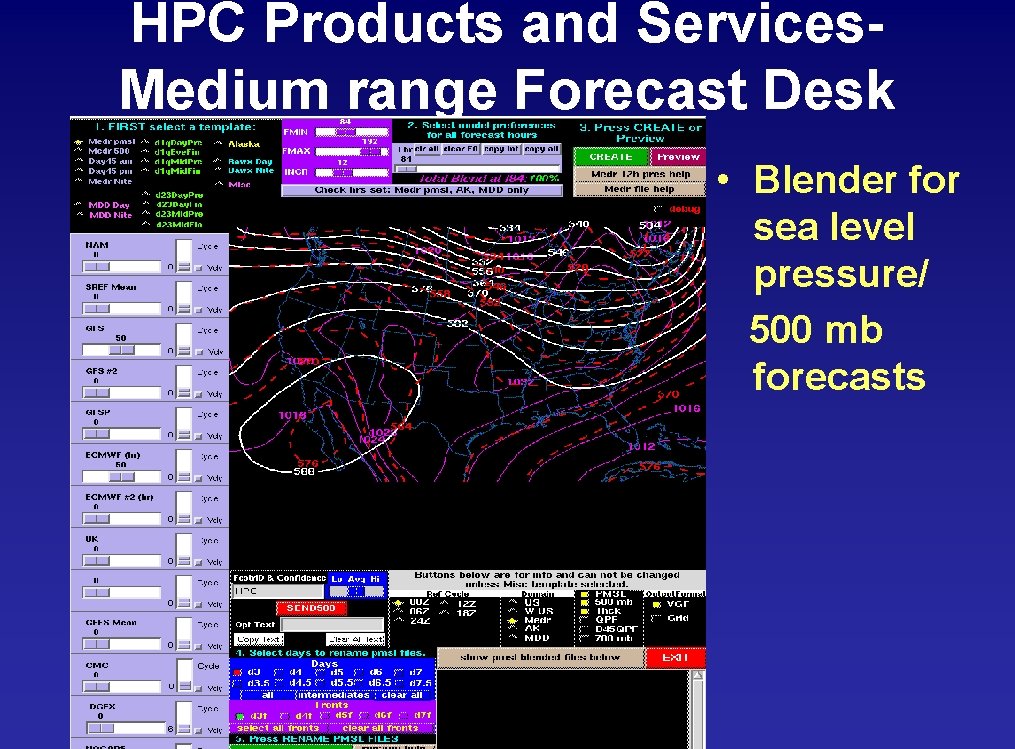
HPC Products and Services. Medium range Forecast Desk • Blender for sea level pressure/ 500 mb forecasts

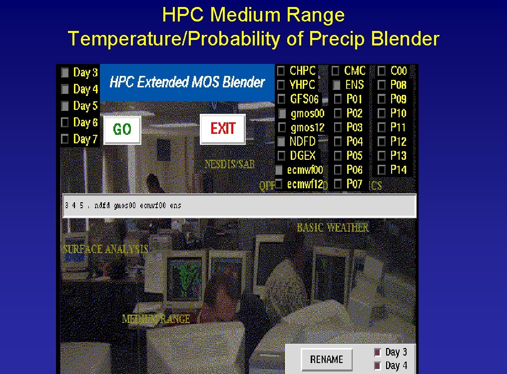
HPC Medium Range Temperature/Probability of Precip Blender

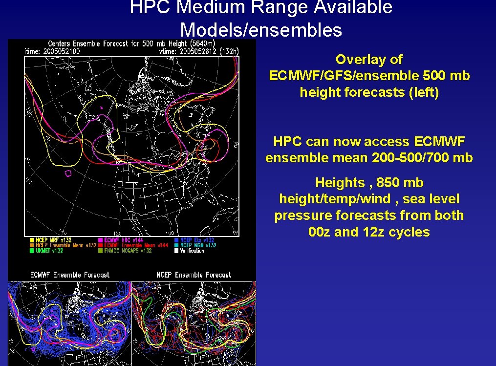
HPC Medium Range Available Models/ensembles Overlay of ECMWF/GFS/ensemble 500 mb height forecasts (left) HPC can now access ECMWF ensemble mean 200 -500/700 mb Heights , 850 mb height/temp/wind , sea level pressure forecasts from both 00 z and 12 z cycles

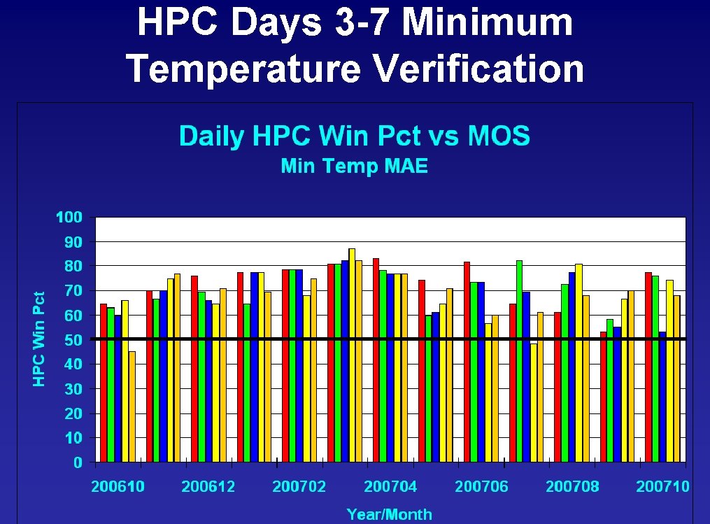
HPC Days 3 -7 Minimum Temperature Verification

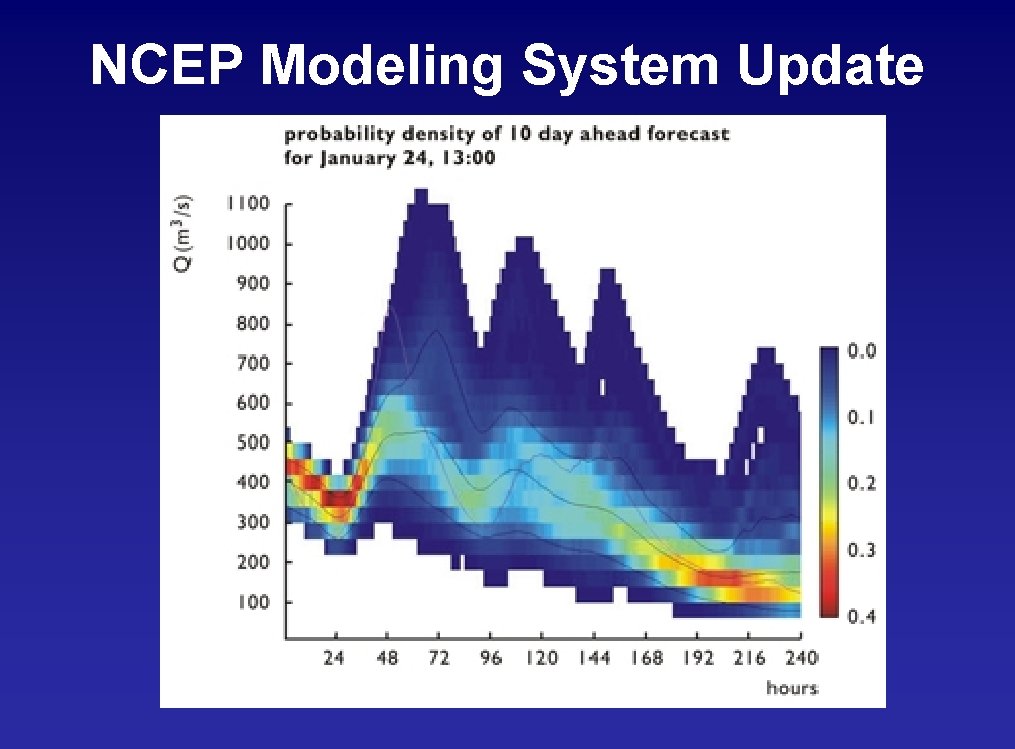
NCEP Modeling System Update

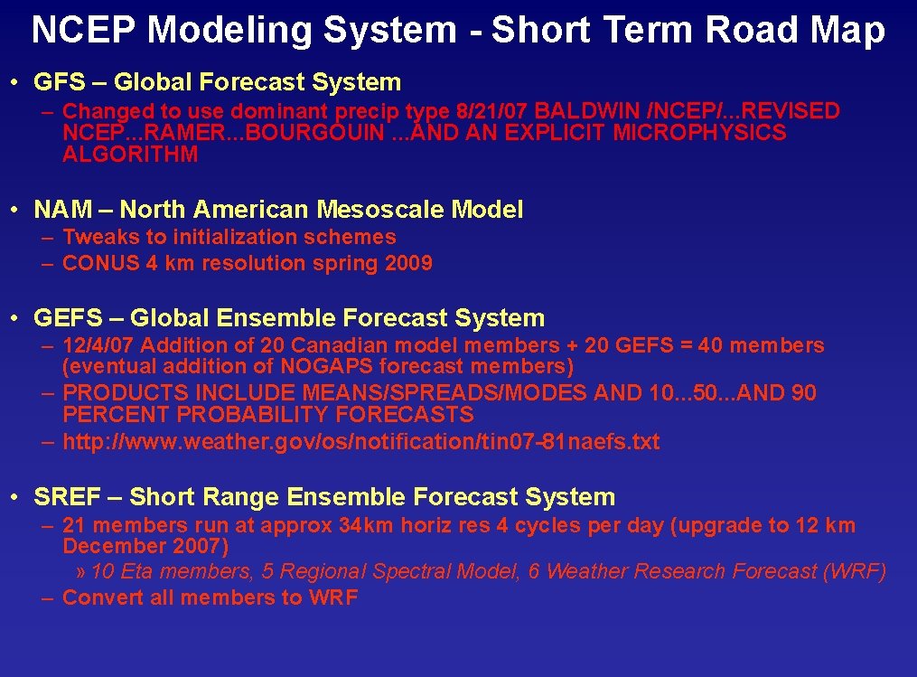
NCEP Modeling System - Short Term Road Map • GFS – Global Forecast System – Changed to use dominant precip type 8/21/07 BALDWIN /NCEP/. . . REVISED NCEP. . . RAMER. . . BOURGOUIN. . . AND AN EXPLICIT MICROPHYSICS ALGORITHM • NAM – North American Mesoscale Model – Tweaks to initialization schemes – CONUS 4 km resolution spring 2009 • GEFS – Global Ensemble Forecast System – 12/4/07 Addition of 20 Canadian model members + 20 GEFS = 40 members (eventual addition of NOGAPS forecast members) – PRODUCTS INCLUDE MEANS/SPREADS/MODES AND 10. . . 50. . . AND 90 PERCENT PROBABILITY FORECASTS – http: //www. weather. gov/os/notification/tin 07 -81 naefs. txt • SREF – Short Range Ensemble Forecast System – 21 members run at approx 34 km horiz res 4 cycles per day (upgrade to 12 km December 2007) » 10 Eta members, 5 Regional Spectral Model, 6 Weather Research Forecast (WRF) – Convert all members to WRF

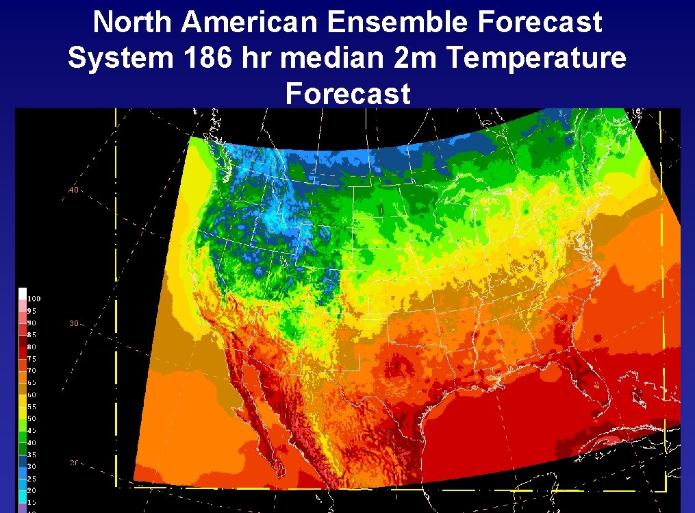
North American Ensemble Forecast System 186 hr median 2 m Temperature Forecast

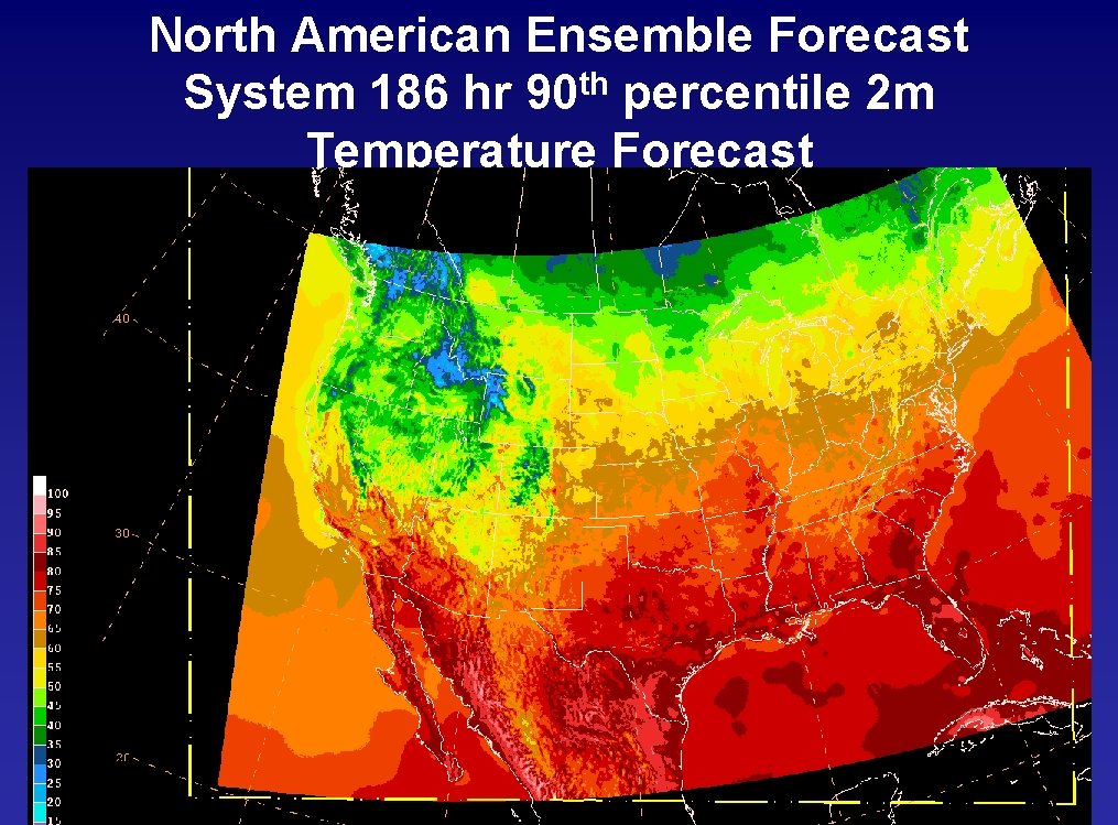
North American Ensemble Forecast System 186 hr 90 th percentile 2 m Temperature Forecast

Questions ? ? ?

HPC Winter Weather Desk Forecast Process Average Snow to Liquid Ratio applied to blended qpf amounts http: //www. eas. slu. edu/CIPS/Research/snowliquidrat. html

Snow to liquid Ratio Verification Roebber Neural net method Caribou Method Climatology

Prism-adjusted accumulations for intermountain west

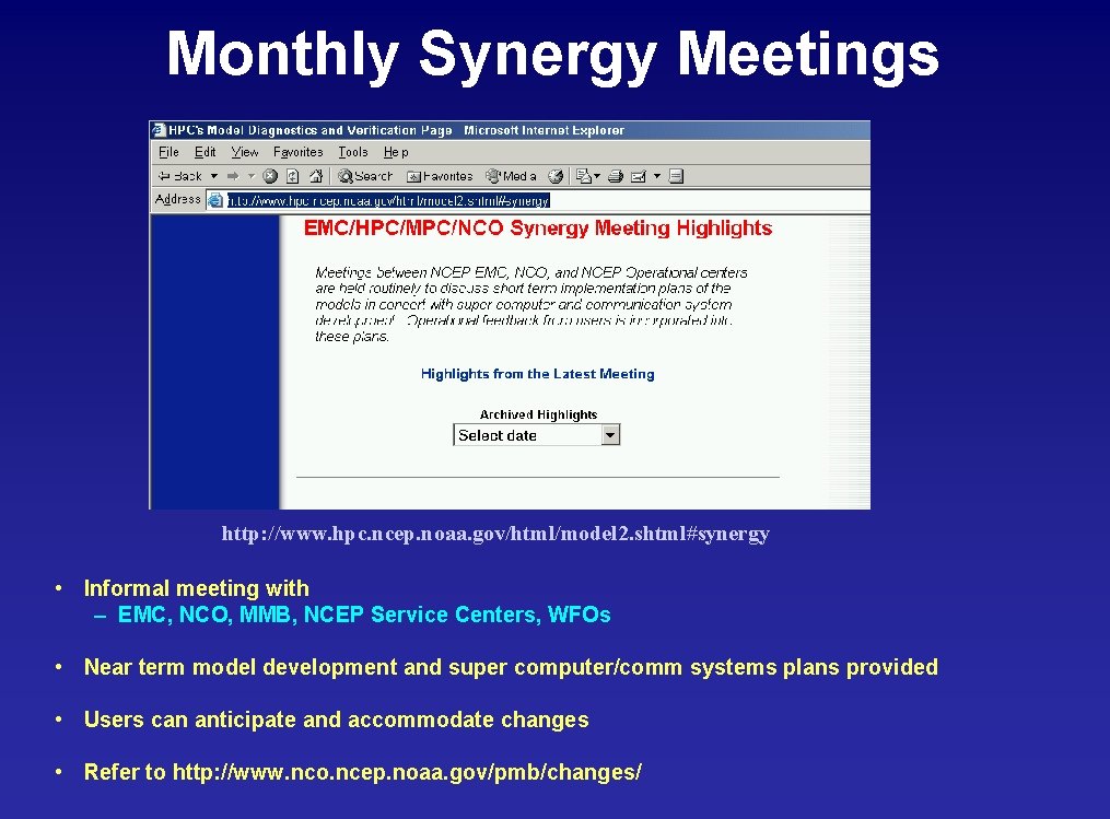
Monthly Synergy Meetings http: //www. hpc. ncep. noaa. gov/html/model 2. shtml#synergy • Informal meeting with – EMC, NCO, MMB, NCEP Service Centers, WFOs • Near term model development and super computer/comm systems plans provided • Users can anticipate and accommodate changes • Refer to http: //www. nco. ncep. noaa. gov/pmb/changes/

• Flash Flood Forecasting: An Ingredients. Based Methodology Doswell, Brooks, and Maddox Weather and Forecasting December 1996 pp. 560– 581

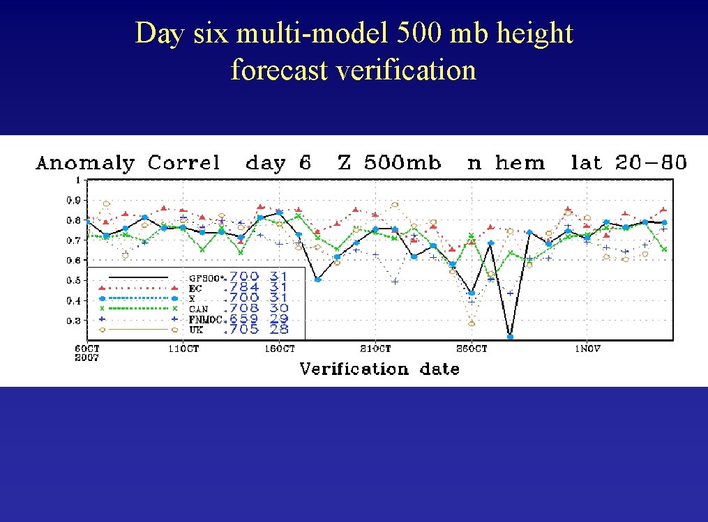
Day six multi-model 500 mb height forecast verification

HPC Days 3 -7 Forecast Methodology • Forecasters modify max/min temperatures and 12 hr Po. Ps at up to 384 points. • Dew point, cloud cover, winds, and precipitation type generated from HPC temperature, Po. P and surface progs. • Forecasters cannot edit these fields. • Basic philosophy is to generate a set of grids that are consistent with the manually generated forecasts • Forecasters can modify MOS point forecasts directly or use a blending tool. – Blender allows forecasters to select a mix of models, ensembles, and current NDFD grids, assign weights, and use the resultant temperatures and Po. Ps as a starting point. These can then be manually modified.

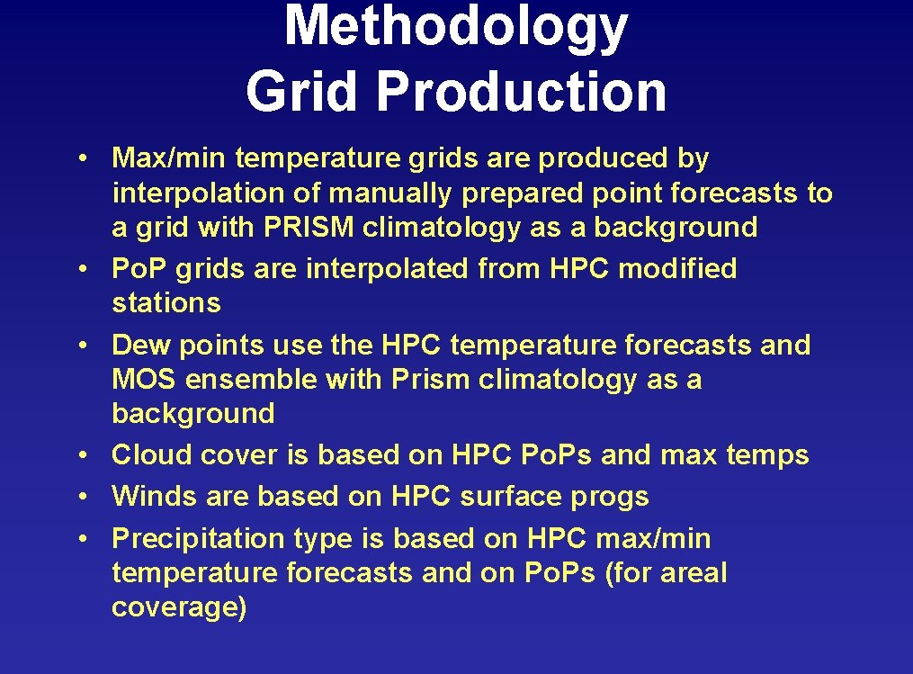
Methodology Grid Production • Max/min temperature grids are produced by interpolation of manually prepared point forecasts to a grid with PRISM climatology as a background • Po. P grids are interpolated from HPC modified stations • Dew points use the HPC temperature forecasts and MOS ensemble with Prism climatology as a background • Cloud cover is based on HPC Po. Ps and max temps • Winds are based on HPC surface progs • Precipitation type is based on HPC max/min temperature forecasts and on Po. Ps (for areal coverage)

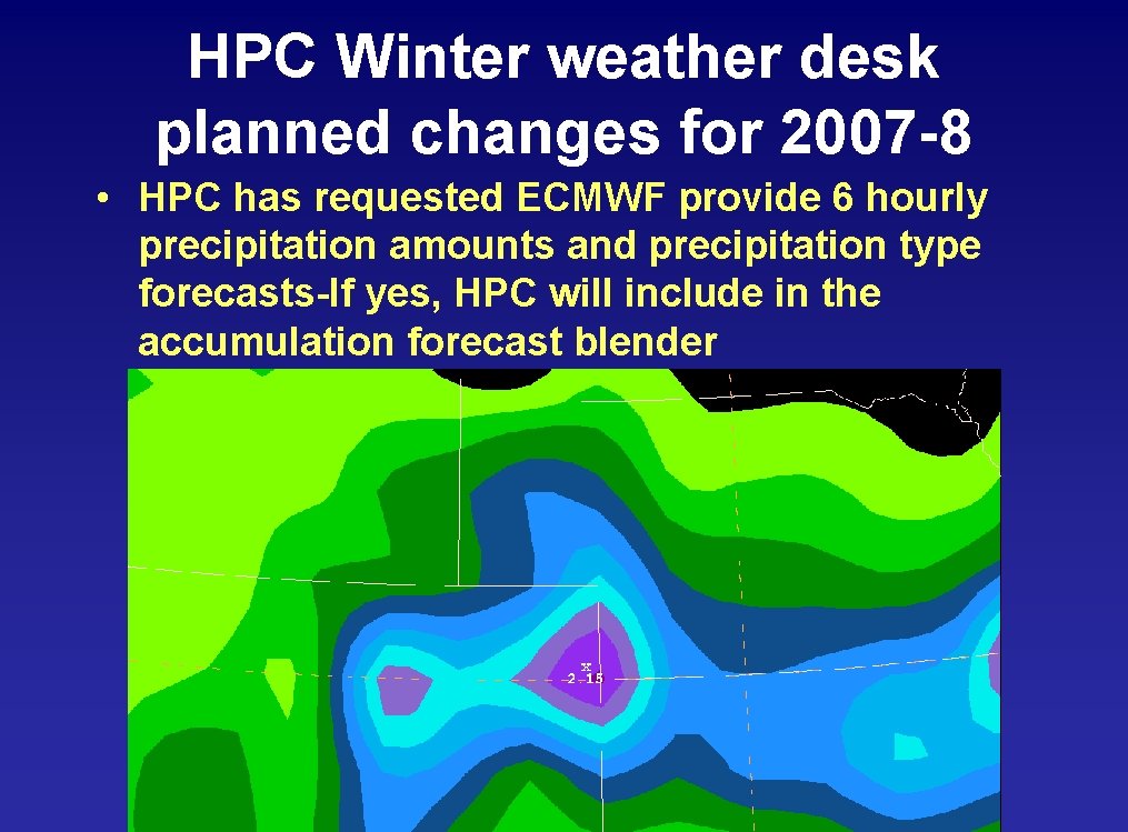
HPC Winter weather desk planned changes for 2007 -8 • HPC has requested ECMWF provide 6 hourly precipitation amounts and precipitation type forecasts-If yes, HPC will include in the accumulation forecast blender

Model/srefmean 84 hour Temperature bias 6/01/07 -8/31/07

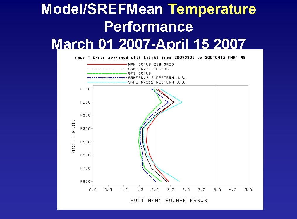
Model/SREFMean Temperature Performance March 01 2007 -April 15 2007

Model/srefmean 84 hour Height rms error 6/01/07 -8/31/07

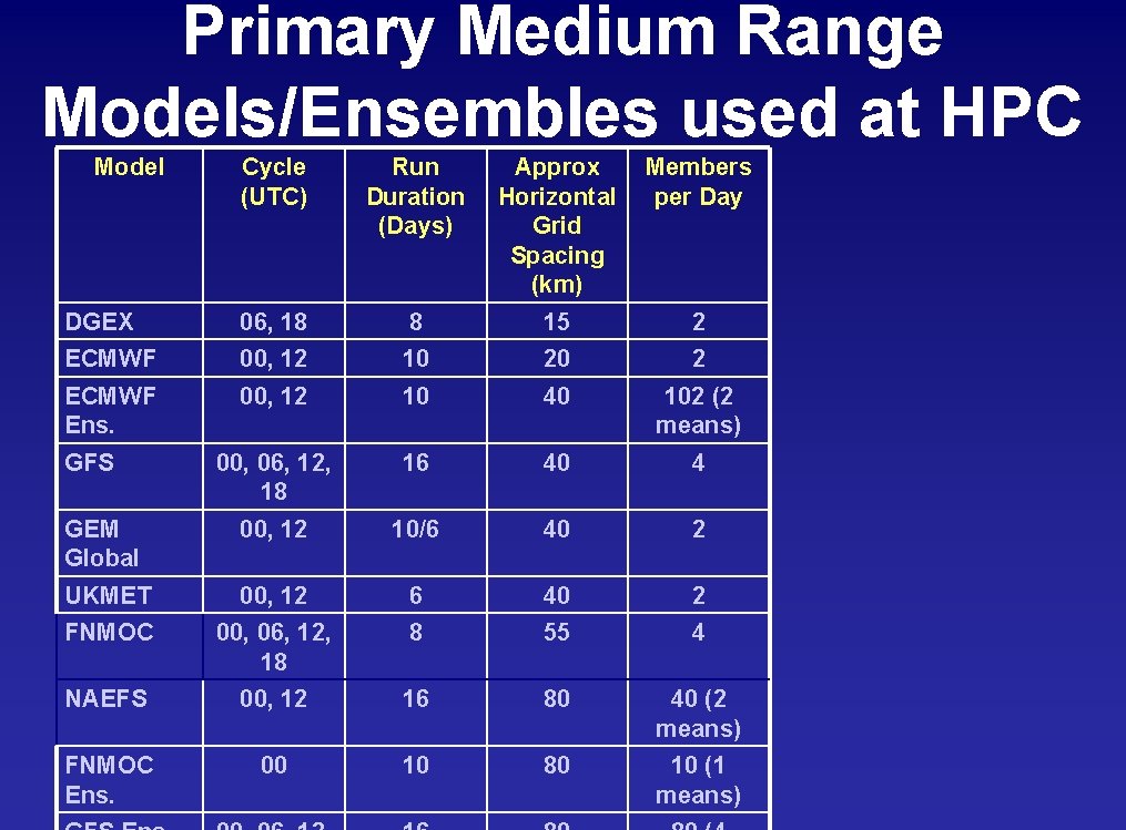
Primary Medium Range Models/Ensembles used at HPC Model Cycle (UTC) Run Duration (Days) DGEX 06, 18 8 15 2 ECMWF 00, 12 10 20 2 ECMWF Ens. 00, 12 10 40 102 (2 means) 00, 06, 12, 18 16 40 4 GEM Global 00, 12 10/6 40 2 UKMET 00, 12 6 40 2 FNMOC 00, 06, 12, 18 8 55 4 NAEFS 00, 12 16 80 40 (2 means) FNMOC Ens. 00 10 80 10 (1 means) GFS Approx Members Horizontal per Day Grid Spacing (km)

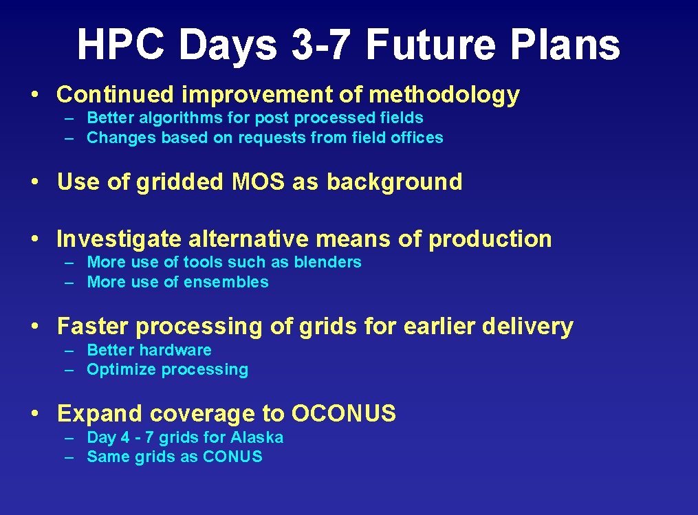
HPC Days 3 -7 Future Plans • Continued improvement of methodology – Better algorithms for post processed fields – Changes based on requests from field offices • Use of gridded MOS as background • Investigate alternative means of production – More use of tools such as blenders – More use of ensembles • Faster processing of grids for earlier delivery – Better hardware – Optimize processing • Expand coverage to OCONUS – Day 4 - 7 grids for Alaska – Same grids as CONUS

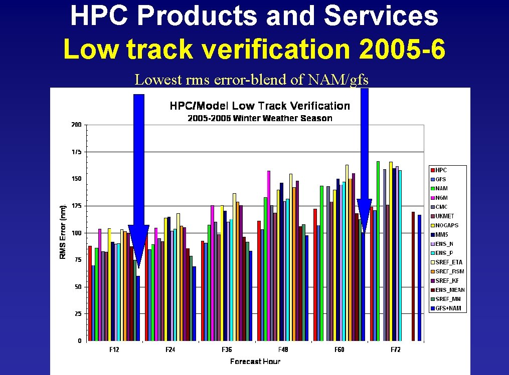
HPC Products and Services Low track verification 2005 -6 Lowest rms error-blend of NAM/gfs

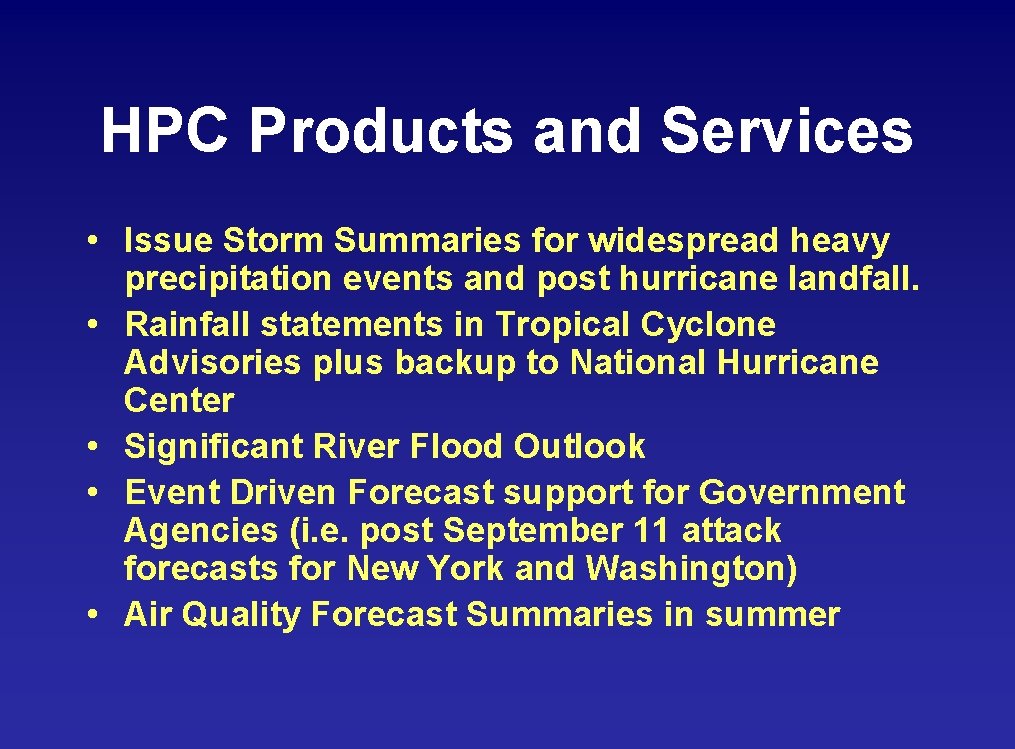
HPC Products and Services • Issue Storm Summaries for widespread heavy precipitation events and post hurricane landfall. • Rainfall statements in Tropical Cyclone Advisories plus backup to National Hurricane Center • Significant River Flood Outlook • Event Driven Forecast support for Government Agencies (i. e. post September 11 attack forecasts for New York and Washington) • Air Quality Forecast Summaries in summer

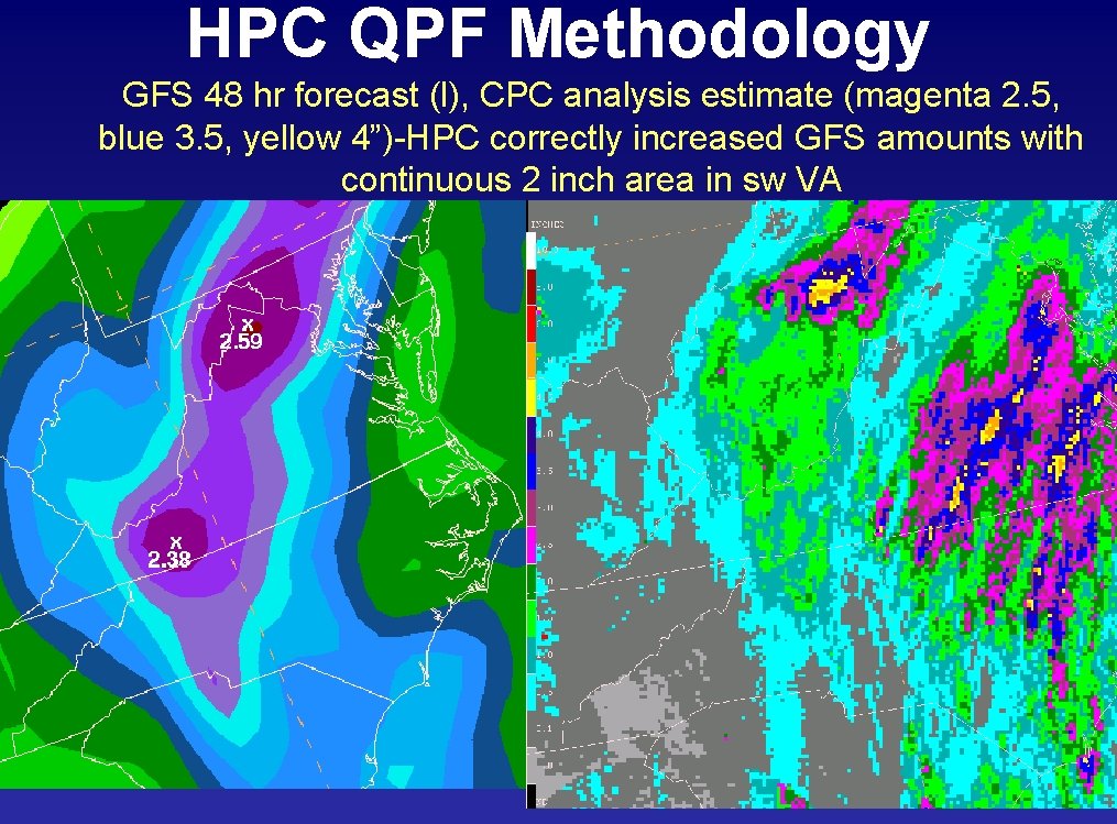
HPC QPF Methodology GFS 48 hr forecast (l), CPC analysis estimate (magenta 2. 5, blue 3. 5, yellow 4”)-HPC correctly increased GFS amounts with continuous 2 inch area in sw VA

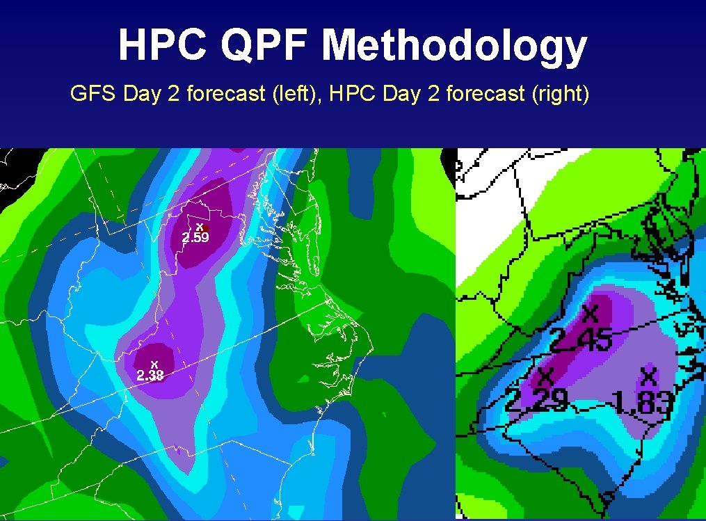
HPC QPF Methodology GFS Day 2 forecast (left), HPC Day 2 forecast (right)

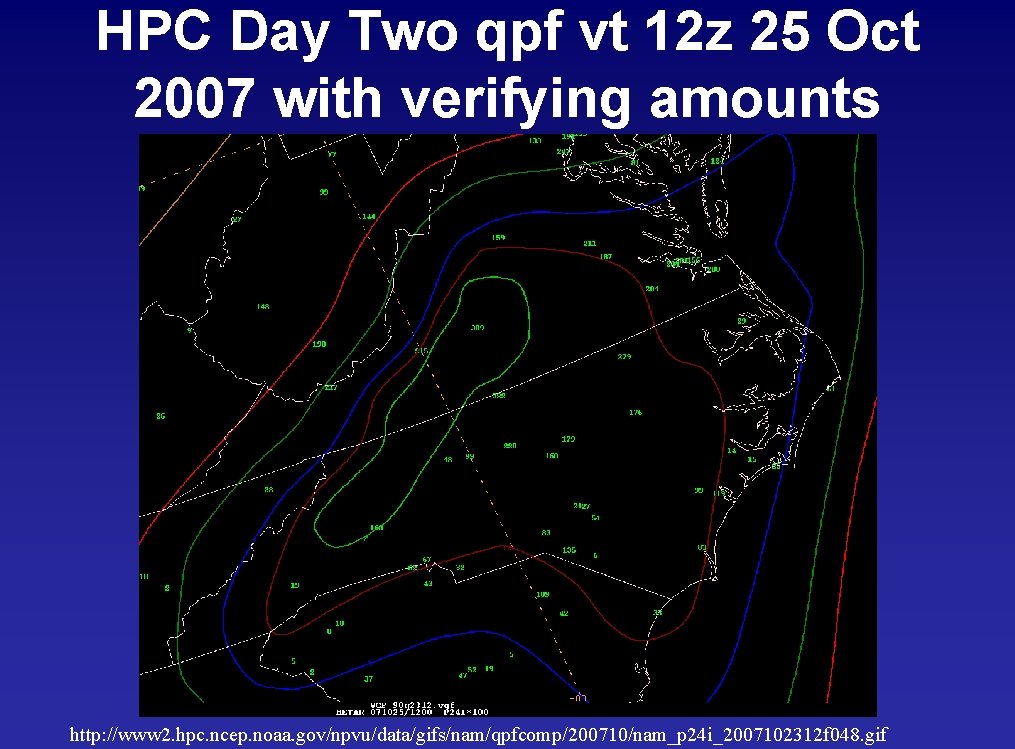
HPC Day Two qpf vt 12 z 25 Oct 2007 with verifying amounts http: //www 2. hpc. ncep. noaa. gov/npvu/data/gifs/nam/qpfcomp/200710/nam_p 24 i_2007102312 f 048. gif

Day two HPC (left), NAM (right), GFS (bottom)