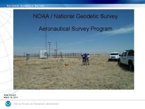
NOAA NGS Precise Geodetic Infrastructure Dr Theresa M


- Slides: 21

NOAA- NGS Precise Geodetic Infrastructure Dr. Theresa M. Damiani Chief- Spatial Reference System Division National Geodetic Survey National Oceanic and Atmospheric Administration October 18, 2018

NGS Mission Statement To define, maintain and provide access to the National Spatial Reference System (NSRS) to meet our nation’s economic, social, and environmental needs. The NSRS is a consistent coordinate system that defines latitude, longitude, height, scale, gravity, and orientation throughout the United States. 2

Eight NRC 2010 Report Recommendations • Updates since 2010 and current NGS status for: – – – #1 Maintaining leadership in geodetic infrastructure #3 Twenty-four fundamental (multi-instrumented) stations #5 Participation with international geodetic services #6 Support the ITRF (GGOS) #7 New Federal Geodetic Service for coordination • Limited NGS past/current work for: – #2 SLR and VLBI Improvements • None other than IERS site survey support – #4 Streaming real-time GNSS data • No current activity – #8 Workforce Analysis • Strategic Human Resources Plan in development 3

Recommendation #1 - Maintaining Leadership • “Invest in maintaining and improving the geodetic infrastructure, through – Upgrades in network design and construction, – Modernization of current observing systems, – Deployment of improved multi-technique observing capabilities, and – Funding opportunities for research, analysis, and education in global geodesy” 4

Modernizing the NSRS by 2022 • The current national datums (NAD 83 and NAVD 88) were established in the 1980 s, before satellite technology revolutionized geodesy. • The current datums have errors exceeding 1 meter. • Current datums are defined through passive control (marks). • Modernizing means: – Replacing the current horizontal datums (NAD 83) with 4 new, platefixed reference frames (NATREF, CATREF, PATREF, and MATREF) tied to the ITRF. – Replacing the current vertical datums (NAVD 88) with a gravimetric geoid-based datum (NAPGD 2022) – Improving data submission, data access, online tools, and survey methodologies (using active control). 5

Geodetic Control Datasets - CORS ❖ Continuously Operating Reference Station Network ❖ Run by more than 200 organizations (various government, academic, and private organizations) ❖ 2010: ~1400 CORS ❖ 2018: ~1800 CORS ❖ 70. 3% CORS upgraded from GPS to GNSS. GPS only 524 GPS+GLO 1075 GPS+GLO+GAL 169 ❖ 2013: defined a 70 km maximum CORS density ❖ Socio-economic value of CORS 2008: $0. 55 billion 2017: $2. 53 billion 6

Growth in Use of CORS- OPUS and Downloads CORS Data Useage, All Services. Fiscal Years 2003 -2018 Growth in thousands of downloads/uploads Service OPUS-RS OPUS-S UFCORS FTP OPUSShare 2008 Useage 2018 Useage 72. 2 182. 1 1, 042. 7 9, 391. 0 155. 0 381. 8 1, 303. 6 59, 262. 3 0. 0 2. 4 Total Useage in Millions of Downloads/Uploads 70 60 50 40 Best Fit Trend 30 Actual Useage 20 10 0 2001 2003 2005 2007 2009 2011 Fiscal Year 2013 2015 2017 2019 OPUS: Online Positioning User Service uses the 5 nearest CORS to calculate the position of a user-uploaded GNSS observations 7

Geodetic Control Datasets – Passive Marks Over 800, 000 geodetic control datasheets GPS on Benchmarks: Citizen science campaign to update GNSS coordinates on marks 8

Geodetic Control Data Sets- Airborne Gravity for the Redefinition of the American Vertical Datum (GRAV-D) Part 1: Airborne Gravity Campaign Status as of 9/30/18 72. 1% complete Completed 2018 9

Geodetic Control Datasets – Geoid Models Released new hybrid and gravimetric geoids in 2009 and 2012 Final new hybrid geoid release in 2019 Yearly experimental gravimetric geoid models, 2014 through 2021 CONUS Alaska Hawaii American Samoa Puerto Rico & US Virgin Islands Guam and Northern Mariana Islands 10

Enabling Research, Analysis, and Education Internal research and analysis – New GNSS software project: multi-constellation GNSS and RINEX 3 – New ITRF 2014 CORS positions and velocities for early 2019 With The COMET Program Educational Videos (11) Small grants to Oregon State and Ohio State Education Activities • Monthly Webinar Series (7500 attendees, 40 recordings online) • In person training: • Airborne Gravity for Geodesy Summer School • OPUS Projects Manager Training • Digital Leveling and GPS Training geodesy. noaa. gov Videos are 5 minutes or less More than 185, 000 views Online Lessons (4) More than 1, 200 quizzes More than 6, 200 sessions 11

Recommendation #3 Twenty-Four Fundamental Stations Federal Partners Foundation CORS Project A set of federally-operated, ultra-highquality, high-reliability stations with the longevity to guarantee citizens access to official NSRS positions and support international positioning consistency efforts. Site ID AB 09 P 777 P 804 Existing Sites AB 51 ATQK Program: Earth. Scope Plate Boundary Observatory (PBO) P 043 CRO 1 BREW FAIR GODE National Aeronautics and Space Administration (NASA) GOL 2 MDO 1 Existing Sites MONP NLIB Program: Global GNSS Network (GGN), operated by Jet Propulsion PIE 1 Laboratory GUAM KOKB MKEA HAL 1 ASPA CNMR GUUG BRSG FLF 1 NOAA- National Geodetic WES 2 Survey (NGS) TMG 2 NEW Existing and New Sites NEW Program: Continuously Operating NEW Reference Stations (CORS) NEW NEW NEW TBD TBD National Science Foundation (NSF) Location Wales, AK Dennard, AR Georgia Petersburg, AK Atqasuk, AK Wyoming Saint Croix, VI* Brewster, WA* Fairbanks, AK Greenbelt, MD* Goldstone, CA* Mc. Donald Observatory, Texas* Mount Laguna, CA* North Liberty, IA* Pie Town, NM* GUAM Kauai, HI* Mauna Kea, HI* Haleakala, HI* American Samoa Saipan, TQ GUAM* Bermuda Richmond, FL* Westford, MA* Boulder, CO Apache Point, NM* Fort Davis, TX* Fort Irwin, CA* Hancock, NH* Los Alamos, NM* Kitt Peak, AZ* Owens Valley, CA* Cold Bay, AK* Existing location in Caribbean Target “fundamental” Foundation CORS: 21 12

Foundation CORS Goals • MOUs in place with NASA and NSF to support the project • All NGS-owned Foundation CORS submitted to the IGS for consideration as stations • Network availability of 90% at all times • Individual Station Down Time < 14 days • Stations provide definitional support for plate rotation models • 5 -year repeat of IERS site surveys for all Foundation CORS 13

Recommendation #5 Support International Geodetic Services • International GNSS Service (IGS) Support: – GPS Orbits: NGS Analysis Center for 25 years – GPS Orbits: NGS served as Analysis Center Coordinator for two terms (2008 -2012, 2012 -2016) – Absolute Antenna Calibration (ANTEX, new robotic arm) – NGS-owned IGS stations (3 existing, 8 more planned as Foundation CORS) • International Earth Rotation Service (IERS) Support: – – Experts in IERS site surveys at “fundamental” sites for ITRF Publishing new ITRF 14 coordinates at CORS in early 2019 Utilizing IERS geophysical models in GNSS processing MOU on Earth Orientation Parameters 14

25 Years of NGS Orbit Products as an IGS Analysis Center 15

Recommendation #5 Support International Geodetic Services • International Gravity Field Service (IGFS) Support: – Chair: • IAG Subcommittee 2. 1 (Terrestrial Gravimetry Techniques) • IAG Subcommittee 2. 2 (Geoid Methodology) Working Group on Geoid Computation Validation – Member: • IAG Study Group 2. 1. 1 (Global absolute gravity reference system) • Steering Committee for International Comparisons of Absolute Gravimeters 2017 (ICAG) – Hosted 3 North American Comparisons of Absolute Gravimeters • 2017 “Key Comparison SIM. M. GK-1” with the National Institutes of Standards and Technology and the International Bureau of Weights and Measures (BIPM) – Hosted Airborne Gravimetry for Geodesy Summer School (IAG Endorsed) – Will evaluate the National Geospatial-Intelligence Agency’s Earth Gravitational Model 2020 (EGM 2020) • May become the basis of the International Height Reference System (IHRS) 16

Recommendation #6 Commit to Maintaining the ITRF • Blueprint Part 1: Commitment to tie the new NSRS reference frames to the ITRF Geometric: Sep 2017 • Foundation CORS • IERS site surveys • International participation with: International Union of Geodesy and Geophysics; International Association of Geodesy; Global Geodetic Observing System Sistema de Referencia Geocéntrico para las Américas United Nations Committee of Experts on Global Geospatial Information Management (UN-GGIM) 17

Recommendation #7 Establish a Federal Geodetic Service The Federal Geodetic Control Subcommittee (FGCS) of the Federal Geographic Data Committee (FGDC) helps coordinate the planning and execution of geodetic surveys, developing standards and specifications for these surveys, and exchanging geodetic survey data and technical information among Federal agencies. Signed 5 October 2018 18

Commitments for the Future • Define a modern NSRS in 2022: Four geometric reference frames and a geopotential datum • Include dynamic models in the NSRS: plate motion, intra-frame velocities, and geoid change. • Complete Foundation CORS by 2023 to support national and international geodetic infrastructure • Create a CORS Comprehensive Plan to grown and modernize the infrastructure. • Continue to invest in a strong NGS Gravity Program. 19

The Future of GRAV-D Commitments: Finish 100% of United States Airborne Gravity Collection FY 19 – Pacific Island Survey FY 20 – Aleutian Islands Survey FY 21 -FY 22 – Remaining areas North America-Pacific Geopotential Datum (NAPGD 2022) • Create new geopotential products: geoid, gravity, DOV… Monitoring and Validation • Design and operationalize a Geoid Monitoring Service (Ge. MS) to track geoid change • Create first-ever dynamic geoid model for the U. S. Aspirations: Outside the United States • Target areas of interest that affect the U. S. geoid and support interests of NGA and neighbors- e. g. Mountains of Mexico and Canada, Caribbean nations • Support for other countries on airborne gravity (IGFS) 20

Commitments for the Future • Improve the quality of orbit products and investigate Foundation CORS participation in IGS Real-Time Service • Support NOAA’s Center for Operational Oceanographic Products and Services (CO-OPS) water level observations – Modernizing geodetic control at tide gauges – Global Sea Level Observing System (GLOSS) Stations – National Water Level Observation Network (NWLON) Stations • Increase engagement and cooperation with FGDC member agencies • Increase interactions with and education of users of U. S. geodetic infrastructure and observing systems in government, industry, and education 21
 Ngs geodetic toolkit
 Datum
Datum Federal geodetic control subcommittee
 State geodetic administration
 Federal geodetic control subcommittee
 Geodetic
 Geodetic surveying
 Federal geodetic control subcommittee
 Ggos
Ggos National geodetic survey data explorer
 Theresa spence scotland.
 Epicardium
 Teaching math at a distance
 Einstieg in eine mängelrechteklausur
 Doc distler
 Theresa snelling
 Theresa lotter
 Lyndsay rowland
 Theresa lotter
 Rubi theresa
 Theresa distler
 Theresa manyan
