National Geospatial Platform Jerry Johnston Department of the

 calls for the")


- Slides: 12
National Geospatial Platform Jerry Johnston Department of the Interior January 6, 2016
The US National Spatial Data Infrastructure ▪ Executive Order 12906 (1994) calls for the establishment of the National Spatial Data Infrastructure (NSDI) ▪ Defined as the “technologies, policies and people necessary to promote sharing of geospatial data throughout all levels of government, the private and non-profit sectors, and the academic community” ▪ Goals include reducing duplication and costs, while making more geographic information available to the public and partners in government and the private sector ▪ Standards development and registries (Geospatial One Stop, Data. gov) followed… ▪ Tens of thousands of datasets registered to shared catalogs 1
What problems still need to be solved? ▪ The role of government in the geospatial ecosystem has changed ▪ Use of geospatial data and maps in the public sector is pervasive – need to focus on driving towards better access to and understanding of the right information ▪ Some significant challenges to address: –Inability to surface the right data or the right map in search results –Past approaches have not allowed for significant collaboration among partners in the NSDI or users of data/services/maps –Making sure it all “works” when you need it to (e. g. , service quality) 2
NSDI Strategic Plan Goals NSDI Strategic Plan Includes: • 3 Strategic Goals • 9 Objectives • 29 Actions 3
NSDI Strategic Goal #1 STRATEGIC GOAL 1: Develop Capabilities for National Shared Services Objective 1. 1. Develop geospatial interoperability reference architecture Objective 1. 2. Establish the Geospatial Platform as the Federal geospatial data, services, and applications Web-based service environment Objective 1. 3. Expand the use of cloud computing Objective 1. 4. Promote the use of geospatial multiagency acquisition vehicles for interagency and intergovernmental purchases 4
Geospatial Platform Components 5
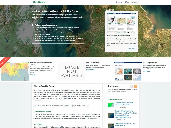
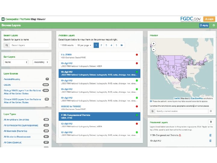
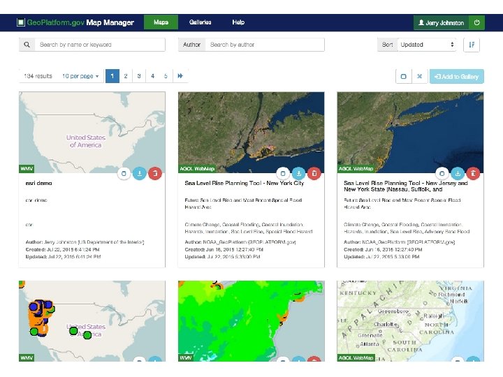
Geoplatform. gov – What’s New ▪ A complete redesign and redeployment of Geoplatform. gov and its underlying capabilities ▪ Hosted in a commercial cloud environment (Amazon Web Services) ▪ Greatly increased capabilities and performance ▪ Fall 2015 “Preview” Release: http: //preview. geoplatform. us –New home page / web design –New Web Map Viewer with integrated service quality measures –Improved capabilities for map gallery creation and sharing –Expanded performance and portfolio measurement tools 6
Geospatial Platform – Shared Investments ▪ Common data / application hosting infrastructure to enable agencies to save time and money –Leveraging Arc. GIS Online –Using commercial cloud computing services to build out additional shared hosting infrastructure for the benefit of FGDC partners Developing shared IT security documentation for the common hosting environment – leveraging DOI Foundational Cloud Hosting Contract and existing relationship with Esri 10
Discussion