II Erosionthe transportation of sediments produced from weathered

- Slides: 35
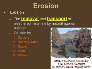
II. Erosion-the transportation of sediments produced from weathered rock. A. Agents of Erosion 1. Gravity-the primary driving force of all transporting agents. a. Influenced by: • slope • saturation of soil • bedrock composition and structure
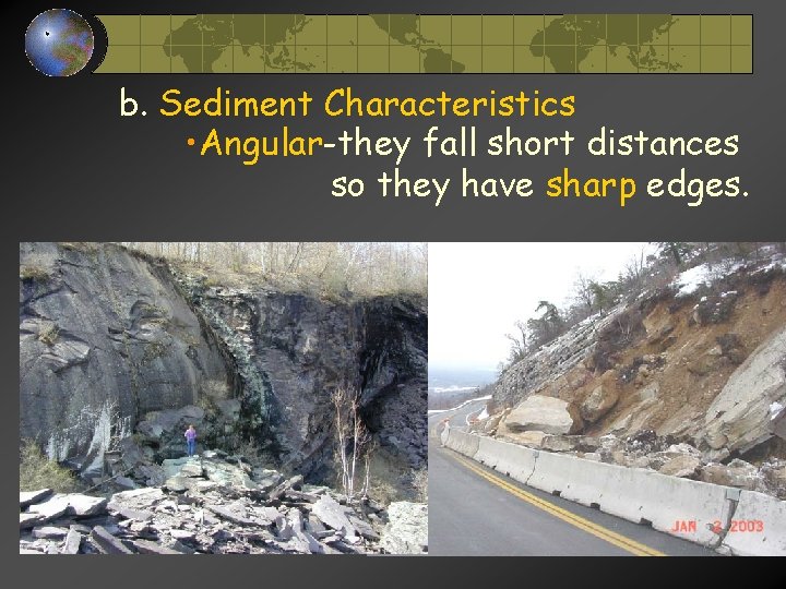
b. Sediment Characteristics • Angular-they fall short distances so they have sharp edges.
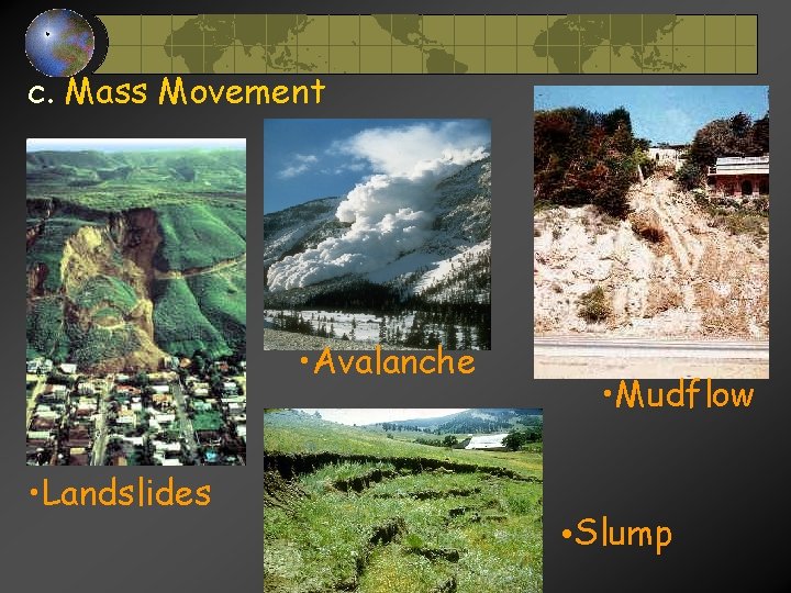
c. Mass Movement • Avalanche • Landslides • Mudflow • Slump
2. Running Water-primary agent of erosion on Earth. a. Stream Velocity is influenced by • gradient-the steeper the slope, the faster the water’s velocity. • discharge(volume of water)-the greater the discharge, the faster the stream velocity.
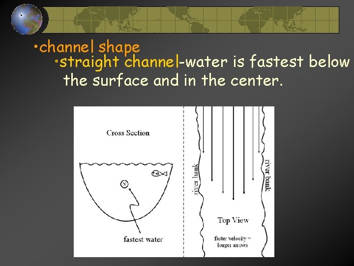
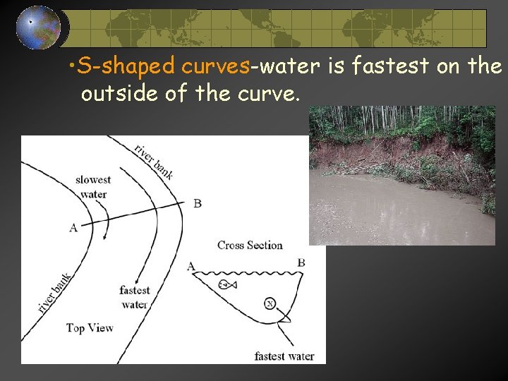
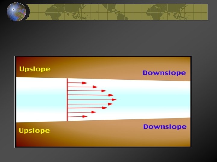
• channel shape • straight channel-water is fastest below the surface and in the center.
• S-shaped curves-water is fastest on the outside of the curve.
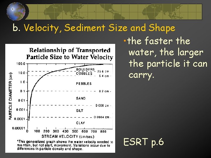
b. Velocity, Sediment Size and Shape • the faster the water, the larger the particle it can carry. ESRT p. 6
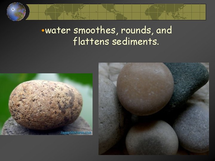
• water smoothes, rounds, and flattens sediments.
c. Stream Load-the load is the material a stream carries. The load is carried in three major ways: 1. Solution: dissolved particles(salts, ions) 2. Suspension: particles are so tiny that they take a very long time to settle, they tend to “hang” in the water. (clay. silt, sand) 3. Saltation: larger sediments that are too big to be lifted, so they bounce, roll or are pushed along. (pebbles, cobbles, boulders)
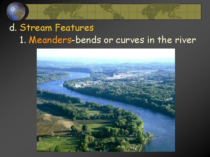
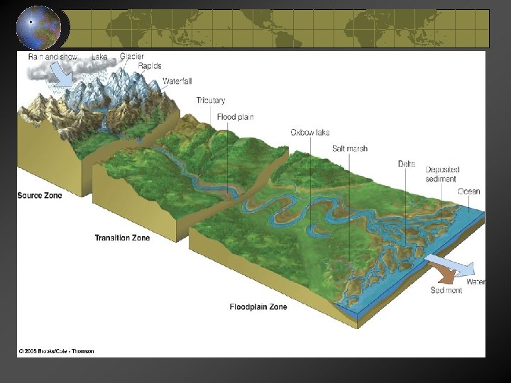
d. Stream Features 1. Meanders-bends or curves in the river
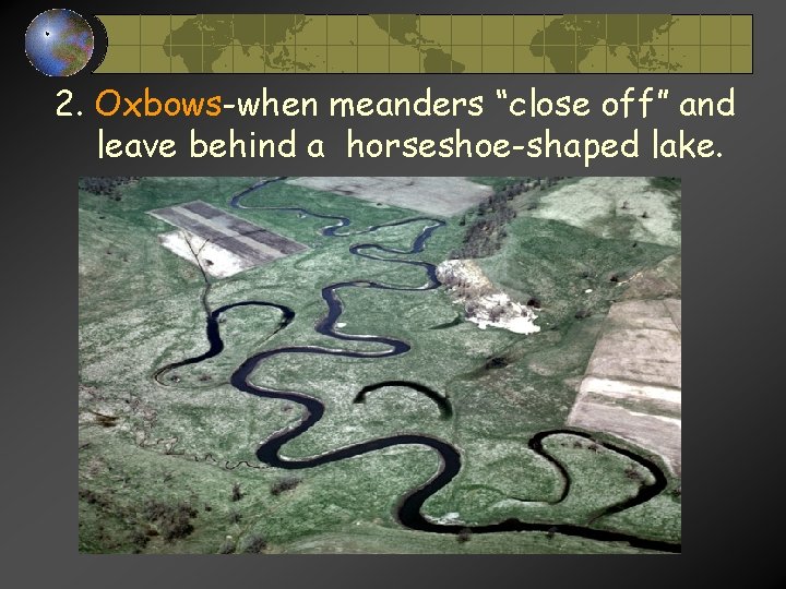
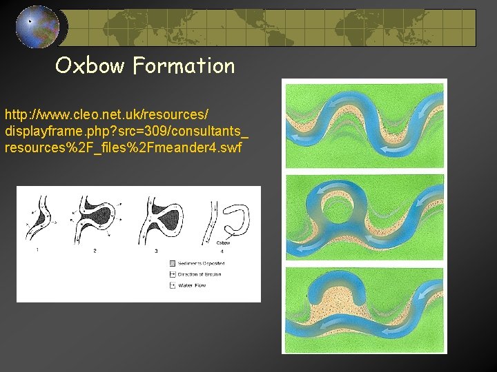
2. Oxbows-when meanders “close off” and leave behind a horseshoe-shaped lake.
Oxbow Formation http: //www. cleo. net. uk/resources/ displayframe. php? src=309/consultants_ resources%2 F_files%2 Fmeander 4. swf
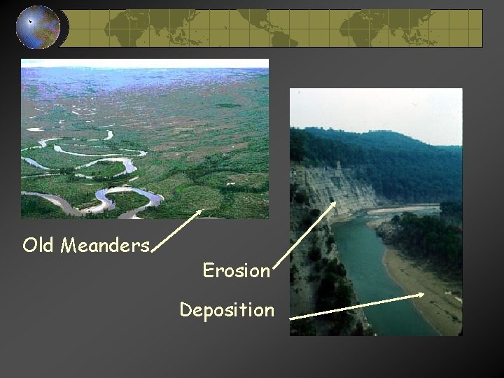
Old Meanders Erosion Deposition
Rivers and Streams
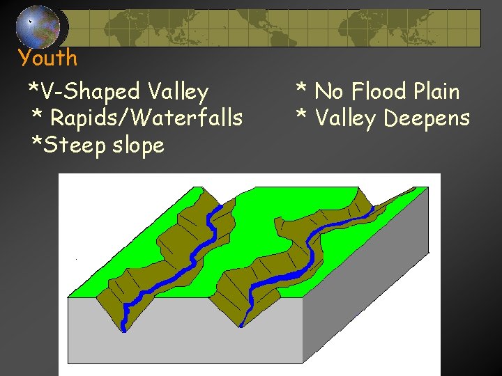
Youth *V-Shaped Valley * Rapids/Waterfalls *Steep slope * No Flood Plain * Valley Deepens
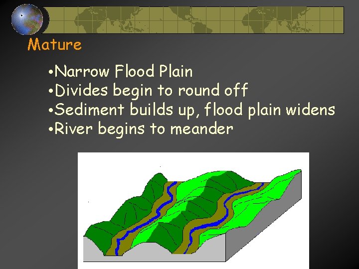
Mature • Narrow Flood Plain • Divides begin to round off • Sediment builds up, flood plain widens • River begins to meander
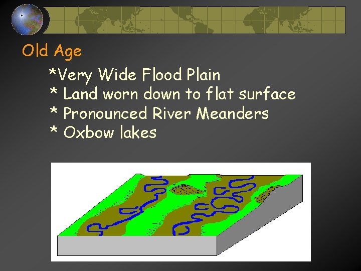
Old Age *Very Wide Flood Plain * Land worn down to flat surface * Pronounced River Meanders * Oxbow lakes
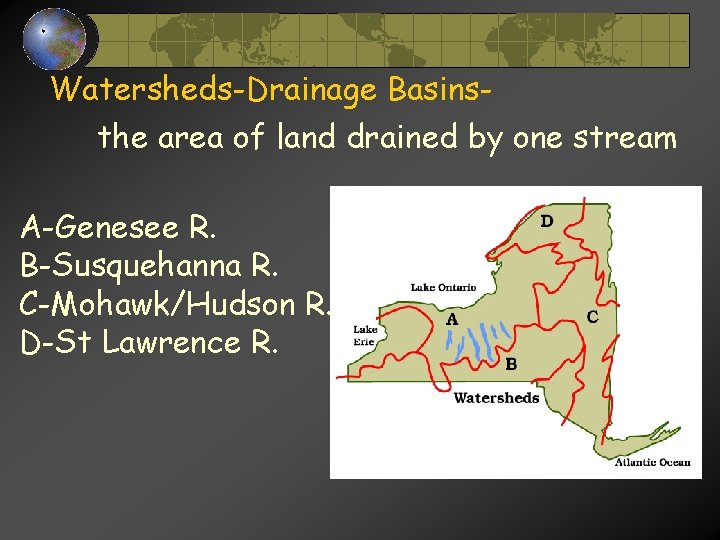
Watersheds-Drainage Basinsthe area of land drained by one stream A-Genesee R. B-Susquehanna R. C-Mohawk/Hudson R. D-St Lawrence R.
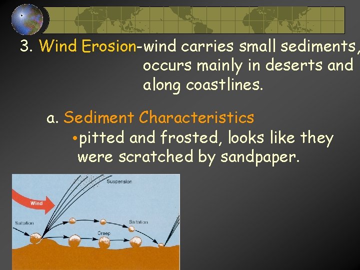
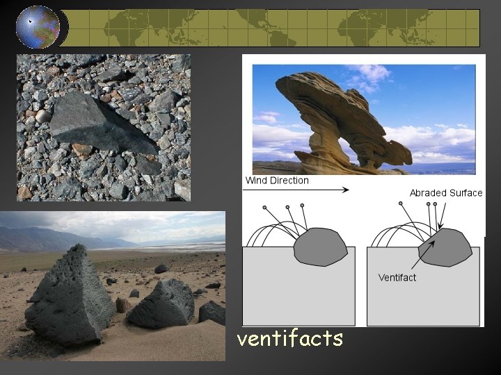
3. Wind Erosion-wind carries small sediments, occurs mainly in deserts and along coastlines. a. Sediment Characteristics • pitted and frosted, looks like they were scratched by sandpaper.
ventifacts
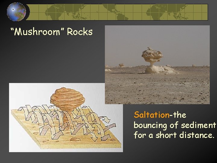
“Mushroom” Rocks Saltation-the bouncing of sediment for a short distance.
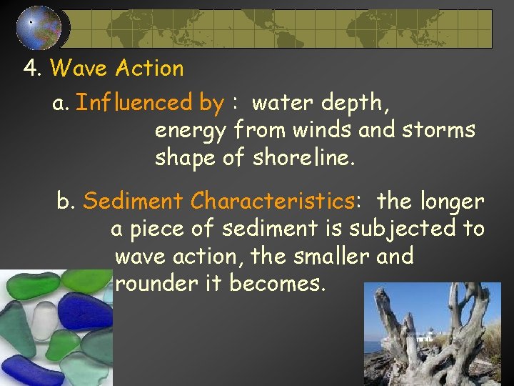
4. Wave Action a. Influenced by : water depth, energy from winds and storms shape of shoreline. b. Sediment Characteristics: the longer a piece of sediment is subjected to wave action, the smaller and rounder it becomes.
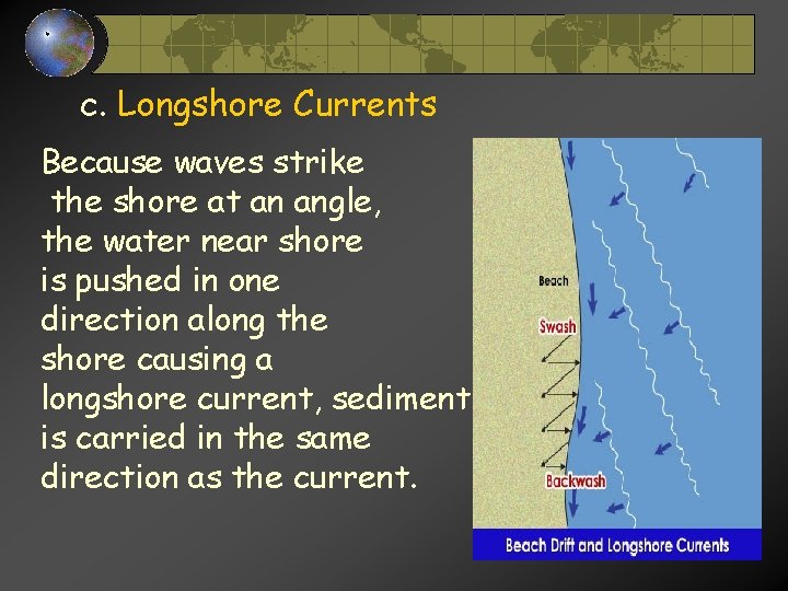
c. Longshore Currents Because waves strike the shore at an angle, the water near shore is pushed in one direction along the shore causing a longshore current, sediment is carried in the same direction as the current.
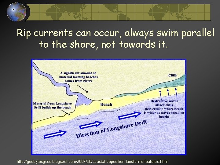
Rip currents can occur, always swim parallel to the shore, not towards it. http: //geobytesgcse. blogspot. com/2007/08/coastal-deposition-landforms-features. html
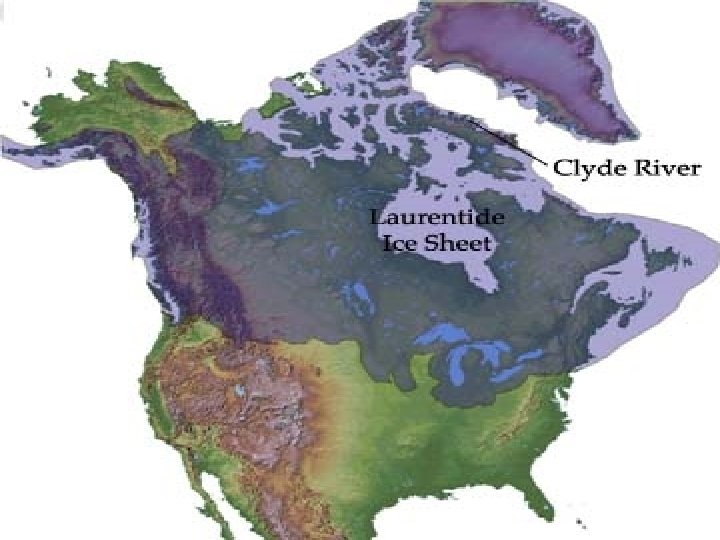
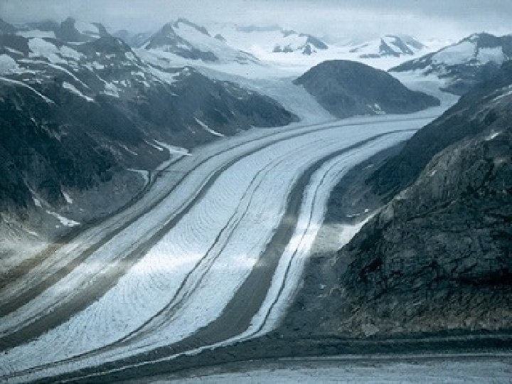
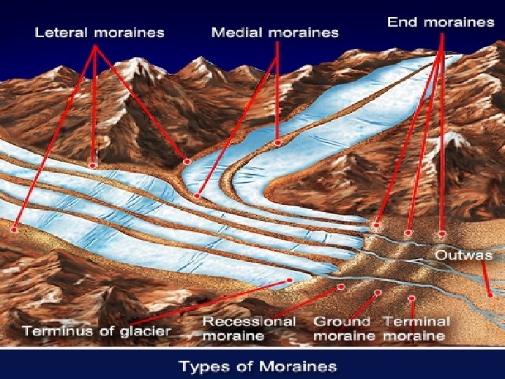
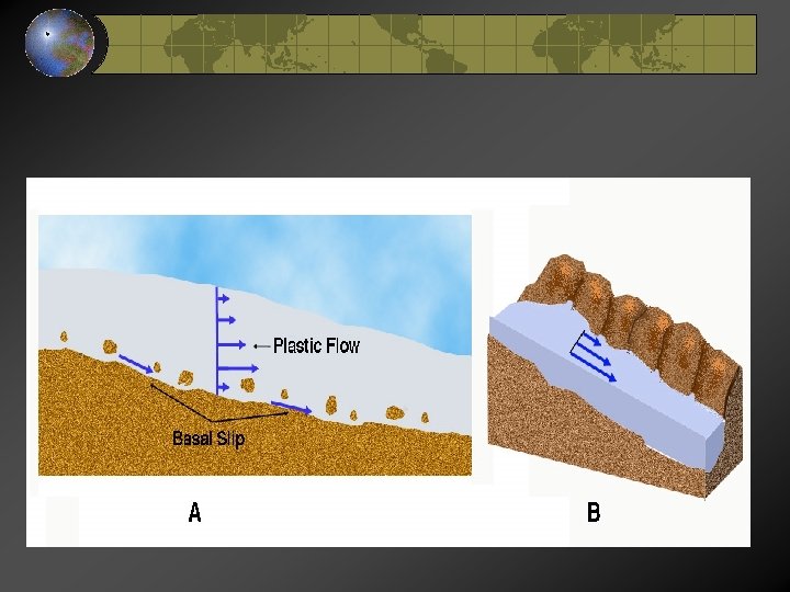
5. Glaciers-mass of ice and snow a. Influenced by: accumulation of ice and snow rate of accumulation steepness of slope
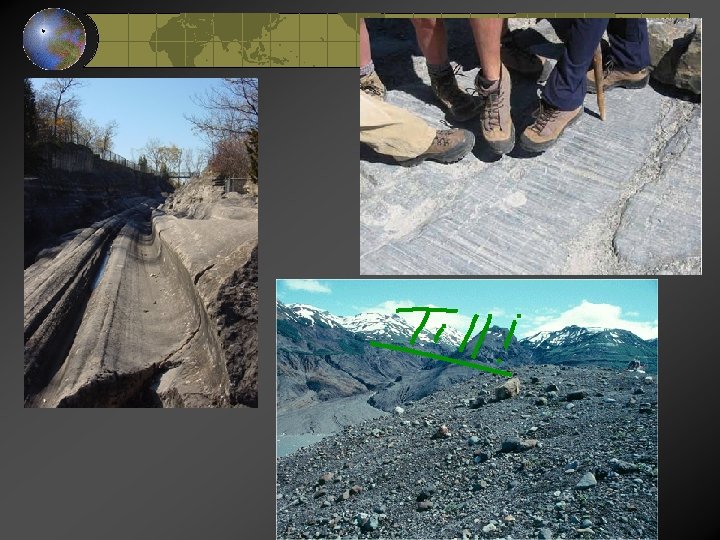
b. Sediment Characteristics grooves, scratches and sub-angular mixture of sediment sizes-unsorted, polished bedrock.
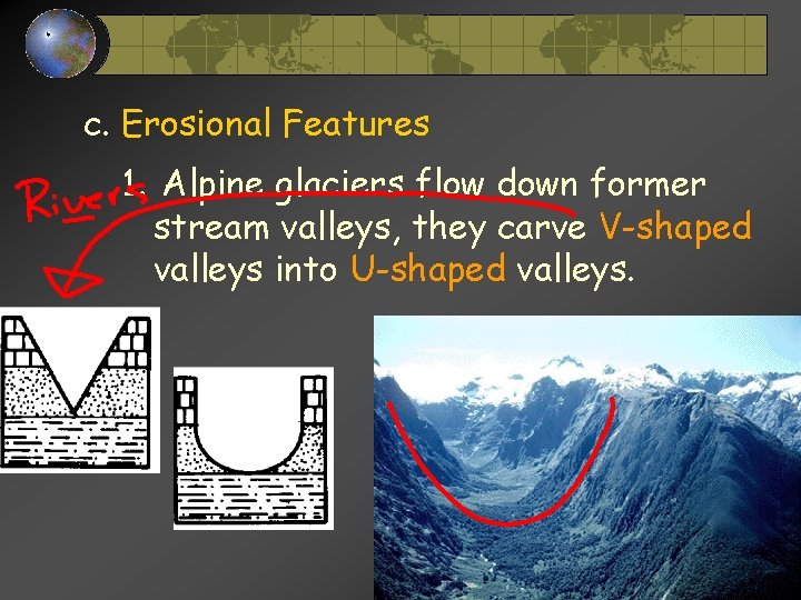
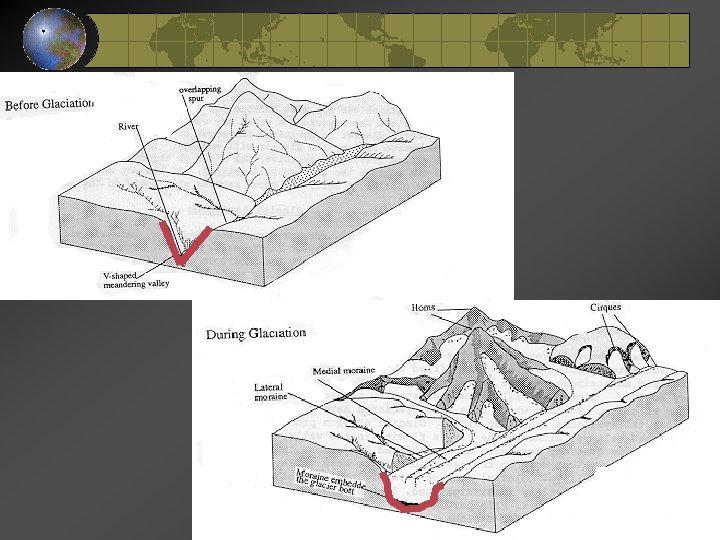
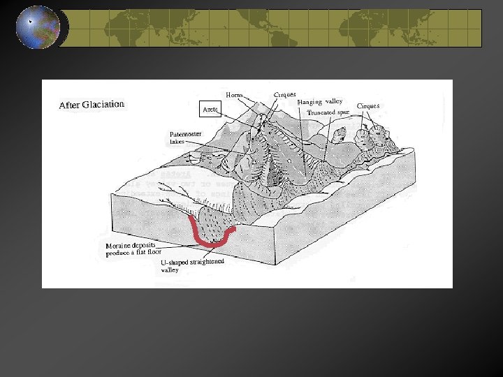
c. Erosional Features 1. Alpine glaciers flow down former stream valleys, they carve V-shaped valleys into U-shaped valleys.