HWRF vortex initialization procedure issues and potential areas

 4 X domain data for filtering 2) Split environment and vortex")
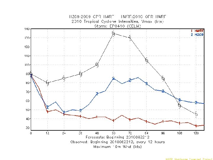
 Celia 2010061900 Bug fixed Original Forecast Time (hr)")
 Official Original Bug fixed Forecast Time (hr)")


 Time series of max. wind speed (Celia: 2010062218) 9 kts")
 Time series of min. pressure (Celia: 2010062218) Although wind weakens")
 then")
 Wind speed (kts) Official beta_ct=0. 5 beta_ct=1. 0 (opr) Forecast")
 Wind speed (kts) beta_ct=0. 1 (opr) beta_ct=0. 7 Forecast Time")


")
")
- Slides: 17
HWRF vortex initialization procedure issues and potential areas to improve Young Kwon, Vijay Tallapragada and HWRF team
Cold start 1) 4 X domain data for filtering 2) Split environment and vortex fields 3) Modify vortex (guess or bogus) merge_nest_4 x_10 m 2. f Cycled run merge_nest_4 x_step 1. f 1) z-dimension mismatch wrf_split_new 2. f hwrf_anl_bogus_10 m. f 2) ICK for determine filter domain hwrf_pert_ct. f 1) Declare INDX 1, 2 to integer 4) Merge vortex and environment If forecast vortex is weaker than observation, bringing bogus vortex hwrf_anl_cs_10 m. f
Wind speed (kts) Celia 2010061900 Bug fixed Original Forecast Time (hr)
Daniel 2010082606 Wind speed (kts) Official Original Bug fixed Forecast Time (hr)
Potential areas of improvement 1. Mass and wind balance of the initial vortex 2. 2. The blending ratio of a composite storm (bogus storm) and 6 hr forecast guess storm 3. Storm size correction : modify RMW but should not outer radius, such as radii of 34 kt or outermost closed isobar 4. Filter strength: There is some remnant of a vortex after filtering, which may indicate the need of stronger filter 5. Resolution of filter domain (currently 1 degree in HWRF but GFDL changed to 0. 5 deg resolution)
Official Steep initial weakening 84 kt to 56 kts in 6 hours
Maximum wind speed (kts) Time series of max. wind speed (Celia: 2010062218) 9 kts drop at the first 9 min 84 kts becomes 55 kts around the first 2 hours Forecast Time (9 min)
Minimum Pressure (h. Pa) Time series of min. pressure (Celia: 2010062218) Although wind weakens during first Pressure although wind weakens 9 min, drop pressure is deepening at the first 9 min Forecast Time (9 min)
In the on of the initialization codes, hwrf_pert_ct. f if(vobs. lt. 32. ) then beta_ct = min(…. . ) usually 0. 1 to 0. 3 else beta_ct = 1. 0 endif beta_ct determines the amount of composite storm to blend initial guess field. 1. 0 means all initial vortex is from 6 hr guess and 0. 0 is for all from composite storm.
Daniel 2010082606 (beta_ct exp) Wind speed (kts) Official beta_ct=0. 5 beta_ct=1. 0 (opr) Forecast Time (hr)
Celia 2010061900 (beta_ct exp) Wind speed (kts) beta_ct=0. 1 (opr) beta_ct=0. 7 Forecast Time (hr)
Celia 2010062218 Model init winds – gradient winds Provided by In-Hyuk Kwon
Initial time 86 kts 65 kts +6 Hr forecast
Potential issue of storm size correction Do we need adjust outer radius (i. e. 34 kt radius) using the same ratio RMW adjustment? Forecasted 34 kt radius Forecasted RMW Adjusted 34 kt radius(? )
Intensity Bias (2009 storms)
Intensity Bias (2010 Celia)