AIR MASSES FRONTS AIR MASS an extremely large
- Slides: 19

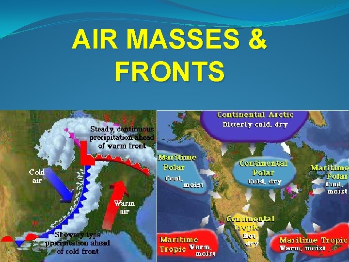
AIR MASSES & FRONTS

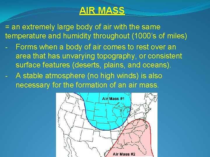
AIR MASS = an extremely large body of air with the same temperature and humidity throughout (1000’s of miles) - Forms when a body of air comes to rest over an area that has unvarying topography, or consistent surface features (deserts, plains, and oceans). - A stable atmosphere (no high winds) is also necessary for the formation of an air mass.

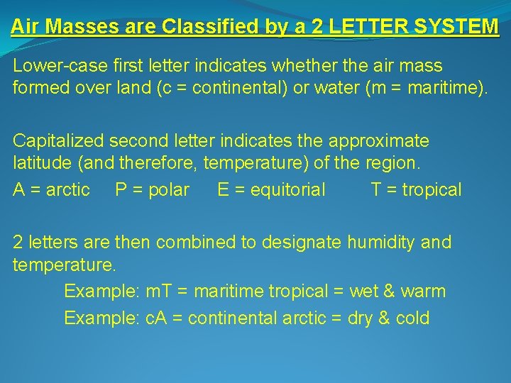
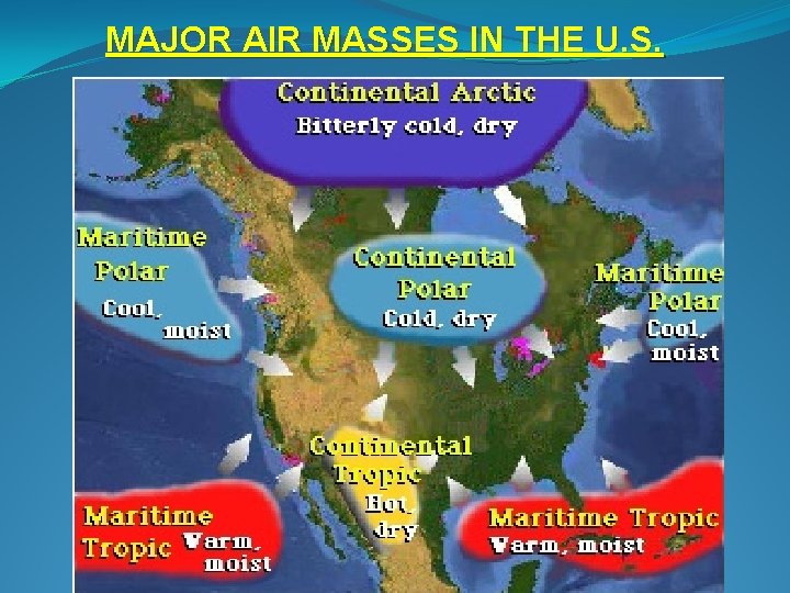
Air Masses are Classified by a 2 LETTER SYSTEM Lower-case first letter indicates whether the air mass formed over land (c = continental) or water (m = maritime). Capitalized second letter indicates the approximate latitude (and therefore, temperature) of the region. A = arctic P = polar E = equitorial T = tropical 2 letters are then combined to designate humidity and temperature. Example: m. T = maritime tropical = wet & warm Example: c. A = continental arctic = dry & cold

MAJOR AIR MASSES IN THE U. S.

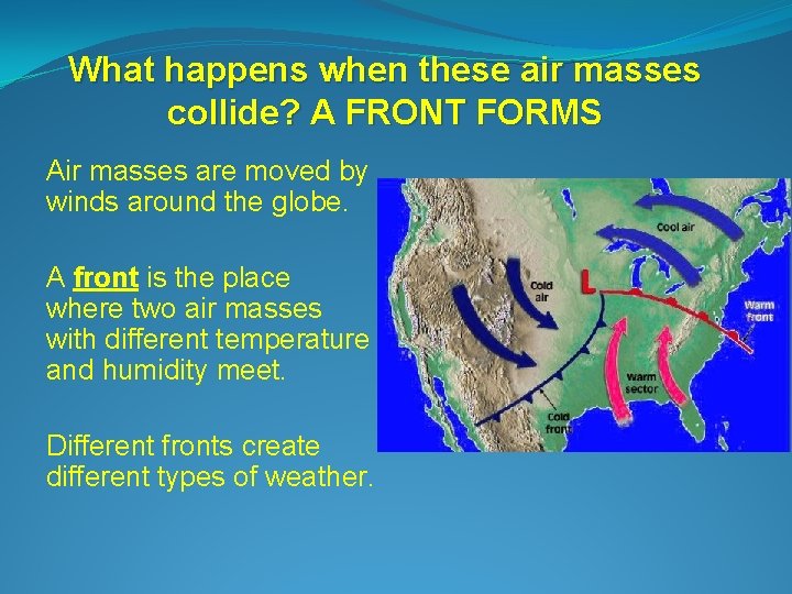
What happens when these air masses collide? A FRONT FORMS Air masses are moved by winds around the globe. A front is the place where two air masses with different temperature and humidity meet. Different fronts create different types of weather.

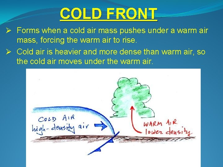
COLD FRONT Ø Forms when a cold air mass pushes under a warm air mass, forcing the warm air to rise. Ø Cold air is heavier and more dense than warm air, so the cold air moves under the warm air.

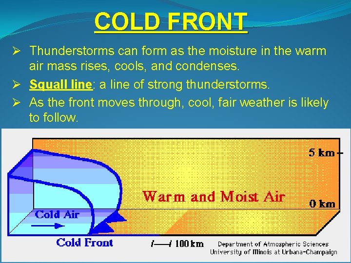
COLD FRONT Ø Thunderstorms can form as the moisture in the warm air mass rises, cools, and condenses. Ø Squall line: a line of strong thunderstorms. Ø As the front moves through, cool, fair weather is likely to follow.

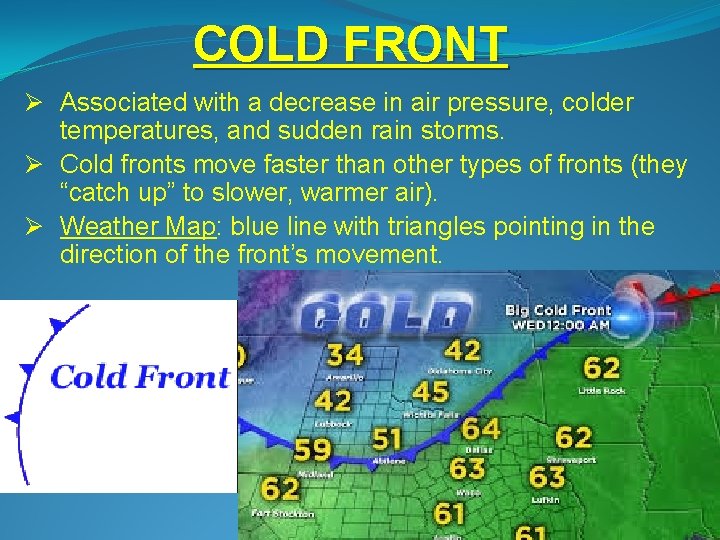
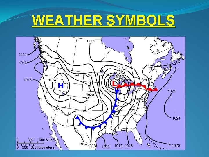
COLD FRONT Ø Associated with a decrease in air pressure, colder temperatures, and sudden rain storms. Ø Cold fronts move faster than other types of fronts (they “catch up” to slower, warmer air). Ø Weather Map: blue line with triangles pointing in the direction of the front’s movement.

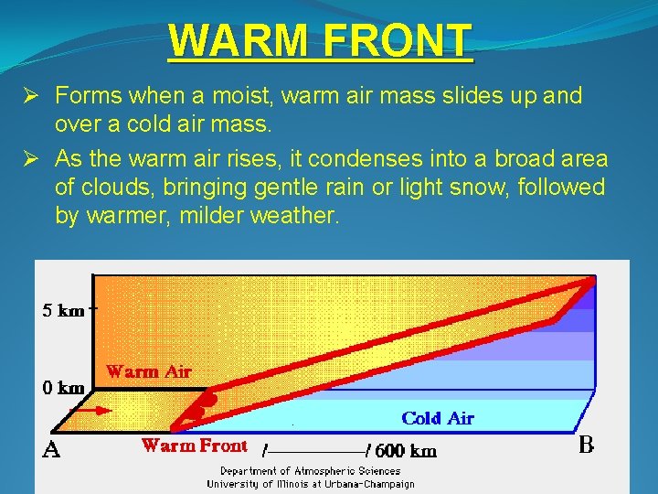
WARM FRONT Ø Forms when a moist, warm air mass slides up and over a cold air mass. Ø As the warm air rises, it condenses into a broad area of clouds, bringing gentle rain or light snow, followed by warmer, milder weather.

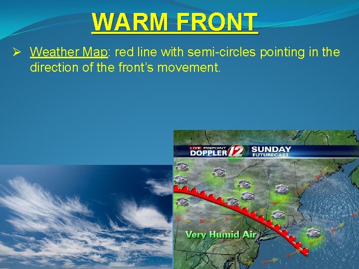
WARM FRONT Ø Weather Map: red line with semi-circles pointing in the direction of the front’s movement.

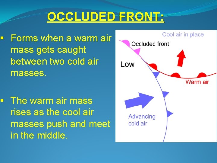
OCCLUDED FRONT: § Forms when a warm air mass gets caught between two cold air masses. § The warm air mass rises as the cool air masses push and meet in the middle.

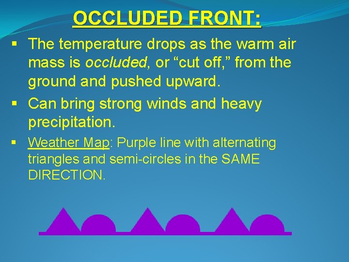
OCCLUDED FRONT: § The temperature drops as the warm air mass is occluded, or “cut off, ” from the ground and pushed upward. § Can bring strong winds and heavy precipitation. § Weather Map: Purple line with alternating triangles and semi-circles in the SAME DIRECTION.

STATIONARY FRONT v Forms when warm and cold air meet and neither air mass has the force to move the other. v They remain stationary, or “standing still. ” v Where the warm and cold air meet, clouds and fog form, and it may rain or snow. Can bring days of clouds and precipitation (often drizzle).

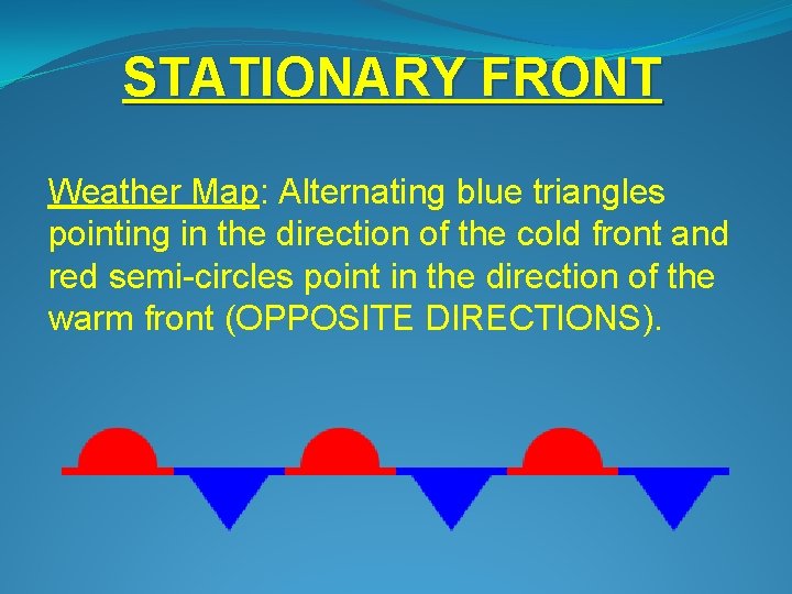
STATIONARY FRONT Weather Map: Alternating blue triangles pointing in the direction of the cold front and red semi-circles point in the direction of the warm front (OPPOSITE DIRECTIONS).

Low Pressure Systems Associated with high winds, warm air, and atmospheric lifting. Clouds, precipitation, and other “bad weather” such as tropical storms and tornadoes. Shown with an “L” on a weather map.

Low Pressure Systems Areas prone to low pressure do not have extreme temperature changes daily or seasonally, because clouds trap heat and block incoming solar radiation. - Equator: warm, light, ascending wet air that cools and condenses into clouds (0°-10° N/S) - Subpolar Low-Pressure Cells: cool, wet weather caused by warm and cold air masses meeting leading to storms (60° N/S latitude)

High Pressure Systems As air cools and condenses, it becomes heavier and falls to the ground, carrying humidity with it. Associated with clear skies and calm weather. Shown as an “H” on a weather map.

High Pressure Systems The absence of clouds means that these areas experience daily and seasonal temperature extremes. Subtropical High-Pressure Cells: hot, dry air descends from the tropics (20°-35° N/S). Polar High-Pressure Cells: extremely cold and dry (90° N/S).

WEATHER SYMBOLS