ACCESS TO DATA FROM MSFD REPORTING Trine Christiansen

- Slides: 21
ACCESS TO DATA FROM MSFD REPORTING Trine Christiansen European Environment Agency
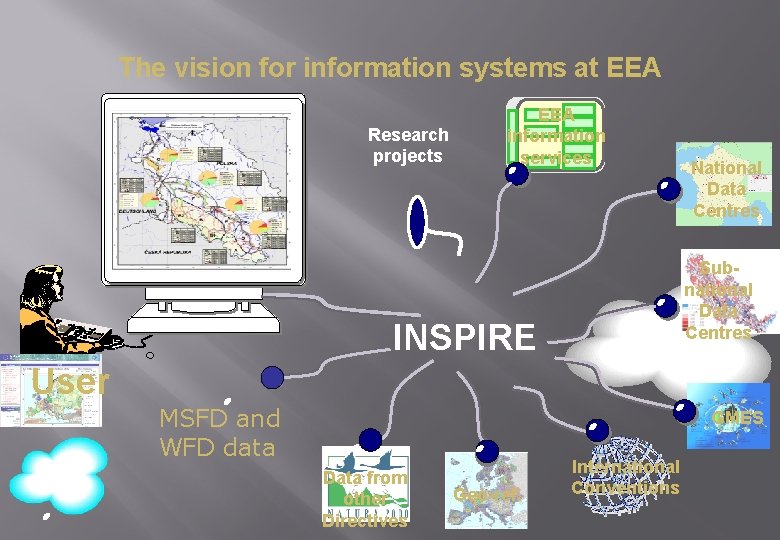
The vision for information systems at EEA Research projects EEA information services National Data Centres Subnational Data Centres INSPIRE User MSFD and WFD data GMES Data from other Directives Geo-ref. International Conventions
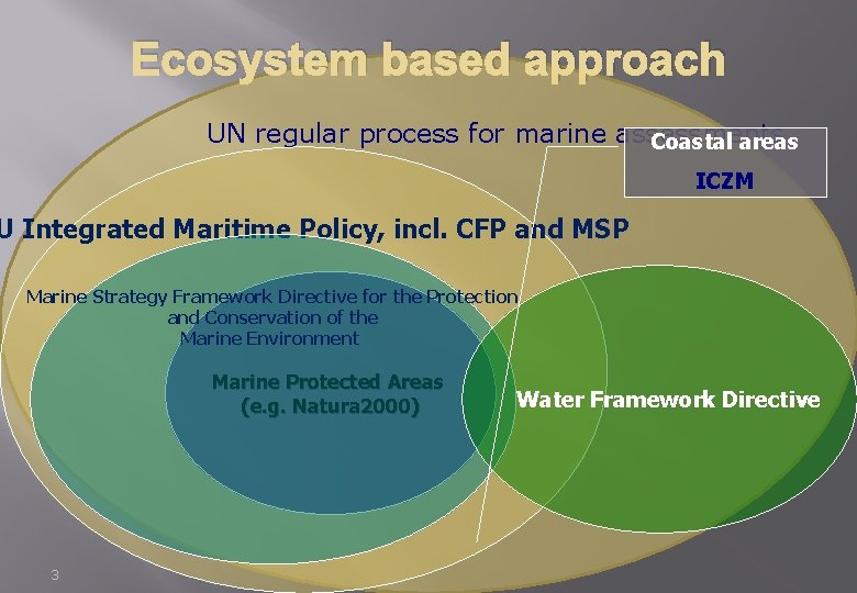
Ecosystem based approach UN regular process for marine assessments Coastal areas ICZM U Integrated Maritime Policy, incl. CFP and MSP Marine Strategy Framework Directive for the Protection and Conservation of the Marine Environment Marine Protected Areas (e. g. Natura 2000) 3 Water Framework Directive
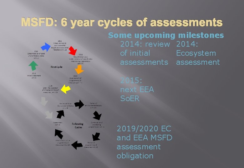
MSFD: 6 year cycles of assessments Some upcoming milestones 2014: review 2014: of initial Ecosystem assessments assessment 2015: next EEA So. ER 2019/2020 EC and EEA MSFD assessment obligation
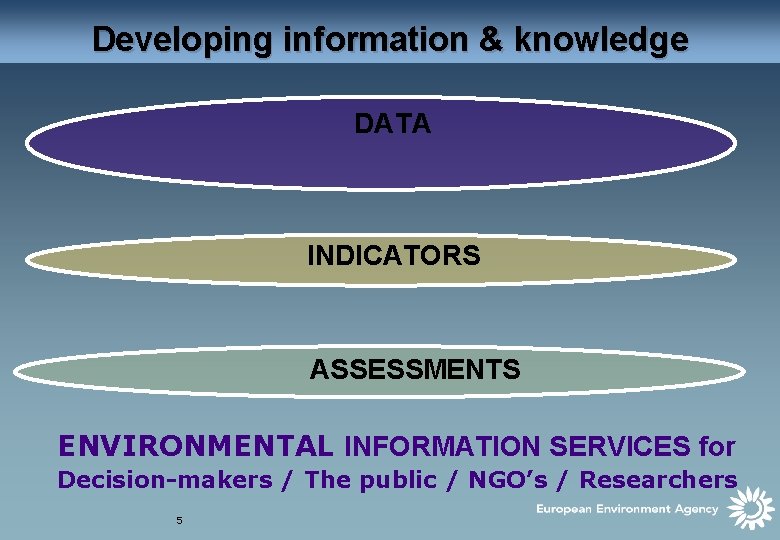
Developing information & knowledge DATA INDICATORS ASSESSMENTS ENVIRONMENTAL INFORMATION SERVICES for Decision-makers / The public / NGO’s / Researchers 5
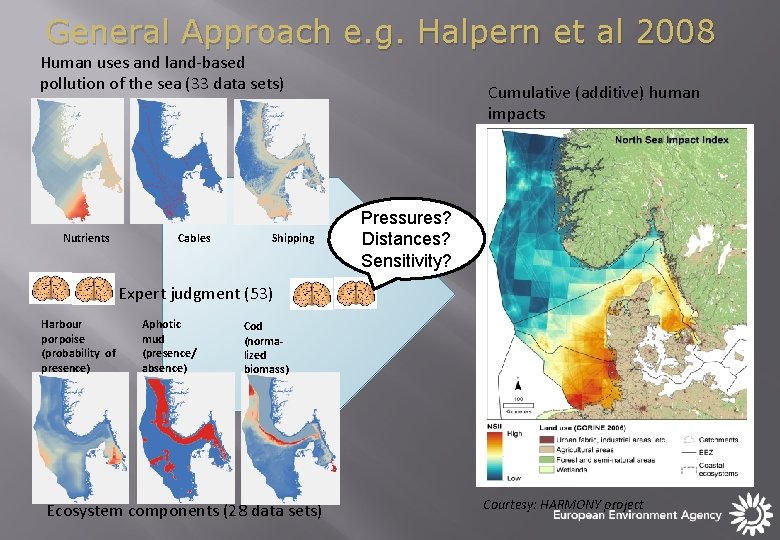
General Approach e. g. Halpern et al 2008 Human uses and land-based pollution of the sea (33 data sets) Nutrients Cables Shipping Cumulative (additive) human impacts Pressures? Distances? Sensitivity? Expert judgment (53) Harbour porpoise (probability of presence) Aphotic mud (presence/ absence) Cod (normalized biomass) Ecosystem components (28 data sets) Courtesy: HARMONY project
Objectives for WISE-Marine � To develop European data sets relevant for GES indicators and monitoring programmes � Prioritized; � Agreed content and format according to the needs of MSFD for use in assessments and to relevant INSPIRE standards; � Ready for assembly. � � To have established effective and efficient data management mechanisms at national and EU levels which allow ready access to the data; To have established public access to the data via web portals, preferably via a single portal.
First and foremost, the objective of WISE-Marine should be to develop data layers/products/indicators at the EU scale, to eventually allow quantitative assessments to be performed. Not sure which legal arguments to use for this, but the Directive is indirectly quantitative by making reference to both indicators and underlying data. A quantitative approach will help fulfill multiple objectives in the long term: MSFD, BD strategy, UN-regular process, Regional sea assessments, and probably others
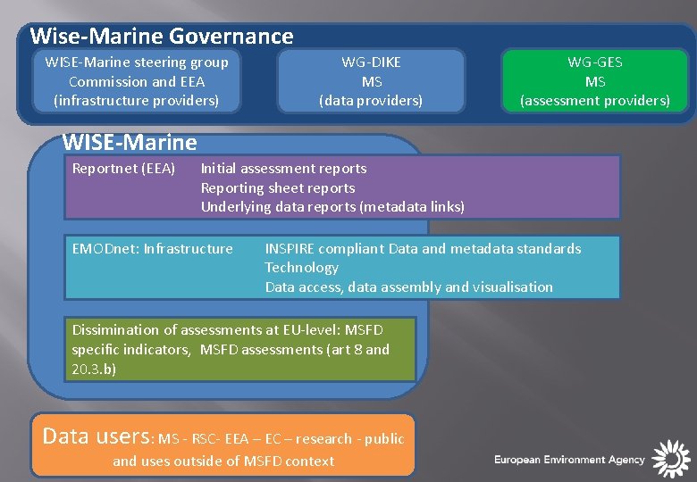
Wise-Marine Governance WISE-Marine steering group Commission and EEA (infrastructure providers) WG-DIKE MS (data providers) WG-GES MS (assessment providers) WISE-Marine Reportnet (EEA) Initial assessment reports Reporting sheet reports Underlying data reports (metadata links) EMODnet: Infrastructure INSPIRE compliant Data and metadata standards Technology Data access, data assembly and visualisation Dissimination of assessments at EU-level: MSFD specific indicators, MSFD assessments (art 8 and 20. 3. b) Data users: MS - RSC- EEA – EC – research - public and uses outside of MSFD context
In the long term: an operational structure � Wise Marine and EMODnet need a working structure that can consider normal data management issues: � Quality assurance and feedback mechanisms to data providers on e. g. meta data and data; � Features and functions needed by users of the system; � Development of specific data products: specific analyses, data layers for specific purposes. � MS and researchers are important users because both can contribute with data and needs.
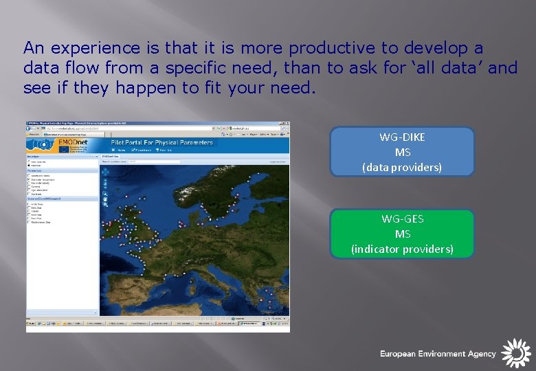
An experience is that it is more productive to develop a data flow from a specific need, than to ask for ‘all data’ and see if they happen to fit your need. WG-DIKE MS (data providers) WG-GES MS (indicator providers)
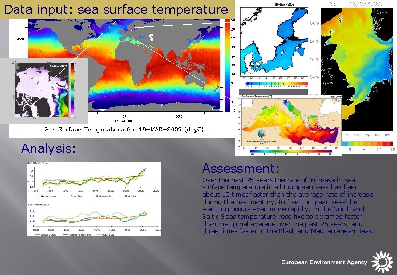
Data input: sea surface temperature Analysis: Assessment: Over the past 25 years the rate of increase in sea surface temperature in all European seas has been about 10 times faster than the average rate of increase during the past century. In five European seas the warming occurs even more rapidly. In the North and Baltic Seas temperature rose five to six times faster than the global average over the past 25 years, and three times faster in the Black and Mediterranean Seas.
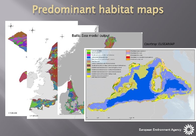
Predominant habitat maps Courtesy: EUSEAMAP
Bringing WISE-Marine and EMODnet together WISE-Marine/MSFD process Use of EMODnet for MSFD purposes should be operational, where possible, from 2012 onwards and fully support MSFD reporting by 2018 * ‘Making data available’ EMODNET (goal for pilot): Develop, test, operate and maintain a portal for data access; *WG-DIKE doc. DIKE 5/2012/09. a 10/27/2020 EMODnet 14
EMODnet
But how far away is 2018? EMODNET: • Is having success in: formats, data discovery and making data available; • Is finding it harder to develop meaningful overall datasets and data products – they will typically need interactions with users. An inverted process? • Outside EMODnet, most used datasets/products arise from a specific need, and the need drives the request for data. 16
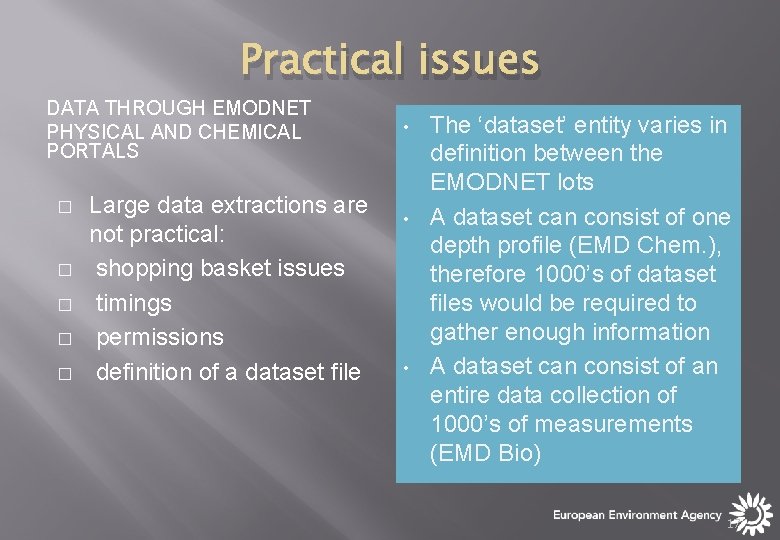
Practical issues DATA THROUGH EMODNET PHYSICAL AND CHEMICAL PORTALS � � � Large data extractions are not practical: shopping basket issues timings permissions definition of a dataset file • • • The ‘dataset’ entity varies in definition between the EMODNET lots A dataset can consist of one depth profile (EMD Chem. ), therefore 1000’s of dataset files would be required to gather enough information A dataset can consist of an entire data collection of 1000’s of measurements (EMD Bio) 17
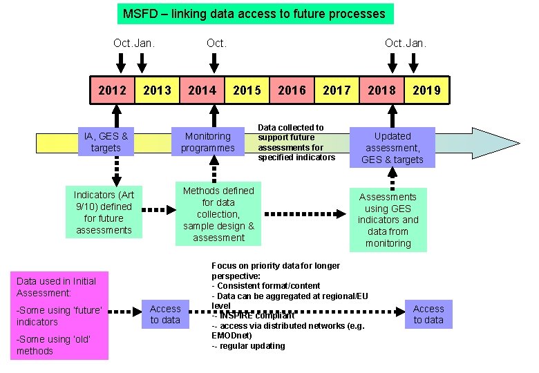
MSFD – linking data access to future processes Oct. Jan. 2012 IA, GES & targets Oct. 2013 2014 Methods defined for data collection, sample design & assessment Data used in Initial Assessment: -Some using ‘old’ methods 2015 Monitoring programmes Indicators (Art 9/10) defined for future assessments -Some using ‘future’ indicators Oct. Jan. Access to data 2016 2017 Data collected to support future assessments for specified indicators 2018 2019 Updated assessment, GES & targets Assessments using GES indicators and data from monitoring Focus on priority data for longer perspective: - Consistent format/content - Data can be aggregated at regional/EU level -- INSPIRE compliant -- access via distributed networks (e. g. EMODnet) -- regular updating Access to data
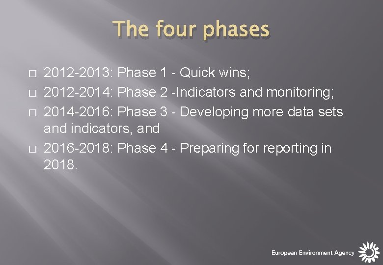
The four phases � � 2012 -2013: Phase 1 - Quick wins; 2012 -2014: Phase 2 -Indicators and monitoring; 2014 -2016: Phase 3 - Developing more data sets and indicators, and 2016 -2018: Phase 4 - Preparing for reporting in 2018.
Phase 1 - quick wins 1. 2. 3. 4. 5. an overview to allow prioritisation and identification of data used in initial assessments, based on reporting of metadata; development of a mechanism for reporting of nutrients, chlorophyll and dissolved oxygen into EMODnet; support to future EMODnet projects on human activities and chemicals; streamlining of reporting requirements for habitats and species, and developing experience for reporting assessment outcomes in a grid-based system.
Thanks for your attention Trine. christiansen@eea. europa. eu