Water for Senegal GIS in Water Resources Fall


")
")


")
- Slides: 16
Water for Senegal GIS in Water Resources Fall 2002 -Term Project Pam Kearfott
Project Objectives n n Develop a better understanding of water issues in Senegal Create basemaps to display and analyze trends and their implications Construct water balance Possible Peace Corps training materials and/or field tools
Senegal – West Africa
Senegal & Bordering Countries
A Brief Country Background § § § Former French colony, size of South Dakota Largely agrarian society, with densely populated, industrialized urban areas Dependence on agriculture and pisciculture Increasing desertification and deforestation Water scarcity is common
Major Features
Rivers, Streams, and Drainage Network RIVERS: Senegal Saloum Gambia Casamance
Data Sources n n AQUASTAT – United Nations Food & Agriculture Organization PASDA – Penn State University’s Digital Chart of the World CRWR’s Digital Atlas of the World Water Balance Geography Network
Methods §Data collection §Separation of country data from continental data §Layer displays §Merging of data & projection systems
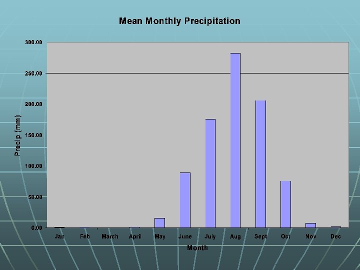
Mean Annual Precipitation Precip (mm)
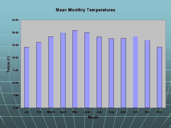
Mean Annual Temperature Temp (C)
August Temperature and Precipitation Gradients Temp Precip
Difficulties Encountered n n n Lack of data for developing countries Anomalies with data sets Data is only from one year – difficult to compare and analyze trends Only 1 runoff measurement in country Incompatibility of projections Still to come – complete water balance
Water Balance (work in progress)