Tornado Detection Limitations David Craft Weather Forecaster Overview
- Slides: 20

Tornado Detection & Limitations David Craft Weather Forecaster

Overview • Background • Doppler Radar Limitations • Examples • Other Tornado Detection Capabilities • Prepare & React Appropriately • References • Bottom Line

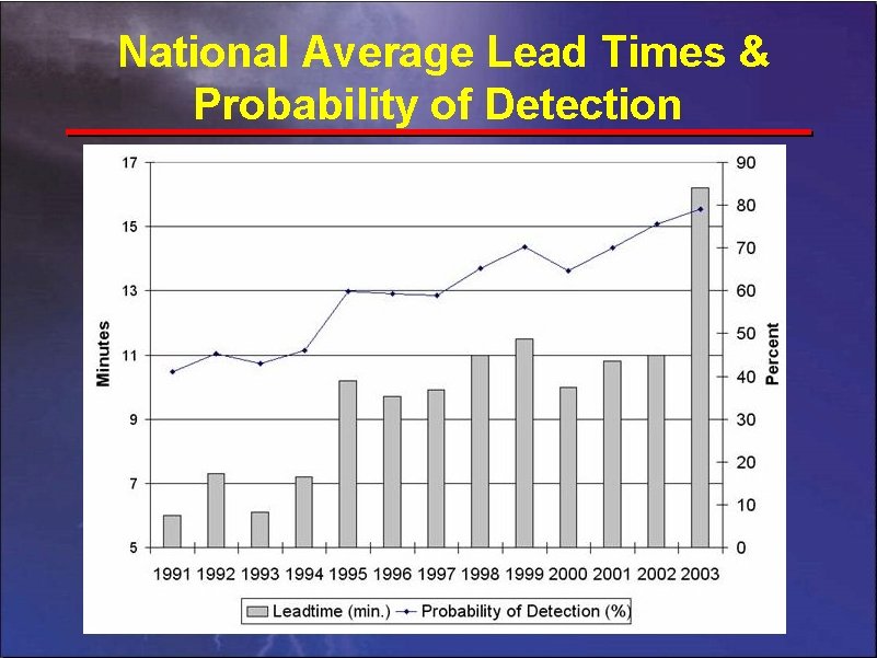
National Average Lead Times & Probability of Detection

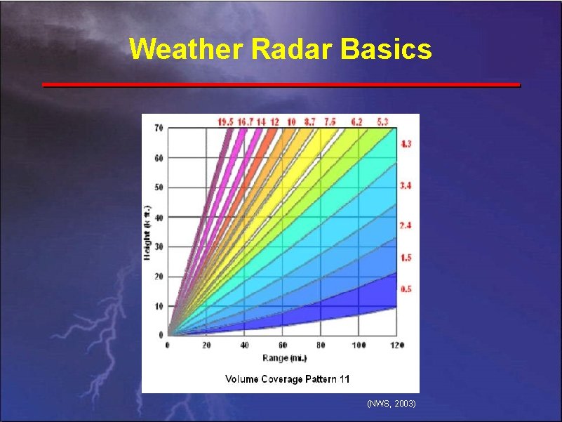
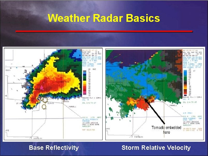
Weather Radar Basics (NWS, 2003)

Weather Radar Basics Base Reflectivity Storm Relative Velocity

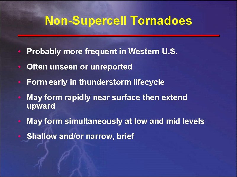
Non-Supercell Tornadoes • Probably more frequent in Western U. S. • Often unseen or unreported • Form early in thunderstorm lifecycle • May form rapidly near surface then extend upward • May form simultaneously at low and mid levels • Shallow and/or narrow, brief

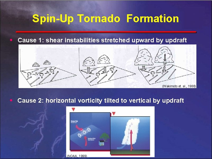
Spin-Up Tornado Formation • Cause 1: shear instabilities stretched upward by updraft (Wakimoto et. al. , 1988) • Cause 2: horizontal vorticity tilted to vertical by updraft (NOAA, 1999)

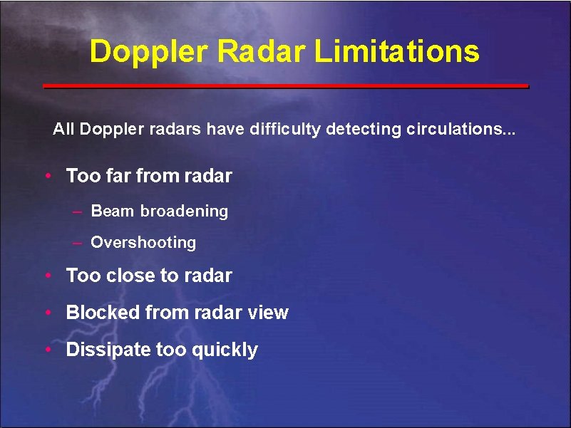
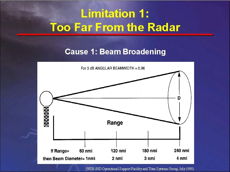
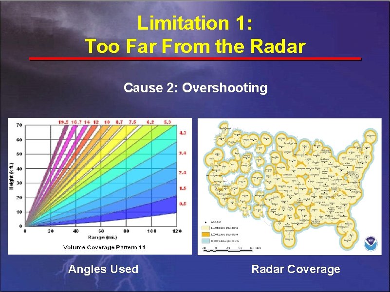
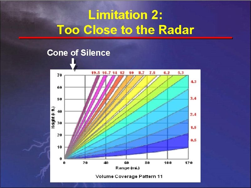
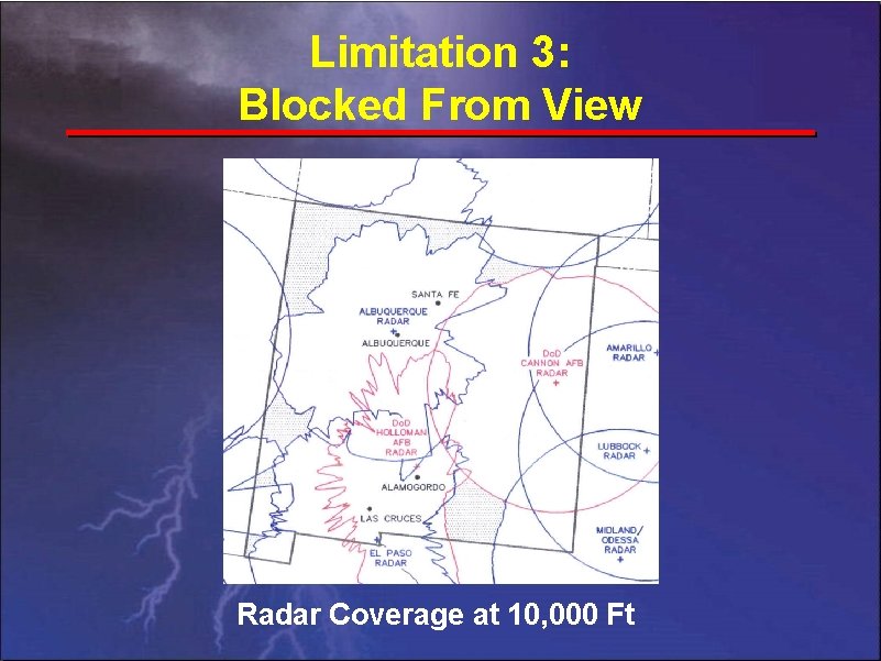
Doppler Radar Limitations All Doppler radars have difficulty detecting circulations. . . • Too far from radar – Beam broadening – Overshooting • Too close to radar • Blocked from radar view • Dissipate too quickly

Limitation 1: Too Far From the Radar Cause 1: Beam Broadening (WSR-88 D Operational Support Facility and Titan Systems Group, July 1998)

Limitation 1: Too Far From the Radar Cause 2: Overshooting Angles Used Radar Coverage

Limitation 2: Too Close to the Radar Cone of Silence

Limitation 3: Blocked From View Radar Coverage at 10, 000 Ft

Limitation 4: Dissipate Too Quickly • Many spin-ups may last only a few minutes • Complete atmosphere scan may take 5 or 6 minutes • Even when detected, spin-ups frequently dissipate before a warning can reach people • New scan strategies will shrink scans to 4. 1 minutes

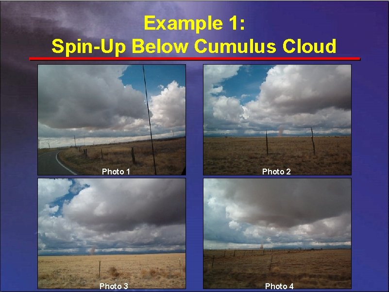
Example 1: Spin-Up Below Cumulus Cloud Photo 1 Photo 3 Photo 2 Photo 4

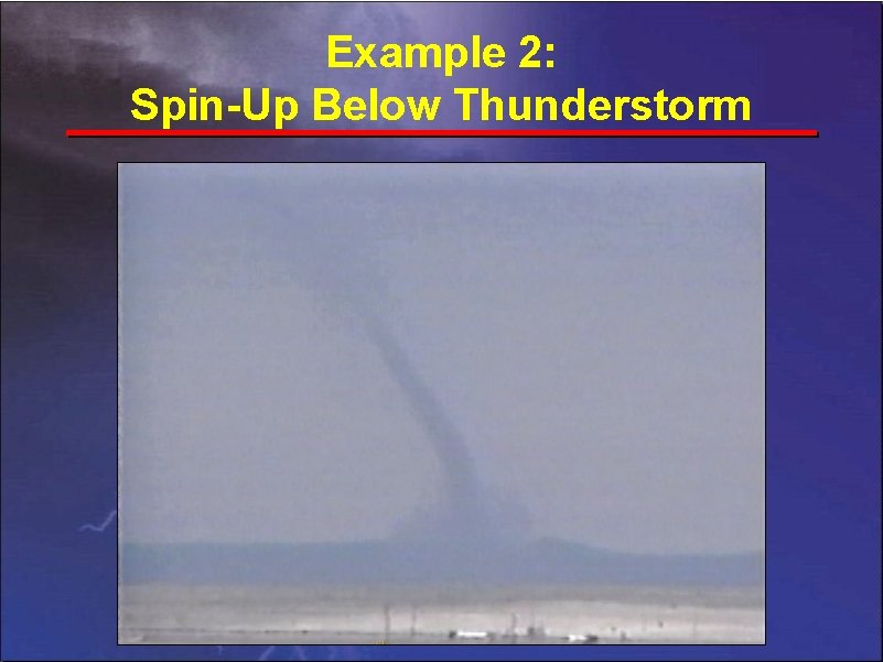
Example 2: Spin-Up Below Thunderstorm

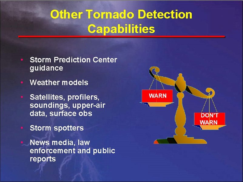
Other Tornado Detection Capabilities • Storm Prediction Center guidance • Weather models • Satellites, profilers, soundings, upper-air data, surface obs • Storm spotters • News media, law enforcement and public reports

Prepare & React Appropriately • FEMA’s tornado safety tips brochure: www. fema. gov/hazards/tornadoes/tornadof. shtm • Watch for small tornadoes with all thunderstorms • U. S. hazards assessment • Severe wx outlook, mesoscale discussions, watches • Hazardous wx outlook & warnings • Use NOAA weather radios • Report tornadoes to NWS, if safely possible

Bottom Line • WSR-88 D’s do a good job at what they’re designed to do: detect strong mid-level circulations • All weather radars have limitations • Small tornadoes frequently exploit these limitations in New Mexico • NWS forecasters use all available resources to overcome tornado detection limitations • Weatherwise media & public can prepare for this dangerous threat and react appropriately when tornadoes strike

References • NOAA, 1999: Thunderstorms…tornadoes…lightning… nature’s most violent storms. A preparedness guide. NOAA/PA #99050, ARC 1122, 16 pp. Cited 2004. [Available online at http: //www. nws. noaa. gov/om/brochures/ttl. pdf]. • NWS, cited 2003: NWS radar FAQs page. [Available online at http: //weather. noaa. gov/radarinfo/radarinfo. html]. • Wakimoto, R. M. , and Wilson, J. W. , 1988: Non-supercell tornadoes. Mon. Wea. Rev. , 117, 1113 -1140. • WSR-88 D Operational Support Facility and Titan Systems Group, July 1998: WSR-88 D Principal User Processor Operator Handbook. Volume II, Applications Terminal, Software Version 10. 0, 267 pp.

Tornado Detection & Limitations Questions for David Craft? David. Craft@noaa. gov