Stratiform Precipitation Processes in Cyclones Passing over the
- Slides: 14

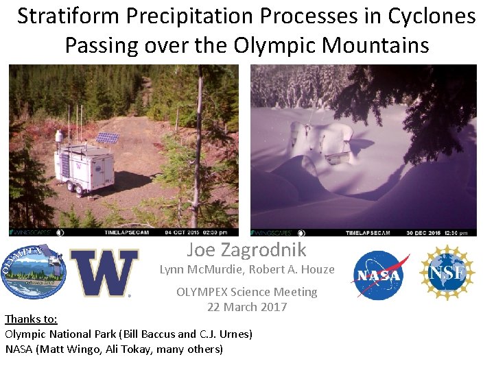
Stratiform Precipitation Processes in Cyclones Passing over the Olympic Mountains Joe Zagrodnik Lynn Mc. Murdie, Robert A. Houze OLYMPEX Science Meeting 22 March 2017 Thanks to: Olympic National Park (Bill Baccus and C. J. Urnes) NASA (Matt Wingo, Ali Tokay, many others)

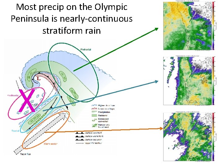
Most precip on the Olympic Peninsula is nearly-continuous stratiform rain X

Goal of this Presentation: • Relate large-scale environmental factors affecting orographic enhancement to precipitation processes: – Flow: • Low-level moisture flux (IVT—Integrated Vapor Transport) – Thermodynamics: • Melting level height • Static Stability – Cloud/Precipitation Microphysics: • Drop size distribution (DSD) and rainfall distribution at a variety of locations/elevations

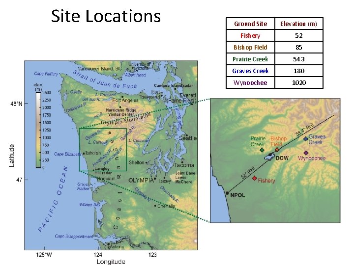
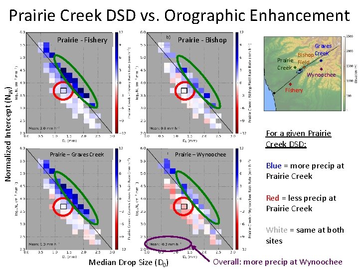
Site Locations Ground Site Elevation (m) Fishery 52 Bishop Field 85 Prairie Creek 543 Graves Creek 180 Wynoochee 1020

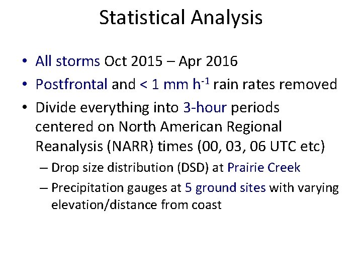
Statistical Analysis • All storms Oct 2015 – Apr 2016 • Postfrontal and < 1 mm h-1 rain rates removed • Divide everything into 3 -hour periods centered on North American Regional Reanalysis (NARR) times (00, 03, 06 UTC etc) – Drop size distribution (DSD) at Prairie Creek – Precipitation gauges at 5 ground sites with varying elevation/distance from coast

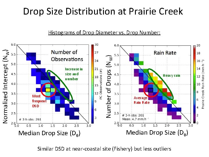
Drop Size Distribution at Prairie Creek Increase in size and number Most frequent DSD Median Drop Size (D 0) Number of Drops (NW) Normalized Intercept (NW) Histograms of Drop Diameter vs. Drop Number: Heavy rain Average Rain Rate Median Drop Size (D 0) Similar DSD at near-coastal site (Fishery) but less outliers

Prairie Creek DSD vs. Orographic Enhancement Prairie - Fishery Prairie - Bishop Graves Bishop Creek Normalized Intercept (NW) Prairie Field Creek Wynoochee Fishery For a given Prairie Creek DSD: Prairie – Graves Creek Prairie – Wynoochee Blue = more precip at Prairie Creek Red = less precip at Prairie Creek White = same at both sites Median Drop Size (D 0) Overall: more precip at Wynoochee

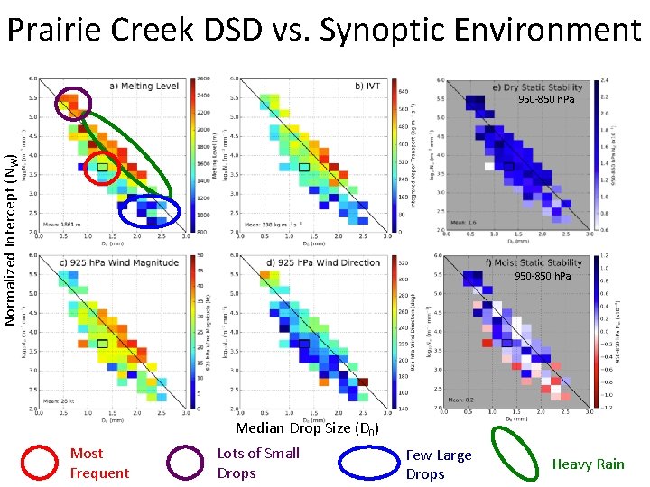
Prairie Creek DSD vs. Synoptic Environment Normalized Intercept (NW) 950 -850 h. Pa Median Drop Size (D 0) Most Frequent Lots of Small Drops Few Large Drops Heavy Rain

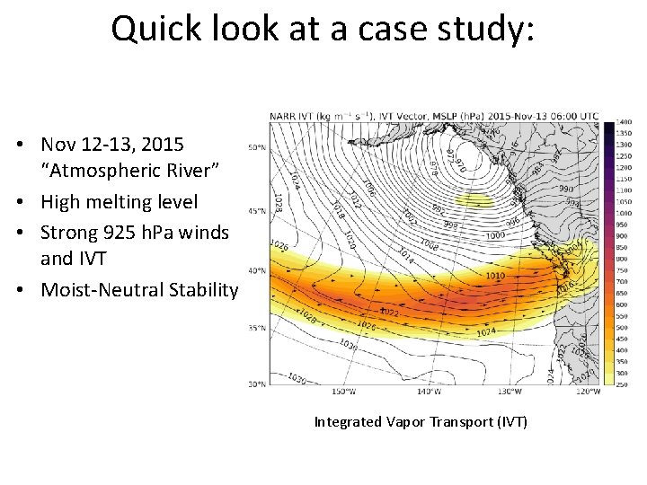
Quick look at a case study: • Nov 12 -13, 2015 “Atmospheric River” • High melting level • Strong 925 h. Pa winds and IVT • Moist-Neutral Stability Integrated Vapor Transport (IVT)

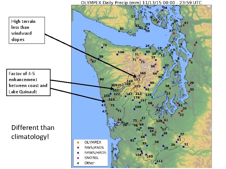
High terrain less than windward slopes Factor of 4 -5 enhancement between coast and Lake Quinault Different than climatology!

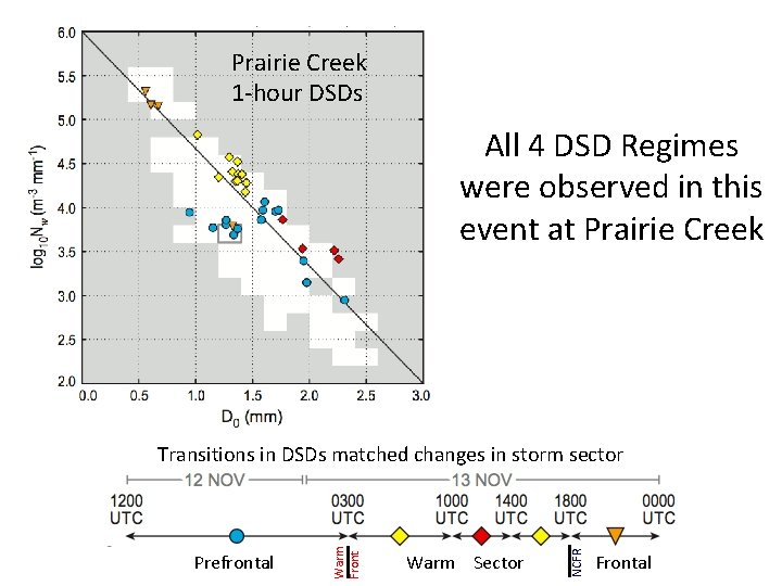
Prairie Creek 1 -hour DSDs All 4 DSD Regimes were observed in this event at Prairie Creek Warm Sector NCFR Prefrontal Warm Front Transitions in DSDs matched changes in storm sector Frontal

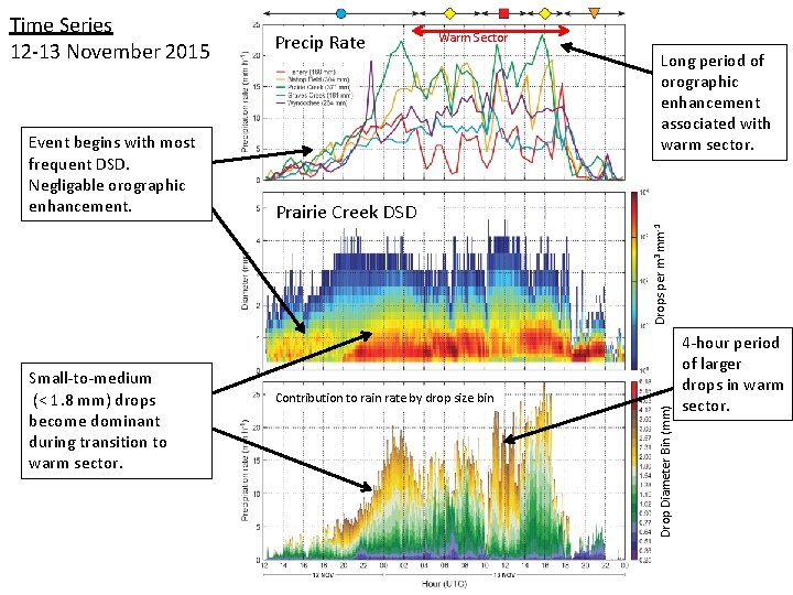
Time Series 12 -13 November 2015 Warm Sector Long period of orographic enhancement associated with warm sector. Prairie Creek DSD Small-to-medium (< 1. 8 mm) drops become dominant during transition to warm sector. Contribution to rain rate by drop size bin Drop Diameter Bin (mm) Drops per m 3 mm-1 Event begins with most frequent DSD. Negligable orographic enhancement. Precip Rate 4 -hour period of larger drops in warm sector.

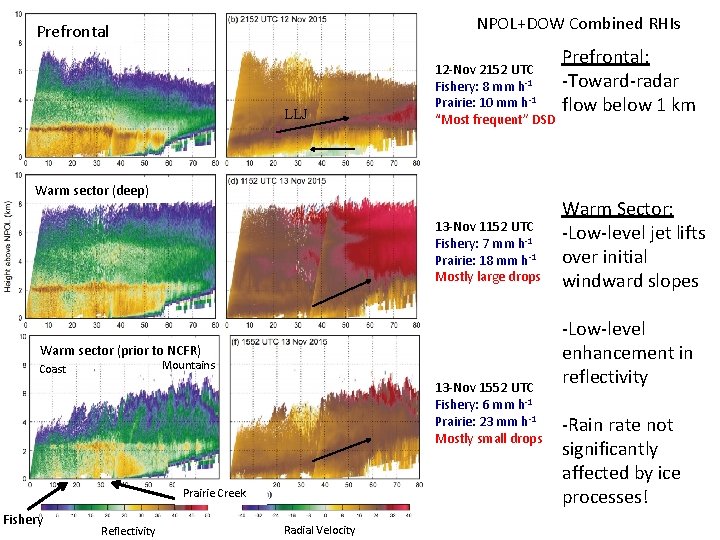
NPOL+DOW Combined RHIs Prefrontal LLJ 12 -Nov 2152 UTC Fishery: 8 mm h-1 Prairie: 10 mm h-1 “Most frequent” DSD Warm sector (deep) 13 -Nov 1152 UTC Fishery: 7 mm h-1 Prairie: 18 mm h-1 Mostly large drops Warm sector (prior to NCFR) Mountains Coast 13 -Nov 1552 UTC Fishery: 6 mm h-1 Prairie: 23 mm h-1 Mostly small drops Prairie Creek Fishery Reflectivity Radial Velocity Prefrontal: -Toward-radar flow below 1 km Warm Sector: -Low-level jet lifts over initial windward slopes -Low-level enhancement in reflectivity -Rain rate not significantly affected by ice processes!

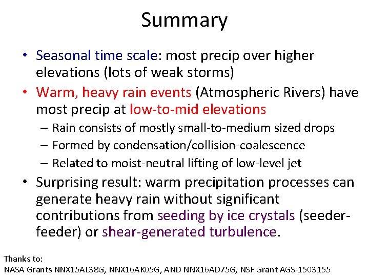
Summary • Seasonal time scale: most precip over higher elevations (lots of weak storms) • Warm, heavy rain events (Atmospheric Rivers) have most precip at low-to-mid elevations – Rain consists of mostly small-to-medium sized drops – Formed by condensation/collision-coalescence – Related to moist-neutral lifting of low-level jet • Surprising result: warm precipitation processes can generate heavy rain without significant contributions from seeding by ice crystals (seederfeeder) or shear-generated turbulence. Thanks to: NASA Grants NNX 15 AL 38 G, NNX 16 AK 05 G, AND NNX 16 AD 75 G, NSF Grant AGS-1503155