SRI LANKA High mountains occupy the southcentral part


 are very poor !")


- Slides: 23
SRI LANKA High mountains occupy the southcentral part of the country with altitude up to 2, 524 m 1
Total land area of Sri Lanka 65, 610 Km 2 Population – 20 million (2012) The existing meteorological network 23 Synoptic Meteorological Stations 37 Automatic Weather Stations 35 Agro-Meteorological Stations 350 Rain-gauge Stations 2
Availability of Historical Climate Data available from 1861 Uninterrupted climate data series available from 1861 - to date at 12 meteorological stations Rainfall data available from the 19 th Century available for over 150 rain-gauge stations Except for daily rainfall and temperature data of all the stations, the balance data sets are still not digitized. The status of the data files are so poor and therefore their recovery and digitization is an issue which need tackled urgently and with expert care ! 3
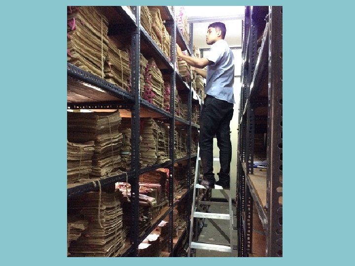
How data records are stored All the data records were stored until very recently in a Record Room with no proper ventilation, humidity/temperature control. During the last few years the Record Room was upgraded with Temperature/humidity control BUT due to poor storage conditions prior to upgrading, some of the data files are in a very poor condition. 4
Principal Meteorological Stations Agrometeorological Stations Raingauge Stations Upper Air Stations Present-day Meteorological Station Network in Sri Lanka 5
View of the Record Room of the Department of Meteorology During the last two years, managed to improve the condition of the record room 6
7
8
9
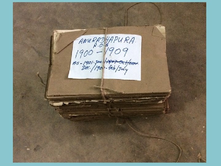
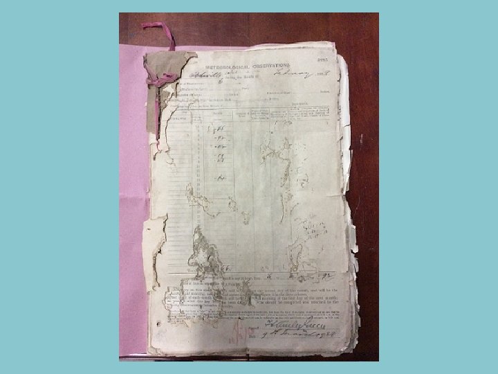
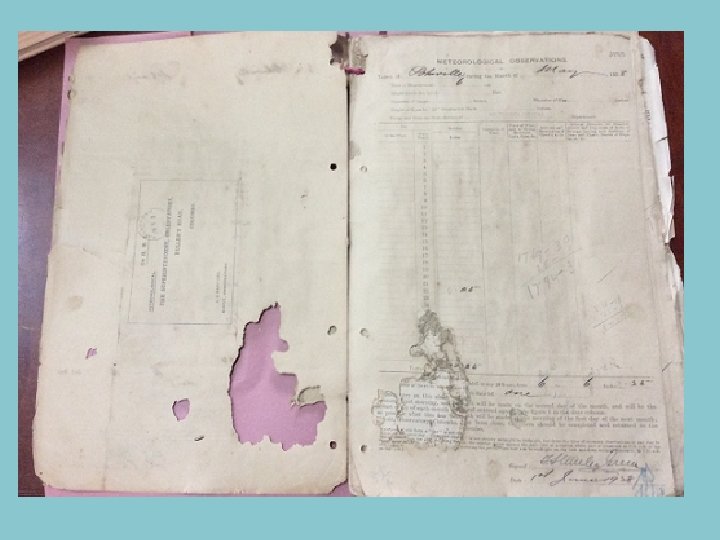
The present condition of these data files (most are bound) are very poor ! Even turning pages of these bound records results in permanent damage 10
11
The present status of some of the charts of the 19 th Century observations 12
13
15
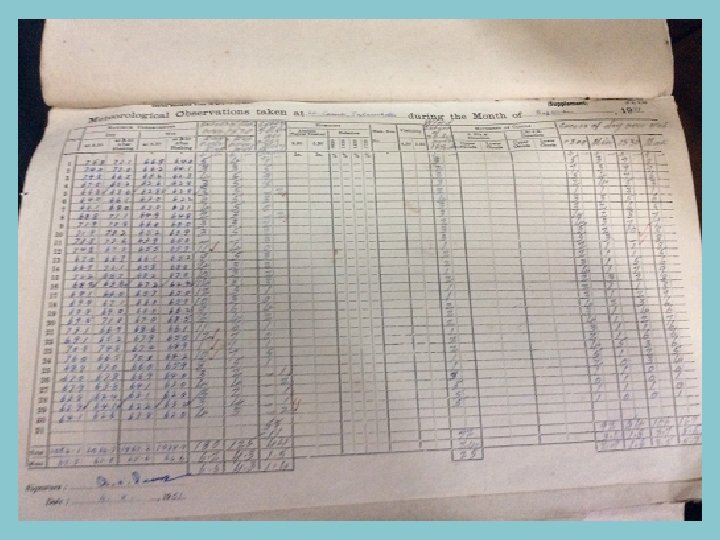
Detail of Availabile Climate Data Already Digitized No. of Daily rainfall Records ≈ 13. 5 million No. of Daily Temperature (Max Min) ≈ 1. 6 million Element Temperature Humidity Rainfall Pressure Others Approximate No. of years 990 1050 980 60 Chart type Daily daily Details of non-digitized paper based infomations Instruments charts Total No. of charts available 361350 383250 357700 21900 Year of the earliest chart 1898 1909 1898 1900 Daily Observation Books with 3 -hourly obsevation Approximately 17, 500 months of records (a record of a months spans 8 -10 pages. ) 20
Gaps & Needs 21
Gaps & Needs Resources and Technology –. . Governments have other priority issues. . Meteorological services are run with very tight budgets Technological issues It is not just an issue of scanning these paper records. Due to poor quality of paper files, not possible to use ordinary scanners ! In 1990 s, several attempts were made to scan the data files. Due to poor quality of files, these efforts resulted in failures. 22
Gaps & Needs…. . Therefore, we need technical guidance with expert and financial assistance from WMO or its partner agency (CCI, GFCS etc. ) care to : - preserve and store the records in well-organized manner - rescue & digitize (or imaging) the remaining climate records/chars - file management of digitized data & images. - proper data-base management system. The other gap we are facing is insufficient human resources in the Department. this can be overcome by hiring capable manpower from private agency or university. CLICOM system was given by the WMO with necessary training and required software. Then CLIMSOFT was introduced and initially technical support was given. Then no more technical guidance for these systems.