Operational Use of Lightning Mapping Array Data Geoffrey

- Slides: 16
Operational Use of Lightning Mapping Array Data Geoffrey Stano, Dennis Buechler, and Christopher Darden Fifth Meeting of the Science Advisory Committee 18 -20 November, 2009 National Space Science and Technology Center, Huntsville, AL transitioning unique NASA data and research technologies to operations
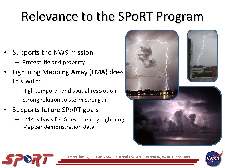
Relevance to the SPo. RT Program • Supports the NWS mission – Protect life and property • Lightning Mapping Array (LMA) does this with: – High temporal and spatial resolution – Strong relation to storm strength • Supports future SPo. RT goals – LMA is basis for Geostationary Lightning Mapper demonstration data transitioning unique NASA data and research technologies to operations
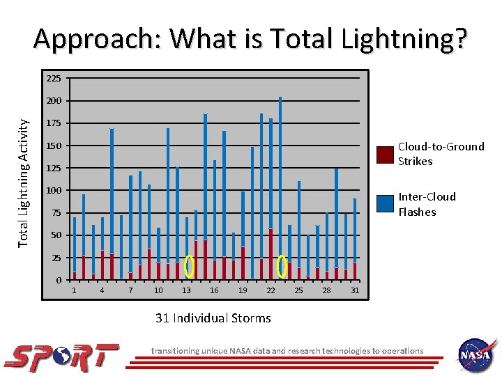
Approach: What is Total Lightning? 225 Total Lightning Activity 200 175 Cloud-to-Ground Strikes 150 125 100 Inter-Cloud Flashes 75 50 25 0 1 4 7 10 13 16 19 22 25 28 31 31 Individual Storms transitioning unique NASA data and research technologies to operations
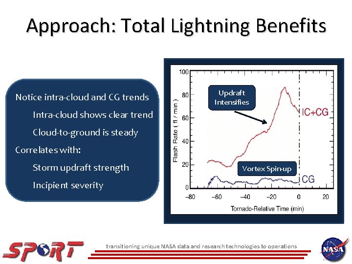
Approach: Total Lightning Benefits Notice intra-cloud and CG trends Updraft Intensifies Intra-cloud shows clear trend Cloud-to-ground is steady Correlates with: Storm updraft strength Vortex Spin-up Incipient severity transitioning unique NASA data and research technologies to operations
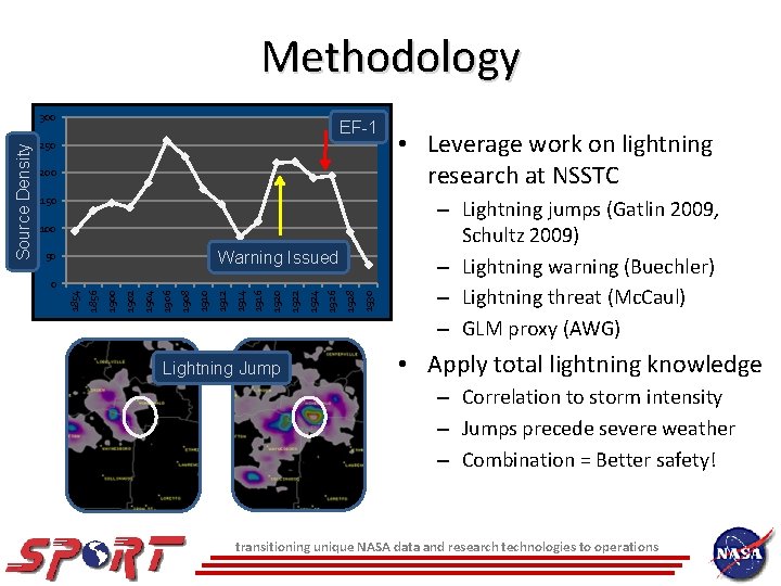
Methodology EF-1 250 200 150 100 Warning Issued 50 Lightning Jump 1930 1928 1926 1924 1922 1920 1916 1914 1912 1910 1908 1906 1904 1902 1900 1856 0 1854 Source Density 300 • Leverage work on lightning research at NSSTC – Lightning jumps (Gatlin 2009, Schultz 2009) – Lightning warning (Buechler) – Lightning threat (Mc. Caul) – GLM proxy (AWG) • Apply total lightning knowledge – Correlation to storm intensity – Jumps precede severe weather – Combination = Better safety! transitioning unique NASA data and research technologies to operations
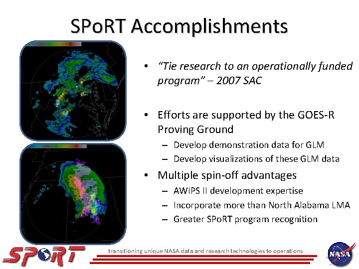
SPo. RT Accomplishments • “Tie research to an operationally funded program” – 2007 SAC • Efforts are supported by the GOES-R Proving Ground – Develop demonstration data for GLM – Develop visualizations of these GLM data • Multiple spin-off advantages – AWIPS II development expertise – Incorporate more than North Alabama LMA – Greater SPo. RT program recognition transitioning unique NASA data and research technologies to operations
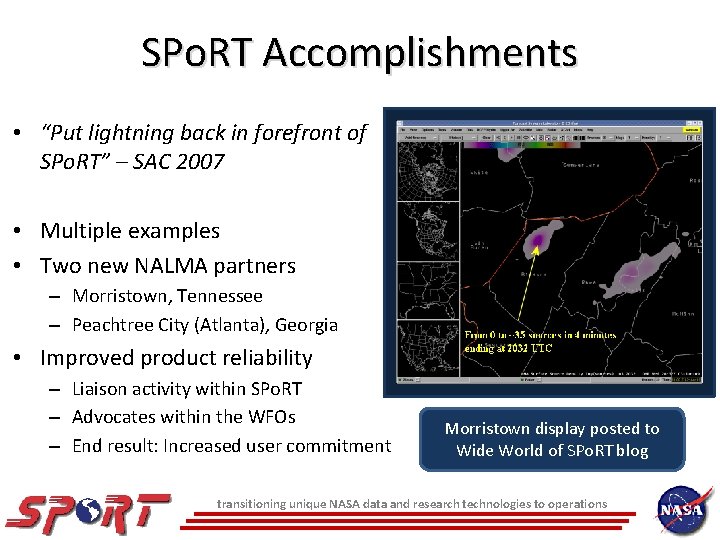
SPo. RT Accomplishments • “Put lightning back in forefront of SPo. RT” – SAC 2007 • Multiple examples • Two new NALMA partners – Morristown, Tennessee – Peachtree City (Atlanta), Georgia • Improved product reliability – Liaison activity within SPo. RT – Advocates within the WFOs – End result: Increased user commitment Morristown display posted to Wide World of SPo. RT blog transitioning unique NASA data and research technologies to operations
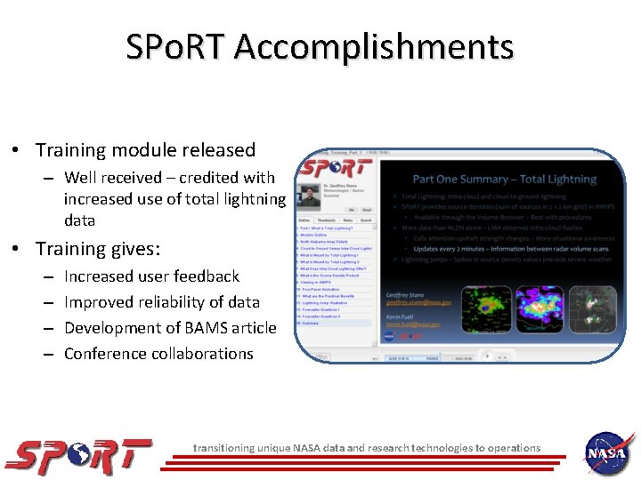
SPo. RT Accomplishments • Training module released – Well received – credited with increased use of total lightning data • Training gives: – – Increased user feedback Improved reliability of data Development of BAMS article Conference collaborations transitioning unique NASA data and research technologies to operations
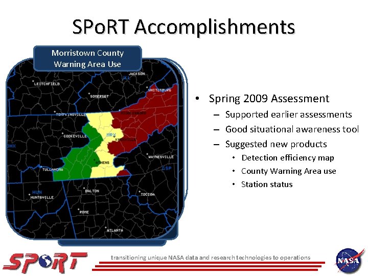
SPo. RT Accomplishments Morristown County NALMA Station Warning Area Use Status • Spring 2009 Assessment – Supported earlier assessments – Good situational awareness tool – Suggested new products • Detection efficiency map • County Warning Area use • Station status Based on percentage of total sources observed by station every 2 Efficiency min Basic Detection transitioning unique NASA data and research technologies to operations
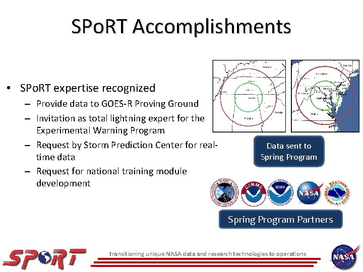
SPo. RT Accomplishments • SPo. RT expertise recognized – Provide data to GOES-R Proving Ground – Invitation as total lightning expert for the Experimental Warning Program – Request by Storm Prediction Center for realtime data – Request for national training module development Data sent to Spring Program Partners transitioning unique NASA data and research technologies to operations
Current Efforts: SCAN System for Convection Analysis and Nowcasting • Results from forecaster feedback – Want to see trend of LMA data – Currently unavailable in real-time • Mamoudou Ba (MDL) is main collaborator – Tracks radar cells – Associates LMA to cells – First applied to Washington D. C. LMA – Implementing at Huntsville transitioning unique NASA data and research technologies to operations
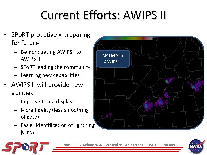
Current Efforts: AWIPS II • SPo. RT proactively preparing for future – Demonstrating AWIPS I to AWIPS II – SPo. RT leading the community – Learning new capabilities NALMA in AWIPS II • AWIPS II will provide new abilities – Improved data displays – More fidelity (less smoothing of data) – Easier identification of lightning jumps transitioning unique NASA data and research technologies to operations
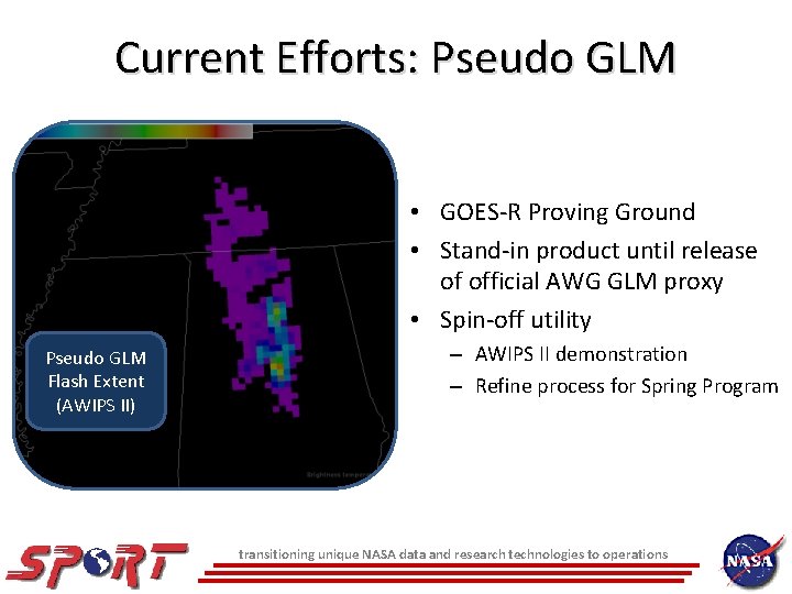
Current Efforts: Pseudo GLM • GOES-R Proving Ground • Stand-in product until release of official AWG GLM proxy • Spin-off utility Pseudo GLM Flash Extent (AWIPS II) – AWIPS II demonstration – Refine process for Spring Program transitioning unique NASA data and research technologies to operations
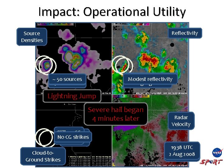
Impact: Operational Utility Reflectivity Source Densities Modest reflectivity Modest Strong Signature ~ 50 sources 250+ sources Lightning Jump Severe hail began 4 minutes later Still nono CGCG Still Nostrikes CG strikes Cloud-to. Ground Strikes Radar Velocity 1938 UTC 1946 1942 UTC 22 Aug 2008
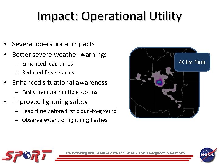
Impact: Operational Utility • Several operational impacts • Better severe weather warnings – Enhanced lead times – Reduced false alarms 40 km Flash • Enhanced situational awareness – Easily monitor multiple storms • Improved lightning safety – Lead time before first cloud-to-ground – Observe extent of lightning flashes transitioning unique NASA data and research technologies to operations
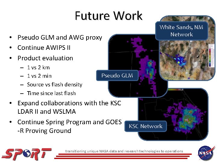
Future Work • Pseudo GLM and AWG proxy • Continue AWIPS II • Product evaluation – – 1 vs 2 km 1 vs 2 min Source vs flash density Time since last flash White Sands, NM Network Pseudo GLM • Expand collaborations with the KSC LDAR II and WSLMA • Continue Spring Program and GOES KSC Network -R Proving Ground transitioning unique NASA data and research technologies to operations