Management of coastal recession at WaltonontheNaze Case Study
")


- Slides: 11
Management of coastal recession at Walton-on-the-Naze (Case Study)
• Walton-on-the-Naze is a coastal town in Essex. It suffers from coastal erosion due to the types of rock which make up the cliff. • The rock types are London Clay and Red Crag and both of these rock types are easily eroded by the sea. • The cliffs also suffer from slumping which makes the defence of the area even more complex. • Longshore drift moves sand along the coastline from south to north. • All of these factors must be considered when deciding the type of management that will be effective in an area.
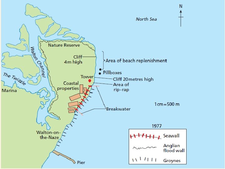
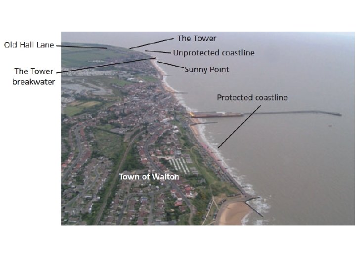
• Walton can be split into two distinct areas. The northern end of the coastline has not been protected because the Environment Agency does not consider the buildings there worth saving. • The only buildings there a Grade II listed Tower and several houses on Old Hall Lane. • The southern part of the coastline has been protected because of the coastal town of Walton with its population of 12, 000.
• In 1977 a major project was completed on the southern part of the coastline. • It consisted of a seawall, breakwaters and groynes. This was to protect the properties on the cliff such as Sunny Point road where the average house price is £ 400, 000. • It must be considered why these particular techniques were used at Walton?
• Groynes were used because longshore drift was occurring along the coastline from the south to the north. The groynes would help to stop longshore drift and keep the beach in place. Breakwaters, which are large groynes, were also placed at regular intervals because of the power of the longshore drift on this particular coastline.
• The cliff was regraded to produce a gentler slope and drainage channels were installed to allow water to flow underground through special tunnels and out onto the beach through holes in the seawall. • The regraded cliff was planted with a variety of shrubs and trees which included gorse and nettles at the side of the path to stop people from scrambling on the cliff. • At the bottom of the cliff there is a seawall - this is to protect the London clay there which is very easily eroded by the sea.
• In 1998 the council paid £ 167, 000 for 300 tonnes of granite to be placed around the Tower breakwater. • This rip-rap has slowed down erosion in this area but has not stopped it. The beach in front of the cliffs at the northern part of the coastline was replenished in 1999 with sand gravel which had been dredged from Harwich Harbour. • However, the majority of this material had been removed by 2003 illustrating the power of longshore drift along this stretch of coastline.
Today’s Activity • Complete the worksheet. • You only have until the end of this lesson. • Stick in the worksheet. • If you finish, read through your exercise book/textbook as revision for the test.
Swanage 2005 Swanage 2006