THE COASTAL PLAINS THE COASTAL PLAINS Coastal plains


- Slides: 13

THE COASTAL PLAINS

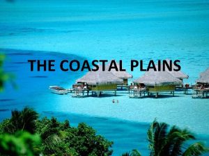
THE COASTAL PLAINS Coastal plains are characterized by an area of flat low lying land that is situated adjacent to a water body often a sea or ocean. It is also of note that coastal plains are separated from the interior of the larger land mass by other unique features.

THE COASTAL PLAINS The total coast line of India is around 4500 km.

THE COASTAL PLAINS The great peninsular plateau is flanked by narrow coastal strips on both the western and the eastern sides along the Arabian sea and the Bay of Bengal respectively. They are known as the coastal plains

THE COASTAL PLAINS The Coastal Plains Western coastal plains Eastern coastal plains

THE COASTAL PLAINS Western coastal plains : The western coastal plains consist of a narrow strip of land in the western part of India between the Western Ghats and the Arabian Sea.

The Western Coastal Plains They extend from Gujarat in the north to the south in Kerala. It is a narrow plain whose width varies from 50 to 80 km. The western coastal plains are smaller than the eastern coastal plains and the region is divided into four parts. 1) Gujarat coastal plains. 2) Konkan coastal plains. 3) Kannad coastal plains. 4) Malabar coastal plains.

The Western Coastal Plains Numerous rivers and backwaters inundate the region. Originating in the Western Ghats, the rivers are fast-flowing and mostly perennial, leading to the formation of estuaries. Major rivers flowing into the sea are the Tapi, Narmada, Mandovi and Zuari. An estuary is a partly enclosed coastal body of water with one or more rivers or streams flowing into it, and with a free connection to the open sea.

The Western Coastal Plains The western coastal plains are characterized by numerous backwaters or lagoons. A lagoon is a body of shallow sea water or brackish water separated from the sea by some form of barrier. The storm activity here is considerably less than on the eastern coastal plains.

THE COASTAL PLAINS The Eastern Coastal Plains : The Eastern Coastal Plain is a wide stretch of land lying between the Eastern Ghats and the Bay of Bengal.

The Eastern Coastal Plains It stretches from Tamil Nadu in the south to West Bengal in the north. The width of the plains varies between 100 and 130 km. The eastern coastal plains are wider and leveled than the western coastal plains and the region is divided into two parts. 1) The Northern Circa. 2) The Coromandel Coast.

The Eastern Coastal Plains 1) The Northern Circar. The region between the Mahanadi river and the Krishna river. 2) Coromandel Coast. The region between the Krishna river and the Kavery river.

The Eastern Coastal Plains Large rivers such as the Mahanadi, the Godavari, the Krishna and the Kavery have formed extensive delta on this coast. Lake Chilika is an important feature along the eastern coast. It is the largest salt water lake in India. A delta is a low triangular landform of alluvial deposits at the mouth of a river where that river flows into an ocean or a large body of water.
 Gulf coastal plains
 The four regions of texas
 Atlantic coastal plain facts
 Natural resources in the plains
 Continental divide
 Coastal sand plains texas
 Coastal plains texas climate
 Blue ridge region
 Varsha bhat
 Pineywoods ecoregion
 Valley and ridge animals
 Gulf coastal plains subregions
 Coastal plains ga to columbus georgia gps
 Coastal plains ga to columbus georgia gps

