EPO THE EPO East Pacific Oscillation index Last


- Slides: 12

EPO THE EPO (East Pacific Oscillation index) Last winter, the EPO was the factor that ended up having its greatest impact on our pattern across the US. The EPO is a height anomaly over Alaska, the Bering Sea, and far NE Russia. A negative state favors warmth across most of the US, while a positive state favors cold weather across most of the US. In all the research I have done on the EPO, the only thing I could find is that it has a high correlation to the NOI (pressure index in the North Pacific) which runs in 6 -8 year trends. Based on this, the EPO should be making a switch from a 6 -8 year positive state to a 6 -8 year negative state either this winter or the next, since we have just passed year 7 of it being positive. (Posted during winter of 2006 -2007)

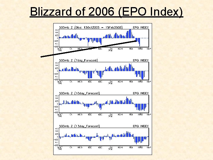
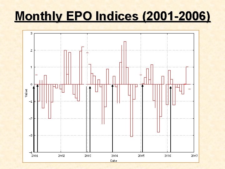
Blizzard of 2006 (EPO Index)

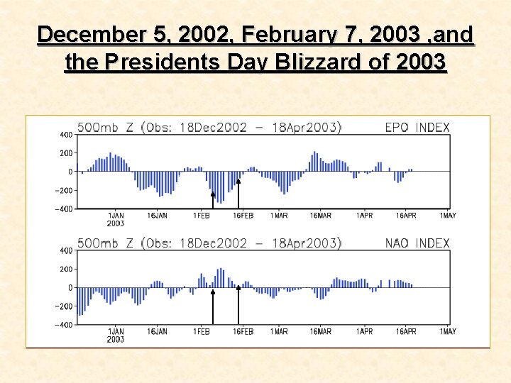
December 5, 2002, February 7, 2003 , and the Presidents Day Blizzard of 2003

Other Factors: NAO and EPO Index • The Eastern Pacific Oscillation (EPO) is the upper wind flow over the Eastern Pacific influenced by the ocean. When in a positive phase, the EPO generally is reflected by dominant stronger zonal flow and/or “troughing” along the West Coast of the U. S. This combination, in turn, tends to funnel milder Pacific air well inland into the country and thus, limits arctic outbreaks by holding them at bay up in Canada. When the EPO is dominated by a negative phase (as with the NAO), more ridging develops along the West Coast as higher pressure extends from the Gulf of Alaska south along the West Coast of Canada (opposite of the positive phase). This, in turn, encourages a northwesterly flow from Canada into the middle and eastern sections of the US and thus, the delivery of polar or arctic air. EPO and Other Climate Indices Click Here for Current EPO Index and Forecast

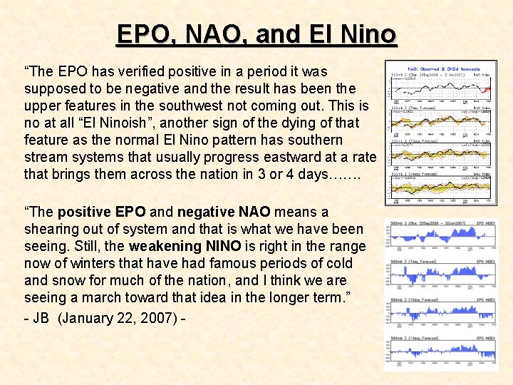
EPO, NAO, and El Nino “The EPO has verified positive in a period it was supposed to be negative and the result has been the upper features in the southwest not coming out. This is no at all “El Ninoish”, another sign of the dying of that feature as the normal El Nino pattern has southern stream systems that usually progress eastward at a rate that brings them across the nation in 3 or 4 days……. “The positive EPO and negative NAO means a shearing out of system and that is what we have been seeing. Still, the weakening NINO is right in the range now of winters that have had famous periods of cold and snow for much of the nation, and I think we are seeing a march toward that idea in the longer term. ” - JB (January 22, 2007) -

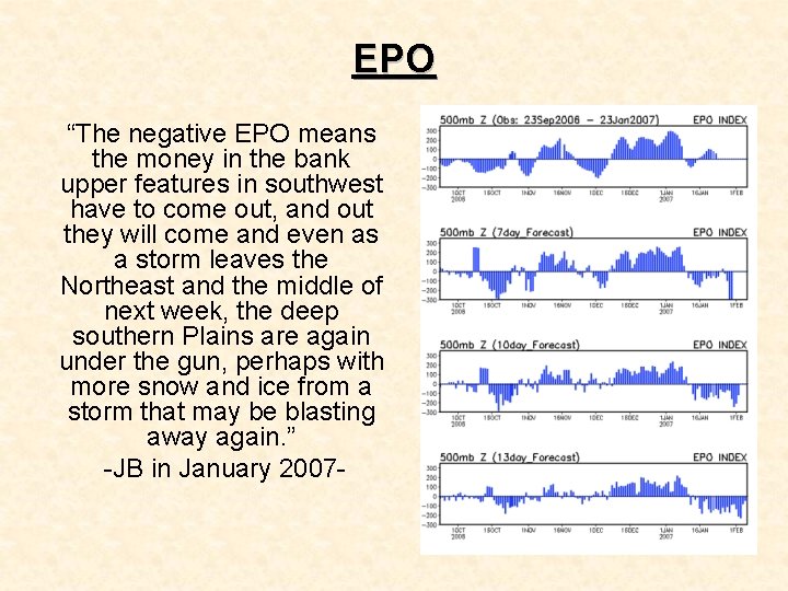
EPO “The negative EPO means the money in the bank upper features in southwest have to come out, and out they will come and even as a storm leaves the Northeast and the middle of next week, the deep southern Plains are again under the gun, perhaps with more snow and ice from a storm that may be blasting away again. ” -JB in January 2007 -

Monthly EPO Indices (2001 -2006)


