OCEANESS 410 5 Evidence for Plate Tectonics from


- Slides: 31

OCEAN/ESS 410 5. Evidence for Plate Tectonics from Magnetics William Wilcock

Lecture/Lab Learning Goals • Understand the basic characteristics of the Earth’s magnetic field and how one measures its orientation • Know the different kinds of rock magnetization and their use in paleomagnetism • Be able to explain the historical concept of polar wander and its explanation in terms of continental drift • Be able to explain patterns of marine magnetic anomalies in terms of plate spreading and magnetic field reversals • Know how to interpret marine magnetic anomalies - LAB

Magnetic north pole Geographic north pole Earth’s Magnetic Field The Earth is surrounded by a magnetic field that is strongest near the poles. The magnetic poles are displaced ~ 11. 5° from the geographic poles about which the Earth rotates. Magnetic south pole Geographic south Pole south pole After Plummer Geodynamo Theory: The magnetic field is generated in the liquid metal region of the outer core. The outer core is extremely hot and flows at a rate of several km/yr in large convection currents. Convecting metal (Fe) creates electrical currents, which in turn create the magnetic field.

Earth’s Magnetic Field • The Earth’s magnetic field close to a dipole. The radial (vertical) and tangential (north-south) components a dipole field are given by θ - Colatitude (0º at south pole; 90º at equator; 180º at north pole μ 0 - magnetic permeability of a vacuum 4π x 10 -7 N A-2 r - distance to the center of the earth (6. 4 x 10⁶ m at the Earth’s surface) M - is the dipole moment which for the earth is 7. 95 x 1022 A m 2 B - is the magnetic field. It units are Teslas 1 T = 1 kg A-1 s-2. 1 n. T = 10 -9 T = 1 Gamma

Earth’s Magnetic Field From The way the Earth Works by P. J. Wyllie, Wiley 1976 Field is twice as strong at the poles as at the equator. About 60, 000 γ at poles and 30, 000 γ at equator

Measuring the Orientation of the Earth’s Magnetic Field D I D = Declination (angle from geographic north) From The way the Earth Works by P. J. Wyllie, Wiley 1976 I = Inclination (dip angle)

Measurements of the Earths Magnetic Field in the Oceans Measurements of the Earth’s magnetic field in the oceans were developed in the 2 nd World War as a way to detect submarines (and later mines) Measurements of the magnetic field were first made with a fluxgate magnetometer. Such instruments are still in use today

Rock Magnetization • Most minerals either repel or concentrate the Earth’s magnetic field lines but do not themselves become magnetized. • A few ferromagnetic minerals retain magnetization. In the oceanic crust the most important is magnetite (Fe 3 O 4). Others include ilmenite (Fe. Ti. O 3), hematite (Fe 2 O 3), and pyrrhotite (Fe. S). • Forms of rock magnetism – Thermo remnant magnetism - rock becomes magnetized when it cools below the Currie temperature (580°C) in a magnetic field – Detrital remnant magnetism - sediments settle in a magnetic field – Chemical remnant magnetism - Hematite precipitates from a fluid circulating through a rock.

Paleomagnetism In the 1950’s scientists learned how to measure the remnant magnetism of rock samples. If one can be sure that the rock has not been rotated by tectonic processes then: • The Declination of the remnant magnetism gives the apparent direction of the North Pole at the time the rock formed. • The Inclination gives the latitude of the rock when it formed

Geochronology In the 1950’s scientists also developed reliable techniques of dating rocks using radioactive isotopes The potassium isotope 40 K decays to 40 Ar with a half-life of 1. 3 x 10⁹ years. As argon is a gas any traces of that element will escape from rocks when they are molten. Therefore, any argon found in solid rocks must have been produced since that molten state ended and the rock solidified. The ratio of 40 K to 40 Ar can be analyzed and a numerical date since the last molten state can be assigned. By combining paleomagnetic data from lava flows with the lava ages, scientists were able to look at changes in the apparent position of the Earth’s magnetic pole with time.

“Polar Wander” (a) Position of the North pole relative to Europe and Asia (b) Position of the North pole relative to Eurasia and North America

Opening of the Atlantic http: //museum. gov. ns. ca/fossils/geol/globe. htm

Polar Wander and Continental Drift K - 100 Myr; Tru - 200 Myr; Cu - 300 Myr; € - 500 Myr (a) Polar wander for North America and Eurasia (b) Polar wander corrected for the opening of the Atlantic

Evidence for Continental Drift - pre 1960’s Evidence • Fit of the Atlantic Coastlines and Geology • Paleontology (Fossils) • Paleoclimate • Paleomagnetism Why wasn’t this evidence accepted? • Physical impossibility of drift (the mantle is solid - it transmits seismic waves) • Difficulties of magnetic measurements - scatter, reversals • Conservatism

Polarity Reversals The mechanism of polarity reversals is poorly understood but they happen quickly (within no more than ~1000 years)

Using volcanic rocks to develop a polarity timescale Most geoscientists were initially skeptical of magnetic reversals but interest increased once it was realized that they provided a means to date events

Polarity timescale from magnetized lava flows The first timescales were obtained in the early 1960’s

History of Polarity Reversals Cretaceous Quiet Zone Jurassic Quiet Zone (a period of very rapid reversals? )

Marine magnetic anomalies The magnetization of the oceanic crust leads to small variations in the intensity of the magnetic field measured at the sea surface

Marine Magnetic Anomalies If we remove the background Earth’s magnetic field from the total magnetic intensity, we obtain the magnetic anomaly

Relationship Between Magnetic Anomalies and the Polarity of the Crust

Magnetic Stripes Raff and Mason, 1961

Vine and Matthews’ Magnetic Tape Recorder Normally magnetized crust N dikes oceanic crust Reversely magnetized crust Magma N Normally magnetized crust

Vine and Matthews’ magnetic tape recorder

Global bathymetry, showing ocean ridge system ge Rid se c Ri acifi tic Eas t P lan -At Mid Map shown in next slide

Location of the Eltanin-19 profile 19 Ship track across the East Pacific Rise which obtained the magnetic anomaly profile shown in the next slide. The measurements were made in the 1960’s by the Columbia University research vessel Eltanin.

Eltanin 19 Magnetic Anomaly Profile Magnetic anomaly, gamma Ocean depth, km The vertical scale for total intensity anomaly is shown in “gammas”. This is the same as nano. Teslas or n. T. The horizontal lines are at zero anomaly; the scale is thus minus 500 to plus 500 n. T.

Symmetry of the Eltanin 19 profile ESE WNW ESE mirror image of measured profile to show symmetry measured profile of total intensity anomalies

Polarity Reversals and Spreading Rate

Depth, m Polarity Reversals and Sedimentation Rates

Age of the Seafloor
 Evidence of the theory of plate tectonics
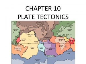
 Chapter 10 plate tectonics
 Marianas trench plate boundary
 Plate tectonics
 Chapter 8 plate tectonics
 Plate tectonics
 Summarize the theory of plate tectonics
 Plate tectonics webquest answer
 Plate tectonics interactive lab
 Oreo cookies and plate tectonics
 Plate tectonics
 Plate tectonics game board
 Plate tectonics definition
 Plate tectonics
 Apes frq plate tectonics
 The plate tectonics theory states that
 Continental drift vs plate tectonics
 Layers of the earth jeopardy
 Chapter 8 plate tectonics
 Harry hess and seafloor spreading
 San andreas fault map
 Plate tectonics vocabulary worksheet
 Oreo tectonics
 Pangaea
 Future plate tectonics
 Driving force of plate tectonics
 Tectonic plates
 Francis bacon plate tectonics
 Continental drift vs plate tectonics
 Mantle magma
 Kesler science plate tectonics
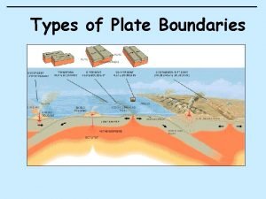
 Boundaries of plate tectonics
